![](/images/other/stat-length.png)
- Randonnées
- Outdoor
- Allemagne
- Hesse
- Main-Kinzig-Kreis
- Flörsbachtal
Flörsbachtal, Main-Kinzig-Kreis : Les meilleures randonnées, itinéraires, parcours, balades et promenades
Flörsbachtal : découvrez les meilleures randonnées : 16 pédestres. Tous ces circuits, parcours, itinéraires et activités en plein air sont disponibles dans nos applications SityTrail pour smartphones et tablettes.
Les meilleurs parcours (16)
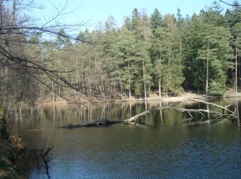
![Randonnée A pied Flörsbachtal - Spessartspuren - Wiesbüttmoor und Flörsbacher Panorama - Photo](https://media.geolcdn.com/t/350/260/f572fa30-e08a-4645-9d7d-2b6b71accb1f.jpeg&format=jpg&maxdim=2)
![A pied A pied](https://static1.geolcdn.com/sitytour/trail-icons/100.png)
Km
A pied
![](/images/other/stat-length.png)
![](https://static1.geolcdn.com/siteimages/upload/files/1508320355ic_sort_den_pos_24dp.png)
![](https://static1.geolcdn.com/siteimages/upload/files/1508320355ic_sort_den_neg_24dp.png)
![](https://static1.geolcdn.com/siteimages/upload/files/16400158638029165_repeat_loop_refresh_sync_direction_icon.png)
• Randonnée créée par Natirpark Hessischer Spessart. Symbole: Blauer Strich und grüner Bogen über gelbem Rechteck auf ...
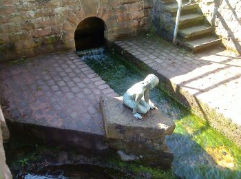
![Randonnée A pied Flörsbachtal - Spessartspuren - Lohrhaupter Widdehuh - Photo](https://media.geolcdn.com/t/350/260/7b2b8aa5-47c0-44c4-97b6-3a2902fb77ab.jpeg&format=jpg&maxdim=2)
![A pied A pied](https://static1.geolcdn.com/sitytour/trail-icons/100.png)
Km
A pied
![](/images/other/stat-length.png)
![](https://static1.geolcdn.com/siteimages/upload/files/1508320355ic_sort_den_pos_24dp.png)
![](https://static1.geolcdn.com/siteimages/upload/files/1508320355ic_sort_den_neg_24dp.png)
![](https://static1.geolcdn.com/siteimages/upload/files/16400158638029165_repeat_loop_refresh_sync_direction_icon.png)
• Randonnée créée par Naturpark Hessischer Spessart. Symbole: Blauer Strich und grüner Bogen über gelbem Rechteck auf ...
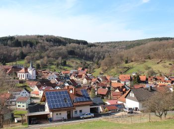
![Randonnée A pied Flörsbachtal - Ortswanderweg Flörsbachtal 6 - Photo](https://media.geolcdn.com/t/350/260/a859b9bb-145d-43d8-9688-9d34fa7389c5.jpeg&format=jpg&maxdim=2)
![A pied A pied](https://static1.geolcdn.com/sitytour/trail-icons/100.png)
Km
A pied
![](/images/other/stat-length.png)
![](https://static1.geolcdn.com/siteimages/upload/files/1508320355ic_sort_den_pos_24dp.png)
![](https://static1.geolcdn.com/siteimages/upload/files/1508320355ic_sort_den_neg_24dp.png)
![](https://static1.geolcdn.com/siteimages/upload/files/16400158638029165_repeat_loop_refresh_sync_direction_icon.png)
• Randonnée créée par Spessartbund. Symbole: Schwarze F6 auf weißem Grund
![Randonnée A pied Flörsbachtal - Ortswanderweg Flörsbachtal 5 - Photo](https://media.geolcdn.com/t/350/260/7b2b8aa5-47c0-44c4-97b6-3a2902fb77ab.jpeg&format=jpg&maxdim=2)
![A pied A pied](https://static1.geolcdn.com/sitytour/trail-icons/100.png)
Km
A pied
![](/images/other/stat-length.png)
![](https://static1.geolcdn.com/siteimages/upload/files/1508320355ic_sort_den_pos_24dp.png)
![](https://static1.geolcdn.com/siteimages/upload/files/1508320355ic_sort_den_neg_24dp.png)
![](https://static1.geolcdn.com/siteimages/upload/files/16400158638029165_repeat_loop_refresh_sync_direction_icon.png)
• Randonnée créée par Spessartbund. Symbole: Schwarze F5 auf weißem Grund
![Randonnée A pied Flörsbachtal - Ortswanderweg Flörsbachtal 4 - Photo](https://media.geolcdn.com/t/350/260/a859b9bb-145d-43d8-9688-9d34fa7389c5.jpeg&format=jpg&maxdim=2)
![A pied A pied](https://static1.geolcdn.com/sitytour/trail-icons/100.png)
Km
A pied
![](/images/other/stat-length.png)
![](https://static1.geolcdn.com/siteimages/upload/files/1508320355ic_sort_den_pos_24dp.png)
![](https://static1.geolcdn.com/siteimages/upload/files/1508320355ic_sort_den_neg_24dp.png)
![](https://static1.geolcdn.com/siteimages/upload/files/16400158638029165_repeat_loop_refresh_sync_direction_icon.png)
• Randonnée créée par Spessartbund.
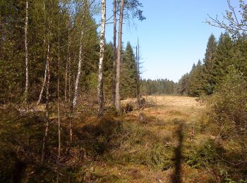
![Randonnée A pied Flörsbachtal - Ortswanderweg Flörsbachtal 9 - Photo](https://media.geolcdn.com/t/350/260/8d04a9aa-d930-4a48-b4d8-4f2e61ec972c.jpeg&format=jpg&maxdim=2)
![A pied A pied](https://static1.geolcdn.com/sitytour/trail-icons/100.png)
Km
A pied
![](/images/other/stat-length.png)
![](https://static1.geolcdn.com/siteimages/upload/files/1508320355ic_sort_den_pos_24dp.png)
![](https://static1.geolcdn.com/siteimages/upload/files/1508320355ic_sort_den_neg_24dp.png)
![](https://static1.geolcdn.com/siteimages/upload/files/16400158638029165_repeat_loop_refresh_sync_direction_icon.png)
• Randonnée créée par Spessartbund. Symbole: Schwarze F9 auf weißem Quadrat
![Randonnée A pied Flörsbachtal - Grünes Eichenblatt, Rundweg Mosborn - Photo](https://media.geolcdn.com/t/350/260/8d04a9aa-d930-4a48-b4d8-4f2e61ec972c.jpeg&format=jpg&maxdim=2)
![A pied A pied](https://static1.geolcdn.com/sitytour/trail-icons/100.png)
Km
A pied
![](/images/other/stat-length.png)
![](https://static1.geolcdn.com/siteimages/upload/files/1508320355ic_sort_den_pos_24dp.png)
![](https://static1.geolcdn.com/siteimages/upload/files/1508320355ic_sort_den_neg_24dp.png)
![](https://static1.geolcdn.com/siteimages/upload/files/16400158638029165_repeat_loop_refresh_sync_direction_icon.png)
• Randonnée créée par Naturpark Spessart. Symbole: Grünes Eichenblatt auf weißem Quadrat
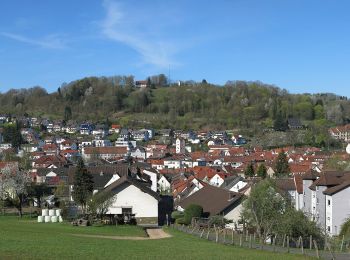
![Randonnée A pied Flörsbachtal - Spessartbogen Zubringer Wiesbütt - Bad Orb - Photo](https://media.geolcdn.com/t/350/260/d3b0064b-c5ea-4c60-945d-a0880b9d7f7e.jpeg&format=jpg&maxdim=2)
![A pied A pied](https://static1.geolcdn.com/sitytour/trail-icons/100.png)
Km
A pied
![](/images/other/stat-length.png)
![](https://static1.geolcdn.com/siteimages/upload/files/1508320355ic_sort_den_pos_24dp.png)
![](https://static1.geolcdn.com/siteimages/upload/files/1508320355ic_sort_den_neg_24dp.png)
![](https://static1.geolcdn.com/siteimages/upload/files/16400158638029165_repeat_loop_refresh_sync_direction_icon.png)
• Randonnée créée par Naturpark Hessischer Spessart. Symbole: dunkelgrauer Strich und mittelgrauer Bogen über hellgrau...
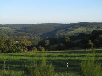
![Randonnée A pied Flörsbachtal - Sonnenhänge Lohrhaupten ( Spessartfährten ) - Photo](https://media.geolcdn.com/t/350/260/49ca7a57-f1e1-4ddd-8369-88fed5da3d84.jpeg&format=jpg&maxdim=2)
![A pied A pied](https://static1.geolcdn.com/sitytour/trail-icons/100.png)
Km
A pied
![](/images/other/stat-length.png)
![](https://static1.geolcdn.com/siteimages/upload/files/1508320355ic_sort_den_pos_24dp.png)
![](https://static1.geolcdn.com/siteimages/upload/files/1508320355ic_sort_den_neg_24dp.png)
![](https://static1.geolcdn.com/siteimages/upload/files/16400158638029165_repeat_loop_refresh_sync_direction_icon.png)
• Randonnée créée par Naturpark Hessischer Spessart und Main Kinzig Kreis. Symbole: blauer Strich und grüner Bogen übe...
![Randonnée A pied Flörsbachtal - Kulturweg Flörsbachtal 1 - Photo](https://media.geolcdn.com/t/350/260/7b2b8aa5-47c0-44c4-97b6-3a2902fb77ab.jpeg&format=jpg&maxdim=2)
![A pied A pied](https://static1.geolcdn.com/sitytour/trail-icons/100.png)
Km
A pied
![](/images/other/stat-length.png)
![](https://static1.geolcdn.com/siteimages/upload/files/1508320355ic_sort_den_pos_24dp.png)
![](https://static1.geolcdn.com/siteimages/upload/files/1508320355ic_sort_den_neg_24dp.png)
![](https://static1.geolcdn.com/siteimages/upload/files/16400158638029165_repeat_loop_refresh_sync_direction_icon.png)
• Randonnée créée par Archäologisches Spessartprojekt. Symbole: Gelbes EU-Schiffchen auf blauem Grund Site web: http...
![Randonnée A pied Flörsbachtal - Schwarzer Keiler, Rundwanderweg Wiesbütt - Photo](https://media.geolcdn.com/t/350/260/f572fa30-e08a-4645-9d7d-2b6b71accb1f.jpeg&format=jpg&maxdim=2)
![A pied A pied](https://static1.geolcdn.com/sitytour/trail-icons/100.png)
Km
A pied
![](/images/other/stat-length.png)
![](https://static1.geolcdn.com/siteimages/upload/files/1508320355ic_sort_den_pos_24dp.png)
![](https://static1.geolcdn.com/siteimages/upload/files/1508320355ic_sort_den_neg_24dp.png)
![](https://static1.geolcdn.com/siteimages/upload/files/16400158638029165_repeat_loop_refresh_sync_direction_icon.png)
• Randonnée créée par Naturpark Spessart. Symbole: Schwarzer Keiler auf weißem Grund
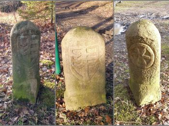
![Randonnée A pied Flörsbachtal - Kulturweg Flörsbachtal 3 - Photo](https://media.geolcdn.com/t/350/260/4d76480f-fb27-49c0-8e4a-ec12938f895d.jpeg&format=jpg&maxdim=2)
![A pied A pied](https://static1.geolcdn.com/sitytour/trail-icons/100.png)
Km
A pied
![](/images/other/stat-length.png)
![](https://static1.geolcdn.com/siteimages/upload/files/1508320355ic_sort_den_pos_24dp.png)
![](https://static1.geolcdn.com/siteimages/upload/files/1508320355ic_sort_den_neg_24dp.png)
![](https://static1.geolcdn.com/siteimages/upload/files/16400158638029165_repeat_loop_refresh_sync_direction_icon.png)
• Randonnée créée par Archäologisches Spessartprojekt. Symbole: Gelbes EU-Schiffchen auf blauem Grund Site web: http...
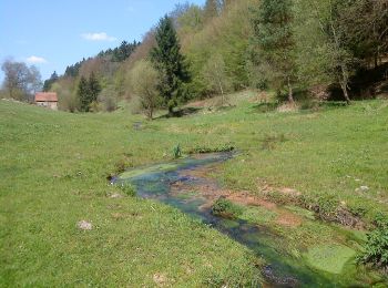
![Randonnée A pied Flörsbachtal - Ortswanderweg Flörsbachtal 2 - Photo](https://media.geolcdn.com/t/350/260/bd294ca4-ff90-47a5-a469-1b9db145a475.jpeg&format=jpg&maxdim=2)
![A pied A pied](https://static1.geolcdn.com/sitytour/trail-icons/100.png)
Km
A pied
![](/images/other/stat-length.png)
![](https://static1.geolcdn.com/siteimages/upload/files/1508320355ic_sort_den_pos_24dp.png)
![](https://static1.geolcdn.com/siteimages/upload/files/1508320355ic_sort_den_neg_24dp.png)
![](https://static1.geolcdn.com/siteimages/upload/files/16400158638029165_repeat_loop_refresh_sync_direction_icon.png)
• Randonnée créée par Spessartbund.
![Randonnée A pied Flörsbachtal - Ortswanderweg Flörsbachtal 8 - Photo](https://media.geolcdn.com/t/350/260/bd294ca4-ff90-47a5-a469-1b9db145a475.jpeg&format=jpg&maxdim=2)
![A pied A pied](https://static1.geolcdn.com/sitytour/trail-icons/100.png)
Km
A pied
![](/images/other/stat-length.png)
![](https://static1.geolcdn.com/siteimages/upload/files/1508320355ic_sort_den_pos_24dp.png)
![](https://static1.geolcdn.com/siteimages/upload/files/1508320355ic_sort_den_neg_24dp.png)
![](https://static1.geolcdn.com/siteimages/upload/files/16400158638029165_repeat_loop_refresh_sync_direction_icon.png)
• Randonnée créée par Spessartbund. Symbole: Schwarze F8 auf weißem Hintergrund
![Randonnée A pied Flörsbachtal - Kulturweg Flörsbachtal 2 - Photo](https://media.geolcdn.com/t/350/260/bd294ca4-ff90-47a5-a469-1b9db145a475.jpeg&format=jpg&maxdim=2)
![A pied A pied](https://static1.geolcdn.com/sitytour/trail-icons/100.png)
Km
A pied
![](/images/other/stat-length.png)
![](https://static1.geolcdn.com/siteimages/upload/files/1508320355ic_sort_den_pos_24dp.png)
![](https://static1.geolcdn.com/siteimages/upload/files/1508320355ic_sort_den_neg_24dp.png)
![](https://static1.geolcdn.com/siteimages/upload/files/16400158638029165_repeat_loop_refresh_sync_direction_icon.png)
• Randonnée créée par Archäologisches Spessartprojekt. Symbole: Gelbes EU-Schiffchen auf blauem Grund Site web: http...
![Randonnée A pied Flörsbachtal - Blauer Schmetterling, Rundweg Mosborn - Photo](https://media.geolcdn.com/t/350/260/ext.jpg?maxdim=2&url=https%3A%2F%2Fstatic1.geolcdn.com%2Fsiteimages%2Fupload%2Ffiles%2F1545311037marcheuse_200dpi.jpg)
![A pied A pied](https://static1.geolcdn.com/sitytour/trail-icons/100.png)
Km
A pied
![](/images/other/stat-length.png)
![](https://static1.geolcdn.com/siteimages/upload/files/1508320355ic_sort_den_pos_24dp.png)
![](https://static1.geolcdn.com/siteimages/upload/files/1508320355ic_sort_den_neg_24dp.png)
![](https://static1.geolcdn.com/siteimages/upload/files/16400158638029165_repeat_loop_refresh_sync_direction_icon.png)
• Randonnée créée par Naturpark Spessart. Symbole: Blauer Schmetterling auf weißem Quadrat
16 randonnées affichées sur 16
Application GPS de randonnée GRATUITE