![](/images/other/stat-length.png)
- Randonnées
- Outdoor
- Allemagne
- Hesse
- Kreis Bergstraße
- Heppenheim
Heppenheim, Kreis Bergstraße : Les meilleures randonnées, itinéraires, parcours, balades et promenades
Heppenheim : découvrez les meilleures randonnées : 19 pédestres. Tous ces circuits, parcours, itinéraires et activités en plein air sont disponibles dans nos applications SityTrail pour smartphones et tablettes.
Les meilleurs parcours (19)
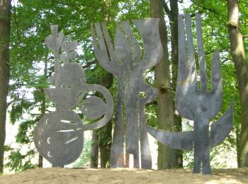
![Randonnée A pied Heppenheim - Rundwanderweg Heppenheim 5: Weinblickweg - Photo](https://media.geolcdn.com/t/350/260/fcb4f804-5c76-49bb-8489-4244983d58e2.jpeg&format=jpg&maxdim=2)
![A pied A pied](https://static1.geolcdn.com/sitytour/trail-icons/100.png)
Km
A pied
![](/images/other/stat-length.png)
![](https://static1.geolcdn.com/siteimages/upload/files/1508320355ic_sort_den_pos_24dp.png)
![](https://static1.geolcdn.com/siteimages/upload/files/1508320355ic_sort_den_neg_24dp.png)
![](https://static1.geolcdn.com/siteimages/upload/files/16400158638029165_repeat_loop_refresh_sync_direction_icon.png)
• Randonnée créée par Odenwaldklub. Symbole: grüne 5 in grünem Kreis, bei 12 Uhr ein grünes H
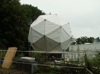
![Randonnée A pied Heppenheim - Rundwanderweg Heppenheim Starkenburg 3: Hambacher Grenzweg - Photo](https://media.geolcdn.com/t/350/260/a76ad390-e1f5-434e-8b18-5ea518b32ea0.jpeg&format=jpg&maxdim=2)
![A pied A pied](https://static1.geolcdn.com/sitytour/trail-icons/100.png)
Km
A pied
![](/images/other/stat-length.png)
![](https://static1.geolcdn.com/siteimages/upload/files/1508320355ic_sort_den_pos_24dp.png)
![](https://static1.geolcdn.com/siteimages/upload/files/1508320355ic_sort_den_neg_24dp.png)
![](https://static1.geolcdn.com/siteimages/upload/files/16400158638029165_repeat_loop_refresh_sync_direction_icon.png)
• Randonnée créée par Geo-Naturpark Bergstraße-Odenwald. Überprüfen (Verlauf wurde geändert) Symbole: Gelbe 3 im gelb...
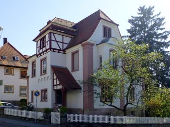
![Randonnée A pied Heppenheim - Rundwanderweg Heppenheim 4: Maiberg-Weg - Photo](https://media.geolcdn.com/t/350/260/56021295-55a0-4077-8cb8-7d346b71da92.jpeg&format=jpg&maxdim=2)
![A pied A pied](https://static1.geolcdn.com/sitytour/trail-icons/100.png)
Km
A pied
![](/images/other/stat-length.png)
![](https://static1.geolcdn.com/siteimages/upload/files/1508320355ic_sort_den_pos_24dp.png)
![](https://static1.geolcdn.com/siteimages/upload/files/1508320355ic_sort_den_neg_24dp.png)
![](https://static1.geolcdn.com/siteimages/upload/files/16400158638029165_repeat_loop_refresh_sync_direction_icon.png)
• Randonnée créée par Geo-Naturpark Bergstraße-Odenwald. Symbole: Weiße 4 in einem oben offenen Kreis, darüber weißes H
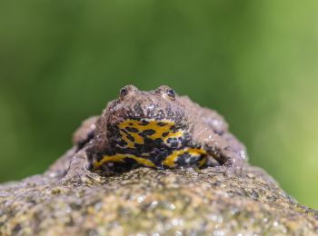
![Randonnée A pied Heppenheim - Rundwanderweg Heppenheim Guldenklinger Höhe 2: Salzkopfweg - Photo](https://media.geolcdn.com/t/350/260/6ce087dd-c2bf-47ad-b971-1683a4455e39.jpeg&format=jpg&maxdim=2)
![A pied A pied](https://static1.geolcdn.com/sitytour/trail-icons/100.png)
Km
A pied
![](/images/other/stat-length.png)
![](https://static1.geolcdn.com/siteimages/upload/files/1508320355ic_sort_den_pos_24dp.png)
![](https://static1.geolcdn.com/siteimages/upload/files/1508320355ic_sort_den_neg_24dp.png)
![](https://static1.geolcdn.com/siteimages/upload/files/16400158638029165_repeat_loop_refresh_sync_direction_icon.png)
• Randonnée créée par Geo-Naturpark Bergstraße-Odenwald. Symbole: Gelbe 2 im gelben Kreis
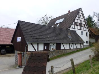
![Randonnée A pied Heppenheim - Rundwanderweg Wald-Erlenbach 1: Igelsbach-Weg - Photo](https://media.geolcdn.com/t/350/260/551f473e-3e35-45dd-93e1-2ac862483c15.jpeg&format=jpg&maxdim=2)
![A pied A pied](https://static1.geolcdn.com/sitytour/trail-icons/100.png)
Km
A pied
![](/images/other/stat-length.png)
![](https://static1.geolcdn.com/siteimages/upload/files/1508320355ic_sort_den_pos_24dp.png)
![](https://static1.geolcdn.com/siteimages/upload/files/1508320355ic_sort_den_neg_24dp.png)
![](https://static1.geolcdn.com/siteimages/upload/files/16400158638029165_repeat_loop_refresh_sync_direction_icon.png)
• Randonnée créée par Geo-Naturpark Bergstraße-Odenwald. Symbole: weiße 1 in weißem Kreis, bei 12 Uhr ein W
![Randonnée A pied Heppenheim - Rundwanderweg Kirschhausen 2 - Photo](https://media.geolcdn.com/t/350/260/6ce087dd-c2bf-47ad-b971-1683a4455e39.jpeg&format=jpg&maxdim=2)
![A pied A pied](https://static1.geolcdn.com/sitytour/trail-icons/100.png)
Km
A pied
![](/images/other/stat-length.png)
![](https://static1.geolcdn.com/siteimages/upload/files/1508320355ic_sort_den_pos_24dp.png)
![](https://static1.geolcdn.com/siteimages/upload/files/1508320355ic_sort_den_neg_24dp.png)
![](https://static1.geolcdn.com/siteimages/upload/files/16400158638029165_repeat_loop_refresh_sync_direction_icon.png)
• Randonnée créée par Geo-Naturpark Bergstraße-Odenwald. Symbole: weiße 2 in weißem Kreis, bei 12 Uhr ein K
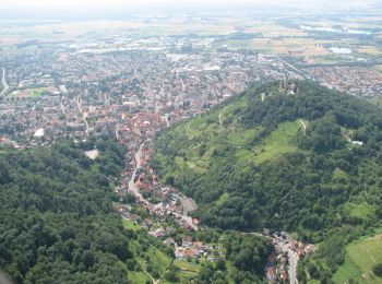
![Randonnée A pied Heppenheim - Rundwanderweg Heppenheim Starkenburg 2: Rund um den Absbrunnen - Photo](https://media.geolcdn.com/t/350/260/ddc46981-9bc8-41dd-87b4-5342005a8844.jpeg&format=jpg&maxdim=2)
![A pied A pied](https://static1.geolcdn.com/sitytour/trail-icons/100.png)
Km
A pied
![](/images/other/stat-length.png)
![](https://static1.geolcdn.com/siteimages/upload/files/1508320355ic_sort_den_pos_24dp.png)
![](https://static1.geolcdn.com/siteimages/upload/files/1508320355ic_sort_den_neg_24dp.png)
![](https://static1.geolcdn.com/siteimages/upload/files/16400158638029165_repeat_loop_refresh_sync_direction_icon.png)
• Randonnée créée par Geo-Naturpark Bergstraße-Odenwald. Symbole: Gelbe 2 im gelben Kreis
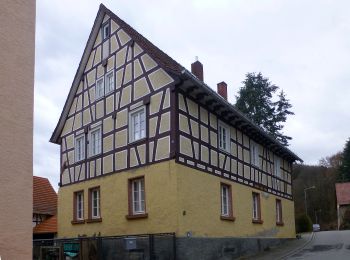
![Randonnée A pied Heppenheim - Rundwanderweg Wald-Erlenbach 3 - Photo](https://media.geolcdn.com/t/350/260/93a94b53-2b89-4ae6-8da9-1efaccc12055.jpeg&format=jpg&maxdim=2)
![A pied A pied](https://static1.geolcdn.com/sitytour/trail-icons/100.png)
Km
A pied
![](/images/other/stat-length.png)
![](https://static1.geolcdn.com/siteimages/upload/files/1508320355ic_sort_den_pos_24dp.png)
![](https://static1.geolcdn.com/siteimages/upload/files/1508320355ic_sort_den_neg_24dp.png)
![](https://static1.geolcdn.com/siteimages/upload/files/16400158638029165_repeat_loop_refresh_sync_direction_icon.png)
• Randonnée créée par Geo-Naturpark Bergstraße-Odenwald. Symbole: weiße 3 im oben offenen Kreis, bei 12 Uhr ein W
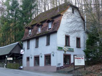
![Randonnée A pied Heppenheim - Rundwanderweg Heppenheim 6: Hügelgrabwanderung - Photo](https://media.geolcdn.com/t/350/260/519170db-99e3-4be0-8dff-09a93bd1ba4a.jpeg&format=jpg&maxdim=2)
![A pied A pied](https://static1.geolcdn.com/sitytour/trail-icons/100.png)
Km
A pied
![](/images/other/stat-length.png)
![](https://static1.geolcdn.com/siteimages/upload/files/1508320355ic_sort_den_pos_24dp.png)
![](https://static1.geolcdn.com/siteimages/upload/files/1508320355ic_sort_den_neg_24dp.png)
![](https://static1.geolcdn.com/siteimages/upload/files/16400158638029165_repeat_loop_refresh_sync_direction_icon.png)
• Randonnée créée par Odenwaldklub. Symbole: weiße 6 in weißem Kreis, bei 12 Uhr ein H
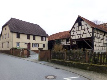
![Randonnée A pied Heppenheim - Rundwanderweg Kirschhausen 1 - Photo](https://media.geolcdn.com/t/350/260/368471dc-8217-4e58-bc68-47f7f97501e6.jpeg&format=jpg&maxdim=2)
![A pied A pied](https://static1.geolcdn.com/sitytour/trail-icons/100.png)
Km
A pied
![](/images/other/stat-length.png)
![](https://static1.geolcdn.com/siteimages/upload/files/1508320355ic_sort_den_pos_24dp.png)
![](https://static1.geolcdn.com/siteimages/upload/files/1508320355ic_sort_den_neg_24dp.png)
![](https://static1.geolcdn.com/siteimages/upload/files/16400158638029165_repeat_loop_refresh_sync_direction_icon.png)
• Randonnée créée par Geo-Naturpark Bergstraße-Odenwald. Symbole: weiße 1 in weißem Kreis, bei 12 Uhr ein K
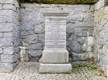
![Randonnée A pied Heppenheim - Rundwanderweg Heppenheim 3: Guldenzoll-Weg - Photo](https://media.geolcdn.com/t/350/260/8d4f4dc9-865e-48cf-b55d-490afe367f2c.jpeg&format=jpg&maxdim=2)
![A pied A pied](https://static1.geolcdn.com/sitytour/trail-icons/100.png)
Km
A pied
![](/images/other/stat-length.png)
![](https://static1.geolcdn.com/siteimages/upload/files/1508320355ic_sort_den_pos_24dp.png)
![](https://static1.geolcdn.com/siteimages/upload/files/1508320355ic_sort_den_neg_24dp.png)
![](https://static1.geolcdn.com/siteimages/upload/files/16400158638029165_repeat_loop_refresh_sync_direction_icon.png)
• Randonnée créée par Geo-Naturpark Bergstraße-Odenwald. Symbole: Weiße 3 in einem oben offenen Kreis, darüber weißes H
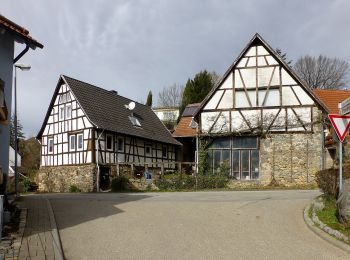
![Randonnée A pied Heppenheim - Rundwanderweg Heppenheim Wolfslücke 3: Kreuzberg-Weg - Photo](https://media.geolcdn.com/t/350/260/559d3312-1967-4567-a047-084f8b500ce1.jpeg&format=jpg&maxdim=2)
![A pied A pied](https://static1.geolcdn.com/sitytour/trail-icons/100.png)
Km
A pied
![](/images/other/stat-length.png)
![](https://static1.geolcdn.com/siteimages/upload/files/1508320355ic_sort_den_pos_24dp.png)
![](https://static1.geolcdn.com/siteimages/upload/files/1508320355ic_sort_den_neg_24dp.png)
![](https://static1.geolcdn.com/siteimages/upload/files/16400158638029165_repeat_loop_refresh_sync_direction_icon.png)
• Randonnée créée par Geo-Naturpark Bergstraße-Odenwald. Symbole: Gelbe 3 im gelben Kreis
![Randonnée A pied Heppenheim - Rundwanderweg Heppenheim Wolfslücke 1: Sommerhof-Weg - Photo](https://media.geolcdn.com/t/350/260/559d3312-1967-4567-a047-084f8b500ce1.jpeg&format=jpg&maxdim=2)
![A pied A pied](https://static1.geolcdn.com/sitytour/trail-icons/100.png)
Km
A pied
![](/images/other/stat-length.png)
![](https://static1.geolcdn.com/siteimages/upload/files/1508320355ic_sort_den_pos_24dp.png)
![](https://static1.geolcdn.com/siteimages/upload/files/1508320355ic_sort_den_neg_24dp.png)
![](https://static1.geolcdn.com/siteimages/upload/files/16400158638029165_repeat_loop_refresh_sync_direction_icon.png)
• Randonnée créée par Geo-Naturpark Bergstraße-Odenwald. Symbole: Gelbe 1 im gelben Kreis
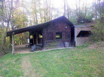
![Randonnée A pied Heppenheim - Rundwanderweg Mörlenbach 4: Obstwiesenweg - Photo](https://media.geolcdn.com/t/350/260/ce0e0668-cfb4-4ad3-8cd0-cbc9746f8007.jpeg&format=jpg&maxdim=2)
![A pied A pied](https://static1.geolcdn.com/sitytour/trail-icons/100.png)
Km
A pied
![](/images/other/stat-length.png)
![](https://static1.geolcdn.com/siteimages/upload/files/1508320355ic_sort_den_pos_24dp.png)
![](https://static1.geolcdn.com/siteimages/upload/files/1508320355ic_sort_den_neg_24dp.png)
![](https://static1.geolcdn.com/siteimages/upload/files/16400158638029165_repeat_loop_refresh_sync_direction_icon.png)
• Randonnée créée par Odenwaldklub. Symbole: Grüne 4 in einem oben offenem grünen Kreis, darüber grünes M
![Randonnée A pied Heppenheim - Rundwanderweg Heppenheim 2: Jägerrast-Weg - Photo](https://media.geolcdn.com/t/350/260/ddc46981-9bc8-41dd-87b4-5342005a8844.jpeg&format=jpg&maxdim=2)
![A pied A pied](https://static1.geolcdn.com/sitytour/trail-icons/100.png)
Km
A pied
![](/images/other/stat-length.png)
![](https://static1.geolcdn.com/siteimages/upload/files/1508320355ic_sort_den_pos_24dp.png)
![](https://static1.geolcdn.com/siteimages/upload/files/1508320355ic_sort_den_neg_24dp.png)
![](https://static1.geolcdn.com/siteimages/upload/files/16400158638029165_repeat_loop_refresh_sync_direction_icon.png)
• Randonnée créée par Geo-Naturpark Bergstraße-Odenwald. Symbole: Weiße 2 in einem oben offenen Kreis, darüber weißes H
![Randonnée A pied Heppenheim - Rundwanderweg Heppenheim Goldbrunnen 2: Panoramaweg - Photo](https://media.geolcdn.com/t/350/260/fcb4f804-5c76-49bb-8489-4244983d58e2.jpeg&format=jpg&maxdim=2)
![A pied A pied](https://static1.geolcdn.com/sitytour/trail-icons/100.png)
Km
A pied
![](/images/other/stat-length.png)
![](https://static1.geolcdn.com/siteimages/upload/files/1508320355ic_sort_den_pos_24dp.png)
![](https://static1.geolcdn.com/siteimages/upload/files/1508320355ic_sort_den_neg_24dp.png)
![](https://static1.geolcdn.com/siteimages/upload/files/16400158638029165_repeat_loop_refresh_sync_direction_icon.png)
• Randonnée créée par Geo-Naturpark Bergstraße-Odenwald. Symbole: Gelbe 2 im gelben Kreis
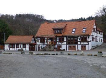
![Randonnée A pied Heppenheim - Rundwanderweg Heppenheim Scheuerberg 9: Schannenbacher-Eck-Weg - Photo](https://media.geolcdn.com/t/350/260/237e3b19-30f9-4f90-8b42-2a0376763cd0.jpeg&format=jpg&maxdim=2)
![A pied A pied](https://static1.geolcdn.com/sitytour/trail-icons/100.png)
Km
A pied
![](/images/other/stat-length.png)
![](https://static1.geolcdn.com/siteimages/upload/files/1508320355ic_sort_den_pos_24dp.png)
![](https://static1.geolcdn.com/siteimages/upload/files/1508320355ic_sort_den_neg_24dp.png)
![](https://static1.geolcdn.com/siteimages/upload/files/16400158638029165_repeat_loop_refresh_sync_direction_icon.png)
• Randonnée créée par Geo-Naturpark Bergstraße-Odenwald. Symbole: Gelbe 9 im gelben Kreis
![Randonnée A pied Heppenheim - Rundwanderweg Heppenheim Scheuerberg 6: Steinschloß-Felsenmeer-Weg - Photo](https://media.geolcdn.com/t/350/260/237e3b19-30f9-4f90-8b42-2a0376763cd0.jpeg&format=jpg&maxdim=2)
![A pied A pied](https://static1.geolcdn.com/sitytour/trail-icons/100.png)
Km
A pied
![](/images/other/stat-length.png)
![](https://static1.geolcdn.com/siteimages/upload/files/1508320355ic_sort_den_pos_24dp.png)
![](https://static1.geolcdn.com/siteimages/upload/files/1508320355ic_sort_den_neg_24dp.png)
![](https://static1.geolcdn.com/siteimages/upload/files/16400158638029165_repeat_loop_refresh_sync_direction_icon.png)
• Randonnée créée par Geo-Naturpark Bergstraße-Odenwald. Symbole: Gelbe 6 im gelben Kreis
![Randonnée A pied Heppenheim - Rundwanderweg Heppenheim An der Lee 3: Um den Steinkopf - Photo](https://media.geolcdn.com/t/350/260/ext.jpg?maxdim=2&url=https%3A%2F%2Fstatic1.geolcdn.com%2Fsiteimages%2Fupload%2Ffiles%2F1545311037marcheuse_200dpi.jpg)
![A pied A pied](https://static1.geolcdn.com/sitytour/trail-icons/100.png)
Km
A pied
![](/images/other/stat-length.png)
![](https://static1.geolcdn.com/siteimages/upload/files/1508320355ic_sort_den_pos_24dp.png)
![](https://static1.geolcdn.com/siteimages/upload/files/1508320355ic_sort_den_neg_24dp.png)
![](https://static1.geolcdn.com/siteimages/upload/files/16400158638029165_repeat_loop_refresh_sync_direction_icon.png)
• Randonnée créée par Geo-Naturpark Bergstraße-Odenwald. Symbole: Gelbe 3 im gelben Kreis
19 randonnées affichées sur 19
Application GPS de randonnée GRATUITE