![](/images/other/stat-length.png)
- Randonnées
- Outdoor
- Allemagne
- Hesse
- Wetteraukreis
- Ober-Mörlen
Ober-Mörlen, Wetteraukreis : Les meilleures randonnées, itinéraires, parcours, balades et promenades
Ober-Mörlen : découvrez les meilleures randonnées : 6 pédestres. Tous ces circuits, parcours, itinéraires et activités en plein air sont disponibles dans nos applications SityTrail pour smartphones et tablettes.
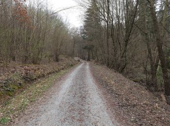
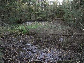
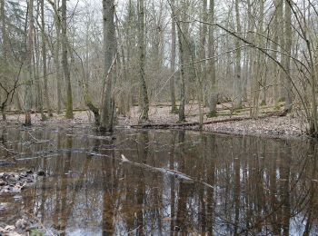
Les meilleurs parcours (6)
![Randonnée A pied Ober-Mörlen - Wanderwege Vogeltal - Eichhornt - Photo](https://media.geolcdn.com/t/350/260/6b4d6d94-8a9b-40f8-8ce7-c02eac9bd4d5.jpeg&format=jpg&maxdim=2)
![A pied A pied](https://static1.geolcdn.com/sitytour/trail-icons/100.png)
Km
A pied
![](/images/other/stat-length.png)
![](https://static1.geolcdn.com/siteimages/upload/files/1508320355ic_sort_den_pos_24dp.png)
![](https://static1.geolcdn.com/siteimages/upload/files/1508320355ic_sort_den_neg_24dp.png)
![](https://static1.geolcdn.com/siteimages/upload/files/16400158638029165_repeat_loop_refresh_sync_direction_icon.png)
• Randonnée créée par Naturpark Hochtaunus. Symbole: braunes Eichhorn auf weißem Grund
![Randonnée A pied Ober-Mörlen - Wanderwege Vogeltal - Eichenblatt - Photo](https://media.geolcdn.com/t/350/260/c0ca58f0-f74a-4e66-a36e-8606437b6a4d.jpeg&format=jpg&maxdim=2)
![A pied A pied](https://static1.geolcdn.com/sitytour/trail-icons/100.png)
Km
A pied
![](/images/other/stat-length.png)
![](https://static1.geolcdn.com/siteimages/upload/files/1508320355ic_sort_den_pos_24dp.png)
![](https://static1.geolcdn.com/siteimages/upload/files/1508320355ic_sort_den_neg_24dp.png)
![](https://static1.geolcdn.com/siteimages/upload/files/16400158638029165_repeat_loop_refresh_sync_direction_icon.png)
• Randonnée créée par Naturpark Hochtaunus. Symbole: grünes Eichenblatt auf weißem Grund
![Randonnée A pied Ober-Mörlen - Wanderwege Vogeltal - Forelle - Photo](https://media.geolcdn.com/t/350/260/95d8ddc0-0284-42c1-84f0-33ed788202ab.jpeg&format=jpg&maxdim=2)
![A pied A pied](https://static1.geolcdn.com/sitytour/trail-icons/100.png)
Km
A pied
![](/images/other/stat-length.png)
![](https://static1.geolcdn.com/siteimages/upload/files/1508320355ic_sort_den_pos_24dp.png)
![](https://static1.geolcdn.com/siteimages/upload/files/1508320355ic_sort_den_neg_24dp.png)
![](https://static1.geolcdn.com/siteimages/upload/files/16400158638029165_repeat_loop_refresh_sync_direction_icon.png)
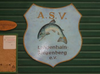
• Randonnée créée par Naturpark Hochtaunus. Symbole: blaue Forelle auf weißem Grund
![Randonnée A pied Ober-Mörlen - Wanderwege Winterstein - Alttier - Photo](https://media.geolcdn.com/t/350/260/a10494c5-c4a9-426a-8a17-49cec3cde2ad.jpeg&format=jpg&maxdim=2)
![A pied A pied](https://static1.geolcdn.com/sitytour/trail-icons/100.png)
Km
A pied
![](/images/other/stat-length.png)
![](https://static1.geolcdn.com/siteimages/upload/files/1508320355ic_sort_den_pos_24dp.png)
![](https://static1.geolcdn.com/siteimages/upload/files/1508320355ic_sort_den_neg_24dp.png)
![](https://static1.geolcdn.com/siteimages/upload/files/16400158638029165_repeat_loop_refresh_sync_direction_icon.png)
• Randonnée créée par Naturpark Hochtaunus. Symbole: rotes Alttier auf weißem Grund
![Randonnée A pied Ober-Mörlen - Wanderwege Winterstein - Keiler - Photo](https://media.geolcdn.com/t/350/260/a3c1120b-b837-45a7-a7e5-5f6e9d5800cb.jpeg&format=jpg&maxdim=2)
![A pied A pied](https://static1.geolcdn.com/sitytour/trail-icons/100.png)
Km
A pied
![](/images/other/stat-length.png)
![](https://static1.geolcdn.com/siteimages/upload/files/1508320355ic_sort_den_pos_24dp.png)
![](https://static1.geolcdn.com/siteimages/upload/files/1508320355ic_sort_den_neg_24dp.png)
![](https://static1.geolcdn.com/siteimages/upload/files/16400158638029165_repeat_loop_refresh_sync_direction_icon.png)
• Randonnée créée par Naturpark Hochtaunus. Symbole: schwarzer Keiler auf weißem Grund
![Randonnée A pied Ober-Mörlen - Wildkatzenpfad am Winterstein - Photo](https://media.geolcdn.com/t/350/260/ext.jpg?maxdim=2&url=https%3A%2F%2Fstatic1.geolcdn.com%2Fsiteimages%2Fupload%2Ffiles%2F1545311037marcheuse_200dpi.jpg)
![A pied A pied](https://static1.geolcdn.com/sitytour/trail-icons/100.png)
Km
A pied
![](/images/other/stat-length.png)
![](https://static1.geolcdn.com/siteimages/upload/files/1508320355ic_sort_den_pos_24dp.png)
![](https://static1.geolcdn.com/siteimages/upload/files/1508320355ic_sort_den_neg_24dp.png)
![](https://static1.geolcdn.com/siteimages/upload/files/16400158638029165_repeat_loop_refresh_sync_direction_icon.png)
• Das Wildkatzen-Walderlebnis: Der Erlebnispfad am Winterstein (Hochtaunus). Auf 7 Kilometer geht es gut 150 Höhenmeter...
6 randonnées affichées sur 6
Application GPS de randonnée GRATUITE