![](/images/other/stat-length.png)
- Randonnées
- Outdoor
- Allemagne
- Rhénanie-Palatinat
- Südwestpfalz
- Spirkelbach
Spirkelbach, Südwestpfalz : Les meilleures randonnées, itinéraires, parcours, balades et promenades
Spirkelbach : découvrez les meilleures randonnées : 4 pédestres. Tous ces circuits, parcours, itinéraires et activités en plein air sont disponibles dans nos applications SityTrail pour smartphones et tablettes.
Les meilleurs parcours (4)
![Randonnée A pied Spirkelbach - Spirkelbacher Höllenberg-Tour - Photo](https://media.geolcdn.com/t/350/260/a1593497-8447-4a1a-96b6-6f6712de8378.jpeg&format=jpg&maxdim=2)
![A pied A pied](https://static1.geolcdn.com/sitytour/trail-icons/100.png)
Km
A pied
![](/images/other/stat-length.png)
![](https://static1.geolcdn.com/siteimages/upload/files/1508320355ic_sort_den_pos_24dp.png)
![](https://static1.geolcdn.com/siteimages/upload/files/1508320355ic_sort_den_neg_24dp.png)
![](https://static1.geolcdn.com/siteimages/upload/files/16400158638029165_repeat_loop_refresh_sync_direction_icon.png)
• Randonnée créée par Tourist-Info Hauenstein. Symbole: Weißer Teufel auf Rotem Quadrat überm Höllenberg
![Randonnée A pied Spirkelbach - Wernersberg 30 - Photo](https://media.geolcdn.com/t/350/260/c9809529-77cb-45e6-a1e4-c4b8eb3b33c3.jpeg&format=jpg&maxdim=2)
![A pied A pied](https://static1.geolcdn.com/sitytour/trail-icons/100.png)
Km
A pied
![](/images/other/stat-length.png)
![](https://static1.geolcdn.com/siteimages/upload/files/1508320355ic_sort_den_pos_24dp.png)
![](https://static1.geolcdn.com/siteimages/upload/files/1508320355ic_sort_den_neg_24dp.png)
![](https://static1.geolcdn.com/siteimages/upload/files/16400158638029165_repeat_loop_refresh_sync_direction_icon.png)
• Randonnée créée par Ortsgemeinde Wernersberg. Symbole: 30
![Randonnée A pied Spirkelbach - Spirkelbacher Rauberg-Tour - Photo](https://media.geolcdn.com/t/350/260/bfc1c8ab-f206-4cef-af6c-a5bb6220458a.jpeg&format=jpg&maxdim=2)
![A pied A pied](https://static1.geolcdn.com/sitytour/trail-icons/100.png)
Km
A pied
![](/images/other/stat-length.png)
![](https://static1.geolcdn.com/siteimages/upload/files/1508320355ic_sort_den_pos_24dp.png)
![](https://static1.geolcdn.com/siteimages/upload/files/1508320355ic_sort_den_neg_24dp.png)
![](https://static1.geolcdn.com/siteimages/upload/files/16400158638029165_repeat_loop_refresh_sync_direction_icon.png)
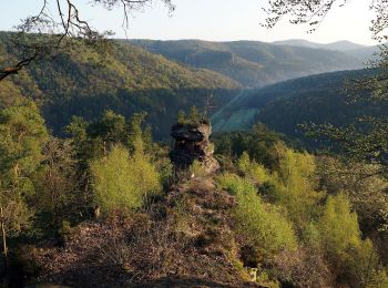
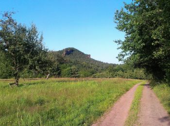
• Symbole: Weißer Berg und Felsen auf rotem Grund
![Randonnée A pied Spirkelbach - Rundwanderweg 2 - Photo](https://media.geolcdn.com/t/350/260/ext.jpg?maxdim=2&url=https%3A%2F%2Fstatic1.geolcdn.com%2Fsiteimages%2Fupload%2Ffiles%2F1545311037marcheuse_200dpi.jpg)
![A pied A pied](https://static1.geolcdn.com/sitytour/trail-icons/100.png)
Km
A pied
![](/images/other/stat-length.png)
![](https://static1.geolcdn.com/siteimages/upload/files/1508320355ic_sort_den_pos_24dp.png)
![](https://static1.geolcdn.com/siteimages/upload/files/1508320355ic_sort_den_neg_24dp.png)
![](https://static1.geolcdn.com/siteimages/upload/files/16400158638029165_repeat_loop_refresh_sync_direction_icon.png)
• Randonnée créée par Pfälzerwald-Verein. Symbole: Schwarze 2 auf weißem Punkt
4 randonnées affichées sur 4
Application GPS de randonnée GRATUITE