![](/images/other/stat-length.png)
- Randonnées
- Outdoor
- Allemagne
- Thuringe
- Wartburgkreis
Wartburgkreis, Thuringe : Les meilleures randonnées, itinéraires, parcours, balades et promenades
Wartburgkreis : découvrez les meilleures randonnées : 41 pédestres. Tous ces circuits, parcours, itinéraires et activités en plein air sont disponibles dans nos applications SityTrail pour smartphones et tablettes.
Les meilleurs parcours (41)
![Randonnée A pied Hörselberg-Hainich - DE-gelber Balken - Photo](https://media.geolcdn.com/t/350/260/33a18f5c-7da2-41b7-9531-3f10eeb0c023.jpeg&format=jpg&maxdim=2)
![A pied A pied](https://static1.geolcdn.com/sitytour/trail-icons/100.png)
Km
A pied
![](/images/other/stat-length.png)
![](https://static1.geolcdn.com/siteimages/upload/files/1508320355ic_sort_den_pos_24dp.png)
![](https://static1.geolcdn.com/siteimages/upload/files/1508320355ic_sort_den_neg_24dp.png)
![](https://static1.geolcdn.com/siteimages/upload/files/16400158638029165_repeat_loop_refresh_sync_direction_icon.png)
• Symbole: gelber Querbalken auf weißem Grund
![Randonnée A pied Bad Liebenstein - Pfeifenweg - Photo](https://media.geolcdn.com/t/350/260/8346413a-d2f4-4218-b2c6-2c2bddcb1ee8.jpeg&format=jpg&maxdim=2)
![A pied A pied](https://static1.geolcdn.com/sitytour/trail-icons/100.png)
Km
A pied
![](/images/other/stat-length.png)
![](https://static1.geolcdn.com/siteimages/upload/files/1508320355ic_sort_den_pos_24dp.png)
![](https://static1.geolcdn.com/siteimages/upload/files/1508320355ic_sort_den_neg_24dp.png)
![](https://static1.geolcdn.com/siteimages/upload/files/16400158638029165_repeat_loop_refresh_sync_direction_icon.png)
• Zwischen Große Meilerstätte und Ruhla nur am Parkplatz Ententeich markiert. Information zum Wegverlauf kam von der To...
![Randonnée A pied Barchfeld-Immelborn - DE-grüner Punkt - Photo](https://media.geolcdn.com/t/350/260/8346413a-d2f4-4218-b2c6-2c2bddcb1ee8.jpeg&format=jpg&maxdim=2)
![A pied A pied](https://static1.geolcdn.com/sitytour/trail-icons/100.png)
Km
A pied
![](/images/other/stat-length.png)
![](https://static1.geolcdn.com/siteimages/upload/files/1508320355ic_sort_den_pos_24dp.png)
![](https://static1.geolcdn.com/siteimages/upload/files/1508320355ic_sort_den_neg_24dp.png)
![](https://static1.geolcdn.com/siteimages/upload/files/16400158638029165_repeat_loop_refresh_sync_direction_icon.png)
• Symbole: grüner Punkt auf weißem Grund
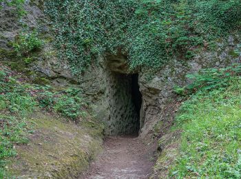
![Randonnée A pied Bad Liebenstein - DE-grünes Dreieck - Photo](https://media.geolcdn.com/t/350/260/fd3e06cc-236b-4572-8fda-d8cb71d90c27.jpeg&format=jpg&maxdim=2)
![A pied A pied](https://static1.geolcdn.com/sitytour/trail-icons/100.png)
Km
A pied
![](/images/other/stat-length.png)
![](https://static1.geolcdn.com/siteimages/upload/files/1508320355ic_sort_den_pos_24dp.png)
![](https://static1.geolcdn.com/siteimages/upload/files/1508320355ic_sort_den_neg_24dp.png)
![](https://static1.geolcdn.com/siteimages/upload/files/16400158638029165_repeat_loop_refresh_sync_direction_icon.png)
• Symbole: grünes Dreieck auf weißem Grund
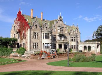
![Randonnée A pied Bad Liebenstein - Rennsteig-Leiter Bad Liebenstein-Schweina-Steinbach - Photo](https://media.geolcdn.com/t/350/260/d8a28adf-d900-47e8-bf79-6c6deff4a0dd.jpeg&format=jpg&maxdim=2)
![A pied A pied](https://static1.geolcdn.com/sitytour/trail-icons/100.png)
Km
A pied
![](/images/other/stat-length.png)
![](https://static1.geolcdn.com/siteimages/upload/files/1508320355ic_sort_den_pos_24dp.png)
![](https://static1.geolcdn.com/siteimages/upload/files/1508320355ic_sort_den_neg_24dp.png)
![](https://static1.geolcdn.com/siteimages/upload/files/16400158638029165_repeat_loop_refresh_sync_direction_icon.png)
• Symbole: gelbes R
![Randonnée A pied Hörselberg-Hainich - Wildkatzenpfad - Photo](https://media.geolcdn.com/t/350/260/4c241237-720f-4c9c-9a1a-8d9bd99344a1.jpeg&format=jpg&maxdim=2)
![A pied A pied](https://static1.geolcdn.com/sitytour/trail-icons/100.png)
Km
A pied
![](/images/other/stat-length.png)
![](https://static1.geolcdn.com/siteimages/upload/files/1508320355ic_sort_den_pos_24dp.png)
![](https://static1.geolcdn.com/siteimages/upload/files/1508320355ic_sort_den_neg_24dp.png)
![](https://static1.geolcdn.com/siteimages/upload/files/16400158638029165_repeat_loop_refresh_sync_direction_icon.png)
• Randonnée créée par Nationalpark Hainich. Symbole: Wildkatze
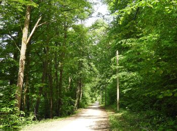
![Randonnée A pied Amt Creuzburg - Hauptwanderweg Eisenach - Wernigerode / Höhenweg - Photo](https://media.geolcdn.com/t/350/260/8649eb3f-2286-4cac-93b8-8de63c2d3044.jpeg&format=jpg&maxdim=2)
![A pied A pied](https://static1.geolcdn.com/sitytour/trail-icons/100.png)
Km
A pied
![](/images/other/stat-length.png)
![](https://static1.geolcdn.com/siteimages/upload/files/1508320355ic_sort_den_pos_24dp.png)
![](https://static1.geolcdn.com/siteimages/upload/files/1508320355ic_sort_den_neg_24dp.png)
![](https://static1.geolcdn.com/siteimages/upload/files/16400158638029165_repeat_loop_refresh_sync_direction_icon.png)
• Symbole: blaues X auf weißem Grund
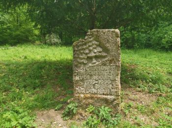
![Randonnée A pied Berka vor dem Hainich - Wanderweg Sulzrieden - Photo](https://media.geolcdn.com/t/350/260/c4d5e7bd-422d-4892-a52b-103b43b8bd93.jpeg&format=jpg&maxdim=2)
![A pied A pied](https://static1.geolcdn.com/sitytour/trail-icons/100.png)
Km
A pied
![](/images/other/stat-length.png)
![](https://static1.geolcdn.com/siteimages/upload/files/1508320355ic_sort_den_pos_24dp.png)
![](https://static1.geolcdn.com/siteimages/upload/files/1508320355ic_sort_den_neg_24dp.png)
![](https://static1.geolcdn.com/siteimages/upload/files/16400158638029165_repeat_loop_refresh_sync_direction_icon.png)
• Randonnée créée par Nationalpark Hainich. Symbole: Eule
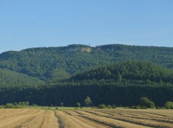
![Randonnée A pied Treffurt - Premiumweg Heldrastein - Photo](https://media.geolcdn.com/t/350/260/d28033e9-b78e-4160-87e6-e70f51e8d099.jpeg&format=jpg&maxdim=2)
![A pied A pied](https://static1.geolcdn.com/sitytour/trail-icons/100.png)
Km
A pied
![](/images/other/stat-length.png)
![](https://static1.geolcdn.com/siteimages/upload/files/1508320355ic_sort_den_pos_24dp.png)
![](https://static1.geolcdn.com/siteimages/upload/files/1508320355ic_sort_den_neg_24dp.png)
![](https://static1.geolcdn.com/siteimages/upload/files/16400158638029165_repeat_loop_refresh_sync_direction_icon.png)
• Symbole: gelber Text P6 in gelbem Kreis
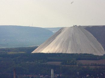
![Randonnée A pied Unterbreizbach - Keltenpfad - Photo](https://media.geolcdn.com/t/350/260/d060de6f-b548-451a-812d-e4f068184b0d.jpeg&format=jpg&maxdim=2)
![A pied A pied](https://static1.geolcdn.com/sitytour/trail-icons/100.png)
Km
A pied
![](/images/other/stat-length.png)
![](https://static1.geolcdn.com/siteimages/upload/files/1508320355ic_sort_den_pos_24dp.png)
![](https://static1.geolcdn.com/siteimages/upload/files/1508320355ic_sort_den_neg_24dp.png)
![](https://static1.geolcdn.com/siteimages/upload/files/16400158638029165_repeat_loop_refresh_sync_direction_icon.png)
• Randonnée créée par Rhönklub. complete Symbole: stilisiertes rotes K auf weißen Grund
![Randonnée A pied Hörselberg-Hainich - Kammweg Hörselberge (Roter Balken) - Photo](https://media.geolcdn.com/t/350/260/5ed1498e-a3ac-4417-bdf1-abde7e1d0063.jpeg&format=jpg&maxdim=2)
![A pied A pied](https://static1.geolcdn.com/sitytour/trail-icons/100.png)
Km
A pied
![](/images/other/stat-length.png)
![](https://static1.geolcdn.com/siteimages/upload/files/1508320355ic_sort_den_pos_24dp.png)
![](https://static1.geolcdn.com/siteimages/upload/files/1508320355ic_sort_den_neg_24dp.png)
![](https://static1.geolcdn.com/siteimages/upload/files/16400158638029165_repeat_loop_refresh_sync_direction_icon.png)
• Symbole: roter Queralken auf weißem Grund
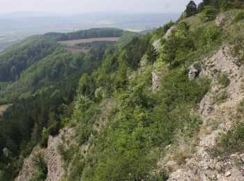
![Randonnée A pied Treffurt - Adolfsburgstieg - Photo](https://media.geolcdn.com/t/350/260/fb5a4a43-7327-472f-bba9-b2db66c9485b.jpeg&format=jpg&maxdim=2)
![A pied A pied](https://static1.geolcdn.com/sitytour/trail-icons/100.png)
Km
A pied
![](/images/other/stat-length.png)
![](https://static1.geolcdn.com/siteimages/upload/files/1508320355ic_sort_den_pos_24dp.png)
![](https://static1.geolcdn.com/siteimages/upload/files/1508320355ic_sort_den_neg_24dp.png)
![](https://static1.geolcdn.com/siteimages/upload/files/16400158638029165_repeat_loop_refresh_sync_direction_icon.png)
• Symbole: Gelbes A auf weißem Grund
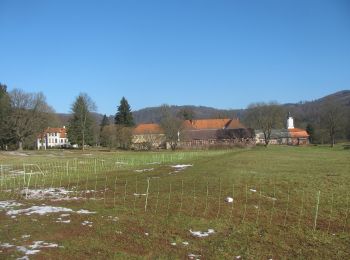
![Randonnée A pied Gerstungen - Altenberger See Rundwanderweg 1 - Photo](https://media.geolcdn.com/t/350/260/ae8fcf22-11ed-4869-8734-369605f460c0.jpeg&format=jpg&maxdim=2)
![A pied A pied](https://static1.geolcdn.com/sitytour/trail-icons/100.png)
Km
A pied
![](/images/other/stat-length.png)
![](https://static1.geolcdn.com/siteimages/upload/files/1508320355ic_sort_den_pos_24dp.png)
![](https://static1.geolcdn.com/siteimages/upload/files/1508320355ic_sort_den_neg_24dp.png)
![](https://static1.geolcdn.com/siteimages/upload/files/16400158638029165_repeat_loop_refresh_sync_direction_icon.png)
• Symbole: Kreis mit Nr. 1
![Randonnée A pied Buttlar - Grenzlehrpfad - Photo](https://media.geolcdn.com/t/350/260/77f76525-5a75-48be-bd81-98a51a9d7e03.jpeg&format=jpg&maxdim=2)
![A pied A pied](https://static1.geolcdn.com/sitytour/trail-icons/100.png)
Km
A pied
![](/images/other/stat-length.png)
![](https://static1.geolcdn.com/siteimages/upload/files/1508320355ic_sort_den_pos_24dp.png)
![](https://static1.geolcdn.com/siteimages/upload/files/1508320355ic_sort_den_neg_24dp.png)
![](https://static1.geolcdn.com/siteimages/upload/files/16400158638029165_repeat_loop_refresh_sync_direction_icon.png)
• Symbole: Schwarzes "GL" auf weißem Grund
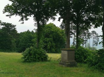
![Randonnée A pied Schleid - Geisaer Amt - Rundwanderweg 2 - Photo](https://media.geolcdn.com/t/350/260/c4229eb8-ddb6-4962-8900-defe2953da25.jpeg&format=jpg&maxdim=2)
![A pied A pied](https://static1.geolcdn.com/sitytour/trail-icons/100.png)
Km
A pied
![](/images/other/stat-length.png)
![](https://static1.geolcdn.com/siteimages/upload/files/1508320355ic_sort_den_pos_24dp.png)
![](https://static1.geolcdn.com/siteimages/upload/files/1508320355ic_sort_den_neg_24dp.png)
![](https://static1.geolcdn.com/siteimages/upload/files/16400158638029165_repeat_loop_refresh_sync_direction_icon.png)
• Randonnée créée par Rhönklub. Symbole: Weiße "2" auf blauem Grund
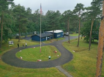
![Randonnée A pied Geisa - Geisaer Amt - Rundwanderweg 1 - Photo](https://media.geolcdn.com/t/350/260/77f76525-5a75-48be-bd81-98a51a9d7e03.jpeg&format=jpg&maxdim=2)
![A pied A pied](https://static1.geolcdn.com/sitytour/trail-icons/100.png)
Km
A pied
![](/images/other/stat-length.png)
![](https://static1.geolcdn.com/siteimages/upload/files/1508320355ic_sort_den_pos_24dp.png)
![](https://static1.geolcdn.com/siteimages/upload/files/1508320355ic_sort_den_neg_24dp.png)
![](https://static1.geolcdn.com/siteimages/upload/files/16400158638029165_repeat_loop_refresh_sync_direction_icon.png)
• Randonnée créée par Rhönklub. Symbole: Weiße 1 auf blauem Grund Site web: http://www.stadt-geisa.org/www/tourismus...
![Randonnée A pied Geisa - Extratour Point-Alpha-Weg - Photo](https://media.geolcdn.com/t/350/260/77f76525-5a75-48be-bd81-98a51a9d7e03.jpeg&format=jpg&maxdim=2)
![A pied A pied](https://static1.geolcdn.com/sitytour/trail-icons/100.png)
Km
A pied
![](/images/other/stat-length.png)
![](https://static1.geolcdn.com/siteimages/upload/files/1508320355ic_sort_den_pos_24dp.png)
![](https://static1.geolcdn.com/siteimages/upload/files/1508320355ic_sort_den_neg_24dp.png)
![](https://static1.geolcdn.com/siteimages/upload/files/16400158638029165_repeat_loop_refresh_sync_direction_icon.png)
• Randonnée créée par Rhönklub. complete Symbole: stilisiertes rotes P auf weißen Grund Site web: http://rhoenklub....
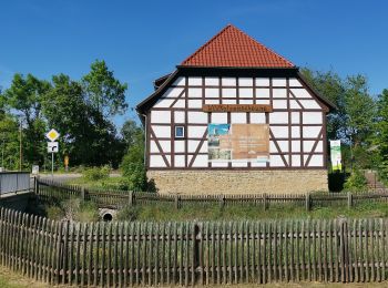
![Randonnée A pied Hörselberg-Hainich - Skulpturen-Wanderweg - Photo](https://media.geolcdn.com/t/350/260/4c241237-720f-4c9c-9a1a-8d9bd99344a1.jpeg&format=jpg&maxdim=2)
![A pied A pied](https://static1.geolcdn.com/sitytour/trail-icons/100.png)
Km
A pied
![](/images/other/stat-length.png)
![](https://static1.geolcdn.com/siteimages/upload/files/1508320355ic_sort_den_pos_24dp.png)
![](https://static1.geolcdn.com/siteimages/upload/files/1508320355ic_sort_den_neg_24dp.png)
![](https://static1.geolcdn.com/siteimages/upload/files/16400158638029165_repeat_loop_refresh_sync_direction_icon.png)
![Randonnée A pied Dermbach - Stadtlengsfeld - Rhön-Rundweg 5 - Photo](https://media.geolcdn.com/t/350/260/2e3efcec-4864-4d76-80ec-a2a1a0689ddd.jpeg&format=jpg&maxdim=2)
![A pied A pied](https://static1.geolcdn.com/sitytour/trail-icons/100.png)
Km
A pied
![](/images/other/stat-length.png)
![](https://static1.geolcdn.com/siteimages/upload/files/1508320355ic_sort_den_pos_24dp.png)
![](https://static1.geolcdn.com/siteimages/upload/files/1508320355ic_sort_den_neg_24dp.png)
![](https://static1.geolcdn.com/siteimages/upload/files/16400158638029165_repeat_loop_refresh_sync_direction_icon.png)
![Randonnée A pied Bad Salzungen - Uhrenweg - Photo](https://media.geolcdn.com/t/350/260/b4a946aa-3427-4099-899a-c35366fd59e4.jpeg&format=jpg&maxdim=2)
![A pied A pied](https://static1.geolcdn.com/sitytour/trail-icons/100.png)
Km
A pied
![](/images/other/stat-length.png)
![](https://static1.geolcdn.com/siteimages/upload/files/1508320355ic_sort_den_pos_24dp.png)
![](https://static1.geolcdn.com/siteimages/upload/files/1508320355ic_sort_den_neg_24dp.png)
![](https://static1.geolcdn.com/siteimages/upload/files/16400158638029165_repeat_loop_refresh_sync_direction_icon.png)
• Geht laut angegebener Webseite weiter über Miniathür zum Uhrenmuseum. Letzter Wegweiser am Rennsteig Symbole: grünes...
20 randonnées affichées sur 41
Application GPS de randonnée GRATUITE