Kornelimünster/Walheim, Aix-la-Chapelle : Les meilleures randonnées, itinéraires, parcours, balades et promenades

2 commentaires

Kornelimünster/Walheim : découvrez les meilleures randonnées : 16 pédestres et 1 à vélo ou VTT. Tous ces circuits, parcours, itinéraires et activités en plein air sont disponibles dans nos applications SityTrail pour smartphones et tablettes.


Les meilleurs parcours (18)

Randonnée Marche Aix-la-Chapelle - Kornelimünster  - Photo
Marche 15.485
Km
GUIDE

Marche

Moyen
(1)
Aix-la-Chapelle, Rhénanie-du-Nord-Westphalie, Région urbaine d'Aix-la-Chapelle, Allemagne
15,5 km | 19,8 km-effort
4h 30min
327 m
327 m
Oui
mumu.larandonneuse

• Parcours retracé sur base des sentiers locaux. 💚 Une rando coup de cœur ! ➡️ Juste au sud d'Aix-la-Chapelle se trouv...
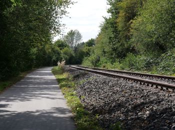
Randonnée A pied Aix-la-Chapelle - Kalkofenweg - Photo
A pied 6.869
Km
GUIDE+

A pied

Facile
Aix-la-Chapelle, Rhénanie-du-Nord-Westphalie, Région urbaine d'Aix-la-Chapelle, Allemagne
6,9 km | 8,1 km-effort
1h 50min
94 m
95 m
Oui
SityTrail - itinéraires balisés pédestres

• vor Ort nicht als "6" gekennzeichnet, wurde wohl lediglich pro forma in das Routennetz aufgenommen Symbole: schwarze...

Randonnée A pied Aix-la-Chapelle - [5] Itertalweg - Variante als Rundweg - Photo
A pied 8.029
Km
GUIDE+

A pied

Facile
Aix-la-Chapelle, Rhénanie-du-Nord-Westphalie, Région urbaine d'Aix-la-Chapelle, Allemagne
8 km | 9,9 km-effort
2h 14min
137 m
137 m
Oui
SityTrail - itinéraires balisés pédestres

Randonnée A pied Aix-la-Chapelle - [1] Kornelimünster - Breinig - Hahn - Photo
A pied 11.971
Km
GUIDE+

A pied

Facile
(1)
Aix-la-Chapelle, Rhénanie-du-Nord-Westphalie, Région urbaine d'Aix-la-Chapelle, Allemagne
12 km | 14,3 km-effort
3h 14min
173 m
175 m
Oui
SityTrail - itinéraires balisés pédestres

Randonnée A pied Aix-la-Chapelle - [2] Kornelimünster - Schleckheim - Photo
A pied 8.058
Km
GUIDE+

A pied

Facile
Aix-la-Chapelle, Rhénanie-du-Nord-Westphalie, Région urbaine d'Aix-la-Chapelle, Allemagne
8,1 km | 9,8 km-effort
2h 13min
132 m
132 m
Oui
SityTrail - itinéraires balisés pédestres

Randonnée A pied Aix-la-Chapelle - [5] Itertalweg: Kornelimünster - Sief - Photo
A pied 6.226
Km
GUIDE+

A pied

Facile
Aix-la-Chapelle, Rhénanie-du-Nord-Westphalie, Région urbaine d'Aix-la-Chapelle, Allemagne
6,2 km | 7,5 km-effort
1h 42min
105 m
64 m
Non
SityTrail - itinéraires balisés pédestres

Randonnée A pied Aix-la-Chapelle - [B1] Rückweg IndeRoute - Photo
A pied 3.215
Km
GUIDE+

A pied

Facile
Aix-la-Chapelle, Rhénanie-du-Nord-Westphalie, Région urbaine d'Aix-la-Chapelle, Allemagne
3,2 km | 4,1 km-effort
55min
74 m
32 m
Non
SityTrail - itinéraires balisés pédestres

Randonnée A pied Aix-la-Chapelle - [4] Kornelimünster - Frankenwald - Krauthausen - Photo
A pied 6.595
Km
GUIDE+

A pied

Facile
Aix-la-Chapelle, Rhénanie-du-Nord-Westphalie, Région urbaine d'Aix-la-Chapelle, Allemagne
6,6 km | 8,1 km-effort
1h 50min
112 m
112 m
Oui
SityTrail - itinéraires balisés pédestres

Randonnée A pied Aix-la-Chapelle - Raeren (gelbes Kreuz) - Photo
A pied 5.264
Km
GUIDE+

A pied

Facile
Aix-la-Chapelle, Rhénanie-du-Nord-Westphalie, Région urbaine d'Aix-la-Chapelle, Allemagne
5,3 km | 6,2 km-effort
1h 24min
77 m
58 m
Non
SityTrail - itinéraires balisés pédestres

• Symbole: Gelbes Kreuz

Randonnée Vélo Aix-la-Chapelle - Duitsland - Eifeltoer - Photo
Vélo 136.734
Km

Vélo

Très facile
Aix-la-Chapelle, Rhénanie-du-Nord-Westphalie, Région urbaine d'Aix-la-Chapelle, Allemagne
137 km | 171 km-effort
Inconnu
2556 m
2558 m
Oui
gpstracks

• More information on GPStracks.nl : http://www.gpstracks.nl

Randonnée Marche Aix-la-Chapelle - Kornelimünster - Photo
Marche 17.096
Km

Marche

Facile
Aix-la-Chapelle, Rhénanie-du-Nord-Westphalie, Région urbaine d'Aix-la-Chapelle, Allemagne
17,1 km | 21 km-effort
4h 27min
284 m
285 m
Oui
flip96

• Rondwandeling vanuit Kornelimünster. Prachtige, eenvoudige wandeling door het groen, langs Iterbach en Inde en het ou...

Randonnée Marche Aix-la-Chapelle - boucle Sief - Photo
Marche 3.71
Km

Marche

Facile
Aix-la-Chapelle, Rhénanie-du-Nord-Westphalie, Région urbaine d'Aix-la-Chapelle, Allemagne
3,7 km | 4,3 km-effort
1h 1min
44 m
44 m
Oui
Lychee

Randonnée Marche Aix-la-Chapelle - boucle Aachen - Photo
Marche 4.034
Km

Marche

Facile
Aix-la-Chapelle, Rhénanie-du-Nord-Westphalie, Région urbaine d'Aix-la-Chapelle, Allemagne
4 km | 5,2 km-effort
1h 21min
84 m
84 m
Oui
Lychee

Randonnée Marche Aix-la-Chapelle - boucle Aachen  - Photo
Marche 5.819
Km

Marche

Moyen
Aix-la-Chapelle, Rhénanie-du-Nord-Westphalie, Région urbaine d'Aix-la-Chapelle, Allemagne
5,8 km | 7,2 km-effort
1h 42min
106 m
107 m
Oui
Lychee

Randonnée Marche Aix-la-Chapelle - boucle Raeren  - Photo
Marche 4.817
Km

Marche

Facile
Aix-la-Chapelle, Rhénanie-du-Nord-Westphalie, Région urbaine d'Aix-la-Chapelle, Allemagne
4,8 km | 5,9 km-effort
1h 21min
79 m
79 m
Oui
Lychee

Randonnée Marche Aix-la-Chapelle - boucle Roetgen  - Photo
Marche 5.286
Km

Marche

Très facile
Aix-la-Chapelle, Rhénanie-du-Nord-Westphalie, Région urbaine d'Aix-la-Chapelle, Allemagne
5,3 km | 6,5 km-effort
1h 42min
91 m
92 m
Oui
Lychee

Randonnée Autre activité Aix-la-Chapelle - Duitsland - Eifelsteig 01: Kornelimünster- Monschau - Photo
Autre activité 31.379
Km

Autre activité

Moyen
Aix-la-Chapelle, Rhénanie-du-Nord-Westphalie, Région urbaine d'Aix-la-Chapelle, Allemagne
31 km | 40 km-effort
8h 44min
709 m
536 m
Non
misph

Randonnée Marche Aix-la-Chapelle - ESt-01 - Photo
Marche 13.995
Km

Marche

Facile
Aix-la-Chapelle, Rhénanie-du-Nord-Westphalie, Région urbaine d'Aix-la-Chapelle, Allemagne
14 km | 18,7 km-effort
4h 3min
401 m
210 m
Non
hubbi

18 randonnées affichées sur 18

Application GPS de randonnée GRATUITE

Logo SityTrail SityTrail

IGN / Instituts géographiques

Télécharger SityTrail sur l'App Store Télécharger SityTrail sur Google Play

Logo SityTrail SityTrail World

Le monde est à vous

Télécharger SityTrail sur l'App Store Télécharger SityTrail sur Google Play Télécharger SityTrail sur Huawei AppGallery

Activités

Fermer
Mes abonnements