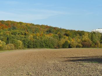
![](/images/other/stat-length.png)
- Randonnées
- Outdoor
- Allemagne
- Bade-Wurtemberg
- Stuttgart
- Inconnu
- Vaihingen
Vaihingen, Inconnu : Les meilleures randonnées, itinéraires, parcours, balades et promenades
Vaihingen : découvrez les meilleures randonnées : 3 pédestres. Tous ces circuits, parcours, itinéraires et activités en plein air sont disponibles dans nos applications SityTrail pour smartphones et tablettes.
Les meilleurs parcours (3)
![Randonnée A pied Inconnu - DE-SAV Rotes Kreuz, Doggenburg - Glemseck - Möhringen - Ruit - ? - Photo](https://media.geolcdn.com/t/350/260/ext.jpg?maxdim=2&url=https%3A%2F%2Fmedia.geolcdn.com%2Ff%2F2da589a0-719c-48ae-adec-f87fb79ed601.jpeg)
![A pied A pied](https://static1.geolcdn.com/sitytour/trail-icons/100.png)
Km
A pied
![](/images/other/stat-length.png)
![](https://static1.geolcdn.com/siteimages/upload/files/1508320355ic_sort_den_pos_24dp.png)
![](https://static1.geolcdn.com/siteimages/upload/files/1508320355ic_sort_den_neg_24dp.png)
![](https://static1.geolcdn.com/siteimages/upload/files/16400158638029165_repeat_loop_refresh_sync_direction_icon.png)
• Randonnée créée par Schwäbischer Albverein. SAV Rotes Kreuz, Doggenburg - Glemseck - Möhringen - Ruit - ? Symbole: ...
![Randonnée A pied Inconnu - DE-SAV Roter Punkt, Solitude - Vaihingen - Photo](https://media.geolcdn.com/t/350/260/ext.jpg?maxdim=2&url=https%3A%2F%2Fmedia.geolcdn.com%2Ff%2F281cc556-30c8-49c9-b502-5a5b91706442.jpeg)
![A pied A pied](https://static1.geolcdn.com/sitytour/trail-icons/100.png)
Km
A pied
![](/images/other/stat-length.png)
![](https://static1.geolcdn.com/siteimages/upload/files/1508320355ic_sort_den_pos_24dp.png)
![](https://static1.geolcdn.com/siteimages/upload/files/1508320355ic_sort_den_neg_24dp.png)
![](https://static1.geolcdn.com/siteimages/upload/files/16400158638029165_repeat_loop_refresh_sync_direction_icon.png)
• Randonnée créée par Schwäbischer Albverein. SAV Roter Punkt, Solitude - Vaihingen Symbole: Roter Punkt auf weißem G...
![Randonnée A pied Inconnu - DE-SAV Blauer Balken, Stuttgart-Rohr - Sindelfingen - Photo](https://media.geolcdn.com/t/350/260/ext.jpg?maxdim=2&url=https%3A%2F%2Fmedia.geolcdn.com%2Ff%2Fa6755622-e45f-45e2-acb1-905894808a0d.jpeg)
![A pied A pied](https://static1.geolcdn.com/sitytour/trail-icons/100.png)
Km
A pied
![](/images/other/stat-length.png)
![](https://static1.geolcdn.com/siteimages/upload/files/1508320355ic_sort_den_pos_24dp.png)
![](https://static1.geolcdn.com/siteimages/upload/files/1508320355ic_sort_den_neg_24dp.png)
![](https://static1.geolcdn.com/siteimages/upload/files/16400158638029165_repeat_loop_refresh_sync_direction_icon.png)
• Randonnée créée par Schwäbischer Albverein. SAV Blauer Balken, Stuttgart-Rohr - Sindelfingen Symbole: Blauer Balken...
3 randonnées affichées sur 3
Application GPS de randonnée GRATUITE