![](/images/other/stat-length.png)
Weinheim, Rhein-Neckar-Kreis : Les meilleures randonnées, itinéraires, parcours, balades et promenades
Weinheim : découvrez les meilleures randonnées : 23 pédestres. Tous ces circuits, parcours, itinéraires et activités en plein air sont disponibles dans nos applications SityTrail pour smartphones et tablettes.
Les meilleurs parcours (23)
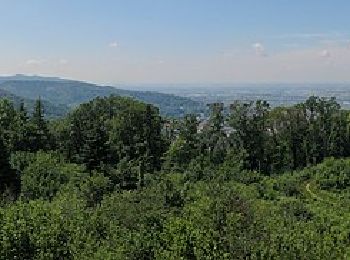
![Randonnée A pied Weinheim - Rundwanderweg Weinheim Hirschkopf 2: Rund um den Hirschkopf - Photo](https://media.geolcdn.com/t/350/260/07b0e5a6-b9b7-48f5-802e-66b19e9dc280.jpeg&format=jpg&maxdim=2)
![A pied A pied](https://static1.geolcdn.com/sitytour/trail-icons/100.png)
Km
A pied
![](/images/other/stat-length.png)
![](https://static1.geolcdn.com/siteimages/upload/files/1508320355ic_sort_den_pos_24dp.png)
![](https://static1.geolcdn.com/siteimages/upload/files/1508320355ic_sort_den_neg_24dp.png)
![](https://static1.geolcdn.com/siteimages/upload/files/16400158638029165_repeat_loop_refresh_sync_direction_icon.png)
• Randonnée créée par Naturpark Neckartal-Odenwald. Symbole: gelbe 2 in gelbem Kreis auf schwarzem Grund
![Randonnée A pied Weinheim - Rundwanderweg Weinheim Hirschkopf 1: Hirschkopfturm-Weg - Photo](https://media.geolcdn.com/t/350/260/07b0e5a6-b9b7-48f5-802e-66b19e9dc280.jpeg&format=jpg&maxdim=2)
![A pied A pied](https://static1.geolcdn.com/sitytour/trail-icons/100.png)
Km
A pied
![](/images/other/stat-length.png)
![](https://static1.geolcdn.com/siteimages/upload/files/1508320355ic_sort_den_pos_24dp.png)
![](https://static1.geolcdn.com/siteimages/upload/files/1508320355ic_sort_den_neg_24dp.png)
![](https://static1.geolcdn.com/siteimages/upload/files/16400158638029165_repeat_loop_refresh_sync_direction_icon.png)
• Randonnée créée par Naturpark Neckartal-Odenwald. Symbole: gelbe 1 in gelbem Kreis auf schwarzem Grund
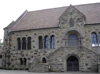
![Randonnée A pied Weinheim - Rundwanderweg Weinheim Wachenburg 3: Taubenberg-Weg - Photo](https://media.geolcdn.com/t/350/260/0052db86-eb64-491a-9e07-2575fde8d9dc.jpeg&format=jpg&maxdim=2)
![A pied A pied](https://static1.geolcdn.com/sitytour/trail-icons/100.png)
Km
A pied
![](/images/other/stat-length.png)
![](https://static1.geolcdn.com/siteimages/upload/files/1508320355ic_sort_den_pos_24dp.png)
![](https://static1.geolcdn.com/siteimages/upload/files/1508320355ic_sort_den_neg_24dp.png)
![](https://static1.geolcdn.com/siteimages/upload/files/16400158638029165_repeat_loop_refresh_sync_direction_icon.png)
• Randonnée créée par Naturpark Neckartal-Odenwald. Symbole: Gelbe 3 im Kreis
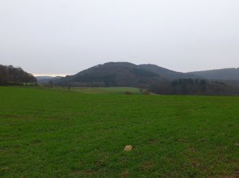
![Randonnée A pied Weinheim - Geopark-Pfad Weinheim-Schriesheim - Photo](https://media.geolcdn.com/t/350/260/b60fde3c-7aee-4bc6-be31-b75eb2125fbb.jpeg&format=jpg&maxdim=2)
![A pied A pied](https://static1.geolcdn.com/sitytour/trail-icons/100.png)
Km
A pied
![](/images/other/stat-length.png)
![](https://static1.geolcdn.com/siteimages/upload/files/1508320355ic_sort_den_pos_24dp.png)
![](https://static1.geolcdn.com/siteimages/upload/files/1508320355ic_sort_den_neg_24dp.png)
![](https://static1.geolcdn.com/siteimages/upload/files/16400158638029165_repeat_loop_refresh_sync_direction_icon.png)
• Randonnée créée par Geo-Naturpark Bergstraße-Odenwald. Symbole: Gelbes L im gelben Kreis
![Randonnée A pied Weinheim - Rundwanderweg Ursenbacher Höhe 6: Eichelberg-Weg - Photo](https://media.geolcdn.com/t/350/260/b60fde3c-7aee-4bc6-be31-b75eb2125fbb.jpeg&format=jpg&maxdim=2)
![A pied A pied](https://static1.geolcdn.com/sitytour/trail-icons/100.png)
Km
A pied
![](/images/other/stat-length.png)
![](https://static1.geolcdn.com/siteimages/upload/files/1508320355ic_sort_den_pos_24dp.png)
![](https://static1.geolcdn.com/siteimages/upload/files/1508320355ic_sort_den_neg_24dp.png)
![](https://static1.geolcdn.com/siteimages/upload/files/16400158638029165_repeat_loop_refresh_sync_direction_icon.png)
• Randonnée créée par Naturpark Neckartal-Odenwald. Symbole: Gelbe 6 im gelben Kreis
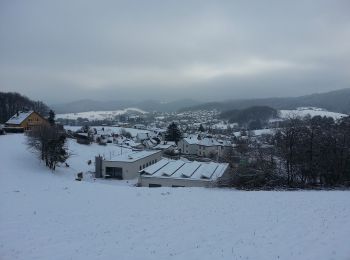
![Randonnée A pied Weinheim - Rundwanderweg Bildstock 5: Rund um den Steinberg - Photo](https://media.geolcdn.com/t/350/260/d1073293-c6b3-43cb-812c-813313e606ff.jpeg&format=jpg&maxdim=2)
![A pied A pied](https://static1.geolcdn.com/sitytour/trail-icons/100.png)
Km
A pied
![](/images/other/stat-length.png)
![](https://static1.geolcdn.com/siteimages/upload/files/1508320355ic_sort_den_pos_24dp.png)
![](https://static1.geolcdn.com/siteimages/upload/files/1508320355ic_sort_den_neg_24dp.png)
![](https://static1.geolcdn.com/siteimages/upload/files/16400158638029165_repeat_loop_refresh_sync_direction_icon.png)
• Randonnée créée par Naturpark Neckartal-Odenwald. Symbole: Gelbe 5 im gelben Kreis
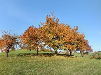
![Randonnée A pied Weinheim - Rundwanderweg Röckelsberg 4: Röckelsberg-Weg - Photo](https://media.geolcdn.com/t/350/260/c2c494f1-9345-46b2-a350-9f036c0727c6.jpeg&format=jpg&maxdim=2)
![A pied A pied](https://static1.geolcdn.com/sitytour/trail-icons/100.png)
Km
A pied
![](/images/other/stat-length.png)
![](https://static1.geolcdn.com/siteimages/upload/files/1508320355ic_sort_den_pos_24dp.png)
![](https://static1.geolcdn.com/siteimages/upload/files/1508320355ic_sort_den_neg_24dp.png)
![](https://static1.geolcdn.com/siteimages/upload/files/16400158638029165_repeat_loop_refresh_sync_direction_icon.png)
• Randonnée créée par Naturpark Neckartal-Odenwald. Symbole: Gelbe 4 im gelben Kreis
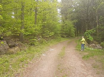
![Randonnée A pied Weinheim - Rundwanderweg Bärsbacher Weg 2: Eichelberg-Weg - Photo](https://media.geolcdn.com/t/350/260/c61ebbdb-bd4e-4171-889d-a94192795791.jpeg&format=jpg&maxdim=2)
![A pied A pied](https://static1.geolcdn.com/sitytour/trail-icons/100.png)
Km
A pied
![](/images/other/stat-length.png)
![](https://static1.geolcdn.com/siteimages/upload/files/1508320355ic_sort_den_pos_24dp.png)
![](https://static1.geolcdn.com/siteimages/upload/files/1508320355ic_sort_den_neg_24dp.png)
![](https://static1.geolcdn.com/siteimages/upload/files/16400158638029165_repeat_loop_refresh_sync_direction_icon.png)
• Randonnée créée par Naturpark Neckartal-Odenwald. Symbole: Gelbe 2 in gelbem Kreis
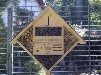
![Randonnée A pied Weinheim - Rundwanderweg 3: Großer Rundweg - Photo](https://media.geolcdn.com/t/350/260/85155e0d-747c-4631-a464-2eab3a8a5c2f.jpeg&format=jpg&maxdim=2)
![A pied A pied](https://static1.geolcdn.com/sitytour/trail-icons/100.png)
Km
A pied
![](/images/other/stat-length.png)
![](https://static1.geolcdn.com/siteimages/upload/files/1508320355ic_sort_den_pos_24dp.png)
![](https://static1.geolcdn.com/siteimages/upload/files/1508320355ic_sort_den_neg_24dp.png)
![](https://static1.geolcdn.com/siteimages/upload/files/16400158638029165_repeat_loop_refresh_sync_direction_icon.png)
• Randonnée créée par Naturpark Neckartal-Odenwald. Symbole: Schwarze 3 in schwarzem Kreis (auf Holzschild)
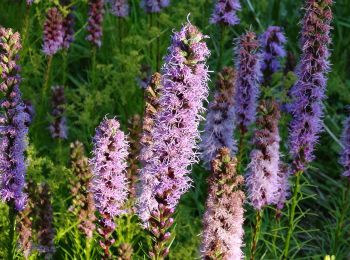
![Randonnée A pied Weinheim - Rundwanderweg 2: Exotenwald-Rundweg - Photo](https://media.geolcdn.com/t/350/260/1afd8d73-817e-4333-89fd-e496623f1073.jpeg&format=jpg&maxdim=2)
![A pied A pied](https://static1.geolcdn.com/sitytour/trail-icons/100.png)
Km
A pied
![](/images/other/stat-length.png)
![](https://static1.geolcdn.com/siteimages/upload/files/1508320355ic_sort_den_pos_24dp.png)
![](https://static1.geolcdn.com/siteimages/upload/files/1508320355ic_sort_den_neg_24dp.png)
![](https://static1.geolcdn.com/siteimages/upload/files/16400158638029165_repeat_loop_refresh_sync_direction_icon.png)
• Randonnée créée par Naturpark Neckartal-Odenwald. Symbole: Schwarze 2 in schwarzem Kreis (auf Holzschild)
![Randonnée A pied Weinheim - Rundwanderweg Bildstock 10: Rund um Oberflockenbach - Photo](https://media.geolcdn.com/t/350/260/d1073293-c6b3-43cb-812c-813313e606ff.jpeg&format=jpg&maxdim=2)
![A pied A pied](https://static1.geolcdn.com/sitytour/trail-icons/100.png)
Km
A pied
![](/images/other/stat-length.png)
![](https://static1.geolcdn.com/siteimages/upload/files/1508320355ic_sort_den_pos_24dp.png)
![](https://static1.geolcdn.com/siteimages/upload/files/1508320355ic_sort_den_neg_24dp.png)
![](https://static1.geolcdn.com/siteimages/upload/files/16400158638029165_repeat_loop_refresh_sync_direction_icon.png)
• Randonnée créée par Naturpark Neckartal-Odenwald. Symbole: Gelbe 10 im gelben Kreis
![Randonnée A pied Weinheim - Rundwanderweg Weinheim Raubschloss 2: Durchs Bannholz - Photo](https://media.geolcdn.com/t/350/260/0052db86-eb64-491a-9e07-2575fde8d9dc.jpeg&format=jpg&maxdim=2)
![A pied A pied](https://static1.geolcdn.com/sitytour/trail-icons/100.png)
Km
A pied
![](/images/other/stat-length.png)
![](https://static1.geolcdn.com/siteimages/upload/files/1508320355ic_sort_den_pos_24dp.png)
![](https://static1.geolcdn.com/siteimages/upload/files/1508320355ic_sort_den_neg_24dp.png)
![](https://static1.geolcdn.com/siteimages/upload/files/16400158638029165_repeat_loop_refresh_sync_direction_icon.png)
• Randonnée créée par Naturpark Neckartal-Odenwald. Symbole: gelbe 2 in gelbem Kreis

![Randonnée A pied Weinheim - Rundwanderweg Weinheim Spelzengrund 1: Bocksberg-Weg - Photo](https://media.geolcdn.com/t/350/260/c9df1804-1185-4657-b8d5-b9397d443519.jpeg&format=jpg&maxdim=2)
![A pied A pied](https://static1.geolcdn.com/sitytour/trail-icons/100.png)
Km
A pied
![](/images/other/stat-length.png)
![](https://static1.geolcdn.com/siteimages/upload/files/1508320355ic_sort_den_pos_24dp.png)
![](https://static1.geolcdn.com/siteimages/upload/files/1508320355ic_sort_den_neg_24dp.png)
![](https://static1.geolcdn.com/siteimages/upload/files/16400158638029165_repeat_loop_refresh_sync_direction_icon.png)
• Randonnée créée par Naturpark Neckartal-Odenwald. Symbole: gelbe 1 in gelbem Kreis auf schwarzem Grund
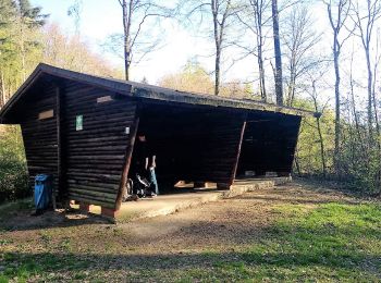
![Randonnée A pied Weinheim - Rundwanderweg Gorxheimertal 1: Wachenberg-Weg - Photo](https://media.geolcdn.com/t/350/260/358c6525-bcb3-4176-8698-b96fbeff9774.jpeg&format=jpg&maxdim=2)
![A pied A pied](https://static1.geolcdn.com/sitytour/trail-icons/100.png)
Km
A pied
![](/images/other/stat-length.png)
![](https://static1.geolcdn.com/siteimages/upload/files/1508320355ic_sort_den_pos_24dp.png)
![](https://static1.geolcdn.com/siteimages/upload/files/1508320355ic_sort_den_neg_24dp.png)
![](https://static1.geolcdn.com/siteimages/upload/files/16400158638029165_repeat_loop_refresh_sync_direction_icon.png)
• Randonnée créée par Geo-Naturpark Bergstraße-Odenwald. Symbole: Weiße 1 in einem oben offenen Kreis, darüber weißes G
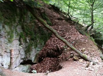
![Randonnée A pied Weinheim - Rundwanderweg Gorxheimertal 3: Eichelberg-Weg - Photo](https://media.geolcdn.com/t/350/260/6954f9ff-d9d4-4523-b381-eadb86b08ff9.jpeg&format=jpg&maxdim=2)
![A pied A pied](https://static1.geolcdn.com/sitytour/trail-icons/100.png)
Km
A pied
![](/images/other/stat-length.png)
![](https://static1.geolcdn.com/siteimages/upload/files/1508320355ic_sort_den_pos_24dp.png)
![](https://static1.geolcdn.com/siteimages/upload/files/1508320355ic_sort_den_neg_24dp.png)
![](https://static1.geolcdn.com/siteimages/upload/files/16400158638029165_repeat_loop_refresh_sync_direction_icon.png)
• Randonnée créée par Geo-Naturpark Bergstraße-Odenwald. Symbole: Weiße 3 in einem oben offenen Kreis, darüber weißes G
![Randonnée A pied Weinheim - Rundwanderweg Judenberg 3: Bärengrund-Weg - Photo](https://media.geolcdn.com/t/350/260/b60fde3c-7aee-4bc6-be31-b75eb2125fbb.jpeg&format=jpg&maxdim=2)
![A pied A pied](https://static1.geolcdn.com/sitytour/trail-icons/100.png)
Km
A pied
![](/images/other/stat-length.png)
![](https://static1.geolcdn.com/siteimages/upload/files/1508320355ic_sort_den_pos_24dp.png)
![](https://static1.geolcdn.com/siteimages/upload/files/1508320355ic_sort_den_neg_24dp.png)
![](https://static1.geolcdn.com/siteimages/upload/files/16400158638029165_repeat_loop_refresh_sync_direction_icon.png)
• Randonnée créée par Naturpark Neckartal-Odenwald. Symbole: Gelbe 3 im gelben Kreis
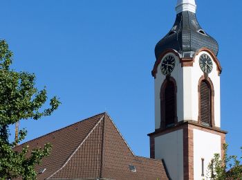
![Randonnée A pied Weinheim - Rundwanderweg Am Bischof 6: Kalter Hergotts-Weg - Photo](https://media.geolcdn.com/t/350/260/d446aae8-32db-4e8d-8d1f-dc2459afb9e0.jpeg&format=jpg&maxdim=2)
![A pied A pied](https://static1.geolcdn.com/sitytour/trail-icons/100.png)
Km
A pied
![](/images/other/stat-length.png)
![](https://static1.geolcdn.com/siteimages/upload/files/1508320355ic_sort_den_pos_24dp.png)
![](https://static1.geolcdn.com/siteimages/upload/files/1508320355ic_sort_den_neg_24dp.png)
![](https://static1.geolcdn.com/siteimages/upload/files/16400158638029165_repeat_loop_refresh_sync_direction_icon.png)
• Randonnée créée par Naturpark Neckartal-Odenwald. Symbole: Gelbe 6 im gelben Kreis
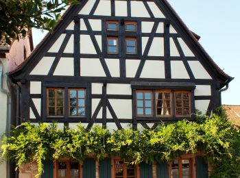
![Randonnée A pied Weinheim - Rundwanderweg Am Bischof 5: Geiersberg-Weg - Photo](https://media.geolcdn.com/t/350/260/9cc0fdc5-156e-48dc-9ee0-c7b7b137559f.jpeg&format=jpg&maxdim=2)
![A pied A pied](https://static1.geolcdn.com/sitytour/trail-icons/100.png)
Km
A pied
![](/images/other/stat-length.png)
![](https://static1.geolcdn.com/siteimages/upload/files/1508320355ic_sort_den_pos_24dp.png)
![](https://static1.geolcdn.com/siteimages/upload/files/1508320355ic_sort_den_neg_24dp.png)
![](https://static1.geolcdn.com/siteimages/upload/files/16400158638029165_repeat_loop_refresh_sync_direction_icon.png)
• Randonnée créée par Naturpark Neckartal-Odenwald. Symbole: Gelbe 5 im gelben Kreis
![Randonnée A pied Weinheim - Rundwanderweg Am Bischof 4: Talberg-Weg - Photo](https://media.geolcdn.com/t/350/260/d446aae8-32db-4e8d-8d1f-dc2459afb9e0.jpeg&format=jpg&maxdim=2)
![A pied A pied](https://static1.geolcdn.com/sitytour/trail-icons/100.png)
Km
A pied
![](/images/other/stat-length.png)
![](https://static1.geolcdn.com/siteimages/upload/files/1508320355ic_sort_den_pos_24dp.png)
![](https://static1.geolcdn.com/siteimages/upload/files/1508320355ic_sort_den_neg_24dp.png)
![](https://static1.geolcdn.com/siteimages/upload/files/16400158638029165_repeat_loop_refresh_sync_direction_icon.png)
• Randonnée créée par Naturpark Neckartal-Odenwald. Symbole: Gelbe 4 im gelben Kreis
![Randonnée A pied Weinheim - Rundwanderweg Weinheim Raubschloss 3: Exotenwald-Weg - Photo](https://media.geolcdn.com/t/350/260/85155e0d-747c-4631-a464-2eab3a8a5c2f.jpeg&format=jpg&maxdim=2)
![A pied A pied](https://static1.geolcdn.com/sitytour/trail-icons/100.png)
Km
A pied
![](/images/other/stat-length.png)
![](https://static1.geolcdn.com/siteimages/upload/files/1508320355ic_sort_den_pos_24dp.png)
![](https://static1.geolcdn.com/siteimages/upload/files/1508320355ic_sort_den_neg_24dp.png)
![](https://static1.geolcdn.com/siteimages/upload/files/16400158638029165_repeat_loop_refresh_sync_direction_icon.png)
• Randonnée créée par Naturpark Neckartal-Odenwald. Symbole: gelbe 3 in gelbem Kreis
20 randonnées affichées sur 23
Application GPS de randonnée GRATUITE