![](/images/other/stat-length.png)
- Randonnées
- Outdoor
- Allemagne
- Bade-Wurtemberg
- Landkreis Rottweil
Landkreis Rottweil, Bade-Wurtemberg : Les meilleures randonnées, itinéraires, parcours, balades et promenades
Landkreis Rottweil : découvrez les meilleures randonnées : 24 pédestres. Tous ces circuits, parcours, itinéraires et activités en plein air sont disponibles dans nos applications SityTrail pour smartphones et tablettes.
Les meilleurs parcours (26)
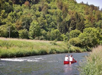
![Randonnée A pied Sulz am Neckar - Äußerer Alternativweg - Dettingen - Weg-2 - Isenburg - Fischingen - Photo](https://media.geolcdn.com/t/350/260/d0e011fd-5507-49bb-ab14-800229085ec1.jpeg&format=jpg&maxdim=2)
![A pied A pied](https://static1.geolcdn.com/sitytour/trail-icons/100.png)
Km
A pied
![](/images/other/stat-length.png)
![](https://static1.geolcdn.com/siteimages/upload/files/1508320355ic_sort_den_pos_24dp.png)
![](https://static1.geolcdn.com/siteimages/upload/files/1508320355ic_sort_den_neg_24dp.png)
![](https://static1.geolcdn.com/siteimages/upload/files/16400158638029165_repeat_loop_refresh_sync_direction_icon.png)
• Randonnée créée par Schwäbischer Albverein - Ortsgruppe Dettingen. Symbole: rotes Kreuz auf weißem Grund
![Randonnée A pied Deißlingen - SAV rote Gabel Wildenstein - Maienbühl Dauchingen Schwenningen - Photo](https://media.geolcdn.com/t/350/260/96a7e94e-8b14-474e-8394-691321662ee8.jpeg&format=jpg&maxdim=2)
![A pied A pied](https://static1.geolcdn.com/sitytour/trail-icons/100.png)
Km
A pied
![](/images/other/stat-length.png)
![](https://static1.geolcdn.com/siteimages/upload/files/1508320355ic_sort_den_pos_24dp.png)
![](https://static1.geolcdn.com/siteimages/upload/files/1508320355ic_sort_den_neg_24dp.png)
![](https://static1.geolcdn.com/siteimages/upload/files/16400158638029165_repeat_loop_refresh_sync_direction_icon.png)
• Randonnée créée par Schwäbischer Albverein. Symbole: rote Gabel auf weißem Quadrat
![Randonnée A pied Zimmern ob Rottweil - Horgen-Ruinie Wildenstein - Photo](https://media.geolcdn.com/t/350/260/7f29cd9e-ee65-49ff-95dd-0a933230cfdd.jpeg&format=jpg&maxdim=2)
![A pied A pied](https://static1.geolcdn.com/sitytour/trail-icons/100.png)
Km
A pied
![](/images/other/stat-length.png)
![](https://static1.geolcdn.com/siteimages/upload/files/1508320355ic_sort_den_pos_24dp.png)
![](https://static1.geolcdn.com/siteimages/upload/files/1508320355ic_sort_den_neg_24dp.png)
![](https://static1.geolcdn.com/siteimages/upload/files/16400158638029165_repeat_loop_refresh_sync_direction_icon.png)
• Randonnée créée par Schwarzwaldverein. Symbole: yellow diamond on white background
![Randonnée A pied Deißlingen - SAV rotes Plus Maienbühl-Oberrotenstein - Photo](https://media.geolcdn.com/t/350/260/93743c74-53d7-4085-83fd-817da1652b63.jpeg&format=jpg&maxdim=2)
![A pied A pied](https://static1.geolcdn.com/sitytour/trail-icons/100.png)
Km
A pied
![](/images/other/stat-length.png)
![](https://static1.geolcdn.com/siteimages/upload/files/1508320355ic_sort_den_pos_24dp.png)
![](https://static1.geolcdn.com/siteimages/upload/files/1508320355ic_sort_den_neg_24dp.png)
![](https://static1.geolcdn.com/siteimages/upload/files/16400158638029165_repeat_loop_refresh_sync_direction_icon.png)
• Randonnée créée par Schwäbischer Alb Verein. Symbole: red cross on white background
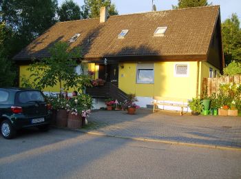
![Randonnée A pied Deißlingen - Maienbühl-Sinkingen - Photo](https://media.geolcdn.com/t/350/260/44373997-e132-40b9-b59e-76110e10781e.jpeg&format=jpg&maxdim=2)
![A pied A pied](https://static1.geolcdn.com/sitytour/trail-icons/100.png)
Km
A pied
![](/images/other/stat-length.png)
![](https://static1.geolcdn.com/siteimages/upload/files/1508320355ic_sort_den_pos_24dp.png)
![](https://static1.geolcdn.com/siteimages/upload/files/1508320355ic_sort_den_neg_24dp.png)
![](https://static1.geolcdn.com/siteimages/upload/files/16400158638029165_repeat_loop_refresh_sync_direction_icon.png)
• Randonnée créée par Schwarzwaldverein. Symbole: yellow diamond on white background
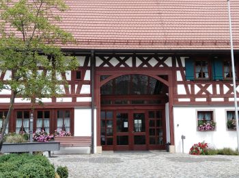
![Randonnée A pied Dietingen - Rotenzimmern-Stausee Schömberg - Photo](https://media.geolcdn.com/t/350/260/46b09618-11cb-4f7c-8bf3-01b8dd8ddad0.jpeg&format=jpg&maxdim=2)
![A pied A pied](https://static1.geolcdn.com/sitytour/trail-icons/100.png)
Km
A pied
![](/images/other/stat-length.png)
![](https://static1.geolcdn.com/siteimages/upload/files/1508320355ic_sort_den_pos_24dp.png)
![](https://static1.geolcdn.com/siteimages/upload/files/1508320355ic_sort_den_neg_24dp.png)
![](https://static1.geolcdn.com/siteimages/upload/files/16400158638029165_repeat_loop_refresh_sync_direction_icon.png)
• Randonnée créée par Schwäbischer Alb Verein. Symbole: blue diamond on white background
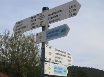
![Randonnée A pied Lauterbach - Lauterbacher Wandersteig - Photo](https://media.geolcdn.com/t/350/260/bd286e0c-0ca8-42d2-8194-0b575bdbe094.jpeg&format=jpg&maxdim=2)
![A pied A pied](https://static1.geolcdn.com/sitytour/trail-icons/100.png)
Km
A pied
![](/images/other/stat-length.png)
![](https://static1.geolcdn.com/siteimages/upload/files/1508320355ic_sort_den_pos_24dp.png)
![](https://static1.geolcdn.com/siteimages/upload/files/1508320355ic_sort_den_neg_24dp.png)
![](https://static1.geolcdn.com/siteimages/upload/files/16400158638029165_repeat_loop_refresh_sync_direction_icon.png)
• Randonnée créée par Schwarzwaldverein. Symbole: Blaue Raute auf weißem Grund
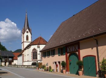
![Randonnée A pied Sulz am Neckar - Glatttalweg - Photo](https://media.geolcdn.com/t/350/260/a90a6a4f-6dd6-4271-9fa2-767583287d5d.jpeg&format=jpg&maxdim=2)
![A pied A pied](https://static1.geolcdn.com/sitytour/trail-icons/100.png)
Km
A pied
![](/images/other/stat-length.png)
![](https://static1.geolcdn.com/siteimages/upload/files/1508320355ic_sort_den_pos_24dp.png)
![](https://static1.geolcdn.com/siteimages/upload/files/1508320355ic_sort_den_neg_24dp.png)
![](https://static1.geolcdn.com/siteimages/upload/files/16400158638029165_repeat_loop_refresh_sync_direction_icon.png)
• Randonnée créée par Schwarzwaldverein. Symbole: Gelbe Raute auf weißem Grund
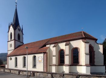
![Randonnée A pied Sulz am Neckar - Glatt-Sulz a.N. - Photo](https://media.geolcdn.com/t/350/260/da3e217e-a625-4869-b121-7375ee420d82.jpeg&format=jpg&maxdim=2)
![A pied A pied](https://static1.geolcdn.com/sitytour/trail-icons/100.png)
Km
A pied
![](/images/other/stat-length.png)
![](https://static1.geolcdn.com/siteimages/upload/files/1508320355ic_sort_den_pos_24dp.png)
![](https://static1.geolcdn.com/siteimages/upload/files/1508320355ic_sort_den_neg_24dp.png)
![](https://static1.geolcdn.com/siteimages/upload/files/16400158638029165_repeat_loop_refresh_sync_direction_icon.png)
• Randonnée créée par Schwarzwaldverein. Symbole: Gelbe Raute auf weißem Grund
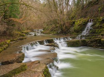
![Randonnée A pied Epfendorf - Schlichemklammweg - Photo](https://media.geolcdn.com/t/350/260/d3eb2c08-afe1-466a-be05-282762d0b7eb.jpeg&format=jpg&maxdim=2)
![A pied A pied](https://static1.geolcdn.com/sitytour/trail-icons/100.png)
Km
A pied
![](/images/other/stat-length.png)
![](https://static1.geolcdn.com/siteimages/upload/files/1508320355ic_sort_den_pos_24dp.png)
![](https://static1.geolcdn.com/siteimages/upload/files/1508320355ic_sort_den_neg_24dp.png)
![](https://static1.geolcdn.com/siteimages/upload/files/16400158638029165_repeat_loop_refresh_sync_direction_icon.png)
• Randonnée créée par Schwäbischer Albverein. Symbole: Roter Punkt auf weißem Grund
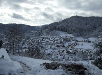
![Randonnée A pied Oberndorf am Neckar - Oberndorf - Schenkenzell - Photo](https://media.geolcdn.com/t/350/260/2728cb1e-ee71-48c5-89f0-dd0078cf8afd.jpeg&format=jpg&maxdim=2)
![A pied A pied](https://static1.geolcdn.com/sitytour/trail-icons/100.png)
Km
A pied
![](/images/other/stat-length.png)
![](https://static1.geolcdn.com/siteimages/upload/files/1508320355ic_sort_den_pos_24dp.png)
![](https://static1.geolcdn.com/siteimages/upload/files/1508320355ic_sort_den_neg_24dp.png)
![](https://static1.geolcdn.com/siteimages/upload/files/16400158638029165_repeat_loop_refresh_sync_direction_icon.png)
• Randonnée créée par Schwarzwaldverein. Symbole: Blaue Raute auf weißem Grund
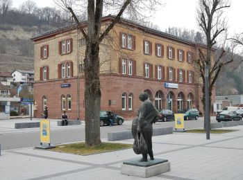
![Randonnée A pied Sulz am Neckar - Sulz am Neckar - Alpirsbach - Photo](https://media.geolcdn.com/t/350/260/e1073625-c7a6-4004-a145-c0d056b15ed2.jpeg&format=jpg&maxdim=2)
![A pied A pied](https://static1.geolcdn.com/sitytour/trail-icons/100.png)
Km
A pied
![](/images/other/stat-length.png)
![](https://static1.geolcdn.com/siteimages/upload/files/1508320355ic_sort_den_pos_24dp.png)
![](https://static1.geolcdn.com/siteimages/upload/files/1508320355ic_sort_den_neg_24dp.png)
![](https://static1.geolcdn.com/siteimages/upload/files/16400158638029165_repeat_loop_refresh_sync_direction_icon.png)
• Randonnée créée par Schwarzwaldverein. Symbole: Blaue Raute auf weißem Grund
![Randonnée A pied Dornhan - Glatttal-Höhenweg - Photo](https://media.geolcdn.com/t/350/260/dd8e719e-c17a-4f6f-bac8-6f14a1c5d3b9.jpeg&format=jpg&maxdim=2)
![A pied A pied](https://static1.geolcdn.com/sitytour/trail-icons/100.png)
Km
A pied
![](/images/other/stat-length.png)
![](https://static1.geolcdn.com/siteimages/upload/files/1508320355ic_sort_den_pos_24dp.png)
![](https://static1.geolcdn.com/siteimages/upload/files/1508320355ic_sort_den_neg_24dp.png)
![](https://static1.geolcdn.com/siteimages/upload/files/16400158638029165_repeat_loop_refresh_sync_direction_icon.png)
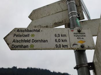
• Randonnée créée par Schwarzwaldverein. Symbole: Gelbe Raute auf weißem Grund
![Randonnée A pied Deißlingen - Rottweil - Lauffen - Trossingen - Lupfen - Photo](https://media.geolcdn.com/t/350/260/79665d16-5935-428e-9af0-40ea3ef97e00.jpeg&format=jpg&maxdim=2)
![A pied A pied](https://static1.geolcdn.com/sitytour/trail-icons/100.png)
Km
A pied
![](/images/other/stat-length.png)
![](https://static1.geolcdn.com/siteimages/upload/files/1508320355ic_sort_den_pos_24dp.png)
![](https://static1.geolcdn.com/siteimages/upload/files/1508320355ic_sort_den_neg_24dp.png)
![](https://static1.geolcdn.com/siteimages/upload/files/16400158638029165_repeat_loop_refresh_sync_direction_icon.png)
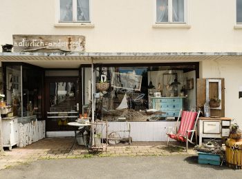
• Randonnée créée par Schwäbischer Albverein. Symbole: liegendes blaues Dreieck auf weißem Grund
![Randonnée A pied Deißlingen - Rottweil / Deißlingen - Aixheim - Klippeneck/Dreifaltigkeitsberg - Photo](https://media.geolcdn.com/t/350/260/4afb36c2-8d09-4ceb-9fb3-05ca3b723f46.jpeg&format=jpg&maxdim=2)
![A pied A pied](https://static1.geolcdn.com/sitytour/trail-icons/100.png)
Km
A pied
![](/images/other/stat-length.png)
![](https://static1.geolcdn.com/siteimages/upload/files/1508320355ic_sort_den_pos_24dp.png)
![](https://static1.geolcdn.com/siteimages/upload/files/1508320355ic_sort_den_neg_24dp.png)
![](https://static1.geolcdn.com/siteimages/upload/files/16400158638029165_repeat_loop_refresh_sync_direction_icon.png)
• Randonnée créée par Schwäbischer Albverein. Symbole: liegendes blaues Dreieck auf weißem Grund
![Randonnée A pied Zimmern ob Rottweil - Rottweil - Schramberg - Photo](https://media.geolcdn.com/t/350/260/88f44463-6c40-40b4-a157-8f6d436a1c26.jpeg&format=jpg&maxdim=2)
![A pied A pied](https://static1.geolcdn.com/sitytour/trail-icons/100.png)
Km
A pied
![](/images/other/stat-length.png)
![](https://static1.geolcdn.com/siteimages/upload/files/1508320355ic_sort_den_pos_24dp.png)
![](https://static1.geolcdn.com/siteimages/upload/files/1508320355ic_sort_den_neg_24dp.png)
![](https://static1.geolcdn.com/siteimages/upload/files/16400158638029165_repeat_loop_refresh_sync_direction_icon.png)
• Randonnée créée par Schwarzwaldverein. Symbole: Blaue Raute auf weißem Grund
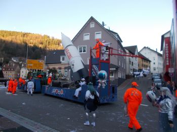
![Randonnée A pied Schramberg - Schramberg - Rotwasser - Photo](https://media.geolcdn.com/t/350/260/db36fa83-aefc-45ac-bfe0-f311a4b70784.jpeg&format=jpg&maxdim=2)
![A pied A pied](https://static1.geolcdn.com/sitytour/trail-icons/100.png)
Km
A pied
![](/images/other/stat-length.png)
![](https://static1.geolcdn.com/siteimages/upload/files/1508320355ic_sort_den_pos_24dp.png)
![](https://static1.geolcdn.com/siteimages/upload/files/1508320355ic_sort_den_neg_24dp.png)
![](https://static1.geolcdn.com/siteimages/upload/files/16400158638029165_repeat_loop_refresh_sync_direction_icon.png)
• Randonnée créée par Schwarzwaldverein. Symbole: Blaue Raute auf weißem Grund
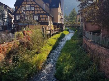
![Randonnée Marche Schramberg - Schramberg - Châteaux de Falkenstein et de Hohenschramberg - Photo](https://media.geolcdn.com/t/350/260/5c1b18a3-2e1e-4018-b6f0-20e65baf2dfc.jpg&format=jpg&maxdim=2)
![Marche Marche](https://static1.geolcdn.com/sitytour/trail-icons/101.png)
Km
Marche
![](/images/other/stat-length.png)
![](https://static1.geolcdn.com/siteimages/upload/files/1508320355ic_sort_den_pos_24dp.png)
![](https://static1.geolcdn.com/siteimages/upload/files/1508320355ic_sort_den_neg_24dp.png)
![](https://static1.geolcdn.com/siteimages/upload/files/16400158638029165_repeat_loop_refresh_sync_direction_icon.png)
• Randonnée au départ de la belle ville de Schramberg qui permet au départ d'apercevoir au loin les ruines du château d...
![Randonnée A pied Schenkenzell - Flößerpfad Kinzigtal: Route Teil 2b - Photo](https://media.geolcdn.com/t/350/260/ext.jpg?maxdim=2&url=https%3A%2F%2Fstatic1.geolcdn.com%2Fsiteimages%2Fupload%2Ffiles%2F1545311037marcheuse_200dpi.jpg)
![A pied A pied](https://static1.geolcdn.com/sitytour/trail-icons/100.png)
Km
A pied
![](/images/other/stat-length.png)
![](https://static1.geolcdn.com/siteimages/upload/files/1508320355ic_sort_den_pos_24dp.png)
![](https://static1.geolcdn.com/siteimages/upload/files/1508320355ic_sort_den_neg_24dp.png)
![](https://static1.geolcdn.com/siteimages/upload/files/16400158638029165_repeat_loop_refresh_sync_direction_icon.png)
• 2020-08-13 jue71: Aussage von Tour-Konzept per Mail: "Wir würden uns natürlich freuen, wenn Sie die Daten auch in OSM...
![Randonnée A pied Dornhan - Hubertushütte-Weiden Schulhaus - Photo](https://media.geolcdn.com/t/350/260/ext.jpg?maxdim=2&url=https%3A%2F%2Fstatic1.geolcdn.com%2Fsiteimages%2Fupload%2Ffiles%2F1545311037marcheuse_200dpi.jpg)
![A pied A pied](https://static1.geolcdn.com/sitytour/trail-icons/100.png)
Km
A pied
![](/images/other/stat-length.png)
![](https://static1.geolcdn.com/siteimages/upload/files/1508320355ic_sort_den_pos_24dp.png)
![](https://static1.geolcdn.com/siteimages/upload/files/1508320355ic_sort_den_neg_24dp.png)
![](https://static1.geolcdn.com/siteimages/upload/files/16400158638029165_repeat_loop_refresh_sync_direction_icon.png)
• Randonnée créée par Schwarzwaldverein. Symbole: yellow diamond on white
20 randonnées affichées sur 26
Application GPS de randonnée GRATUITE