![](/images/other/stat-length.png)
- Randonnées
- Outdoor
- Allemagne
- Bavière
- Landkreis Lichtenfels
- Ebensfeld
Ebensfeld, Landkreis Lichtenfels : Les meilleures randonnées, itinéraires, parcours, balades et promenades
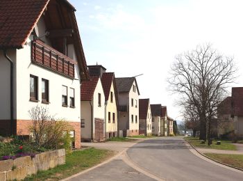
Ebensfeld : découvrez les meilleures randonnées : 14 pédestres. Tous ces circuits, parcours, itinéraires et activités en plein air sont disponibles dans nos applications SityTrail pour smartphones et tablettes.
Les meilleurs parcours (14)
![Randonnée A pied Ebensfeld - Verbindungsweg gelber Balken (Gleusdorf) - Busendorf - Tafel 2688 - Photo](https://media.geolcdn.com/t/350/260/f6fb59a1-0b68-48d8-85fd-eef716c17b1f.jpeg&format=jpg&maxdim=2)
![A pied A pied](https://static1.geolcdn.com/sitytour/trail-icons/100.png)
Km
A pied
![](/images/other/stat-length.png)
![](https://static1.geolcdn.com/siteimages/upload/files/1508320355ic_sort_den_pos_24dp.png)
![](https://static1.geolcdn.com/siteimages/upload/files/1508320355ic_sort_den_neg_24dp.png)
![](https://static1.geolcdn.com/siteimages/upload/files/16400158638029165_repeat_loop_refresh_sync_direction_icon.png)
• Randonnée créée par Landkreis Lichtenfels. Symbole: Gelber Strich auf weißem Hintergrund
![Randonnée A pied Ebensfeld - Kleine Döringstädter Runde - Photo](https://media.geolcdn.com/t/350/260/fe7ca50c-73e6-4322-9c79-2d13983beab7.jpeg&format=jpg&maxdim=2)
![A pied A pied](https://static1.geolcdn.com/sitytour/trail-icons/100.png)
Km
A pied
![](/images/other/stat-length.png)
![](https://static1.geolcdn.com/siteimages/upload/files/1508320355ic_sort_den_pos_24dp.png)
![](https://static1.geolcdn.com/siteimages/upload/files/1508320355ic_sort_den_neg_24dp.png)
![](https://static1.geolcdn.com/siteimages/upload/files/16400158638029165_repeat_loop_refresh_sync_direction_icon.png)
• Randonnée créée par Landkreis Lichtenfels. Symbole: Weiße 3 zwischen zwei Punkten auf rotem Hintergrund
![Randonnée A pied Ebensfeld - Freiberger Runde - Photo](https://media.geolcdn.com/t/350/260/140e8397-a66a-4fe1-8fb1-28958a4a686a.jpeg&format=jpg&maxdim=2)
![A pied A pied](https://static1.geolcdn.com/sitytour/trail-icons/100.png)
Km
A pied
![](/images/other/stat-length.png)
![](https://static1.geolcdn.com/siteimages/upload/files/1508320355ic_sort_den_pos_24dp.png)
![](https://static1.geolcdn.com/siteimages/upload/files/1508320355ic_sort_den_neg_24dp.png)
![](https://static1.geolcdn.com/siteimages/upload/files/16400158638029165_repeat_loop_refresh_sync_direction_icon.png)
• Randonnée créée par Landkreis Lichtenfels. Zwischen T 2636 und Wanderwegweiser 20 unmarkiert Symbole: Blauer Strich...
![Randonnée A pied Ebensfeld - Große Kleukheimer Runde, auch Kelbachtaler Höhenweg (große Runde) - Photo](https://media.geolcdn.com/t/350/260/9f8e833d-f213-4e22-9238-de8dc2499235.jpeg&format=jpg&maxdim=2)
![A pied A pied](https://static1.geolcdn.com/sitytour/trail-icons/100.png)
Km
A pied
![](/images/other/stat-length.png)
![](https://static1.geolcdn.com/siteimages/upload/files/1508320355ic_sort_den_pos_24dp.png)
![](https://static1.geolcdn.com/siteimages/upload/files/1508320355ic_sort_den_neg_24dp.png)
![](https://static1.geolcdn.com/siteimages/upload/files/16400158638029165_repeat_loop_refresh_sync_direction_icon.png)
• Randonnée créée par Kelbachtaler Blasmusik Prächting. Symbole: Notenlinie mit Violinenschlüssel auf gelbem Hintergrund
![Randonnée A pied Ebensfeld - Kleine Kleukheimer Runde, auch Kelbachtaler Höhenweg (kleine Runde) - Photo](https://media.geolcdn.com/t/350/260/e3a4154e-10d8-4726-bf91-6602cdbadc86.jpeg&format=jpg&maxdim=2)
![A pied A pied](https://static1.geolcdn.com/sitytour/trail-icons/100.png)
Km
A pied
![](/images/other/stat-length.png)
![](https://static1.geolcdn.com/siteimages/upload/files/1508320355ic_sort_den_pos_24dp.png)
![](https://static1.geolcdn.com/siteimages/upload/files/1508320355ic_sort_den_neg_24dp.png)
![](https://static1.geolcdn.com/siteimages/upload/files/16400158638029165_repeat_loop_refresh_sync_direction_icon.png)
• Randonnée créée par Kelbachtaler Blasmusik Prächting. Markierung teilweise unvollständig, keine Unterscheidung zur g...
![Randonnée A pied Ebensfeld - Pferdsfelder Kapellenweg - Photo](https://media.geolcdn.com/t/350/260/5d054942-eb89-472d-bcb1-1caf1d457b80.jpeg&format=jpg&maxdim=2)
![A pied A pied](https://static1.geolcdn.com/sitytour/trail-icons/100.png)
Km
A pied
![](/images/other/stat-length.png)
![](https://static1.geolcdn.com/siteimages/upload/files/1508320355ic_sort_den_pos_24dp.png)
![](https://static1.geolcdn.com/siteimages/upload/files/1508320355ic_sort_den_neg_24dp.png)
![](https://static1.geolcdn.com/siteimages/upload/files/16400158638029165_repeat_loop_refresh_sync_direction_icon.png)
• Randonnée créée par Landkreis Lichtenfels. Symbole: Weiße 6 zwischen zwei Punkten auf rotem Hintergrund
![Randonnée A pied Ebensfeld - Küpser Lindenweg - Photo](https://media.geolcdn.com/t/350/260/a291f203-055a-4679-9cff-c005120e0b93.jpeg&format=jpg&maxdim=2)
![A pied A pied](https://static1.geolcdn.com/sitytour/trail-icons/100.png)
Km
A pied
![](/images/other/stat-length.png)
![](https://static1.geolcdn.com/siteimages/upload/files/1508320355ic_sort_den_pos_24dp.png)
![](https://static1.geolcdn.com/siteimages/upload/files/1508320355ic_sort_den_neg_24dp.png)
![](https://static1.geolcdn.com/siteimages/upload/files/16400158638029165_repeat_loop_refresh_sync_direction_icon.png)
• teilweise alte Markierung Küpser Rundweg Symbole: blauer Kreis auf weißem Grund
![Randonnée A pied Ebensfeld - Keltenweg E - Photo](https://media.geolcdn.com/t/350/260/ebea86b0-6d87-4627-a203-bc3b8143ce05.jpeg&format=jpg&maxdim=2)
![A pied A pied](https://static1.geolcdn.com/sitytour/trail-icons/100.png)
Km
A pied
![](/images/other/stat-length.png)
![](https://static1.geolcdn.com/siteimages/upload/files/1508320355ic_sort_den_pos_24dp.png)
![](https://static1.geolcdn.com/siteimages/upload/files/1508320355ic_sort_den_neg_24dp.png)
![](https://static1.geolcdn.com/siteimages/upload/files/16400158638029165_repeat_loop_refresh_sync_direction_icon.png)
• Randonnée créée par Landkreis Lichtenfels. Symbole: Keltisches Gefäß und Ammonit auf gelbem Hrund
![Randonnée A pied Ebensfeld - Mainseeweg - Photo](https://media.geolcdn.com/t/350/260/b724cbd5-81b4-44ca-9076-1b739bf964b6.jpeg&format=jpg&maxdim=2)
![A pied A pied](https://static1.geolcdn.com/sitytour/trail-icons/100.png)
Km
A pied
![](/images/other/stat-length.png)
![](https://static1.geolcdn.com/siteimages/upload/files/1508320355ic_sort_den_pos_24dp.png)
![](https://static1.geolcdn.com/siteimages/upload/files/1508320355ic_sort_den_neg_24dp.png)
![](https://static1.geolcdn.com/siteimages/upload/files/16400158638029165_repeat_loop_refresh_sync_direction_icon.png)
• Randonnée créée par Landkreis Lichtenfels. Symbole: Weiße 10 zwischen zwei Punkten auf rotem Hintergrund
![Randonnée A pied Ebensfeld - Ebensfelder Main-Runde oder Wiesener Rundweg - Photo](https://media.geolcdn.com/t/350/260/6c06bf63-2b39-4917-bff6-048fb7ba0492.jpeg&format=jpg&maxdim=2)
![A pied A pied](https://static1.geolcdn.com/sitytour/trail-icons/100.png)
Km
A pied
![](/images/other/stat-length.png)
![](https://static1.geolcdn.com/siteimages/upload/files/1508320355ic_sort_den_pos_24dp.png)
![](https://static1.geolcdn.com/siteimages/upload/files/1508320355ic_sort_den_neg_24dp.png)
![](https://static1.geolcdn.com/siteimages/upload/files/16400158638029165_repeat_loop_refresh_sync_direction_icon.png)
• Randonnée créée par Landkreis Lichtenfels. Symbole: Weiße 5 zwischen zwei Punkten auf rotem Hintergrund
![Randonnée A pied Ebensfeld - Veitsberg Höhenweg - Photo](https://media.geolcdn.com/t/350/260/7060b700-6a84-4530-9d00-4b0dcb3b30a5.jpeg&format=jpg&maxdim=2)
![A pied A pied](https://static1.geolcdn.com/sitytour/trail-icons/100.png)
Km
A pied
![](/images/other/stat-length.png)
![](https://static1.geolcdn.com/siteimages/upload/files/1508320355ic_sort_den_pos_24dp.png)
![](https://static1.geolcdn.com/siteimages/upload/files/1508320355ic_sort_den_neg_24dp.png)
![](https://static1.geolcdn.com/siteimages/upload/files/16400158638029165_repeat_loop_refresh_sync_direction_icon.png)
• Randonnée créée par Landkreis Lichtenfels;Tourismusverein Ebensfeld. teilweise alte Markierung Veitsbergweg Symbole...
![Randonnée A pied Ebensfeld - Horsdorfer Weg - Photo](https://media.geolcdn.com/t/350/260/6c06bf63-2b39-4917-bff6-048fb7ba0492.jpeg&format=jpg&maxdim=2)
![A pied A pied](https://static1.geolcdn.com/sitytour/trail-icons/100.png)
Km
A pied
![](/images/other/stat-length.png)
![](https://static1.geolcdn.com/siteimages/upload/files/1508320355ic_sort_den_pos_24dp.png)
![](https://static1.geolcdn.com/siteimages/upload/files/1508320355ic_sort_den_neg_24dp.png)
![](https://static1.geolcdn.com/siteimages/upload/files/16400158638029165_repeat_loop_refresh_sync_direction_icon.png)
• Randonnée créée par Landkreis Lichtenfels. Symbole: Blaue Raute auf weißem Hintergrund
![Randonnée A pied Ebensfeld - Große Döringstädter Runde - Photo](https://media.geolcdn.com/t/350/260/d45a4ad8-b67c-481f-ae88-ea0e13415335.jpeg&format=jpg&maxdim=2)
![A pied A pied](https://static1.geolcdn.com/sitytour/trail-icons/100.png)
Km
A pied
![](/images/other/stat-length.png)
![](https://static1.geolcdn.com/siteimages/upload/files/1508320355ic_sort_den_pos_24dp.png)
![](https://static1.geolcdn.com/siteimages/upload/files/1508320355ic_sort_den_neg_24dp.png)
![](https://static1.geolcdn.com/siteimages/upload/files/16400158638029165_repeat_loop_refresh_sync_direction_icon.png)
• Randonnée créée par Landkreis Lichtenfels. teilweise noch alte Markierung (blaue 2 weißem Grund) Symbole: Weiße 2 z...
![Randonnée A pied Ebensfeld - Ummersberg Runde - Photo](https://media.geolcdn.com/t/350/260/d18b70c2-4be8-47e5-83ba-ad3d52cd6988.jpeg&format=jpg&maxdim=2)
![A pied A pied](https://static1.geolcdn.com/sitytour/trail-icons/100.png)
Km
A pied
![](/images/other/stat-length.png)
![](https://static1.geolcdn.com/siteimages/upload/files/1508320355ic_sort_den_pos_24dp.png)
![](https://static1.geolcdn.com/siteimages/upload/files/1508320355ic_sort_den_neg_24dp.png)
![](https://static1.geolcdn.com/siteimages/upload/files/16400158638029165_repeat_loop_refresh_sync_direction_icon.png)
• Randonnée créée par Landkreis Lichtenfels. Symbole: Weiße 1 zwischen zwei Punkten auf rotem Hintergrund
14 randonnées affichées sur 14
Application GPS de randonnée GRATUITE