![](/images/other/stat-length.png)
- Randonnées
- Outdoor
- Allemagne
- Bavière
- Landkreis Forchheim
- Forchheim
Forchheim, Landkreis Forchheim : Les meilleures randonnées, itinéraires, parcours, balades et promenades
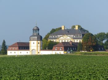
Forchheim : découvrez les meilleures randonnées : 15 pédestres. Tous ces circuits, parcours, itinéraires et activités en plein air sont disponibles dans nos applications SityTrail pour smartphones et tablettes.
Les meilleurs parcours (15)
![Randonnée A pied Forchheim - Lauferlebnis Fränkische Schweiz F1 - Photo](https://media.geolcdn.com/t/350/260/26c4143f-324a-4388-92bc-ca4f4fd11244.jpeg&format=jpg&maxdim=2)
![A pied A pied](https://static1.geolcdn.com/sitytour/trail-icons/100.png)
Km
A pied
![](/images/other/stat-length.png)
![](https://static1.geolcdn.com/siteimages/upload/files/1508320355ic_sort_den_pos_24dp.png)
![](https://static1.geolcdn.com/siteimages/upload/files/1508320355ic_sort_den_neg_24dp.png)
![](https://static1.geolcdn.com/siteimages/upload/files/16400158638029165_repeat_loop_refresh_sync_direction_icon.png)
• Randonnée créée par Landkreis Forchheim. Symbole: F1 in weiß auf grünem Hintergrund
![Randonnée A pied Forchheim - Jubiläumsweg 1914 - Photo](https://media.geolcdn.com/t/350/260/3c94f5e2-8d5c-478a-bffe-ecaca4655e99.jpeg&format=jpg&maxdim=2)
![A pied A pied](https://static1.geolcdn.com/sitytour/trail-icons/100.png)
Km
A pied
![](/images/other/stat-length.png)
![](https://static1.geolcdn.com/siteimages/upload/files/1508320355ic_sort_den_pos_24dp.png)
![](https://static1.geolcdn.com/siteimages/upload/files/1508320355ic_sort_den_neg_24dp.png)
![](https://static1.geolcdn.com/siteimages/upload/files/16400158638029165_repeat_loop_refresh_sync_direction_icon.png)
• Randonnée créée par Fränkischer Albverein. Symbole: FAV-Emblem auf grünem Hintergrund
![Randonnée A pied Forchheim - Kersbach-Schlaifhausen - Photo](https://media.geolcdn.com/t/350/260/e4986558-fafa-48e1-b585-99a6745c78af.jpeg&format=jpg&maxdim=2)
![A pied A pied](https://static1.geolcdn.com/sitytour/trail-icons/100.png)
Km
A pied
![](/images/other/stat-length.png)
![](https://static1.geolcdn.com/siteimages/upload/files/1508320355ic_sort_den_pos_24dp.png)
![](https://static1.geolcdn.com/siteimages/upload/files/1508320355ic_sort_den_neg_24dp.png)
![](https://static1.geolcdn.com/siteimages/upload/files/16400158638029165_repeat_loop_refresh_sync_direction_icon.png)
• Randonnée créée par Fränkische Schweiz - Verein. Symbole: Grüner senkrechter Balken auf weißem Grund
![Randonnée A pied Forchheim - Burk-Lunzkeller - Photo](https://media.geolcdn.com/t/350/260/b11da8fd-f99d-4791-b455-75ca8722117e.jpeg&format=jpg&maxdim=2)
![A pied A pied](https://static1.geolcdn.com/sitytour/trail-icons/100.png)
Km
A pied
![](/images/other/stat-length.png)
![](https://static1.geolcdn.com/siteimages/upload/files/1508320355ic_sort_den_pos_24dp.png)
![](https://static1.geolcdn.com/siteimages/upload/files/1508320355ic_sort_den_neg_24dp.png)
![](https://static1.geolcdn.com/siteimages/upload/files/16400158638029165_repeat_loop_refresh_sync_direction_icon.png)
• Randonnée créée par Stadt Forchheim. Symbole: Gelbes Dreieck auf weißem Grund
![Randonnée A pied Forchheim - Forchheim-Rettern - Photo](https://media.geolcdn.com/t/350/260/40a01605-c3c6-4c7b-a777-77a3d0faa222.jpeg&format=jpg&maxdim=2)
![A pied A pied](https://static1.geolcdn.com/sitytour/trail-icons/100.png)
Km
A pied
![](/images/other/stat-length.png)
![](https://static1.geolcdn.com/siteimages/upload/files/1508320355ic_sort_den_pos_24dp.png)
![](https://static1.geolcdn.com/siteimages/upload/files/1508320355ic_sort_den_neg_24dp.png)
![](https://static1.geolcdn.com/siteimages/upload/files/16400158638029165_repeat_loop_refresh_sync_direction_icon.png)
• Randonnée créée par Deutscher Alpenverein Forchheim. Symbole: Roter Schrägstrich auf weißem Hintergrund
![Randonnée A pied Forchheim - Burk-Schlammersdorf - Photo](https://media.geolcdn.com/t/350/260/fb21268b-bb1a-4f10-86d6-abec2697bf4f.jpeg&format=jpg&maxdim=2)
![A pied A pied](https://static1.geolcdn.com/sitytour/trail-icons/100.png)
Km
A pied
![](/images/other/stat-length.png)
![](https://static1.geolcdn.com/siteimages/upload/files/1508320355ic_sort_den_pos_24dp.png)
![](https://static1.geolcdn.com/siteimages/upload/files/1508320355ic_sort_den_neg_24dp.png)
![](https://static1.geolcdn.com/siteimages/upload/files/16400158638029165_repeat_loop_refresh_sync_direction_icon.png)
• Randonnée créée par Stadt Forchheim. Symbole: grünes Kreuz
![Randonnée A pied Forchheim - Forchheim-Walberla - Photo](https://media.geolcdn.com/t/350/260/3a04dbbc-4c94-4be6-b470-1733007fa544.jpeg&format=jpg&maxdim=2)
![A pied A pied](https://static1.geolcdn.com/sitytour/trail-icons/100.png)
Km
A pied
![](/images/other/stat-length.png)
![](https://static1.geolcdn.com/siteimages/upload/files/1508320355ic_sort_den_pos_24dp.png)
![](https://static1.geolcdn.com/siteimages/upload/files/1508320355ic_sort_den_neg_24dp.png)
![](https://static1.geolcdn.com/siteimages/upload/files/16400158638029165_repeat_loop_refresh_sync_direction_icon.png)
• Randonnée créée par Stadt Forchheim. Symbole: Blauer Schrägstrich auf weißem Grund
![Randonnée A pied Forchheim - Zielwanderweg Forchheim- Reifenberg - Photo](https://media.geolcdn.com/t/350/260/c0d50f5e-a0ed-4c0b-9884-db0325098052.jpeg&format=jpg&maxdim=2)
![A pied A pied](https://static1.geolcdn.com/sitytour/trail-icons/100.png)
Km
A pied
![](/images/other/stat-length.png)
![](https://static1.geolcdn.com/siteimages/upload/files/1508320355ic_sort_den_pos_24dp.png)
![](https://static1.geolcdn.com/siteimages/upload/files/1508320355ic_sort_den_neg_24dp.png)
![](https://static1.geolcdn.com/siteimages/upload/files/16400158638029165_repeat_loop_refresh_sync_direction_icon.png)
• Randonnée créée par Stadt Forchheim. Symbole: Grüner Schrägstrich auf weißem Hintergrund
![Randonnée A pied Forchheim - Forchheim-Reifenberg - Photo](https://media.geolcdn.com/t/350/260/a2fc3e56-1972-4362-ae96-0d14221be161.jpeg&format=jpg&maxdim=2)
![A pied A pied](https://static1.geolcdn.com/sitytour/trail-icons/100.png)
Km
A pied
![](/images/other/stat-length.png)
![](https://static1.geolcdn.com/siteimages/upload/files/1508320355ic_sort_den_pos_24dp.png)
![](https://static1.geolcdn.com/siteimages/upload/files/1508320355ic_sort_den_neg_24dp.png)
![](https://static1.geolcdn.com/siteimages/upload/files/16400158638029165_repeat_loop_refresh_sync_direction_icon.png)
• Randonnée créée par Stadt Forchheim. Symbole: Grüner senkrechter Strich auf weißem Hintergeund
![Randonnée A pied Forchheim - Forchheim-Weilersbach - Photo](https://media.geolcdn.com/t/350/260/a2fc3e56-1972-4362-ae96-0d14221be161.jpeg&format=jpg&maxdim=2)
![A pied A pied](https://static1.geolcdn.com/sitytour/trail-icons/100.png)
Km
A pied
![](/images/other/stat-length.png)
![](https://static1.geolcdn.com/siteimages/upload/files/1508320355ic_sort_den_pos_24dp.png)
![](https://static1.geolcdn.com/siteimages/upload/files/1508320355ic_sort_den_neg_24dp.png)
![](https://static1.geolcdn.com/siteimages/upload/files/16400158638029165_repeat_loop_refresh_sync_direction_icon.png)
• Randonnée créée par Deutscher Alpenverein Forchheim. Symbole: Gelber Senkrechtstrich auf weißem Hintergrund
![Randonnée A pied Forchheim - Forchheim-Bammersdorf-Rettern - Photo](https://media.geolcdn.com/t/350/260/23786ceb-0bf2-42ab-806f-dd63532c4e0f.jpeg&format=jpg&maxdim=2)
![A pied A pied](https://static1.geolcdn.com/sitytour/trail-icons/100.png)
Km
A pied
![](/images/other/stat-length.png)
![](https://static1.geolcdn.com/siteimages/upload/files/1508320355ic_sort_den_pos_24dp.png)
![](https://static1.geolcdn.com/siteimages/upload/files/1508320355ic_sort_den_neg_24dp.png)
![](https://static1.geolcdn.com/siteimages/upload/files/16400158638029165_repeat_loop_refresh_sync_direction_icon.png)
• Randonnée créée par Deutscher Alpenverein Forchheim. Symbole: Blauer senkrechter Strich auf weißem Hintergrund
![Randonnée A pied Forchheim - Forchheim Walking-Fitness Route - Photo](https://media.geolcdn.com/t/350/260/47517a8b-d5b7-4e51-9632-9d18d1c565f4.jpeg&format=jpg&maxdim=2)
![A pied A pied](https://static1.geolcdn.com/sitytour/trail-icons/100.png)
Km
A pied
![](/images/other/stat-length.png)
![](https://static1.geolcdn.com/siteimages/upload/files/1508320355ic_sort_den_pos_24dp.png)
![](https://static1.geolcdn.com/siteimages/upload/files/1508320355ic_sort_den_neg_24dp.png)
![](https://static1.geolcdn.com/siteimages/upload/files/16400158638029165_repeat_loop_refresh_sync_direction_icon.png)
• Randonnée créée par Stadt Forchheim. Symbole: Hellgrüne Tafel
![Randonnée A pied Forchheim - Forchheim Walking-Vital Route - Photo](https://media.geolcdn.com/t/350/260/6d5d70f2-13e3-47b5-a259-6d126d92a017.jpeg&format=jpg&maxdim=2)
![A pied A pied](https://static1.geolcdn.com/sitytour/trail-icons/100.png)
Km
A pied
![](/images/other/stat-length.png)
![](https://static1.geolcdn.com/siteimages/upload/files/1508320355ic_sort_den_pos_24dp.png)
![](https://static1.geolcdn.com/siteimages/upload/files/1508320355ic_sort_den_neg_24dp.png)
![](https://static1.geolcdn.com/siteimages/upload/files/16400158638029165_repeat_loop_refresh_sync_direction_icon.png)
• Randonnée créée par Stadt Forchheim. Fast fertig Symbole: Hellblaue Tafel
![Randonnée A pied Forchheim - Forchheim Walking-Jungbrunnen Route - Photo](https://media.geolcdn.com/t/350/260/6d5d70f2-13e3-47b5-a259-6d126d92a017.jpeg&format=jpg&maxdim=2)
![A pied A pied](https://static1.geolcdn.com/sitytour/trail-icons/100.png)
Km
A pied
![](/images/other/stat-length.png)
![](https://static1.geolcdn.com/siteimages/upload/files/1508320355ic_sort_den_pos_24dp.png)
![](https://static1.geolcdn.com/siteimages/upload/files/1508320355ic_sort_den_neg_24dp.png)
![](https://static1.geolcdn.com/siteimages/upload/files/16400158638029165_repeat_loop_refresh_sync_direction_icon.png)
• Randonnée créée par Stadt Forchheim. Symbole: Orangene Tafel
![Randonnée A pied Forchheim - Lauferlebnis Fränkische Schweiz F3 - Photo](https://media.geolcdn.com/t/350/260/ext.jpg?maxdim=2&url=https%3A%2F%2Fstatic1.geolcdn.com%2Fsiteimages%2Fupload%2Ffiles%2F1545311037marcheuse_200dpi.jpg)
![A pied A pied](https://static1.geolcdn.com/sitytour/trail-icons/100.png)
Km
A pied
![](/images/other/stat-length.png)
![](https://static1.geolcdn.com/siteimages/upload/files/1508320355ic_sort_den_pos_24dp.png)
![](https://static1.geolcdn.com/siteimages/upload/files/1508320355ic_sort_den_neg_24dp.png)
![](https://static1.geolcdn.com/siteimages/upload/files/16400158638029165_repeat_loop_refresh_sync_direction_icon.png)
• Randonnée créée par Landkreis Forchheim. Symbole: F3 in weiß auf rotem Hintergrund
15 randonnées affichées sur 15
Application GPS de randonnée GRATUITE