![](/images/other/stat-length.png)
Laufach, Landkreis Aschaffenburg : Les meilleures randonnées, itinéraires, parcours, balades et promenades
Laufach : découvrez les meilleures randonnées : 10 pédestres. Tous ces circuits, parcours, itinéraires et activités en plein air sont disponibles dans nos applications SityTrail pour smartphones et tablettes.
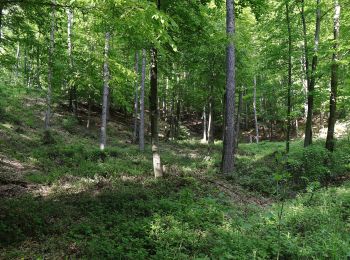
Les meilleurs parcours (10)
![Randonnée A pied Laufach - Frohnhofen Rundwanderweg F1 - Photo](https://media.geolcdn.com/t/350/260/fdff1b94-80a0-4e7f-98b6-b15761402970.jpeg&format=jpg&maxdim=2)
![A pied A pied](https://static1.geolcdn.com/sitytour/trail-icons/100.png)
Km
A pied
![](/images/other/stat-length.png)
![](https://static1.geolcdn.com/siteimages/upload/files/1508320355ic_sort_den_pos_24dp.png)
![](https://static1.geolcdn.com/siteimages/upload/files/1508320355ic_sort_den_neg_24dp.png)
![](https://static1.geolcdn.com/siteimages/upload/files/16400158638029165_repeat_loop_refresh_sync_direction_icon.png)
• Randonnée créée par Spechte Laufach. Symbole: Schwarze F1 auf weißem Kreis
![Randonnée A pied Laufach - Roter Hase, Rundwanderweg Laufach - Photo](https://media.geolcdn.com/t/350/260/30c9fbb3-aad6-4e1a-897f-e1470992e5f2.jpeg&format=jpg&maxdim=2)
![A pied A pied](https://static1.geolcdn.com/sitytour/trail-icons/100.png)
Km
A pied
![](/images/other/stat-length.png)
![](https://static1.geolcdn.com/siteimages/upload/files/1508320355ic_sort_den_pos_24dp.png)
![](https://static1.geolcdn.com/siteimages/upload/files/1508320355ic_sort_den_neg_24dp.png)
![](https://static1.geolcdn.com/siteimages/upload/files/16400158638029165_repeat_loop_refresh_sync_direction_icon.png)
• Randonnée créée par Naturpark Spessart. Symbole: roter Hase auf weißem Grund
![Randonnée A pied Laufach - Laufach Rundwanderweg L3 - Photo](https://media.geolcdn.com/t/350/260/511addfa-c33b-4853-aa96-c6ced777fb23.jpeg&format=jpg&maxdim=2)
![A pied A pied](https://static1.geolcdn.com/sitytour/trail-icons/100.png)
Km
A pied
![](/images/other/stat-length.png)
![](https://static1.geolcdn.com/siteimages/upload/files/1508320355ic_sort_den_pos_24dp.png)
![](https://static1.geolcdn.com/siteimages/upload/files/1508320355ic_sort_den_neg_24dp.png)
![](https://static1.geolcdn.com/siteimages/upload/files/16400158638029165_repeat_loop_refresh_sync_direction_icon.png)
• Randonnée créée par Spessartbund. Symbole: Schwarzes L3 auf weißem Kreis
![Randonnée A pied Laufach - Panoramawanderweg Falkenberg - Photo](https://media.geolcdn.com/t/350/260/b8e22972-65f3-4107-b9bf-9b36e6668b0d.jpeg&format=jpg&maxdim=2)
![A pied A pied](https://static1.geolcdn.com/sitytour/trail-icons/100.png)
Km
A pied
![](/images/other/stat-length.png)
![](https://static1.geolcdn.com/siteimages/upload/files/1508320355ic_sort_den_pos_24dp.png)
![](https://static1.geolcdn.com/siteimages/upload/files/1508320355ic_sort_den_neg_24dp.png)
![](https://static1.geolcdn.com/siteimages/upload/files/16400158638029165_repeat_loop_refresh_sync_direction_icon.png)
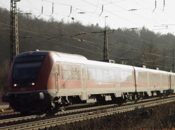
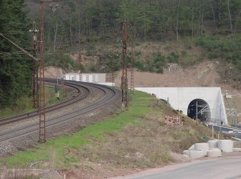
• Randonnée créée par DB ProjektBau GmbH. Symbole: Tunnel mit Schriftzug
![Randonnée A pied Laufach - Laufach Rundwanderweg L2 - Photo](https://media.geolcdn.com/t/350/260/b8e22972-65f3-4107-b9bf-9b36e6668b0d.jpeg&format=jpg&maxdim=2)
![A pied A pied](https://static1.geolcdn.com/sitytour/trail-icons/100.png)
Km
A pied
![](/images/other/stat-length.png)
![](https://static1.geolcdn.com/siteimages/upload/files/1508320355ic_sort_den_pos_24dp.png)
![](https://static1.geolcdn.com/siteimages/upload/files/1508320355ic_sort_den_neg_24dp.png)
![](https://static1.geolcdn.com/siteimages/upload/files/16400158638029165_repeat_loop_refresh_sync_direction_icon.png)
• Randonnée créée par Spessartbund. Symbole: Schwarzes L2 auf weißem Grund Site web: http://www.spechte-laufach.de
![Randonnée A pied Laufach - Frohnhofen Rundwanderweg 2 - Photo](https://media.geolcdn.com/t/350/260/6280b3fe-7d28-4770-a0e6-ea6eebdbde65.jpeg&format=jpg&maxdim=2)
![A pied A pied](https://static1.geolcdn.com/sitytour/trail-icons/100.png)
Km
A pied
![](/images/other/stat-length.png)
![](https://static1.geolcdn.com/siteimages/upload/files/1508320355ic_sort_den_pos_24dp.png)
![](https://static1.geolcdn.com/siteimages/upload/files/1508320355ic_sort_den_neg_24dp.png)
![](https://static1.geolcdn.com/siteimages/upload/files/16400158638029165_repeat_loop_refresh_sync_direction_icon.png)
• Randonnée créée par Spechte Laufach. Symbole: Schwarze 2 auf weißem Kreis
![Randonnée A pied Laufach - Laufach Rundwanderweg L1 - Photo](https://media.geolcdn.com/t/350/260/511addfa-c33b-4853-aa96-c6ced777fb23.jpeg&format=jpg&maxdim=2)
![A pied A pied](https://static1.geolcdn.com/sitytour/trail-icons/100.png)
Km
A pied
![](/images/other/stat-length.png)
![](https://static1.geolcdn.com/siteimages/upload/files/1508320355ic_sort_den_pos_24dp.png)
![](https://static1.geolcdn.com/siteimages/upload/files/1508320355ic_sort_den_neg_24dp.png)
![](https://static1.geolcdn.com/siteimages/upload/files/16400158638029165_repeat_loop_refresh_sync_direction_icon.png)
• Randonnée créée par Spessartbund. Symbole: Schwarze L1 auf weißem Grund Site web: http://www.spechte-laufach.de
![Randonnée A pied Laufach - Schwarzer Fuchs, Rundwanderweg Laufach - Photo](https://media.geolcdn.com/t/350/260/511addfa-c33b-4853-aa96-c6ced777fb23.jpeg&format=jpg&maxdim=2)
![A pied A pied](https://static1.geolcdn.com/sitytour/trail-icons/100.png)
Km
A pied
![](/images/other/stat-length.png)
![](https://static1.geolcdn.com/siteimages/upload/files/1508320355ic_sort_den_pos_24dp.png)
![](https://static1.geolcdn.com/siteimages/upload/files/1508320355ic_sort_den_neg_24dp.png)
![](https://static1.geolcdn.com/siteimages/upload/files/16400158638029165_repeat_loop_refresh_sync_direction_icon.png)
• Randonnée créée par Naturpark Spessart. Symbole: Schwarzer Fuchs auf weißem Grund
![Randonnée A pied Laufach - Kulturweg Laufach 1 - Photo](https://media.geolcdn.com/t/350/260/47b0fc2f-88e6-47d2-bb19-46a0197981a3.jpeg&format=jpg&maxdim=2)
![A pied A pied](https://static1.geolcdn.com/sitytour/trail-icons/100.png)
Km
A pied
![](/images/other/stat-length.png)
![](https://static1.geolcdn.com/siteimages/upload/files/1508320355ic_sort_den_pos_24dp.png)
![](https://static1.geolcdn.com/siteimages/upload/files/1508320355ic_sort_den_neg_24dp.png)
![](https://static1.geolcdn.com/siteimages/upload/files/16400158638029165_repeat_loop_refresh_sync_direction_icon.png)
• Randonnée créée par Archäologisches Spessartprojekt. Symbole: Gelbes EU-Schiffchen auf blauem Grund
![Randonnée A pied Laufach - Roter Schmetterling, Rundwandeerweg Hain Seebachtal - Photo](https://media.geolcdn.com/t/350/260/b8e22972-65f3-4107-b9bf-9b36e6668b0d.jpeg&format=jpg&maxdim=2)
![A pied A pied](https://static1.geolcdn.com/sitytour/trail-icons/100.png)
Km
A pied
![](/images/other/stat-length.png)
![](https://static1.geolcdn.com/siteimages/upload/files/1508320355ic_sort_den_pos_24dp.png)
![](https://static1.geolcdn.com/siteimages/upload/files/1508320355ic_sort_den_neg_24dp.png)
![](https://static1.geolcdn.com/siteimages/upload/files/16400158638029165_repeat_loop_refresh_sync_direction_icon.png)
• Randonnée créée par Naturpark Spessart. Symbole: Roter Schmetterling auf weißem Grund
10 randonnées affichées sur 10
Application GPS de randonnée GRATUITE