![](/images/other/stat-length.png)
- Randonnées
- Outdoor
- Allemagne
- Bavière
- Landkreis Hof
Landkreis Hof, Bavière : Les meilleures randonnées, itinéraires, parcours, balades et promenades
Landkreis Hof : découvrez les meilleures randonnées : 97 pédestres. Tous ces circuits, parcours, itinéraires et activités en plein air sont disponibles dans nos applications SityTrail pour smartphones et tablettes.
Les meilleurs parcours (97)
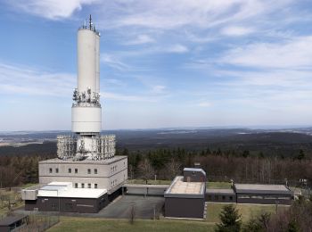
![Randonnée A pied Martinlamitzer Forst Nord - Oberkotzau-Kornberg - Photo](https://media.geolcdn.com/t/350/260/601fef35-8bd2-4667-b84c-c59b79d455c7.jpeg&format=jpg&maxdim=2)
![A pied A pied](https://static1.geolcdn.com/sitytour/trail-icons/100.png)
Km
A pied
![](/images/other/stat-length.png)
![](https://static1.geolcdn.com/siteimages/upload/files/1508320355ic_sort_den_pos_24dp.png)
![](https://static1.geolcdn.com/siteimages/upload/files/1508320355ic_sort_den_neg_24dp.png)
![](https://static1.geolcdn.com/siteimages/upload/files/16400158638029165_repeat_loop_refresh_sync_direction_icon.png)
• Randonnée créée par Fichtelgebirgsverein. Symbole: oben weiß unten blau
![Randonnée A pied Zell im Fichtelgebirge - Sparneck-Großer Waldstein - Photo](https://media.geolcdn.com/t/350/260/87905438-ca66-42aa-999c-81adc2a03c89.jpeg&format=jpg&maxdim=2)
![A pied A pied](https://static1.geolcdn.com/sitytour/trail-icons/100.png)
Km
A pied
![](/images/other/stat-length.png)
![](https://static1.geolcdn.com/siteimages/upload/files/1508320355ic_sort_den_pos_24dp.png)
![](https://static1.geolcdn.com/siteimages/upload/files/1508320355ic_sort_den_neg_24dp.png)
![](https://static1.geolcdn.com/siteimages/upload/files/16400158638029165_repeat_loop_refresh_sync_direction_icon.png)
• Randonnée créée par Fichtelgebirgsverein.
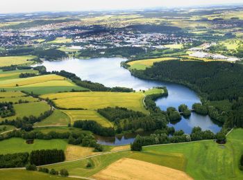
![Randonnée A pied Konradsreuth - Rundwanderweg 1 Oberkotzau - Photo](https://media.geolcdn.com/t/350/260/9a8978f4-ce11-4aa8-9d5c-1c9a9df6ebba.jpeg&format=jpg&maxdim=2)
![A pied A pied](https://static1.geolcdn.com/sitytour/trail-icons/100.png)
Km
A pied
![](/images/other/stat-length.png)
![](https://static1.geolcdn.com/siteimages/upload/files/1508320355ic_sort_den_pos_24dp.png)
![](https://static1.geolcdn.com/siteimages/upload/files/1508320355ic_sort_den_neg_24dp.png)
![](https://static1.geolcdn.com/siteimages/upload/files/16400158638029165_repeat_loop_refresh_sync_direction_icon.png)
• Randonnée créée par Fichtelgebirgsverein.
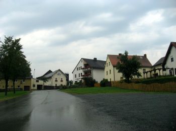
![Randonnée A pied Rehau - Rundwanderweg 1 Fohrenreuth - Photo](https://media.geolcdn.com/t/350/260/6a952cb8-2f5d-4d42-baff-3936030c0274.jpeg&format=jpg&maxdim=2)
![A pied A pied](https://static1.geolcdn.com/sitytour/trail-icons/100.png)
Km
A pied
![](/images/other/stat-length.png)
![](https://static1.geolcdn.com/siteimages/upload/files/1508320355ic_sort_den_pos_24dp.png)
![](https://static1.geolcdn.com/siteimages/upload/files/1508320355ic_sort_den_neg_24dp.png)
![](https://static1.geolcdn.com/siteimages/upload/files/16400158638029165_repeat_loop_refresh_sync_direction_icon.png)
• Randonnée créée par FGV.
![Randonnée A pied Rehau - Rundwanderweg 3 Fohrenreuth - Photo](https://media.geolcdn.com/t/350/260/ff87cd7e-0ce7-49c9-a223-bd18eebec758.jpeg&format=jpg&maxdim=2)
![A pied A pied](https://static1.geolcdn.com/sitytour/trail-icons/100.png)
Km
A pied
![](/images/other/stat-length.png)
![](https://static1.geolcdn.com/siteimages/upload/files/1508320355ic_sort_den_pos_24dp.png)
![](https://static1.geolcdn.com/siteimages/upload/files/1508320355ic_sort_den_neg_24dp.png)
![](https://static1.geolcdn.com/siteimages/upload/files/16400158638029165_repeat_loop_refresh_sync_direction_icon.png)
• Randonnée créée par FGV.
![Randonnée A pied Rehau - Mit der Arnika in den Rehauer Forst - Photo](https://media.geolcdn.com/t/350/260/23fc0b98-8189-4d37-b9c8-7d7db54e3cca.jpeg&format=jpg&maxdim=2)
![A pied A pied](https://static1.geolcdn.com/sitytour/trail-icons/100.png)
Km
A pied
![](/images/other/stat-length.png)
![](https://static1.geolcdn.com/siteimages/upload/files/1508320355ic_sort_den_pos_24dp.png)
![](https://static1.geolcdn.com/siteimages/upload/files/1508320355ic_sort_den_neg_24dp.png)
![](https://static1.geolcdn.com/siteimages/upload/files/16400158638029165_repeat_loop_refresh_sync_direction_icon.png)
• Randonnée créée par Fichtelgebirgsverein. Symbole: oranger Punkt in der Mitte eines kreisförmigem gelben Pfeils auf ...
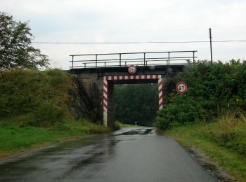
![Randonnée A pied Rehau - Mit der Arnika zum Kornberg - Photo](https://media.geolcdn.com/t/350/260/ff87cd7e-0ce7-49c9-a223-bd18eebec758.jpeg&format=jpg&maxdim=2)
![A pied A pied](https://static1.geolcdn.com/sitytour/trail-icons/100.png)
Km
A pied
![](/images/other/stat-length.png)
![](https://static1.geolcdn.com/siteimages/upload/files/1508320355ic_sort_den_pos_24dp.png)
![](https://static1.geolcdn.com/siteimages/upload/files/1508320355ic_sort_den_neg_24dp.png)
![](https://static1.geolcdn.com/siteimages/upload/files/16400158638029165_repeat_loop_refresh_sync_direction_icon.png)
• Randonnée créée par Fichtelgebirgsverein. Symbole: oranger Punkt in der Mitte eines kreisförmigem gelben Pfeils auf ...
![Randonnée A pied Schwarzenbach a.Wald - Reizenstein-Weg DÖ 34 - Photo](https://media.geolcdn.com/t/350/260/4de2f118-dd1a-4964-882a-5e4cf16ea9b3.jpeg&format=jpg&maxdim=2)
![A pied A pied](https://static1.geolcdn.com/sitytour/trail-icons/100.png)
Km
A pied
![](/images/other/stat-length.png)
![](https://static1.geolcdn.com/siteimages/upload/files/1508320355ic_sort_den_pos_24dp.png)
![](https://static1.geolcdn.com/siteimages/upload/files/1508320355ic_sort_den_neg_24dp.png)
![](https://static1.geolcdn.com/siteimages/upload/files/16400158638029165_repeat_loop_refresh_sync_direction_icon.png)
• Randonnée créée par Frankenwaldverein. Symbole: grünes DÖ34 auf weißem Grund
![Randonnée A pied Schwarzenbach a.Wald - Türkengrund-Weg DÖ 21 - Photo](https://media.geolcdn.com/t/350/260/4de2f118-dd1a-4964-882a-5e4cf16ea9b3.jpeg&format=jpg&maxdim=2)
![A pied A pied](https://static1.geolcdn.com/sitytour/trail-icons/100.png)
Km
A pied
![](/images/other/stat-length.png)
![](https://static1.geolcdn.com/siteimages/upload/files/1508320355ic_sort_den_pos_24dp.png)
![](https://static1.geolcdn.com/siteimages/upload/files/1508320355ic_sort_den_neg_24dp.png)
![](https://static1.geolcdn.com/siteimages/upload/files/16400158638029165_repeat_loop_refresh_sync_direction_icon.png)
• Randonnée créée par Frankenwaldverein. Symbole: grünes DÖ21 auf weißem Grund
![Randonnée A pied Schauenstein - Paradies-Weg OS 26 - Photo](https://media.geolcdn.com/t/350/260/787da7a9-e5c3-4536-bb8c-ec4f0c42b757.jpeg&format=jpg&maxdim=2)
![A pied A pied](https://static1.geolcdn.com/sitytour/trail-icons/100.png)
Km
A pied
![](/images/other/stat-length.png)
![](https://static1.geolcdn.com/siteimages/upload/files/1508320355ic_sort_den_pos_24dp.png)
![](https://static1.geolcdn.com/siteimages/upload/files/1508320355ic_sort_den_neg_24dp.png)
![](https://static1.geolcdn.com/siteimages/upload/files/16400158638029165_repeat_loop_refresh_sync_direction_icon.png)
• Randonnée créée par Frankenwaldverein e.V..
![Randonnée A pied Helmbrechts - Stockhöhen-Weg OS 25 - Photo](https://media.geolcdn.com/t/350/260/879e210e-5f24-4183-a068-356b49ef24f3.jpeg&format=jpg&maxdim=2)
![A pied A pied](https://static1.geolcdn.com/sitytour/trail-icons/100.png)
Km
A pied
![](/images/other/stat-length.png)
![](https://static1.geolcdn.com/siteimages/upload/files/1508320355ic_sort_den_pos_24dp.png)
![](https://static1.geolcdn.com/siteimages/upload/files/1508320355ic_sort_den_neg_24dp.png)
![](https://static1.geolcdn.com/siteimages/upload/files/16400158638029165_repeat_loop_refresh_sync_direction_icon.png)
• Randonnée créée par Frankenwaldverein e.V..
![Randonnée A pied Schwarzenbach a.Wald - Oberland-Weg DÖ 82 - Photo](https://media.geolcdn.com/t/350/260/134e3896-0418-4537-bd97-93d957e265d3.jpeg&format=jpg&maxdim=2)
![A pied A pied](https://static1.geolcdn.com/sitytour/trail-icons/100.png)
Km
A pied
![](/images/other/stat-length.png)
![](https://static1.geolcdn.com/siteimages/upload/files/1508320355ic_sort_den_pos_24dp.png)
![](https://static1.geolcdn.com/siteimages/upload/files/1508320355ic_sort_den_neg_24dp.png)
![](https://static1.geolcdn.com/siteimages/upload/files/16400158638029165_repeat_loop_refresh_sync_direction_icon.png)
• Randonnée créée par Frankenwaldverein. Symbole: grünes DÖ82 auf weißem Grund
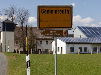
![Randonnée A pied Schwarzenbach a.Wald - Zegast-Weg DÖ 81 - Photo](https://media.geolcdn.com/t/350/260/4dd67436-87d4-4e7c-8989-f221cb72bf73.jpeg&format=jpg&maxdim=2)
![A pied A pied](https://static1.geolcdn.com/sitytour/trail-icons/100.png)
Km
A pied
![](/images/other/stat-length.png)
![](https://static1.geolcdn.com/siteimages/upload/files/1508320355ic_sort_den_pos_24dp.png)
![](https://static1.geolcdn.com/siteimages/upload/files/1508320355ic_sort_den_neg_24dp.png)
![](https://static1.geolcdn.com/siteimages/upload/files/16400158638029165_repeat_loop_refresh_sync_direction_icon.png)
• Randonnée créée par Frankenwaldverein. Symbole: grünes DÖ81 auf weißem Grund
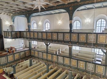
![Randonnée A pied Berg - Schwamma-Weg US73 - Photo](https://media.geolcdn.com/t/350/260/80348f5a-f04a-42f0-a0b2-ab2a72fba677.jpeg&format=jpg&maxdim=2)
![A pied A pied](https://static1.geolcdn.com/sitytour/trail-icons/100.png)
Km
A pied
![](/images/other/stat-length.png)
![](https://static1.geolcdn.com/siteimages/upload/files/1508320355ic_sort_den_pos_24dp.png)
![](https://static1.geolcdn.com/siteimages/upload/files/1508320355ic_sort_den_neg_24dp.png)
![](https://static1.geolcdn.com/siteimages/upload/files/16400158638029165_repeat_loop_refresh_sync_direction_icon.png)
• Randonnée créée par Frankenwaldverein. Symbole: grünes US73 auf weißem Grund
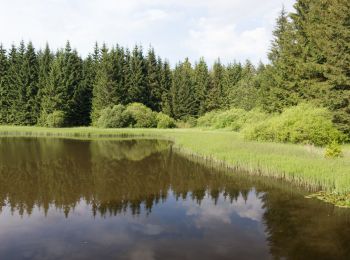
![Randonnée A pied Geroldsgrün - Floßteichweg DÖ 90 - Photo](https://media.geolcdn.com/t/350/260/d6ff0331-64af-487c-b95f-f7b9d0d71164.jpeg&format=jpg&maxdim=2)
![A pied A pied](https://static1.geolcdn.com/sitytour/trail-icons/100.png)
Km
A pied
![](/images/other/stat-length.png)
![](https://static1.geolcdn.com/siteimages/upload/files/1508320355ic_sort_den_pos_24dp.png)
![](https://static1.geolcdn.com/siteimages/upload/files/1508320355ic_sort_den_neg_24dp.png)
![](https://static1.geolcdn.com/siteimages/upload/files/16400158638029165_repeat_loop_refresh_sync_direction_icon.png)
• Randonnée créée par Frankenwaldverein.
![Randonnée A pied Geroldsgrüner Forst - Dürrenwaider Panoramaweg DÖ 99 - Photo](https://media.geolcdn.com/t/350/260/d5c2ed47-b5a6-4f3b-9b62-4496da14505b.jpeg&format=jpg&maxdim=2)
![A pied A pied](https://static1.geolcdn.com/sitytour/trail-icons/100.png)
Km
A pied
![](/images/other/stat-length.png)
![](https://static1.geolcdn.com/siteimages/upload/files/1508320355ic_sort_den_pos_24dp.png)
![](https://static1.geolcdn.com/siteimages/upload/files/1508320355ic_sort_den_neg_24dp.png)
![](https://static1.geolcdn.com/siteimages/upload/files/16400158638029165_repeat_loop_refresh_sync_direction_icon.png)
• Randonnée créée par Frankenwaldverein.
![Randonnée A pied Geroldsgrüner Forst - Kohlstattweg DÖ 98 - Photo](https://media.geolcdn.com/t/350/260/d5c2ed47-b5a6-4f3b-9b62-4496da14505b.jpeg&format=jpg&maxdim=2)
![A pied A pied](https://static1.geolcdn.com/sitytour/trail-icons/100.png)
Km
A pied
![](/images/other/stat-length.png)
![](https://static1.geolcdn.com/siteimages/upload/files/1508320355ic_sort_den_pos_24dp.png)
![](https://static1.geolcdn.com/siteimages/upload/files/1508320355ic_sort_den_neg_24dp.png)
![](https://static1.geolcdn.com/siteimages/upload/files/16400158638029165_repeat_loop_refresh_sync_direction_icon.png)
• Randonnée créée par Frankenwaldverein.
![Randonnée A pied Geroldsgrün - Langesbühlweg DÖ 95 - Photo](https://media.geolcdn.com/t/350/260/d5c2ed47-b5a6-4f3b-9b62-4496da14505b.jpeg&format=jpg&maxdim=2)
![A pied A pied](https://static1.geolcdn.com/sitytour/trail-icons/100.png)
Km
A pied
![](/images/other/stat-length.png)
![](https://static1.geolcdn.com/siteimages/upload/files/1508320355ic_sort_den_pos_24dp.png)
![](https://static1.geolcdn.com/siteimages/upload/files/1508320355ic_sort_den_neg_24dp.png)
![](https://static1.geolcdn.com/siteimages/upload/files/16400158638029165_repeat_loop_refresh_sync_direction_icon.png)
• Randonnée créée par Frankenwaldverein.
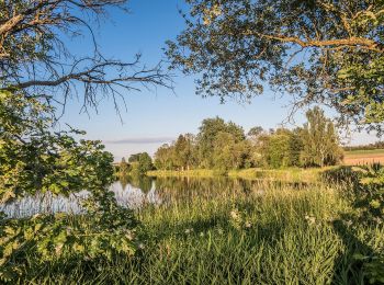
![Randonnée A pied Bad Steben - Stemmer Steig DÖ 93 - Photo](https://media.geolcdn.com/t/350/260/75fdccb3-dbf3-408a-87f9-455ce5dd0dbc.jpeg&format=jpg&maxdim=2)
![A pied A pied](https://static1.geolcdn.com/sitytour/trail-icons/100.png)
Km
A pied
![](/images/other/stat-length.png)
![](https://static1.geolcdn.com/siteimages/upload/files/1508320355ic_sort_den_pos_24dp.png)
![](https://static1.geolcdn.com/siteimages/upload/files/1508320355ic_sort_den_neg_24dp.png)
![](https://static1.geolcdn.com/siteimages/upload/files/16400158638029165_repeat_loop_refresh_sync_direction_icon.png)
• Randonnée créée par Frankenwaldverein.
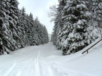
![Randonnée A pied Geroldsgrüner Forst - Vochelaweg DÖ 91 - Photo](https://media.geolcdn.com/t/350/260/dc5a8647-c39d-49f0-9c37-125f10df8e44.jpeg&format=jpg&maxdim=2)
![A pied A pied](https://static1.geolcdn.com/sitytour/trail-icons/100.png)
Km
A pied
![](/images/other/stat-length.png)
![](https://static1.geolcdn.com/siteimages/upload/files/1508320355ic_sort_den_pos_24dp.png)
![](https://static1.geolcdn.com/siteimages/upload/files/1508320355ic_sort_den_neg_24dp.png)
![](https://static1.geolcdn.com/siteimages/upload/files/16400158638029165_repeat_loop_refresh_sync_direction_icon.png)
• Randonnée créée par Frankenwaldverein.
20 randonnées affichées sur 97
Application GPS de randonnée GRATUITE
Activités
Régions proches
- Bad Steben
- Berg
- Forst Schwarzenbach am Wald
- Gerlaser Forst
- Geroldsgrün
- Geroldsgrüner Forst
- Helmbrechts
- Issigau
- Köditz
- Konradsreuth
- Lichtenberg
- Martinlamitzer Forst Nord
- Naila
- Regnitzlosau
- Rehau
- Schauenstein
- Schwarzenbach a.Wald
- Schwarzenbach a.d.Saale
- Selbitz
- Sparneck
- Töpen
- Weißdorf
- Zell im Fichtelgebirge