Brannenburg, Landkreis Rosenheim : Les meilleures randonnées, itinéraires, parcours, balades et promenades

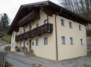
Brannenburg : découvrez les meilleures randonnées : 17 pédestres et 1 à vélo ou VTT. Tous ces circuits, parcours, itinéraires et activités en plein air sont disponibles dans nos applications SityTrail pour smartphones et tablettes.


Les meilleurs parcours (18)

Randonnée A pied Brannenburg - BF6 - Über Stock und Stein - Photo
A pied 15.973
Km
PRO

A pied

Moyen
Brannenburg, Bavière, Landkreis Rosenheim, Allemagne
16 km | 27 km-effort
6h 4min
807 m
802 m
Oui
SityTrail - itinéraires balisés pédestres

• Randonnée créée par Gemeinde Fischbachau; Gemeinde Bad Feilnbach; Gemeinde Brannenburg. Symbole: Gelbe Wegweisschilder

Randonnée A pied Brannenburg - Petrusquelle - Trail - Photo
A pied 4.44
Km
PRO

A pied

Facile
Brannenburg, Bavière, Landkreis Rosenheim, Allemagne
4,4 km | 5,4 km-effort
1h 14min
76 m
69 m
Oui
SityTrail - itinéraires balisés pédestres

• Randonnée créée par DSV nordic aktiv WALKING ZENTRUM. Symbole: Blaues Schild mit weißem Pfeil

Randonnée A pied Brannenburg - OEL CHECK - Trail - Photo
A pied 9.756
Km
PRO

A pied

Facile
Brannenburg, Bavière, Landkreis Rosenheim, Allemagne
9,8 km | 12,7 km-effort
2h 53min
223 m
215 m
Oui
SityTrail - itinéraires balisés pédestres

• Randonnée créée par DSV nordic aktiv WALKING ZENTRUM. Symbole: Rotes Schild mit weißem Pfeil

Randonnée A pied Brannenburg - HAAS - Trail - Photo
A pied 8.792
Km
PRO

A pied

Facile
Brannenburg, Bavière, Landkreis Rosenheim, Allemagne
8,8 km | 12,7 km-effort
2h 52min
290 m
293 m
Oui
SityTrail - itinéraires balisés pédestres

• Randonnée créée par DSV nordic aktiv WALKING ZENTRUM. Symbole: Schwarzes Schild mit weißem Pfeil

Randonnée A pied Brannenburg - Wanderweg 0 - Brannenburg - Photo
A pied 4.36
Km
PRO

A pied

Facile
Brannenburg, Bavière, Landkreis Rosenheim, Allemagne
4,4 km | 7,6 km-effort
1h 43min
236 m
252 m
Oui
SityTrail - itinéraires balisés pédestres

• Randonnée créée par Gemeinde Brannenburg. Symbole: Roter Text auf gelbem Hintergrund

Randonnée A pied Brannenburg - Wanderweg 5 - Brannenburg - Photo
A pied 4.297
Km
PRO

A pied

Facile
Brannenburg, Bavière, Landkreis Rosenheim, Allemagne
4,3 km | 6,7 km-effort
1h 31min
180 m
175 m
Oui
SityTrail - itinéraires balisés pédestres

• Randonnée créée par Gemeinde Brannenburg. Symbole: Roter Text auf gelbem Hintergrund

Randonnée A pied Brannenburg - Wanderweg 6 - Brannenburg - Photo
A pied 3.029
Km
PRO

A pied

Facile
Brannenburg, Bavière, Landkreis Rosenheim, Allemagne
3 km | 4,9 km-effort
1h 7min
140 m
147 m
Oui
SityTrail - itinéraires balisés pédestres

• Randonnée créée par Gemeinde Brannenburg. Symbole: Roter Text auf gelbem Hintergrund

Randonnée A pied Brannenburg - Kulturverführung Degerndorf - Photo
A pied 4.733
Km
PRO

A pied

Facile
Brannenburg, Bavière, Landkreis Rosenheim, Allemagne
4,7 km | 5,8 km-effort
1h 19min
83 m
83 m
Oui
SityTrail - itinéraires balisés pédestres

• Symbole: Bronzefahnen

Randonnée A pied Brannenburg - Wanderweg 9 - Brannenburg - Photo
A pied 10.658
Km
PRO

A pied

Facile
Brannenburg, Bavière, Landkreis Rosenheim, Allemagne
10,7 km | 19,2 km-effort
4h 22min
641 m
652 m
Oui
SityTrail - itinéraires balisés pédestres

• Randonnée créée par Gemeinde Brannenburg. Symbole: Roter Text auf gelbem Hintergrund

Randonnée A pied Brannenburg - Wendelstein - Reindler Alm - Mitteralm - Aipl - Zahnradbahn (Talbahnhof) - Photo
A pied 8.693
Km
PRO

A pied

Moyen
Brannenburg, Bavière, Landkreis Rosenheim, Allemagne
8,7 km | 21 km-effort
4h 44min
1217 m
2 m
Non
SityTrail - itinéraires balisés pédestres

• Randonnée créée par Wendelsteinbahn GmbH. Symbole: Weißes W umrundet von einem weißen Kreis auf blauem Hintergrund

Randonnée A pied Brannenburg - Wanderweg 8 - Brannenburg - Photo
A pied 7.697
Km
PRO

A pied

Facile
Brannenburg, Bavière, Landkreis Rosenheim, Allemagne
7,7 km | 11,3 km-effort
2h 33min
267 m
271 m
Oui
SityTrail - itinéraires balisés pédestres

• Randonnée créée par Gemeinde Brannenburg. Symbole: Roter Text auf gelbem Hintergrund

Randonnée A pied Brannenburg - BR7 - Brannenburg - Photo
A pied 3.001
Km
PRO

A pied

Facile
Brannenburg, Bavière, Landkreis Rosenheim, Allemagne
3 km | 4,7 km-effort
1h 3min
91 m
230 m
Non
SityTrail - itinéraires balisés pédestres

• Randonnée créée par Gemeinde Brannenburg. Symbole: Gelbe Wegweisschilder

Randonnée A pied Brannenburg - Wanderweg 1 - Brannenburg - Photo
A pied 4.463
Km
PRO

A pied

Facile
Brannenburg, Bavière, Landkreis Rosenheim, Allemagne
4,5 km | 4,9 km-effort
1h 6min
33 m
31 m
Oui
SityTrail - itinéraires balisés pédestres

Randonnée A pied Brannenburg - Wanderweg 2 - Brannenburg - Photo
A pied 5.863
Km
PRO

A pied

Facile
Brannenburg, Bavière, Landkreis Rosenheim, Allemagne
5,9 km | 6,4 km-effort
1h 27min
41 m
40 m
Oui
SityTrail - itinéraires balisés pédestres

Randonnée A pied Brannenburg - Wanderweg 3 - Brannenburg - Photo
A pied 10.561
Km
PRO

A pied

Facile
Brannenburg, Bavière, Landkreis Rosenheim, Allemagne
10,6 km | 11,8 km-effort
2h 40min
90 m
89 m
Oui
SityTrail - itinéraires balisés pédestres

Randonnée A pied Brannenburg - Wanderweg 9b - Hochsalwand - Photo
A pied 3.835
Km
PRO

A pied

Facile
Brannenburg, Bavière, Landkreis Rosenheim, Allemagne
3,8 km | 6,6 km-effort
1h 30min
169 m
326 m
Non
SityTrail - itinéraires balisés pédestres

• Symbole: Gelbe Schilder mit roter Zahl

Randonnée A pied Brannenburg - Wanderweg BR2 - Brannenburg - Photo
A pied 13.961
Km
PRO

A pied

Moyen
Brannenburg, Bavière, Landkreis Rosenheim, Allemagne
14 km | 25 km-effort
5h 37min
811 m
811 m
Oui
SityTrail - itinéraires balisés pédestres

• Randonnée créée par Gemeinde Brannenburg. Symbole: Gelbe Wegweisschilder mit schwarzer Schrift oder grüne Schilder m...

Randonnée V.T.T. Brannenburg - Duitsland - Wendelstein Inntal - Photo
V.T.T. 29.101
Km

V.T.T.

Très facile
Brannenburg, Bavière, Landkreis Rosenheim, Allemagne
29 km | 43 km-effort
Inconnu
1030 m
1030 m
Oui
gpstracks

• More information on GPStracks.nl : http://www.gpstracks.nl

18 randonnées affichées sur 18

Application GPS de randonnée GRATUITE

Logo SityTrail SityTrail

IGN / Instituts géographiques

Télécharger SityTrail sur l'App Store Télécharger SityTrail sur Google Play

Logo SityTrail SityTrail World

Le monde est à vous

Télécharger SityTrail sur l'App Store Télécharger SityTrail sur Google Play Télécharger SityTrail sur Huawei AppGallery

Activités

Fermer
Mes abonnements