![](/images/other/stat-length.png)
- Randonnées
- Outdoor
- Allemagne
- Bavière
- Ratisbonne
Ratisbonne, Bavière : Les meilleures randonnées, itinéraires, parcours, balades et promenades
Ratisbonne : découvrez les meilleures randonnées : 12 pédestres et 1 à vélo ou VTT. Tous ces circuits, parcours, itinéraires et activités en plein air sont disponibles dans nos applications SityTrail pour smartphones et tablettes.
Les meilleurs parcours (13)
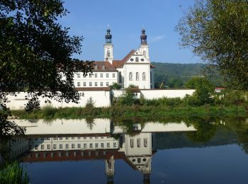
![Randonnée A pied - Wanderroute W 01 Regensburg - Pielenhofen (Rotes Dreieck) - Photo](https://media.geolcdn.com/t/350/260/0de89893-d035-40cc-b96a-19aeb5d51b0a.jpeg&format=jpg&maxdim=2)
![A pied A pied](https://static1.geolcdn.com/sitytour/trail-icons/100.png)
Km
A pied
![](/images/other/stat-length.png)
![](https://static1.geolcdn.com/siteimages/upload/files/1508320355ic_sort_den_pos_24dp.png)
![](https://static1.geolcdn.com/siteimages/upload/files/1508320355ic_sort_den_neg_24dp.png)
![](https://static1.geolcdn.com/siteimages/upload/files/16400158638029165_repeat_loop_refresh_sync_direction_icon.png)
• Randonnée créée par Waldverein Regensburg. Symbole: Rotes Dreieck (Spitze zur Seite) auf weißem Grund
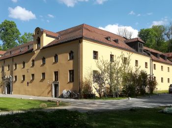
![Randonnée A pied - S 16 Regensburg-Prüfening - Pentling (Rotes Rechteck) - Photo](https://media.geolcdn.com/t/350/260/f95ec4c9-1500-4b17-8e34-f444ae9de0d8.jpeg&format=jpg&maxdim=2)
![A pied A pied](https://static1.geolcdn.com/sitytour/trail-icons/100.png)
Km
A pied
![](/images/other/stat-length.png)
![](https://static1.geolcdn.com/siteimages/upload/files/1508320355ic_sort_den_pos_24dp.png)
![](https://static1.geolcdn.com/siteimages/upload/files/1508320355ic_sort_den_neg_24dp.png)
![](https://static1.geolcdn.com/siteimages/upload/files/16400158638029165_repeat_loop_refresh_sync_direction_icon.png)
• Randonnée créée par Waldverein Regensburg. Symbole: Rotes Rechteck auf weißem Grund
![Randonnée A pied - W 67 Regensburg - Etterzhausen (Blaues Rechteck) - Photo](https://media.geolcdn.com/t/350/260/f95ec4c9-1500-4b17-8e34-f444ae9de0d8.jpeg&format=jpg&maxdim=2)
![A pied A pied](https://static1.geolcdn.com/sitytour/trail-icons/100.png)
Km
A pied
![](/images/other/stat-length.png)
![](https://static1.geolcdn.com/siteimages/upload/files/1508320355ic_sort_den_pos_24dp.png)
![](https://static1.geolcdn.com/siteimages/upload/files/1508320355ic_sort_den_neg_24dp.png)
![](https://static1.geolcdn.com/siteimages/upload/files/16400158638029165_repeat_loop_refresh_sync_direction_icon.png)
• Randonnée créée par Waldverein Regensburg. Symbole: Blaues Rechteck auf weißem Grund
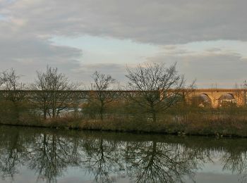
![Randonnée A pied - W 07 Regensburg - Eichhofen (Blaues Dreieck) - Photo](https://media.geolcdn.com/t/350/260/4f3e9c63-f895-4c1a-b1e2-e373d20f9274.jpeg&format=jpg&maxdim=2)
![A pied A pied](https://static1.geolcdn.com/sitytour/trail-icons/100.png)
Km
A pied
![](/images/other/stat-length.png)
![](https://static1.geolcdn.com/siteimages/upload/files/1508320355ic_sort_den_pos_24dp.png)
![](https://static1.geolcdn.com/siteimages/upload/files/1508320355ic_sort_den_neg_24dp.png)
![](https://static1.geolcdn.com/siteimages/upload/files/16400158638029165_repeat_loop_refresh_sync_direction_icon.png)
• Randonnée créée par Waldverein Regensburg. Symbole: Blaues Dreieck (Spitze zur Seite) auf weißem Grund
![Randonnée A pied - W 06 Regensburg - Eilsbrunn (Rotes Dreieck) - Photo](https://media.geolcdn.com/t/350/260/f95ec4c9-1500-4b17-8e34-f444ae9de0d8.jpeg&format=jpg&maxdim=2)
![A pied A pied](https://static1.geolcdn.com/sitytour/trail-icons/100.png)
Km
A pied
![](/images/other/stat-length.png)
![](https://static1.geolcdn.com/siteimages/upload/files/1508320355ic_sort_den_pos_24dp.png)
![](https://static1.geolcdn.com/siteimages/upload/files/1508320355ic_sort_den_neg_24dp.png)
![](https://static1.geolcdn.com/siteimages/upload/files/16400158638029165_repeat_loop_refresh_sync_direction_icon.png)
• Randonnée créée par Waldverein Regensburg. Symbole: Rotes Dreieck (Spitze zur Seite) auf weißem Grund
![Randonnée A pied - W 05 Regensburg - Alling (Grünes Dreieck) - Photo](https://media.geolcdn.com/t/350/260/4f3e9c63-f895-4c1a-b1e2-e373d20f9274.jpeg&format=jpg&maxdim=2)
![A pied A pied](https://static1.geolcdn.com/sitytour/trail-icons/100.png)
Km
A pied
![](/images/other/stat-length.png)
![](https://static1.geolcdn.com/siteimages/upload/files/1508320355ic_sort_den_pos_24dp.png)
![](https://static1.geolcdn.com/siteimages/upload/files/1508320355ic_sort_den_neg_24dp.png)
![](https://static1.geolcdn.com/siteimages/upload/files/16400158638029165_repeat_loop_refresh_sync_direction_icon.png)
• Randonnée créée par Waldverein Regensburg. Symbole: Grünes Dreieck (Spitze zur Seite) auf weißem Grund
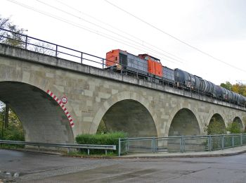
![Randonnée A pied - W 24 Regensburg - Eichhofen (Rotes Dreieck) - Photo](https://media.geolcdn.com/t/350/260/8f172980-91a3-46ad-bc0c-bb9245653fc9.jpeg&format=jpg&maxdim=2)
![A pied A pied](https://static1.geolcdn.com/sitytour/trail-icons/100.png)
Km
A pied
![](/images/other/stat-length.png)
![](https://static1.geolcdn.com/siteimages/upload/files/1508320355ic_sort_den_pos_24dp.png)
![](https://static1.geolcdn.com/siteimages/upload/files/1508320355ic_sort_den_neg_24dp.png)
![](https://static1.geolcdn.com/siteimages/upload/files/16400158638029165_repeat_loop_refresh_sync_direction_icon.png)
• Randonnée créée par Waldverein Regensburg. Symbole: Rotes Dreieck (Spitze zur Seite) auf weißem Grund
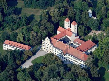
![Randonnée A pied - W 04 Regensburg - Anschluss an W5 (Grünes Rechteck) - Photo](https://media.geolcdn.com/t/350/260/7269e121-41e3-4122-a8a5-87cf95847aa0.jpeg&format=jpg&maxdim=2)
![A pied A pied](https://static1.geolcdn.com/sitytour/trail-icons/100.png)
Km
A pied
![](/images/other/stat-length.png)
![](https://static1.geolcdn.com/siteimages/upload/files/1508320355ic_sort_den_pos_24dp.png)
![](https://static1.geolcdn.com/siteimages/upload/files/1508320355ic_sort_den_neg_24dp.png)
![](https://static1.geolcdn.com/siteimages/upload/files/16400158638029165_repeat_loop_refresh_sync_direction_icon.png)
• Randonnée créée par Waldverein Regensburg. Symbole: Grünes Rechteck auf weißem Grund
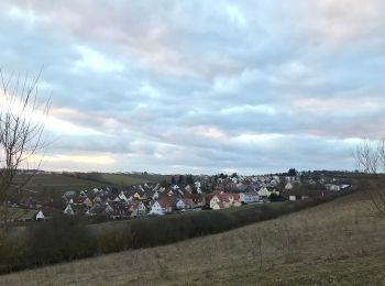
![Randonnée A pied - S 08 Regensburg-Graß - Hohengebraching (Rotes Dreieck) - Photo](https://media.geolcdn.com/t/350/260/ccea801e-51aa-4a5b-a2f0-e6646cc00abe.jpeg&format=jpg&maxdim=2)
![A pied A pied](https://static1.geolcdn.com/sitytour/trail-icons/100.png)
Km
A pied
![](/images/other/stat-length.png)
![](https://static1.geolcdn.com/siteimages/upload/files/1508320355ic_sort_den_pos_24dp.png)
![](https://static1.geolcdn.com/siteimages/upload/files/1508320355ic_sort_den_neg_24dp.png)
![](https://static1.geolcdn.com/siteimages/upload/files/16400158638029165_repeat_loop_refresh_sync_direction_icon.png)
• Randonnée créée par Waldverein Regensburg. Symbole: Rotes Dreieck auf weißem Grund, in der Natur in Richtung Norden ...
![Randonnée A pied - S 21 Regensburg-Neuprüll - Unterirading [Walba] (Grünes Rechteck) - Photo](https://media.geolcdn.com/t/350/260/f7ecf863-2b2d-4886-b112-06f87ea34e11.jpeg&format=jpg&maxdim=2)
![A pied A pied](https://static1.geolcdn.com/sitytour/trail-icons/100.png)
Km
A pied
![](/images/other/stat-length.png)
![](https://static1.geolcdn.com/siteimages/upload/files/1508320355ic_sort_den_pos_24dp.png)
![](https://static1.geolcdn.com/siteimages/upload/files/1508320355ic_sort_den_neg_24dp.png)
![](https://static1.geolcdn.com/siteimages/upload/files/16400158638029165_repeat_loop_refresh_sync_direction_icon.png)
• Randonnée créée par Waldverein Regensburg. Symbole: Grünes Rechteck auf weißem Grund
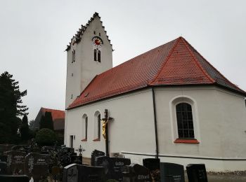
![Randonnée A pied - S 22 Oberisling - Hohengebraching (Rotes Rechteck) - Photo](https://media.geolcdn.com/t/350/260/0e5988d8-7405-4c69-8d6c-c7ae299193fe.jpeg&format=jpg&maxdim=2)
![A pied A pied](https://static1.geolcdn.com/sitytour/trail-icons/100.png)
Km
A pied
![](/images/other/stat-length.png)
![](https://static1.geolcdn.com/siteimages/upload/files/1508320355ic_sort_den_pos_24dp.png)
![](https://static1.geolcdn.com/siteimages/upload/files/1508320355ic_sort_den_neg_24dp.png)
![](https://static1.geolcdn.com/siteimages/upload/files/16400158638029165_repeat_loop_refresh_sync_direction_icon.png)
• Randonnée créée par Waldverein Regensburg. Symbole: Rotes Rechteck auf weißem Grund
![Randonnée Cyclotourisme - Regensburg Traubing - Photo](https://media.geolcdn.com/t/350/260/ext.jpg?maxdim=2&url=https%3A%2F%2Fstatic1.geolcdn.com%2Fsiteimages%2Fupload%2Ffiles%2F1524743154velo.jpg)
![Cyclotourisme Cyclotourisme](https://static1.geolcdn.com/sitytour/trail-icons/204.png)
Km
Cyclotourisme
![](/images/other/stat-length.png)
![](https://static1.geolcdn.com/siteimages/upload/files/1508320355ic_sort_den_pos_24dp.png)
![](https://static1.geolcdn.com/siteimages/upload/files/1508320355ic_sort_den_neg_24dp.png)
![](https://static1.geolcdn.com/siteimages/upload/files/16400158638029165_repeat_loop_refresh_sync_direction_icon.png)
![Randonnée Marche - Ratisbonne - Photo](https://media.geolcdn.com/t/350/260/ext.jpg?maxdim=2&url=https%3A%2F%2Fstatic1.geolcdn.com%2Fsiteimages%2Fupload%2Ffiles%2F1553511878bg_sport_marche.png)
![Marche Marche](https://static1.geolcdn.com/sitytour/trail-icons/101.png)
Km
Marche
![](/images/other/stat-length.png)
![](https://static1.geolcdn.com/siteimages/upload/files/1508320355ic_sort_den_pos_24dp.png)
![](https://static1.geolcdn.com/siteimages/upload/files/1508320355ic_sort_den_neg_24dp.png)
![](https://static1.geolcdn.com/siteimages/upload/files/16400158638029165_repeat_loop_refresh_sync_direction_icon.png)
13 randonnées affichées sur 13
Application GPS de randonnée GRATUITE