Landkreis Ostallgäu, Bavière : Les meilleures randonnées, itinéraires, parcours, balades et promenades

Landkreis Ostallgäu : découvrez les meilleures randonnées : 17 pédestres. Tous ces circuits, parcours, itinéraires et activités en plein air sont disponibles dans nos applications SityTrail pour smartphones et tablettes.


Les meilleurs parcours (18)
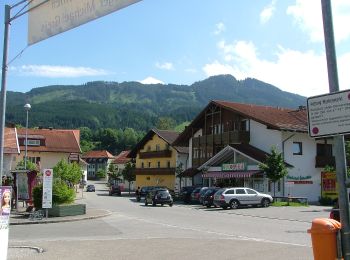
Randonnée A pied Nesselwang - Nesselwang - lokale beschilderte Wanderwege - Photo
A pied 5.565
Km
GUIDE+

A pied

Facile
Nesselwang, Bavière, Landkreis Ostallgäu, Allemagne
5,6 km | 6,8 km-effort
1h 33min
82 m
134 m
Non
SityTrail - itinéraires balisés pédestres

• Randonnée créée par Gemeinde Nesselwang.
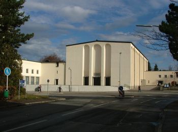
Randonnée A pied Pforzen - DAV Gablonzer Rundwanderweg - Photo
A pied 8.436
Km
GUIDE+

A pied

Facile
Pforzen, Bavière, Landkreis Ostallgäu, Allemagne
8,4 km | 10,1 km-effort
2h 17min
122 m
122 m
Oui
SityTrail - itinéraires balisés pédestres

• Symbole: DAV

Randonnée A pied Lengenwang - Lengenwanger Kapellenweg - Photo
A pied 4.334
Km
GUIDE+

A pied

Facile
Lengenwang, Bavière, Landkreis Ostallgäu, Allemagne
4,3 km | 4,6 km-effort
1h 3min
9 m
63 m
Non
SityTrail - itinéraires balisés pédestres

• Symbole: bell

Randonnée A pied Füssen - Lechweg - Photo
A pied 14.066
Km
GUIDE+

A pied

Moyen
Füssen, Bavière, Landkreis Ostallgäu, Allemagne
14,1 km | 21 km-effort
4h 39min
471 m
523 m
Non
SityTrail - itinéraires balisés pédestres

Randonnée A pied Marktoberdorf - Terra Nostra II - Photo
A pied 3.329
Km
GUIDE+

A pied

Facile
Marktoberdorf, Bavière, Landkreis Ostallgäu, Allemagne
3,3 km | 4 km-effort
54min
42 m
81 m
Non
SityTrail - itinéraires balisés pédestres

Randonnée A pied Schwangau - Alpsee-Rundweg - Photo
A pied 5.204
Km
GUIDE+

A pied

Facile
Schwangau, Bavière, Landkreis Ostallgäu, Allemagne
5,2 km | 6,9 km-effort
1h 34min
129 m
130 m
Oui
SityTrail - itinéraires balisés pédestres

Randonnée A pied Füssen - Hopfensee-Rundweg - Photo
A pied 6.863
Km
GUIDE+

A pied

Facile
Füssen, Bavière, Landkreis Ostallgäu, Allemagne
6,9 km | 7,6 km-effort
1h 43min
53 m
53 m
Oui
SityTrail - itinéraires balisés pédestres

Randonnée A pied Schwangau - Naturpfad Ahornreitweg - Photo
A pied 5.777
Km
GUIDE+

A pied

Facile
Schwangau, Bavière, Landkreis Ostallgäu, Allemagne
5,8 km | 12 km-effort
2h 44min
618 m
24 m
Non
SityTrail - itinéraires balisés pédestres

Randonnée A pied Nesselwang - Ge(h)zeiten - Photo
A pied 3.118
Km
GUIDE+

A pied

Facile
Nesselwang, Bavière, Landkreis Ostallgäu, Allemagne
3,1 km | 4 km-effort
54min
72 m
45 m
Non
SityTrail - itinéraires balisés pédestres

Randonnée A pied Pfronten - Fallmühle-Schwarzwandweg - Photo
A pied 8.992
Km
GUIDE+

A pied

Facile
Pfronten, Bavière, Landkreis Ostallgäu, Allemagne
9 km | 14,8 km-effort
3h 22min
435 m
445 m
Non
SityTrail - itinéraires balisés pédestres

Randonnée A pied Seeg - 5-Seen-Runde - Photo
A pied 11.638
Km
GUIDE+

A pied

Facile
Seeg, Bavière, Landkreis Ostallgäu, Allemagne
11,6 km | 14,2 km-effort
3h 13min
194 m
194 m
Oui
SityTrail - itinéraires balisés pédestres

Randonnée Marche Nesselwang - Nesselwang Alpspitz - Photo
Marche 10.775
Km

Marche

Moyen
Nesselwang, Bavière, Landkreis Ostallgäu, Allemagne
10,8 km | 19,2 km-effort
3h 30min
617 m
681 m
Non
fissettemichel

• montée raide beaucoup escaliers métalliques difficiles pour les chiens..retour facile

Randonnée Moto Schwangau - Neuschwanstein - Garmisch Partenkirchen - Photo
Moto 70.892
Km

Moto

Très facile
Schwangau, Bavière, Landkreis Ostallgäu, Allemagne
71 km | 85 km-effort
Inconnu
1010 m
1110 m
Non
Bernard Lejeune

Randonnée Marche Schwangau - Tour de l'Alpsee - Photo
Marche 6.927
Km

Marche

Très facile
Schwangau, Bavière, Landkreis Ostallgäu, Allemagne
6,9 km | 9 km-effort
2h 7min
155 m
155 m
Oui
libertju

Randonnée Marche Schwangau - Autour du Neuschwanstein - Photo
Marche 11.336
Km

Marche

Facile
Schwangau, Bavière, Landkreis Ostallgäu, Allemagne
11,3 km | 17,4 km-effort
5h 0min
454 m
447 m
Oui
libertju

Randonnée Marche Schwangau - Neuschwanstein - Photo
Marche 15.922
Km

Marche

Très facile
Schwangau, Bavière, Landkreis Ostallgäu, Allemagne
15,9 km | 22 km-effort
7h 43min
440 m
435 m
Non
Papamoju

Randonnée Marche Füssen - fussen 1 - Photo
Marche 6.515
Km

Marche

Très facile
Füssen, Bavière, Landkreis Ostallgäu, Allemagne
6,5 km | 7,3 km-effort
4h 22min
62 m
64 m
Oui
Papamoju

Randonnée Marche Schwangau - Neuschwanstein 16.1 - Photo
Marche 16.203
Km

Marche

Très facile
Schwangau, Bavière, Landkreis Ostallgäu, Allemagne
16,2 km | 23 km-effort
Inconnu
492 m
499 m
Oui
Papamoju

18 randonnées affichées sur 18

Application GPS de randonnée GRATUITE

Logo SityTrail SityTrail

IGN / Instituts géographiques

Télécharger SityTrail sur l'App Store Télécharger SityTrail sur Google Play

Logo SityTrail SityTrail World

Le monde est à vous

Télécharger SityTrail sur l'App Store Télécharger SityTrail sur Google Play Télécharger SityTrail sur Huawei AppGallery

Activités

Régions proches

Fermer
Mes abonnements