![](/images/other/stat-length.png)
- Randonnées
- Outdoor
- République Tchèque
- Jihovýchod
- Moravie du Sud
Moravie du Sud, Jihovýchod : Les meilleures randonnées, itinéraires, parcours, balades et promenades
Moravie du Sud : découvrez les meilleures randonnées : 75 pédestres. Tous ces circuits, parcours, itinéraires et activités en plein air sont disponibles dans nos applications SityTrail pour smartphones et tablettes.
Les meilleurs parcours (75)
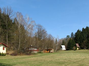
![Randonnée A pied Moravany - NS Po hranici - Photo](https://media.geolcdn.com/t/350/260/6550aa3c-ddad-4c9f-aab9-f02be33a07e5.jpeg&format=jpg&maxdim=2)
![A pied A pied](https://static1.geolcdn.com/sitytour/trail-icons/100.png)
Km
A pied
![](/images/other/stat-length.png)
![](https://static1.geolcdn.com/siteimages/upload/files/1508320355ic_sort_den_pos_24dp.png)
![](https://static1.geolcdn.com/siteimages/upload/files/1508320355ic_sort_den_neg_24dp.png)
![](https://static1.geolcdn.com/siteimages/upload/files/16400158638029165_repeat_loop_refresh_sync_direction_icon.png)
• Randonnée créée par cz:KČT. tagování inspirováno https://www.openstreetmap.org/relation/6445716
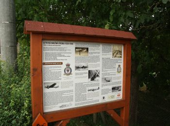
![Randonnée A pied Mikulovice - NS moravského včelařství - Photo](https://media.geolcdn.com/t/350/260/aecb43d3-b381-46bc-996f-8597bd3a76e0.jpeg&format=jpg&maxdim=2)
![A pied A pied](https://static1.geolcdn.com/sitytour/trail-icons/100.png)
Km
A pied
![](/images/other/stat-length.png)
![](https://static1.geolcdn.com/siteimages/upload/files/1508320355ic_sort_den_pos_24dp.png)
![](https://static1.geolcdn.com/siteimages/upload/files/1508320355ic_sort_den_neg_24dp.png)
![](https://static1.geolcdn.com/siteimages/upload/files/16400158638029165_repeat_loop_refresh_sync_direction_icon.png)
• Randonnée créée par Mikulovice.
![Randonnée A pied Tišnov - Po starých názvech Jamného - Photo](https://media.geolcdn.com/t/350/260/179411d4-a256-427f-9746-de8ed0aa2d4f.jpeg&format=jpg&maxdim=2)
![A pied A pied](https://static1.geolcdn.com/sitytour/trail-icons/100.png)
Km
A pied
![](/images/other/stat-length.png)
![](https://static1.geolcdn.com/siteimages/upload/files/1508320355ic_sort_den_pos_24dp.png)
![](https://static1.geolcdn.com/siteimages/upload/files/1508320355ic_sort_den_neg_24dp.png)
![](https://static1.geolcdn.com/siteimages/upload/files/16400158638029165_repeat_loop_refresh_sync_direction_icon.png)
• Randonnée créée par Osadní úřad Jamné.
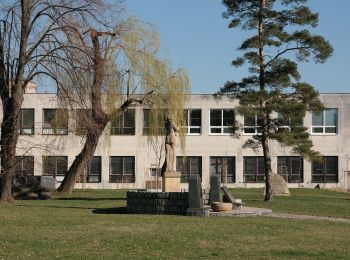
![Randonnée A pied Miroslav - Okruh Miroslavské kopce - Photo](https://media.geolcdn.com/t/350/260/3221cc3c-a9f3-4f28-880f-beaad17e940f.jpeg&format=jpg&maxdim=2)
![A pied A pied](https://static1.geolcdn.com/sitytour/trail-icons/100.png)
Km
A pied
![](/images/other/stat-length.png)
![](https://static1.geolcdn.com/siteimages/upload/files/1508320355ic_sort_den_pos_24dp.png)
![](https://static1.geolcdn.com/siteimages/upload/files/1508320355ic_sort_den_neg_24dp.png)
![](https://static1.geolcdn.com/siteimages/upload/files/16400158638029165_repeat_loop_refresh_sync_direction_icon.png)
• Randonnée créée par cz:KČT.
![Randonnée A pied Domašov - Naučná stezka Rudka - Photo](https://media.geolcdn.com/t/350/260/cd89e092-9e11-4b0e-847d-1385bffcb052.jpeg&format=jpg&maxdim=2)
![A pied A pied](https://static1.geolcdn.com/sitytour/trail-icons/100.png)
Km
A pied
![](/images/other/stat-length.png)
![](https://static1.geolcdn.com/siteimages/upload/files/1508320355ic_sort_den_pos_24dp.png)
![](https://static1.geolcdn.com/siteimages/upload/files/1508320355ic_sort_den_neg_24dp.png)
![](https://static1.geolcdn.com/siteimages/upload/files/16400158638029165_repeat_loop_refresh_sync_direction_icon.png)
• Randonnée créée par Obec Rudka.
![Randonnée A pied Bukovinka - [Ž] Rakovecké údolí - Malá Říčka - Photo](https://media.geolcdn.com/t/350/260/d06663d7-1067-4c22-b72c-d81a6dabd113.jpeg&format=jpg&maxdim=2)
![A pied A pied](https://static1.geolcdn.com/sitytour/trail-icons/100.png)
Km
A pied
![](/images/other/stat-length.png)
![](https://static1.geolcdn.com/siteimages/upload/files/1508320355ic_sort_den_pos_24dp.png)
![](https://static1.geolcdn.com/siteimages/upload/files/1508320355ic_sort_den_neg_24dp.png)
![](https://static1.geolcdn.com/siteimages/upload/files/16400158638029165_repeat_loop_refresh_sync_direction_icon.png)
• Randonnée créée par cz:KČT.
![Randonnée A pied Nosislav - [M] Nosislav - Výhon - Photo](https://media.geolcdn.com/t/350/260/f5229b3c-0400-439f-9460-019b796ae514.jpeg&format=jpg&maxdim=2)
![A pied A pied](https://static1.geolcdn.com/sitytour/trail-icons/100.png)
Km
A pied
![](/images/other/stat-length.png)
![](https://static1.geolcdn.com/siteimages/upload/files/1508320355ic_sort_den_pos_24dp.png)
![](https://static1.geolcdn.com/siteimages/upload/files/1508320355ic_sort_den_neg_24dp.png)
![](https://static1.geolcdn.com/siteimages/upload/files/16400158638029165_repeat_loop_refresh_sync_direction_icon.png)
• Randonnée créée par cz:KČT.
![Randonnée A pied Velké Opatovice - NS Velké Opatovice a okolí - Photo](https://media.geolcdn.com/t/350/260/a55e7f62-0be2-4b16-9696-9bcbbb42a559.jpeg&format=jpg&maxdim=2)
![A pied A pied](https://static1.geolcdn.com/sitytour/trail-icons/100.png)
Km
A pied
![](/images/other/stat-length.png)
![](https://static1.geolcdn.com/siteimages/upload/files/1508320355ic_sort_den_pos_24dp.png)
![](https://static1.geolcdn.com/siteimages/upload/files/1508320355ic_sort_den_neg_24dp.png)
![](https://static1.geolcdn.com/siteimages/upload/files/16400158638029165_repeat_loop_refresh_sync_direction_icon.png)
• Randonnée créée par cz:KČT.
![Randonnée A pied Rousínov - CZ-Studánková NS - Photo](https://media.geolcdn.com/t/350/260/26c2a764-b50a-4157-b115-4b0a7dcb62ae.jpeg&format=jpg&maxdim=2)
![A pied A pied](https://static1.geolcdn.com/sitytour/trail-icons/100.png)
Km
A pied
![](/images/other/stat-length.png)
![](https://static1.geolcdn.com/siteimages/upload/files/1508320355ic_sort_den_pos_24dp.png)
![](https://static1.geolcdn.com/siteimages/upload/files/1508320355ic_sort_den_neg_24dp.png)
![](https://static1.geolcdn.com/siteimages/upload/files/16400158638029165_repeat_loop_refresh_sync_direction_icon.png)
• Randonnée créée par cz:KČT.
![Randonnée A pied Kyjov - NS Kyjov - Bohuslavice - Photo](https://media.geolcdn.com/t/350/260/16565716-f7da-4e94-8dac-0505f2bd9da5.jpeg&format=jpg&maxdim=2)
![A pied A pied](https://static1.geolcdn.com/sitytour/trail-icons/100.png)
Km
A pied
![](/images/other/stat-length.png)
![](https://static1.geolcdn.com/siteimages/upload/files/1508320355ic_sort_den_pos_24dp.png)
![](https://static1.geolcdn.com/siteimages/upload/files/1508320355ic_sort_den_neg_24dp.png)
![](https://static1.geolcdn.com/siteimages/upload/files/16400158638029165_repeat_loop_refresh_sync_direction_icon.png)
• Randonnée créée par cz:KČT. Symbole: major
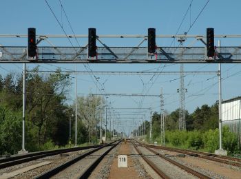
![Randonnée A pied Bzenec - NS Váté písky - Photo](https://media.geolcdn.com/t/350/260/e969c51e-804c-48a2-a694-904dc798e5a4.jpeg&format=jpg&maxdim=2)
![A pied A pied](https://static1.geolcdn.com/sitytour/trail-icons/100.png)
Km
A pied
![](/images/other/stat-length.png)
![](https://static1.geolcdn.com/siteimages/upload/files/1508320355ic_sort_den_pos_24dp.png)
![](https://static1.geolcdn.com/siteimages/upload/files/1508320355ic_sort_den_neg_24dp.png)
![](https://static1.geolcdn.com/siteimages/upload/files/16400158638029165_repeat_loop_refresh_sync_direction_icon.png)
• Randonnée créée par cz:KČT. Symbole: major
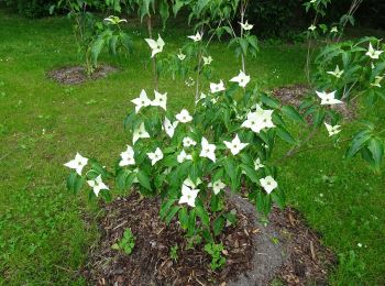
![Randonnée A pied Sedlec - NS Lednické rybníky - Photo](https://media.geolcdn.com/t/350/260/1c01ab89-d5cd-4c84-82f8-92c11e7665a3.jpeg&format=jpg&maxdim=2)
![A pied A pied](https://static1.geolcdn.com/sitytour/trail-icons/100.png)
Km
A pied
![](/images/other/stat-length.png)
![](https://static1.geolcdn.com/siteimages/upload/files/1508320355ic_sort_den_pos_24dp.png)
![](https://static1.geolcdn.com/siteimages/upload/files/1508320355ic_sort_den_neg_24dp.png)
![](https://static1.geolcdn.com/siteimages/upload/files/16400158638029165_repeat_loop_refresh_sync_direction_icon.png)
• Randonnée créée par cz:KČT.
![Randonnée A pied Velké Pavlovice - NS Zastavení v kraji vína a meruněk - Photo](https://media.geolcdn.com/t/350/260/708e3aa3-f60e-428a-a214-42171592e431.jpeg&format=jpg&maxdim=2)
![A pied A pied](https://static1.geolcdn.com/sitytour/trail-icons/100.png)
Km
A pied
![](/images/other/stat-length.png)
![](https://static1.geolcdn.com/siteimages/upload/files/1508320355ic_sort_den_pos_24dp.png)
![](https://static1.geolcdn.com/siteimages/upload/files/1508320355ic_sort_den_neg_24dp.png)
![](https://static1.geolcdn.com/siteimages/upload/files/16400158638029165_repeat_loop_refresh_sync_direction_icon.png)
• Randonnée créée par cz:KČT. green hiking
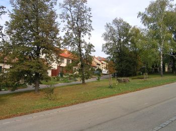
![Randonnée A pied Kobylí - NS Kobylí - Photo](https://media.geolcdn.com/t/350/260/319a677c-7989-41b9-be78-3f07487ba098.jpeg&format=jpg&maxdim=2)
![A pied A pied](https://static1.geolcdn.com/sitytour/trail-icons/100.png)
Km
A pied
![](/images/other/stat-length.png)
![](https://static1.geolcdn.com/siteimages/upload/files/1508320355ic_sort_den_pos_24dp.png)
![](https://static1.geolcdn.com/siteimages/upload/files/1508320355ic_sort_den_neg_24dp.png)
![](https://static1.geolcdn.com/siteimages/upload/files/16400158638029165_repeat_loop_refresh_sync_direction_icon.png)
• Randonnée créée par cz:KČT.
![Randonnée A pied Hustopeče - Mandloňová NS - Photo](https://media.geolcdn.com/t/350/260/fe1036b5-094b-4768-a841-ed5954c5125b.jpeg&format=jpg&maxdim=2)
![A pied A pied](https://static1.geolcdn.com/sitytour/trail-icons/100.png)
Km
A pied
![](/images/other/stat-length.png)
![](https://static1.geolcdn.com/siteimages/upload/files/1508320355ic_sort_den_pos_24dp.png)
![](https://static1.geolcdn.com/siteimages/upload/files/1508320355ic_sort_den_neg_24dp.png)
![](https://static1.geolcdn.com/siteimages/upload/files/16400158638029165_repeat_loop_refresh_sync_direction_icon.png)
• Randonnée créée par cz:KČT.
![Randonnée A pied Onšov - NS Karla Claryho - Photo](https://media.geolcdn.com/t/350/260/3ebb76a8-92c2-4bef-81de-0753f94a5be8.jpeg&format=jpg&maxdim=2)
![A pied A pied](https://static1.geolcdn.com/sitytour/trail-icons/100.png)
Km
A pied
![](/images/other/stat-length.png)
![](https://static1.geolcdn.com/siteimages/upload/files/1508320355ic_sort_den_pos_24dp.png)
![](https://static1.geolcdn.com/siteimages/upload/files/1508320355ic_sort_den_neg_24dp.png)
![](https://static1.geolcdn.com/siteimages/upload/files/16400158638029165_repeat_loop_refresh_sync_direction_icon.png)
• Randonnée créée par cz:KČT.
![Randonnée A pied Šatov - NS Za historií, vínem a opevněním - Photo](https://media.geolcdn.com/t/350/260/55b44c17-a805-4f4d-b8d8-eedf73749f9a.jpeg&format=jpg&maxdim=2)
![A pied A pied](https://static1.geolcdn.com/sitytour/trail-icons/100.png)
Km
A pied
![](/images/other/stat-length.png)
![](https://static1.geolcdn.com/siteimages/upload/files/1508320355ic_sort_den_pos_24dp.png)
![](https://static1.geolcdn.com/siteimages/upload/files/1508320355ic_sort_den_neg_24dp.png)
![](https://static1.geolcdn.com/siteimages/upload/files/16400158638029165_repeat_loop_refresh_sync_direction_icon.png)
• Randonnée créée par cz:KČT.
![Randonnée A pied Božice - NS Údolím lásky - Photo](https://media.geolcdn.com/t/350/260/33569034-0db8-4d72-a0e8-ffb991a038f9.jpeg&format=jpg&maxdim=2)
![A pied A pied](https://static1.geolcdn.com/sitytour/trail-icons/100.png)
Km
A pied
![](/images/other/stat-length.png)
![](https://static1.geolcdn.com/siteimages/upload/files/1508320355ic_sort_den_pos_24dp.png)
![](https://static1.geolcdn.com/siteimages/upload/files/1508320355ic_sort_den_neg_24dp.png)
![](https://static1.geolcdn.com/siteimages/upload/files/16400158638029165_repeat_loop_refresh_sync_direction_icon.png)
• Randonnée créée par cz:KČT. Symbole: green:white:green_bar
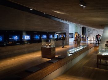
![Randonnée A pied Pavlov - NS Archeostezka Dolní Věstonice - Pavlov - Photo](https://media.geolcdn.com/t/350/260/5e0199f9-0103-4637-bdf9-f9a02f137294.jpeg&format=jpg&maxdim=2)
![A pied A pied](https://static1.geolcdn.com/sitytour/trail-icons/100.png)
Km
A pied
![](/images/other/stat-length.png)
![](https://static1.geolcdn.com/siteimages/upload/files/1508320355ic_sort_den_pos_24dp.png)
![](https://static1.geolcdn.com/siteimages/upload/files/1508320355ic_sort_den_neg_24dp.png)
![](https://static1.geolcdn.com/siteimages/upload/files/16400158638029165_repeat_loop_refresh_sync_direction_icon.png)
• Randonnée créée par cz:KČT. Symbole: green:white:green_bar
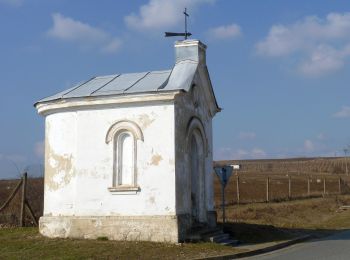
![Randonnée A pied Pasohlávky - naučná stezka Věstonická nádrž - Photo](https://media.geolcdn.com/t/350/260/3d0b1149-4243-407e-a2fd-50ba23414fb3.jpeg&format=jpg&maxdim=2)
![A pied A pied](https://static1.geolcdn.com/sitytour/trail-icons/100.png)
Km
A pied
![](/images/other/stat-length.png)
![](https://static1.geolcdn.com/siteimages/upload/files/1508320355ic_sort_den_pos_24dp.png)
![](https://static1.geolcdn.com/siteimages/upload/files/1508320355ic_sort_den_neg_24dp.png)
![](https://static1.geolcdn.com/siteimages/upload/files/16400158638029165_repeat_loop_refresh_sync_direction_icon.png)
• Randonnée créée par cz:KČT. Symbole: green:white:green_bar
20 randonnées affichées sur 75
Application GPS de randonnée GRATUITE
Activités
Régions proches
- Adamov
- Bílovice nad Svitavou
- Bítov
- Blansko
- Blučina
- Boskovice
- Božice
- Brankovice
- Břeclav
- Brno
- Bukovinka
- Bzenec
- Čebín
- Domašov
- Dubňany
- Havraníky
- Hustopeče
- Ježkovice
- Kobylí
- Kunštát
- Kyjov
- Lednice
- Lesná
- Lesonice
- Letovice
- Lomnice
- Mikulovice
- Miroslav
- Mokrá-Horákov
- Moravany
- Moravské Knínice
- Moravský Krumlov
- Nedvědice
- Nemochovice
- Nesovice
- Nosislav
- Nový Přerov
- Ochoz u Brna
- Omice
- Onšov
- Ostrov u Macochy
- Pasohlávky
- Pavlov
- Předklášteří
- Pustiměř
- Račice-Pístovice
- Rousínov
- Rozdrojovice
- Šatov
- Sedlec
- Strážnice
- Šumná
- Tetčice
- Tišnov
- Tvarožná Lhota
- Valtice
- Velké Opatovice
- Velké Pavlovice
- Vranov
- Vranov nad Dyjí
- Vratěnín
- Ždánice
- Židlochovice
- Znojmo