![](/images/other/stat-length.png)
- Randonnées
- Outdoor
- République Tchèque
- Severozápad
- Karlovarský kraj
- Saint-Joachimsthal
Saint-Joachimsthal, Karlovarský kraj : Les meilleures randonnées, itinéraires, parcours, balades et promenades
Saint-Joachimsthal : découvrez les meilleures randonnées : 5 pédestres. Tous ces circuits, parcours, itinéraires et activités en plein air sont disponibles dans nos applications SityTrail pour smartphones et tablettes.
Les meilleurs parcours (5)
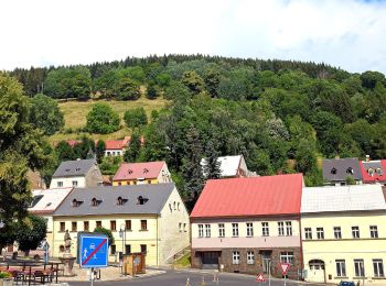
![Randonnée A pied Saint-Joachimsthal - [Ž] Popov – Lanovka na Klínovec - Photo](https://media.geolcdn.com/t/350/260/162e79a2-d856-44dc-be95-d3c9e04c2a98.jpeg&format=jpg&maxdim=2)
![A pied A pied](https://static1.geolcdn.com/sitytour/trail-icons/100.png)
Km
A pied
![](/images/other/stat-length.png)
![](https://static1.geolcdn.com/siteimages/upload/files/1508320355ic_sort_den_pos_24dp.png)
![](https://static1.geolcdn.com/siteimages/upload/files/1508320355ic_sort_den_neg_24dp.png)
![](https://static1.geolcdn.com/siteimages/upload/files/16400158638029165_repeat_loop_refresh_sync_direction_icon.png)
• Randonnée créée par cz:KČT. žlutá:Popov-Lanovka_na_Klínovec
![Randonnée A pied Saint-Joachimsthal - naučná stezka Jáchymovské peklo - Photo](https://media.geolcdn.com/t/350/260/212b6420-01c3-4115-b8b8-7f484b00b4a3.jpeg&format=jpg&maxdim=2)
![A pied A pied](https://static1.geolcdn.com/sitytour/trail-icons/100.png)
Km
A pied
![](/images/other/stat-length.png)
![](https://static1.geolcdn.com/siteimages/upload/files/1508320355ic_sort_den_pos_24dp.png)
![](https://static1.geolcdn.com/siteimages/upload/files/1508320355ic_sort_den_neg_24dp.png)
![](https://static1.geolcdn.com/siteimages/upload/files/16400158638029165_repeat_loop_refresh_sync_direction_icon.png)
• Randonnée créée par cz:KČT.
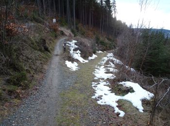
![Randonnée A pied Saint-Joachimsthal - [Ž] Klínovec - Radošov - Photo](https://media.geolcdn.com/t/350/260/45832ed6-7d58-4e59-9ee7-9272ace5bf81.jpeg&format=jpg&maxdim=2)
![A pied A pied](https://static1.geolcdn.com/sitytour/trail-icons/100.png)
Km
A pied
![](/images/other/stat-length.png)
![](https://static1.geolcdn.com/siteimages/upload/files/1508320355ic_sort_den_pos_24dp.png)
![](https://static1.geolcdn.com/siteimages/upload/files/1508320355ic_sort_den_neg_24dp.png)
![](https://static1.geolcdn.com/siteimages/upload/files/16400158638029165_repeat_loop_refresh_sync_direction_icon.png)
• Randonnée créée par cz:KČT.
![Randonnée A pied Saint-Joachimsthal - Hornická naučná stezka Dr. Jana Hlouška - Photo](https://media.geolcdn.com/t/350/260/9fd4827e-815b-4d6d-be28-8d4a257dff69.jpeg&format=jpg&maxdim=2)
![A pied A pied](https://static1.geolcdn.com/sitytour/trail-icons/100.png)
Km
A pied
![](/images/other/stat-length.png)
![](https://static1.geolcdn.com/siteimages/upload/files/1508320355ic_sort_den_pos_24dp.png)
![](https://static1.geolcdn.com/siteimages/upload/files/1508320355ic_sort_den_neg_24dp.png)
![](https://static1.geolcdn.com/siteimages/upload/files/16400158638029165_repeat_loop_refresh_sync_direction_icon.png)
![Randonnée A pied Saint-Joachimsthal - naučná stezka Montánní krajina Krušných hor - Photo](https://media.geolcdn.com/t/350/260/08a89af8-01cb-422c-8ff5-b3835d4a6cd2.jpeg&format=jpg&maxdim=2)
![A pied A pied](https://static1.geolcdn.com/sitytour/trail-icons/100.png)
Km
A pied
![](/images/other/stat-length.png)
![](https://static1.geolcdn.com/siteimages/upload/files/1508320355ic_sort_den_pos_24dp.png)
![](https://static1.geolcdn.com/siteimages/upload/files/1508320355ic_sort_den_neg_24dp.png)
![](https://static1.geolcdn.com/siteimages/upload/files/16400158638029165_repeat_loop_refresh_sync_direction_icon.png)
5 randonnées affichées sur 5
Application GPS de randonnée GRATUITE