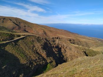
![](/images/other/stat-length.png)
- Randonnées
- Outdoor
- Cap-vert
Cap-vert : Les meilleures randonnées, itinéraires, parcours, balades et promenades
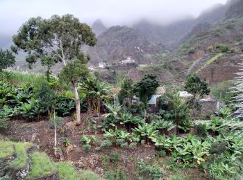
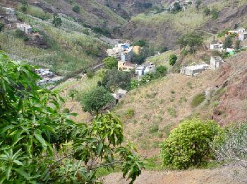
Cap-vert : découvrez les 151 meilleurs circuits de randonnée pédestre ou à vélo. Notre catalogue préparé à la main par nos randonneurs regorge de superbes paysages qui n'attendent qu'à être explorés. Téléchargez ces itinéraires dans SityTrail, notre application de GPS de randonnée gratuite disponible sur Android et iOS.
Les meilleurs parcours (151)
![Randonnée A pied - Chã de Igreja - Boca de Ambas Ribeiras - Photo](https://media.geolcdn.com/t/350/260/ext.jpg?maxdim=2&url=https%3A%2F%2Fstatic1.geolcdn.com%2Fsiteimages%2Fupload%2Ffiles%2F1545311037marcheuse_200dpi.jpg)
![A pied A pied](https://static1.geolcdn.com/sitytour/trail-icons/100.png)
Km
A pied
![](/images/other/stat-length.png)
![](https://static1.geolcdn.com/siteimages/upload/files/1508320355ic_sort_den_pos_24dp.png)
![](https://static1.geolcdn.com/siteimages/upload/files/1508320355ic_sort_den_neg_24dp.png)
![](https://static1.geolcdn.com/siteimages/upload/files/16400158638029165_repeat_loop_refresh_sync_direction_icon.png)
• Caminhada superbe numa montanha que divide o vale de Ribeira Grande e o Vale da Garça.
![Randonnée Marche - tarrafat plage sable noir et piscine naturelle - Photo](https://media.geolcdn.com/t/350/260/0287558f-7fda-4f0e-bbef-52ede05fda28.jpg&format=jpg&maxdim=2)
![Marche Marche](https://static1.geolcdn.com/sitytour/trail-icons/101.png)
Km
Marche
![](/images/other/stat-length.png)
![](https://static1.geolcdn.com/siteimages/upload/files/1508320355ic_sort_den_pos_24dp.png)
![](https://static1.geolcdn.com/siteimages/upload/files/1508320355ic_sort_den_neg_24dp.png)
![](https://static1.geolcdn.com/siteimages/upload/files/16400158638029165_repeat_loop_refresh_sync_direction_icon.png)
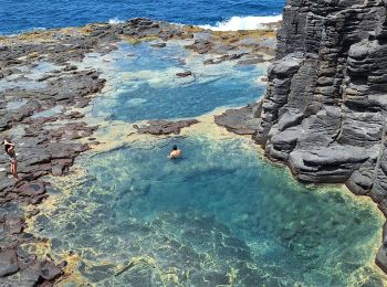
• belle ballade. retour en aluger. sable de la plage magnifique et personne. Des singes vous accompagne occasionnellement
![Randonnée Marche - tarrafat tour du mont - Photo](https://media.geolcdn.com/t/350/260/04aaf357-c396-41bb-b916-bcfa6cee6699.jpg&format=jpg&maxdim=2)
![Marche Marche](https://static1.geolcdn.com/sitytour/trail-icons/101.png)
Km
Marche
![](/images/other/stat-length.png)
![](https://static1.geolcdn.com/siteimages/upload/files/1508320355ic_sort_den_pos_24dp.png)
![](https://static1.geolcdn.com/siteimages/upload/files/1508320355ic_sort_den_neg_24dp.png)
![](https://static1.geolcdn.com/siteimages/upload/files/16400158638029165_repeat_loop_refresh_sync_direction_icon.png)
• belle ballade mais attention au retour sa glisse fort dans la décente.
![Randonnée Marche - vallée de paul - Photo](https://media.geolcdn.com/t/350/260/793a7cb9-010a-40ea-bb9d-f3215fcd48bb.jpg&format=jpg&maxdim=2)
![Marche Marche](https://static1.geolcdn.com/sitytour/trail-icons/101.png)
Km
Marche
![](/images/other/stat-length.png)
![](https://static1.geolcdn.com/siteimages/upload/files/1508320355ic_sort_den_pos_24dp.png)
![](https://static1.geolcdn.com/siteimages/upload/files/1508320355ic_sort_den_neg_24dp.png)
![](https://static1.geolcdn.com/siteimages/upload/files/16400158638029165_repeat_loop_refresh_sync_direction_icon.png)
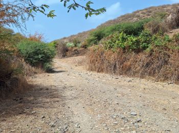
• très vert et belle descente. bien venue après de très grosses ballades d'avant.
![Randonnée Marche - chã de igreja ponta do sol - Photo](https://media.geolcdn.com/t/350/260/adaed0a5-6c28-4afe-b823-9afc9e37e7f3.jpg&format=jpg&maxdim=2)
![Marche Marche](https://static1.geolcdn.com/sitytour/trail-icons/101.png)
Km
Marche
![](/images/other/stat-length.png)
![](https://static1.geolcdn.com/siteimages/upload/files/1508320355ic_sort_den_pos_24dp.png)
![](https://static1.geolcdn.com/siteimages/upload/files/1508320355ic_sort_den_neg_24dp.png)
![](https://static1.geolcdn.com/siteimages/upload/files/16400158638029165_repeat_loop_refresh_sync_direction_icon.png)
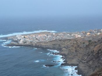
• belle ballade côtière tout le long.
![Randonnée Marche - meio de espanha - chã igreja - Photo](https://media.geolcdn.com/t/350/260/1a968236-d759-454f-8966-4847c5d3176a.jpg&format=jpg&maxdim=2)
![Marche Marche](https://static1.geolcdn.com/sitytour/trail-icons/101.png)
Km
Marche
![](/images/other/stat-length.png)
![](https://static1.geolcdn.com/siteimages/upload/files/1508320355ic_sort_den_pos_24dp.png)
![](https://static1.geolcdn.com/siteimages/upload/files/1508320355ic_sort_den_neg_24dp.png)
![](https://static1.geolcdn.com/siteimages/upload/files/16400158638029165_repeat_loop_refresh_sync_direction_icon.png)
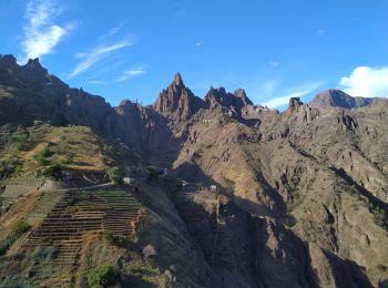
• 3 cols à passer avec une grosse décente de 60o de dénivelé. Pas facile la randonnée ! la fin 1 km sur la côte dans l...
![Randonnée Marche - chat de morte fadiminguinda - Photo](https://media.geolcdn.com/t/350/260/82db1799-eef4-465c-aa04-4d21c5aefb31.jpg&format=jpg&maxdim=2)
![Marche Marche](https://static1.geolcdn.com/sitytour/trail-icons/101.png)
Km
Marche
![](/images/other/stat-length.png)
![](https://static1.geolcdn.com/siteimages/upload/files/1508320355ic_sort_den_pos_24dp.png)
![](https://static1.geolcdn.com/siteimages/upload/files/1508320355ic_sort_den_neg_24dp.png)
![](https://static1.geolcdn.com/siteimages/upload/files/16400158638029165_repeat_loop_refresh_sync_direction_icon.png)
• belle ballade à faire le matin tôt, départ 6h30 pour rester à l'ombre pour passer le col est arriver au premier vill...
![Randonnée Marche - chã de morte - Photo](https://media.geolcdn.com/t/350/260/28fe082c-0a6a-4df0-a3aa-b853d2a2755f.jpg&format=jpg&maxdim=2)
![Marche Marche](https://static1.geolcdn.com/sitytour/trail-icons/101.png)
Km
Marche
![](/images/other/stat-length.png)
![](https://static1.geolcdn.com/siteimages/upload/files/1508320355ic_sort_den_pos_24dp.png)
![](https://static1.geolcdn.com/siteimages/upload/files/1508320355ic_sort_den_neg_24dp.png)
![](https://static1.geolcdn.com/siteimages/upload/files/16400158638029165_repeat_loop_refresh_sync_direction_icon.png)
• boucle avec départ à prendre avec véhicule monté standard malgres les applonds mais arrivé sur le plateau c'est supe...
![Randonnée Marche - CF-TC 101 - Photo](https://media.geolcdn.com/t/350/260/82982f6d-4452-4368-b2d4-7752f41218f8.jpg&format=jpg&maxdim=2)
![Marche Marche](https://static1.geolcdn.com/sitytour/trail-icons/101.png)
Km
Marche
![](/images/other/stat-length.png)
![](https://static1.geolcdn.com/siteimages/upload/files/1508320355ic_sort_den_pos_24dp.png)
![](https://static1.geolcdn.com/siteimages/upload/files/1508320355ic_sort_den_neg_24dp.png)
![](https://static1.geolcdn.com/siteimages/upload/files/16400158638029165_repeat_loop_refresh_sync_direction_icon.png)
• Chã Feijoal - Topo Coroa - Norte (Mirim de Égua)
![Randonnée Marche - GR 01 - Photo](https://media.geolcdn.com/t/350/260/d53bfc71-4445-4581-95ba-08ad0f9c19a7.jpg&format=jpg&maxdim=2)
![Marche Marche](https://static1.geolcdn.com/sitytour/trail-icons/101.png)
Km
Marche
![](/images/other/stat-length.png)
![](https://static1.geolcdn.com/siteimages/upload/files/1508320355ic_sort_den_pos_24dp.png)
![](https://static1.geolcdn.com/siteimages/upload/files/1508320355ic_sort_den_neg_24dp.png)
![](https://static1.geolcdn.com/siteimages/upload/files/16400158638029165_repeat_loop_refresh_sync_direction_icon.png)
• Mirim de Egua - Monte Trigo
![Randonnée Marche - AT/CV 101 - Photo](https://media.geolcdn.com/t/350/260/3e9bd8cc-537c-4600-9693-facaee65c546.jpg&format=jpg&maxdim=2)
![Marche Marche](https://static1.geolcdn.com/sitytour/trail-icons/101.png)
Km
Marche
![](/images/other/stat-length.png)
![](https://static1.geolcdn.com/siteimages/upload/files/1508320355ic_sort_den_pos_24dp.png)
![](https://static1.geolcdn.com/siteimages/upload/files/1508320355ic_sort_den_neg_24dp.png)
![](https://static1.geolcdn.com/siteimages/upload/files/16400158638029165_repeat_loop_refresh_sync_direction_icon.png)
• Alto Mira - Covada R. Cruz
![Randonnée Marche - Cha de Igreja - Boca de Coruja - Photo](https://media.geolcdn.com/t/350/260/a6b93792-c027-43b2-995b-2ebbb0461853.jpg&format=jpg&maxdim=2)
![Marche Marche](https://static1.geolcdn.com/sitytour/trail-icons/101.png)
Km
Marche
![](/images/other/stat-length.png)
![](https://static1.geolcdn.com/siteimages/upload/files/1508320355ic_sort_den_pos_24dp.png)
![](https://static1.geolcdn.com/siteimages/upload/files/1508320355ic_sort_den_neg_24dp.png)
![](https://static1.geolcdn.com/siteimages/upload/files/16400158638029165_repeat_loop_refresh_sync_direction_icon.png)
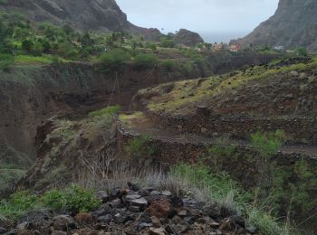
• Caminhada Moderada entre dois vales.
![Randonnée Marche - Lagoa-Alto Mira - Photo](https://media.geolcdn.com/t/350/260/ext.jpg?maxdim=2&url=https%3A%2F%2Fstatic1.geolcdn.com%2Fsiteimages%2Fupload%2Ffiles%2F1553511878bg_sport_marche.png)
![Marche Marche](https://static1.geolcdn.com/sitytour/trail-icons/101.png)
Km
Marche
![](/images/other/stat-length.png)
![](https://static1.geolcdn.com/siteimages/upload/files/1508320355ic_sort_den_pos_24dp.png)
![](https://static1.geolcdn.com/siteimages/upload/files/1508320355ic_sort_den_neg_24dp.png)
![](https://static1.geolcdn.com/siteimages/upload/files/16400158638029165_repeat_loop_refresh_sync_direction_icon.png)
![Randonnée Voiture - Tour de Fogo - Photo](https://media.geolcdn.com/t/350/260/cabc0e48-0a6c-4be1-8099-8069fa8f3422.jpg&format=jpg&maxdim=2)
![Voiture Voiture](https://static1.geolcdn.com/sitytour/trail-icons/401.png)
Km
Voiture
![](/images/other/stat-length.png)
![](https://static1.geolcdn.com/siteimages/upload/files/1508320355ic_sort_den_pos_24dp.png)
![](https://static1.geolcdn.com/siteimages/upload/files/1508320355ic_sort_den_neg_24dp.png)
![](https://static1.geolcdn.com/siteimages/upload/files/16400158638029165_repeat_loop_refresh_sync_direction_icon.png)
• Tour de Fogo
![Randonnée Marche - boucle aguada de chã de pedras - Photo](https://media.geolcdn.com/t/350/260/1c691a87-ee90-4e86-a009-da299792cb16.jpg&format=jpg&maxdim=2)
![Marche Marche](https://static1.geolcdn.com/sitytour/trail-icons/101.png)
Km
Marche
![](/images/other/stat-length.png)
![](https://static1.geolcdn.com/siteimages/upload/files/1508320355ic_sort_den_pos_24dp.png)
![](https://static1.geolcdn.com/siteimages/upload/files/1508320355ic_sort_den_neg_24dp.png)
![](https://static1.geolcdn.com/siteimages/upload/files/16400158638029165_repeat_loop_refresh_sync_direction_icon.png)
• belle boucle un peut courte. j'ai essayé un chemin pour allonger dans le haut mais il n'existe pas vraiment.
![Randonnée Marche - Cap vert 7 - Photo](https://media.geolcdn.com/t/350/260/d91f76f2-63cd-4c24-a448-e3186390395d.jpg&format=jpg&maxdim=2)
![Marche Marche](https://static1.geolcdn.com/sitytour/trail-icons/101.png)
Km
Marche
![](/images/other/stat-length.png)
![](https://static1.geolcdn.com/siteimages/upload/files/1508320355ic_sort_den_pos_24dp.png)
![](https://static1.geolcdn.com/siteimages/upload/files/1508320355ic_sort_den_neg_24dp.png)
![](https://static1.geolcdn.com/siteimages/upload/files/16400158638029165_repeat_loop_refresh_sync_direction_icon.png)
![Randonnée Marche - Cabo de Ribeira - Vila das Pombas - Photo](https://media.geolcdn.com/t/350/260/83205c11-2546-439d-a886-c5cc4ac1a804.jpg&format=jpg&maxdim=2)
![Marche Marche](https://static1.geolcdn.com/sitytour/trail-icons/101.png)
Km
Marche
![](/images/other/stat-length.png)
![](https://static1.geolcdn.com/siteimages/upload/files/1508320355ic_sort_den_pos_24dp.png)
![](https://static1.geolcdn.com/siteimages/upload/files/1508320355ic_sort_den_neg_24dp.png)
![](https://static1.geolcdn.com/siteimages/upload/files/16400158638029165_repeat_loop_refresh_sync_direction_icon.png)
![Randonnée Marche - Lagoa - Alto Mira - Photo](https://media.geolcdn.com/t/350/260/92dcaeed-42dc-4042-b5ab-f13502d20603.jpg&format=jpg&maxdim=2)
![Marche Marche](https://static1.geolcdn.com/sitytour/trail-icons/101.png)
Km
Marche
![](/images/other/stat-length.png)
![](https://static1.geolcdn.com/siteimages/upload/files/1508320355ic_sort_den_pos_24dp.png)
![](https://static1.geolcdn.com/siteimages/upload/files/1508320355ic_sort_den_neg_24dp.png)
![](https://static1.geolcdn.com/siteimages/upload/files/16400158638029165_repeat_loop_refresh_sync_direction_icon.png)
![Randonnée Marche - Caibros - Lagoa - Photo](https://media.geolcdn.com/t/350/260/d9d3148e-267c-440c-9fab-b866833484c9.jpg&format=jpg&maxdim=2)
![Marche Marche](https://static1.geolcdn.com/sitytour/trail-icons/101.png)
Km
Marche
![](/images/other/stat-length.png)
![](https://static1.geolcdn.com/siteimages/upload/files/1508320355ic_sort_den_pos_24dp.png)
![](https://static1.geolcdn.com/siteimages/upload/files/1508320355ic_sort_den_neg_24dp.png)
![](https://static1.geolcdn.com/siteimages/upload/files/16400158638029165_repeat_loop_refresh_sync_direction_icon.png)
![Randonnée Marche - Caibros -Lagoa - Photo](https://media.geolcdn.com/t/350/260/90f8b7ce-b143-4675-a80e-5b9212849c0c.jpg&format=jpg&maxdim=2)
![Marche Marche](https://static1.geolcdn.com/sitytour/trail-icons/101.png)
Km
Marche
![](/images/other/stat-length.png)
![](https://static1.geolcdn.com/siteimages/upload/files/1508320355ic_sort_den_pos_24dp.png)
![](https://static1.geolcdn.com/siteimages/upload/files/1508320355ic_sort_den_neg_24dp.png)
![](https://static1.geolcdn.com/siteimages/upload/files/16400158638029165_repeat_loop_refresh_sync_direction_icon.png)
• Caminhada com vista sobre dois vales; Chã de Pedras e Caibros. Sempre subindo até o planalto de Lagoa.
20 randonnées affichées sur 151
Application GPS de randonnée GRATUITE