


10,5 km | 19,6 km-effort
Torres del Paine : découvrez les meilleures randonnées : 6 pédestres. Tous ces circuits, parcours, itinéraires et activités en plein air sont disponibles dans nos applications SityTrail pour smartphones et tablettes.
Marche


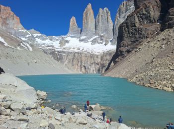
• mirador torre del Paine
Marche

Voiture
• En bus.

Bateau à moteur
• Traversée en bateau du lac et visite du Glacier Grey.

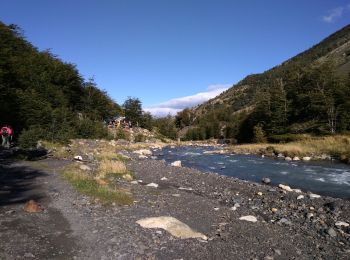
Marche
• Montée depuis Camp Grey à la troisième passerelle. Absolument sublime avec un temps magnifique. Magique !
Marche
• Loooong et humide mais l’arrivée sur le glacier Grey est magnifique.
Marche
• Fantastiques paysages mais interminable
Marche
8 randonnées affichées sur 8
Application GPS de randonnée GRATUITE
 SityTrail
IGN / Instituts géographiques
SityTrail World
Le monde est à vous