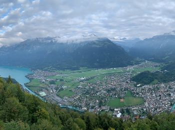
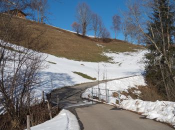
![](/images/other/stat-length.png)
- Randonnées
- Outdoor
- Suisse
- Lucerne
Lucerne, Suisse : Les meilleures randonnées, itinéraires, parcours, balades et promenades
Lucerne : découvrez les meilleures randonnées : 255 pédestres et 7 à vélo ou VTT. Tous ces circuits, parcours, itinéraires et activités en plein air sont disponibles dans nos applications SityTrail pour smartphones et tablettes.
Les meilleurs parcours (335)
![Randonnée A pied Flühli - Brienzergratweg - Photo](https://media.geolcdn.com/t/350/260/ca81fee7-1fb0-4c82-9d62-d1557b9c006e.jpeg&format=jpg&maxdim=2)
![A pied A pied](https://static1.geolcdn.com/sitytour/trail-icons/100.png)
Km
A pied
![](/images/other/stat-length.png)
![](https://static1.geolcdn.com/siteimages/upload/files/1508320355ic_sort_den_pos_24dp.png)
![](https://static1.geolcdn.com/siteimages/upload/files/1508320355ic_sort_den_neg_24dp.png)
![](https://static1.geolcdn.com/siteimages/upload/files/16400158638029165_repeat_loop_refresh_sync_direction_icon.png)
• Anspruch: sehr schwierig ✔︎ Aufstieg: 1029 m ✔︎ Wandern mit Einkehrmöglichkeit. Größtes Outdoorportal im Alpenraum! ...
![Randonnée A pied Escholzmatt-Marbach - Escholzmatt - Wiggen - Photo](https://media.geolcdn.com/t/350/260/4d58d89b-5d16-4aa9-90f7-ba4d58e2f382.jpeg&format=jpg&maxdim=2)
![A pied A pied](https://static1.geolcdn.com/sitytour/trail-icons/100.png)
Km
A pied
![](/images/other/stat-length.png)
![](https://static1.geolcdn.com/siteimages/upload/files/1508320355ic_sort_den_pos_24dp.png)
![](https://static1.geolcdn.com/siteimages/upload/files/1508320355ic_sort_den_neg_24dp.png)
![](https://static1.geolcdn.com/siteimages/upload/files/16400158638029165_repeat_loop_refresh_sync_direction_icon.png)
• Symbole: gelbe Raute
![Randonnée A pied Entlebuch - Entlebuch - Finsterwald - Photo](https://media.geolcdn.com/t/350/260/83443230-e86b-4a87-b6ec-31db228fd4db.jpeg&format=jpg&maxdim=2)
![A pied A pied](https://static1.geolcdn.com/sitytour/trail-icons/100.png)
Km
A pied
![](/images/other/stat-length.png)
![](https://static1.geolcdn.com/siteimages/upload/files/1508320355ic_sort_den_pos_24dp.png)
![](https://static1.geolcdn.com/siteimages/upload/files/1508320355ic_sort_den_neg_24dp.png)
![](https://static1.geolcdn.com/siteimages/upload/files/16400158638029165_repeat_loop_refresh_sync_direction_icon.png)
• Symbole: gelber Rhombus
![Randonnée A pied Vitznau - Vitznau - ? - Photo](https://media.geolcdn.com/t/350/260/10de32ec-55e7-44c9-ada3-f272dbd34359.jpeg&format=jpg&maxdim=2)
![A pied A pied](https://static1.geolcdn.com/sitytour/trail-icons/100.png)
Km
A pied
![](/images/other/stat-length.png)
![](https://static1.geolcdn.com/siteimages/upload/files/1508320355ic_sort_den_pos_24dp.png)
![](https://static1.geolcdn.com/siteimages/upload/files/1508320355ic_sort_den_neg_24dp.png)
![](https://static1.geolcdn.com/siteimages/upload/files/16400158638029165_repeat_loop_refresh_sync_direction_icon.png)
• Symbole: gelbe Raute
![Randonnée A pied Beromünster - Neudorf - Unter Blosenberg - Photo](https://media.geolcdn.com/t/350/260/a9e8306d-f111-4dfc-9c67-cc4e4df5163f.jpeg&format=jpg&maxdim=2)
![A pied A pied](https://static1.geolcdn.com/sitytour/trail-icons/100.png)
Km
A pied
![](/images/other/stat-length.png)
![](https://static1.geolcdn.com/siteimages/upload/files/1508320355ic_sort_den_pos_24dp.png)
![](https://static1.geolcdn.com/siteimages/upload/files/1508320355ic_sort_den_neg_24dp.png)
![](https://static1.geolcdn.com/siteimages/upload/files/16400158638029165_repeat_loop_refresh_sync_direction_icon.png)
• Randonnée créée par Luzerner Wanderwege. Symbole: gelber Rhombus
![Randonnée A pied Udligenswil - Udligenswil - Chli Äbnet - Photo](https://media.geolcdn.com/t/350/260/763fb024-6d16-4ade-817f-3a76f6afafb5.jpeg&format=jpg&maxdim=2)
![A pied A pied](https://static1.geolcdn.com/sitytour/trail-icons/100.png)
Km
A pied
![](/images/other/stat-length.png)
![](https://static1.geolcdn.com/siteimages/upload/files/1508320355ic_sort_den_pos_24dp.png)
![](https://static1.geolcdn.com/siteimages/upload/files/1508320355ic_sort_den_neg_24dp.png)
![](https://static1.geolcdn.com/siteimages/upload/files/16400158638029165_repeat_loop_refresh_sync_direction_icon.png)
• Randonnée créée par Luzerner Wanderwege. Udligenswil - Chli Äbnet Symbole: gelber Rhombus
![Randonnée A pied Root - Gisikon Root - Perlen - Photo](https://media.geolcdn.com/t/350/260/d5288a4f-3e4d-471c-9d68-b4538b72559a.jpeg&format=jpg&maxdim=2)
![A pied A pied](https://static1.geolcdn.com/sitytour/trail-icons/100.png)
Km
A pied
![](/images/other/stat-length.png)
![](https://static1.geolcdn.com/siteimages/upload/files/1508320355ic_sort_den_pos_24dp.png)
![](https://static1.geolcdn.com/siteimages/upload/files/1508320355ic_sort_den_neg_24dp.png)
![](https://static1.geolcdn.com/siteimages/upload/files/16400158638029165_repeat_loop_refresh_sync_direction_icon.png)
• Randonnée créée par Luzerner Wanderwege. Gisikon Root - Perlen Symbole: gelber Rhombus
![Randonnée A pied Buchrain - Buchrain - Root - Photo](https://media.geolcdn.com/t/350/260/d5288a4f-3e4d-471c-9d68-b4538b72559a.jpeg&format=jpg&maxdim=2)
![A pied A pied](https://static1.geolcdn.com/sitytour/trail-icons/100.png)
Km
A pied
![](/images/other/stat-length.png)
![](https://static1.geolcdn.com/siteimages/upload/files/1508320355ic_sort_den_pos_24dp.png)
![](https://static1.geolcdn.com/siteimages/upload/files/1508320355ic_sort_den_neg_24dp.png)
![](https://static1.geolcdn.com/siteimages/upload/files/16400158638029165_repeat_loop_refresh_sync_direction_icon.png)
• Randonnée créée par Luzerner Wanderwege. Buchrain - Root Symbole: gelber Rhombus
![Randonnée A pied Lucerne - Luzern - Talacheri - Photo](https://media.geolcdn.com/t/350/260/8d2c5217-fdc8-4c6a-b925-8d2a056612d5.jpeg&format=jpg&maxdim=2)
![A pied A pied](https://static1.geolcdn.com/sitytour/trail-icons/100.png)
Km
A pied
![](/images/other/stat-length.png)
![](https://static1.geolcdn.com/siteimages/upload/files/1508320355ic_sort_den_pos_24dp.png)
![](https://static1.geolcdn.com/siteimages/upload/files/1508320355ic_sort_den_neg_24dp.png)
![](https://static1.geolcdn.com/siteimages/upload/files/16400158638029165_repeat_loop_refresh_sync_direction_icon.png)
• Randonnée créée par Luzerner Wanderwege. Luzern - Talacheri Symbole: gelber Rhombus
![Randonnée A pied Schüpfheim - Luswald - Obstaldenegg - Photo](https://media.geolcdn.com/t/350/260/01fd9a14-c746-417e-8fd1-57b9a8196b14.jpeg&format=jpg&maxdim=2)
![A pied A pied](https://static1.geolcdn.com/sitytour/trail-icons/100.png)
Km
A pied
![](/images/other/stat-length.png)
![](https://static1.geolcdn.com/siteimages/upload/files/1508320355ic_sort_den_pos_24dp.png)
![](https://static1.geolcdn.com/siteimages/upload/files/1508320355ic_sort_den_neg_24dp.png)
![](https://static1.geolcdn.com/siteimages/upload/files/16400158638029165_repeat_loop_refresh_sync_direction_icon.png)
• Luswald - Obstaldenegg Symbole: gelber Rhombus
![Randonnée A pied Escholzmatt-Marbach - Escholzmatt - Gmeinwerch - Photo](https://media.geolcdn.com/t/350/260/60782932-6c95-46c3-8c82-35582f2aa958.jpeg&format=jpg&maxdim=2)
![A pied A pied](https://static1.geolcdn.com/sitytour/trail-icons/100.png)
Km
A pied
![](/images/other/stat-length.png)
![](https://static1.geolcdn.com/siteimages/upload/files/1508320355ic_sort_den_pos_24dp.png)
![](https://static1.geolcdn.com/siteimages/upload/files/1508320355ic_sort_den_neg_24dp.png)
![](https://static1.geolcdn.com/siteimages/upload/files/16400158638029165_repeat_loop_refresh_sync_direction_icon.png)
• Escholzmatt - Gmeinwerch Symbole: gelber Rhombus
![Randonnée A pied Escholzmatt-Marbach - Turner - Escholzmatt - Photo](https://media.geolcdn.com/t/350/260/ab170680-3695-4170-8e98-6debfb0c25d2.jpeg&format=jpg&maxdim=2)
![A pied A pied](https://static1.geolcdn.com/sitytour/trail-icons/100.png)
Km
A pied
![](/images/other/stat-length.png)
![](https://static1.geolcdn.com/siteimages/upload/files/1508320355ic_sort_den_pos_24dp.png)
![](https://static1.geolcdn.com/siteimages/upload/files/1508320355ic_sort_den_neg_24dp.png)
![](https://static1.geolcdn.com/siteimages/upload/files/16400158638029165_repeat_loop_refresh_sync_direction_icon.png)
• Turner - Escholzmatt Symbole: gelber Rhombus
![Randonnée A pied Escholzmatt-Marbach - Escholzmatt - Turner - Photo](https://media.geolcdn.com/t/350/260/56c882fb-1a93-481b-a8e7-100563ee2863.jpeg&format=jpg&maxdim=2)
![A pied A pied](https://static1.geolcdn.com/sitytour/trail-icons/100.png)
Km
A pied
![](/images/other/stat-length.png)
![](https://static1.geolcdn.com/siteimages/upload/files/1508320355ic_sort_den_pos_24dp.png)
![](https://static1.geolcdn.com/siteimages/upload/files/1508320355ic_sort_den_neg_24dp.png)
![](https://static1.geolcdn.com/siteimages/upload/files/16400158638029165_repeat_loop_refresh_sync_direction_icon.png)
• Escholzmatt - Turner Symbole: gelber Rhombus
![Randonnée A pied Schüpfheim - Luswald - Bodenmatt - Photo](https://media.geolcdn.com/t/350/260/80f882f8-dff2-4eb3-bd6d-444f6585cf4c.jpeg&format=jpg&maxdim=2)
![A pied A pied](https://static1.geolcdn.com/sitytour/trail-icons/100.png)
Km
A pied
![](/images/other/stat-length.png)
![](https://static1.geolcdn.com/siteimages/upload/files/1508320355ic_sort_den_pos_24dp.png)
![](https://static1.geolcdn.com/siteimages/upload/files/1508320355ic_sort_den_neg_24dp.png)
![](https://static1.geolcdn.com/siteimages/upload/files/16400158638029165_repeat_loop_refresh_sync_direction_icon.png)
• Luswald - Bodenmatt Symbole: gelber Rhombus
![Randonnée A pied Hitzkirch - Schloss Heidegg - Kleinwangen - Photo](https://media.geolcdn.com/t/350/260/1d2533b4-e813-4e18-bbbb-b4c20a4e1bc7.jpeg&format=jpg&maxdim=2)
![A pied A pied](https://static1.geolcdn.com/sitytour/trail-icons/100.png)
Km
A pied
![](/images/other/stat-length.png)
![](https://static1.geolcdn.com/siteimages/upload/files/1508320355ic_sort_den_pos_24dp.png)
![](https://static1.geolcdn.com/siteimages/upload/files/1508320355ic_sort_den_neg_24dp.png)
![](https://static1.geolcdn.com/siteimages/upload/files/16400158638029165_repeat_loop_refresh_sync_direction_icon.png)
• Schloss Heidegg - Kleinwangen Symbole: gelber Diamant
![Randonnée A pied Schwarzenberg - Stäfeli - Wassermoos - Photo](https://media.geolcdn.com/t/350/260/13b92ce8-80ba-46b3-a9c8-99b839572839.jpeg&format=jpg&maxdim=2)
![A pied A pied](https://static1.geolcdn.com/sitytour/trail-icons/100.png)
Km
A pied
![](/images/other/stat-length.png)
![](https://static1.geolcdn.com/siteimages/upload/files/1508320355ic_sort_den_pos_24dp.png)
![](https://static1.geolcdn.com/siteimages/upload/files/1508320355ic_sort_den_neg_24dp.png)
![](https://static1.geolcdn.com/siteimages/upload/files/16400158638029165_repeat_loop_refresh_sync_direction_icon.png)
• Stäfeli - Wassermoos Symbole: gelber Rhombus
![Randonnée A pied Escholzmatt-Marbach - Wittenschwändi - Schwandacher - Photo](https://media.geolcdn.com/t/350/260/60782932-6c95-46c3-8c82-35582f2aa958.jpeg&format=jpg&maxdim=2)
![A pied A pied](https://static1.geolcdn.com/sitytour/trail-icons/100.png)
Km
A pied
![](/images/other/stat-length.png)
![](https://static1.geolcdn.com/siteimages/upload/files/1508320355ic_sort_den_pos_24dp.png)
![](https://static1.geolcdn.com/siteimages/upload/files/1508320355ic_sort_den_neg_24dp.png)
![](https://static1.geolcdn.com/siteimages/upload/files/16400158638029165_repeat_loop_refresh_sync_direction_icon.png)
• Wittenschwändi - Schwandacher Symbole: gelber Diamant
![Randonnée A pied Malters - CH-Rengg - Ännigen - Photo](https://media.geolcdn.com/t/350/260/0a636d36-8ad8-46ef-9809-998a2b54d854.jpeg&format=jpg&maxdim=2)
![A pied A pied](https://static1.geolcdn.com/sitytour/trail-icons/100.png)
Km
A pied
![](/images/other/stat-length.png)
![](https://static1.geolcdn.com/siteimages/upload/files/1508320355ic_sort_den_pos_24dp.png)
![](https://static1.geolcdn.com/siteimages/upload/files/1508320355ic_sort_den_neg_24dp.png)
![](https://static1.geolcdn.com/siteimages/upload/files/16400158638029165_repeat_loop_refresh_sync_direction_icon.png)
• Rengg - Ännigen Symbole: gelber Rhombus
![Randonnée A pied Willisau - Obere Stalde - Willisau - Photo](https://media.geolcdn.com/t/350/260/2856643f-b04f-40c3-8ad6-480023ee8377.jpeg&format=jpg&maxdim=2)
![A pied A pied](https://static1.geolcdn.com/sitytour/trail-icons/100.png)
Km
A pied
![](/images/other/stat-length.png)
![](https://static1.geolcdn.com/siteimages/upload/files/1508320355ic_sort_den_pos_24dp.png)
![](https://static1.geolcdn.com/siteimages/upload/files/1508320355ic_sort_den_neg_24dp.png)
![](https://static1.geolcdn.com/siteimages/upload/files/16400158638029165_repeat_loop_refresh_sync_direction_icon.png)
• Obere Stalde - Willisau Symbole: gelber Rhombus
![Randonnée A pied Neuenkirch - Neuenkirch - Hellbühl - Photo](https://media.geolcdn.com/t/350/260/c18bf806-11ef-402c-9e09-2e01b0252c50.jpeg&format=jpg&maxdim=2)
![A pied A pied](https://static1.geolcdn.com/sitytour/trail-icons/100.png)
Km
A pied
![](/images/other/stat-length.png)
![](https://static1.geolcdn.com/siteimages/upload/files/1508320355ic_sort_den_pos_24dp.png)
![](https://static1.geolcdn.com/siteimages/upload/files/1508320355ic_sort_den_neg_24dp.png)
![](https://static1.geolcdn.com/siteimages/upload/files/16400158638029165_repeat_loop_refresh_sync_direction_icon.png)
• Randonnée créée par Luzerner Wanderwege. Neuenkirch - Hellbühl Symbole: gelber Diamant
20 randonnées affichées sur 335
Application GPS de randonnée GRATUITE