![](/images/other/stat-length.png)
Stäfa, Bezirk Meilen : Les meilleures randonnées, itinéraires, parcours, balades et promenades
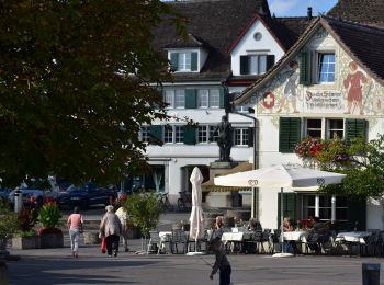
Stäfa : découvrez les meilleures randonnées : 7 pédestres. Tous ces circuits, parcours, itinéraires et activités en plein air sont disponibles dans nos applications SityTrail pour smartphones et tablettes.
Les meilleurs parcours (8)
![Randonnée A pied Stäfa - Stäfa. Ein Dorf bewegt: Mutzmalen - Lattenberg - Photo](https://media.geolcdn.com/t/350/260/1029bbd8-d2a8-45f5-9b2d-3c662c8683de.jpeg&format=jpg&maxdim=2)
![A pied A pied](https://static1.geolcdn.com/sitytour/trail-icons/100.png)
Km
A pied
![](/images/other/stat-length.png)
![](https://static1.geolcdn.com/siteimages/upload/files/1508320355ic_sort_den_pos_24dp.png)
![](https://static1.geolcdn.com/siteimages/upload/files/1508320355ic_sort_den_neg_24dp.png)
![](https://static1.geolcdn.com/siteimages/upload/files/16400158638029165_repeat_loop_refresh_sync_direction_icon.png)
• Randonnée créée par Stäfa-ein Dorf bewegt. http://www.staefa.ch/documents/Gemeindekarte_def.pdf. Stäfa-ein Dorf bewe...
![Randonnée A pied Stäfa - Stäfa-ein Dorf bewegt: Risitobel - Püntacher - Photo](https://media.geolcdn.com/t/350/260/1029bbd8-d2a8-45f5-9b2d-3c662c8683de.jpeg&format=jpg&maxdim=2)
![A pied A pied](https://static1.geolcdn.com/sitytour/trail-icons/100.png)
Km
A pied
![](/images/other/stat-length.png)
![](https://static1.geolcdn.com/siteimages/upload/files/1508320355ic_sort_den_pos_24dp.png)
![](https://static1.geolcdn.com/siteimages/upload/files/1508320355ic_sort_den_neg_24dp.png)
![](https://static1.geolcdn.com/siteimages/upload/files/16400158638029165_repeat_loop_refresh_sync_direction_icon.png)
• Randonnée créée par Stäfa-ein Dorf bewegt. http://www.staefa.ch/documents/Gemeindekarte_def.pdf. Stäfa-ein Dorf bewe...
![Randonnée A pied Stäfa - Stäfa Schiff - Oetwil - Photo](https://media.geolcdn.com/t/350/260/bb2d22e2-3f3d-448f-8f20-84a0edbd4662.jpeg&format=jpg&maxdim=2)
![A pied A pied](https://static1.geolcdn.com/sitytour/trail-icons/100.png)
Km
A pied
![](/images/other/stat-length.png)
![](https://static1.geolcdn.com/siteimages/upload/files/1508320355ic_sort_den_pos_24dp.png)
![](https://static1.geolcdn.com/siteimages/upload/files/1508320355ic_sort_den_neg_24dp.png)
![](https://static1.geolcdn.com/siteimages/upload/files/16400158638029165_repeat_loop_refresh_sync_direction_icon.png)
• Randonnée créée par Zürcher Wanderwege ZAW.
![Randonnée A pied Stäfa - Stäfa-ein Dorf bewegt: Top of Stäfa - Photo](https://media.geolcdn.com/t/350/260/1b4ad704-896b-46b1-b224-c31437822c2d.jpeg&format=jpg&maxdim=2)
![A pied A pied](https://static1.geolcdn.com/sitytour/trail-icons/100.png)
Km
A pied
![](/images/other/stat-length.png)
![](https://static1.geolcdn.com/siteimages/upload/files/1508320355ic_sort_den_pos_24dp.png)
![](https://static1.geolcdn.com/siteimages/upload/files/1508320355ic_sort_den_neg_24dp.png)
![](https://static1.geolcdn.com/siteimages/upload/files/16400158638029165_repeat_loop_refresh_sync_direction_icon.png)
• Randonnée créée par Stäfa. Ein Dorf bewegt. http://www.staefa.ch/documents/Gemeindekarte_def.pdf.
![Randonnée A pied Stäfa - Grüningen Haufland - Stäfa Schiff - Photo](https://media.geolcdn.com/t/350/260/bb2d22e2-3f3d-448f-8f20-84a0edbd4662.jpeg&format=jpg&maxdim=2)
![A pied A pied](https://static1.geolcdn.com/sitytour/trail-icons/100.png)
Km
A pied
![](/images/other/stat-length.png)
![](https://static1.geolcdn.com/siteimages/upload/files/1508320355ic_sort_den_pos_24dp.png)
![](https://static1.geolcdn.com/siteimages/upload/files/1508320355ic_sort_den_neg_24dp.png)
![](https://static1.geolcdn.com/siteimages/upload/files/16400158638029165_repeat_loop_refresh_sync_direction_icon.png)
• Randonnée créée par Zürcher Wanderwege ZAW. Symbole: gelbe Raute
![Randonnée A pied Stäfa - Stäfa-ein Dorf bewegt: Frohberg - Torlen - Photo](https://media.geolcdn.com/t/350/260/1b4ad704-896b-46b1-b224-c31437822c2d.jpeg&format=jpg&maxdim=2)
![A pied A pied](https://static1.geolcdn.com/sitytour/trail-icons/100.png)
Km
A pied
![](/images/other/stat-length.png)
![](https://static1.geolcdn.com/siteimages/upload/files/1508320355ic_sort_den_pos_24dp.png)
![](https://static1.geolcdn.com/siteimages/upload/files/1508320355ic_sort_den_neg_24dp.png)
![](https://static1.geolcdn.com/siteimages/upload/files/16400158638029165_repeat_loop_refresh_sync_direction_icon.png)
• Randonnée créée par Stäfa. Ein Dorf bewegt. http://www.staefa.ch/documents/Gemeindekarte_def.pdf. Stäfa-ein Dorf bew...
![Randonnée Marche Stäfa - stafa_glarus - Photo](https://media.geolcdn.com/t/350/260/ext.jpg?maxdim=2&url=https%3A%2F%2Fstatic1.geolcdn.com%2Fsiteimages%2Fupload%2Ffiles%2F1553511878bg_sport_marche.png)
![Marche Marche](https://static1.geolcdn.com/sitytour/trail-icons/101.png)
Km
Marche
![](/images/other/stat-length.png)
![](https://static1.geolcdn.com/siteimages/upload/files/1508320355ic_sort_den_pos_24dp.png)
![](https://static1.geolcdn.com/siteimages/upload/files/1508320355ic_sort_den_neg_24dp.png)
![](https://static1.geolcdn.com/siteimages/upload/files/16400158638029165_repeat_loop_refresh_sync_direction_icon.png)
•
![Randonnée Raquettes à neige Stäfa - jkdjkefdklwe - Photo](https://media.geolcdn.com/t/350/260/ext.jpg?maxdim=2&url=https%3A%2F%2Fstatic1.geolcdn.com%2Fsiteimages%2Fupload%2Ffiles%2F1524743153raquette.jpg)
![Raquettes à neige Raquettes à neige](https://static1.geolcdn.com/sitytour/trail-icons/504.png)
Km
Raquettes à neige
![](/images/other/stat-length.png)
![](https://static1.geolcdn.com/siteimages/upload/files/1508320355ic_sort_den_pos_24dp.png)
![](https://static1.geolcdn.com/siteimages/upload/files/1508320355ic_sort_den_neg_24dp.png)
![](https://static1.geolcdn.com/siteimages/upload/files/16400158638029165_repeat_loop_refresh_sync_direction_icon.png)
• jlkfjkjsdfkljsdklfjskldjfskdjflksdjkkl
8 randonnées affichées sur 8
Application GPS de randonnée GRATUITE