![](/images/other/stat-length.png)
- Randonnées
- Outdoor
- Canada
- Québec
Québec, Canada : Les meilleures randonnées, itinéraires, parcours, balades et promenades
Québec : découvrez les meilleures randonnées : 247 pédestres et 15 à vélo ou VTT. Tous ces circuits, parcours, itinéraires et activités en plein air sont disponibles dans nos applications SityTrail pour smartphones et tablettes.
Les meilleurs parcours (315)
![Randonnée Marche Montréal - Pointe aux Carrières et Île Bizard - Photo](https://media.geolcdn.com/t/350/260/ext.jpg?maxdim=2&url=https%3A%2F%2Fstatic1.geolcdn.com%2Fsiteimages%2Fupload%2Ffiles%2F1553511878bg_sport_marche.png)
![Marche Marche](https://static1.geolcdn.com/sitytour/trail-icons/101.png)
Km
Marche
![](/images/other/stat-length.png)
![](https://static1.geolcdn.com/siteimages/upload/files/1508320355ic_sort_den_pos_24dp.png)
![](https://static1.geolcdn.com/siteimages/upload/files/1508320355ic_sort_den_neg_24dp.png)
![](https://static1.geolcdn.com/siteimages/upload/files/16400158638029165_repeat_loop_refresh_sync_direction_icon.png)
• Sentier se trouvant près de Montréal, qui comprend un lac. La randonnée propose de magnifiques vues sur le lac et ell...
![Randonnée Marche Mont-Albert - Mont Ernest-Laforce - Photo](https://media.geolcdn.com/t/350/260/ext.jpg?maxdim=2&url=https%3A%2F%2Fstatic1.geolcdn.com%2Fsiteimages%2Fupload%2Ffiles%2F1553511878bg_sport_marche.png)
![Marche Marche](https://static1.geolcdn.com/sitytour/trail-icons/101.png)
Km
Marche
![](/images/other/stat-length.png)
![](https://static1.geolcdn.com/siteimages/upload/files/1508320355ic_sort_den_pos_24dp.png)
![](https://static1.geolcdn.com/siteimages/upload/files/1508320355ic_sort_den_neg_24dp.png)
![](https://static1.geolcdn.com/siteimages/upload/files/16400158638029165_repeat_loop_refresh_sync_direction_icon.png)
• Cette randonnée se situe dans le parc national de la Gaspésie. Elle est assez courte et permet de rejoindre le sommet...
![Randonnée Marche Coaticook - Le Mont Pinacle - Photo](https://media.geolcdn.com/t/350/260/ext.jpg?maxdim=2&url=https%3A%2F%2Fstatic1.geolcdn.com%2Fsiteimages%2Fupload%2Ffiles%2F1553511878bg_sport_marche.png)
![Marche Marche](https://static1.geolcdn.com/sitytour/trail-icons/101.png)
Km
Marche
![](/images/other/stat-length.png)
![](https://static1.geolcdn.com/siteimages/upload/files/1508320355ic_sort_den_pos_24dp.png)
![](https://static1.geolcdn.com/siteimages/upload/files/1508320355ic_sort_den_neg_24dp.png)
![](https://static1.geolcdn.com/siteimages/upload/files/16400158638029165_repeat_loop_refresh_sync_direction_icon.png)
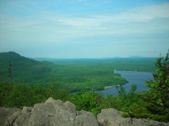
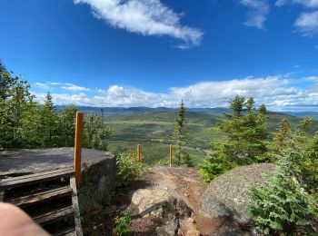
• Ce sommet est réputé pour offrir de superbes panoramas pour peu d’efforts. Le sentier passe par de magnifiques points...
![Randonnée Marche Labelle - Le Mont Gorille - Photo](https://media.geolcdn.com/t/350/260/ext.jpg?maxdim=2&url=https%3A%2F%2Fstatic1.geolcdn.com%2Fsiteimages%2Fupload%2Ffiles%2F1553511878bg_sport_marche.png)
![Marche Marche](https://static1.geolcdn.com/sitytour/trail-icons/101.png)
Km
Marche
![](/images/other/stat-length.png)
![](https://static1.geolcdn.com/siteimages/upload/files/1508320355ic_sort_den_pos_24dp.png)
![](https://static1.geolcdn.com/siteimages/upload/files/1508320355ic_sort_den_neg_24dp.png)
![](https://static1.geolcdn.com/siteimages/upload/files/16400158638029165_repeat_loop_refresh_sync_direction_icon.png)
• Le sommet du Mont Gorille est assez boisé mais on peut néanmoins apercevoir de superbes panoramas. Le sentier débute ...
![Randonnée Marche Mont-Saint-Hilaire - Le Mont Saint-Hilaire - Photo](https://media.geolcdn.com/t/350/260/ext.jpg?maxdim=2&url=https%3A%2F%2Fstatic1.geolcdn.com%2Fsiteimages%2Fupload%2Ffiles%2F1553511878bg_sport_marche.png)
![Marche Marche](https://static1.geolcdn.com/sitytour/trail-icons/101.png)
Km
Marche
![](/images/other/stat-length.png)
![](https://static1.geolcdn.com/siteimages/upload/files/1508320355ic_sort_den_pos_24dp.png)
![](https://static1.geolcdn.com/siteimages/upload/files/1508320355ic_sort_den_neg_24dp.png)
![](https://static1.geolcdn.com/siteimages/upload/files/16400158638029165_repeat_loop_refresh_sync_direction_icon.png)
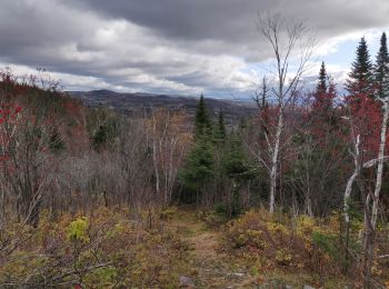
• Cette montagne est assez populaire. Par temps clair, il est possible d’apercevoir à partir du sommet, le centre-ville...
![Randonnée Marche Notre-Dame-des-Bois - Montagne de Marbre - Photo](https://media.geolcdn.com/t/350/260/ext.jpg?maxdim=2&url=https%3A%2F%2Fstatic1.geolcdn.com%2Fsiteimages%2Fupload%2Ffiles%2F1553511878bg_sport_marche.png)
![Marche Marche](https://static1.geolcdn.com/sitytour/trail-icons/101.png)
Km
Marche
![](/images/other/stat-length.png)
![](https://static1.geolcdn.com/siteimages/upload/files/1508320355ic_sort_den_pos_24dp.png)
![](https://static1.geolcdn.com/siteimages/upload/files/1508320355ic_sort_den_neg_24dp.png)
![](https://static1.geolcdn.com/siteimages/upload/files/16400158638029165_repeat_loop_refresh_sync_direction_icon.png)
• Cette montagne située dans la région du Cantons-de-l’Est se trouve à la frontière entre les Etats-Unis et le Canada. ...
![Randonnée Marche Saint-Bruno-de-Montarville - Sentier du Lac SeigneurialParc national du Mont-Saint-Bruno - Photo](https://media.geolcdn.com/t/350/260/ext.jpg?maxdim=2&url=https%3A%2F%2Fstatic1.geolcdn.com%2Fsiteimages%2Fupload%2Ffiles%2F1553511878bg_sport_marche.png)
![Marche Marche](https://static1.geolcdn.com/sitytour/trail-icons/101.png)
Km
Marche
![](/images/other/stat-length.png)
![](https://static1.geolcdn.com/siteimages/upload/files/1508320355ic_sort_den_pos_24dp.png)
![](https://static1.geolcdn.com/siteimages/upload/files/1508320355ic_sort_den_neg_24dp.png)
![](https://static1.geolcdn.com/siteimages/upload/files/16400158638029165_repeat_loop_refresh_sync_direction_icon.png)
• Le parc national du Mont-Saint-Bruno est très prisé des randonneurs de tous les niveaux. Il possède plus de 200 espè...
![Randonnée Marche Saint-Mathieu-du-Parc - Recreoforestier Chutte du Diable - Photo](https://media.geolcdn.com/t/350/260/552c6a71-f41e-4353-a5e3-f3c85d2458d5.jpg&format=jpg&maxdim=2)
![Marche Marche](https://static1.geolcdn.com/sitytour/trail-icons/101.png)
Km
Marche
![](/images/other/stat-length.png)
![](https://static1.geolcdn.com/siteimages/upload/files/1508320355ic_sort_den_pos_24dp.png)
![](https://static1.geolcdn.com/siteimages/upload/files/1508320355ic_sort_den_neg_24dp.png)
![](https://static1.geolcdn.com/siteimages/upload/files/16400158638029165_repeat_loop_refresh_sync_direction_icon.png)
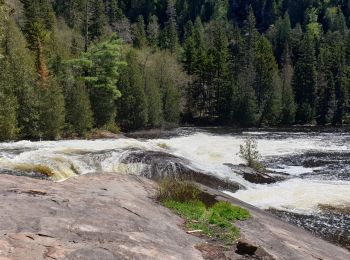
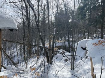
• très belle rando en forêt pour découvrir la chute du diable. Sentier de 10,700 km difficile par le fait de trouver de...
![Randonnée Marche L'Anse-Saint-Jean - Anse Saint Jean Lac des Croches Belvédère des Iles - Photo](https://media.geolcdn.com/t/350/260/767ee151-f6d5-4888-9430-21685ad551b8.jpg&format=jpg&maxdim=2)
![Marche Marche](https://static1.geolcdn.com/sitytour/trail-icons/101.png)
Km
Marche
![](/images/other/stat-length.png)
![](https://static1.geolcdn.com/siteimages/upload/files/1508320355ic_sort_den_pos_24dp.png)
![](https://static1.geolcdn.com/siteimages/upload/files/1508320355ic_sort_den_neg_24dp.png)
![](https://static1.geolcdn.com/siteimages/upload/files/16400158638029165_repeat_loop_refresh_sync_direction_icon.png)
• Belle rando en Forêt permettant les belvédères et surtout le magnifique lac la Croche
![A pied A pied](https://static1.geolcdn.com/sitytour/trail-icons/100.png)
Km
A pied
![](/images/other/stat-length.png)
![](https://static1.geolcdn.com/siteimages/upload/files/1508320355ic_sort_den_pos_24dp.png)
![](https://static1.geolcdn.com/siteimages/upload/files/1508320355ic_sort_den_neg_24dp.png)
![](https://static1.geolcdn.com/siteimages/upload/files/16400158638029165_repeat_loop_refresh_sync_direction_icon.png)
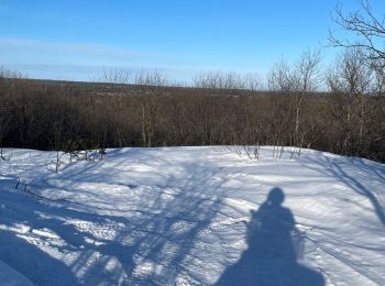
• Parcourez ce sentier et accédez au sommet dénudé du mont Chauve qui s’élève à près de 600 mètres. La longueur de ce s...
![Randonnée Marche Lac-Matapédia - Les crêtes - Photo](https://media.geolcdn.com/t/350/260/af4fe0fa-9cb7-4a56-937d-c615aae99277.jpg&format=jpg&maxdim=2)
![Marche Marche](https://static1.geolcdn.com/sitytour/trail-icons/101.png)
Km
Marche
![](/images/other/stat-length.png)
![](https://static1.geolcdn.com/siteimages/upload/files/1508320355ic_sort_den_pos_24dp.png)
![](https://static1.geolcdn.com/siteimages/upload/files/1508320355ic_sort_den_neg_24dp.png)
![](https://static1.geolcdn.com/siteimages/upload/files/16400158638029165_repeat_loop_refresh_sync_direction_icon.png)
• jolie chemin de forêt qui commence par une montee un peu rude et qui finit sur une vue magnifique du lac Matapédia.
![Randonnée Marche Petit-Saguenay - Sentier de la pinède petit Saguenay - Photo](https://media.geolcdn.com/t/350/260/ext.jpg?maxdim=2&url=https%3A%2F%2Fservices.sitytrail.com%2FGeolivesWS%2FDownloadMedia.ashx%3FTrailID%3D798095%26Media%3Dfix__20170728165203.jpg)
![Marche Marche](https://static1.geolcdn.com/sitytour/trail-icons/101.png)
Km
Marche
![](/images/other/stat-length.png)
![](https://static1.geolcdn.com/siteimages/upload/files/1508320355ic_sort_den_pos_24dp.png)
![](https://static1.geolcdn.com/siteimages/upload/files/1508320355ic_sort_den_neg_24dp.png)
![](https://static1.geolcdn.com/siteimages/upload/files/16400158638029165_repeat_loop_refresh_sync_direction_icon.png)
• Anse st Étienne
![Randonnée Marche Montréal - Le Vieux Montréal - Photo](https://media.geolcdn.com/t/350/260/ext.jpg?maxdim=2&url=https%3A%2F%2Fservices.sitytrail.com%2FGeolivesWS%2FDownloadMedia.ashx%3FTrailID%3D115244%26Media%3Ddfbaf340-e916-4b0b-be7a-11807bf702c1.jpg)
![Marche Marche](https://static1.geolcdn.com/sitytour/trail-icons/101.png)
Km
Marche
![](/images/other/stat-length.png)
![](https://static1.geolcdn.com/siteimages/upload/files/1508320355ic_sort_den_pos_24dp.png)
![](https://static1.geolcdn.com/siteimages/upload/files/1508320355ic_sort_den_neg_24dp.png)
![](https://static1.geolcdn.com/siteimages/upload/files/16400158638029165_repeat_loop_refresh_sync_direction_icon.png)
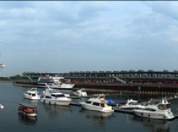
• Circuit à travers le Vieux Montréal
![Randonnée Marche Sacré-Coeur - Rando sentier le Fjord de Saguenay 12km - Photo](https://media.geolcdn.com/t/350/260/ee4953b6-c2e3-4d35-a8c9-f87e12f9f10e.jpg&format=jpg&maxdim=2)
![Marche Marche](https://static1.geolcdn.com/sitytour/trail-icons/101.png)
Km
Marche
![](/images/other/stat-length.png)
![](https://static1.geolcdn.com/siteimages/upload/files/1508320355ic_sort_den_pos_24dp.png)
![](https://static1.geolcdn.com/siteimages/upload/files/1508320355ic_sort_den_neg_24dp.png)
![](https://static1.geolcdn.com/siteimages/upload/files/16400158638029165_repeat_loop_refresh_sync_direction_icon.png)
![Randonnée Marche Rivière-Éternité - Rivière Eternité - Point vue du Géant - 10 km - Photo](https://media.geolcdn.com/t/350/260/ext.jpg?maxdim=2&url=https%3A%2F%2Fstatic1.geolcdn.com%2Fsiteimages%2Fupload%2Ffiles%2F1553511878bg_sport_marche.png)
![Marche Marche](https://static1.geolcdn.com/sitytour/trail-icons/101.png)
Km
Marche
![](/images/other/stat-length.png)
![](https://static1.geolcdn.com/siteimages/upload/files/1508320355ic_sort_den_pos_24dp.png)
![](https://static1.geolcdn.com/siteimages/upload/files/1508320355ic_sort_den_neg_24dp.png)
![](https://static1.geolcdn.com/siteimages/upload/files/16400158638029165_repeat_loop_refresh_sync_direction_icon.png)
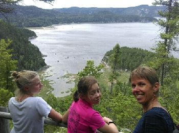
• Parc National du Fjord de Saguenay
![Randonnée Marche La Tuque - La Tuque - Lac Lafrance - Photo](https://media.geolcdn.com/t/350/260/71d2e980-5b2c-49d4-a55e-81973867ddbd.jpg&format=jpg&maxdim=2)
![Marche Marche](https://static1.geolcdn.com/sitytour/trail-icons/101.png)
Km
Marche
![](/images/other/stat-length.png)
![](https://static1.geolcdn.com/siteimages/upload/files/1508320355ic_sort_den_pos_24dp.png)
![](https://static1.geolcdn.com/siteimages/upload/files/1508320355ic_sort_den_neg_24dp.png)
![](https://static1.geolcdn.com/siteimages/upload/files/16400158638029165_repeat_loop_refresh_sync_direction_icon.png)
• Marche facile !!! Balisage ne correspond pas au descriptif dans le fascicule « Escapades des sentiers »
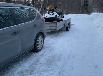
![Moto neige Moto neige](https://static1.geolcdn.com/sitytour/trail-icons/507.png)
Km
Moto neige
![](/images/other/stat-length.png)
![](https://static1.geolcdn.com/siteimages/upload/files/1508320355ic_sort_den_pos_24dp.png)
![](https://static1.geolcdn.com/siteimages/upload/files/1508320355ic_sort_den_neg_24dp.png)
![](https://static1.geolcdn.com/siteimages/upload/files/16400158638029165_repeat_loop_refresh_sync_direction_icon.png)
![Randonnée Moto neige Rawdon - Marwan trail - Photo](https://media.geolcdn.com/t/350/260/29a70ca9-3d24-4e54-9bda-61b1f03c47c2.jpg&format=jpg&maxdim=2)
![Moto neige Moto neige](https://static1.geolcdn.com/sitytour/trail-icons/507.png)
Km
Moto neige
![](/images/other/stat-length.png)
![](https://static1.geolcdn.com/siteimages/upload/files/1508320355ic_sort_den_pos_24dp.png)
![](https://static1.geolcdn.com/siteimages/upload/files/1508320355ic_sort_den_neg_24dp.png)
![](https://static1.geolcdn.com/siteimages/upload/files/16400158638029165_repeat_loop_refresh_sync_direction_icon.png)
• Motoneige
![Randonnée Moto neige Rawdon - Marwan - Photo](https://media.geolcdn.com/t/350/260/af48a44a-93a7-4655-9fff-42b4ab01b24f.jpg&format=jpg&maxdim=2)
![Moto neige Moto neige](https://static1.geolcdn.com/sitytour/trail-icons/507.png)
Km
Moto neige
![](/images/other/stat-length.png)
![](https://static1.geolcdn.com/siteimages/upload/files/1508320355ic_sort_den_pos_24dp.png)
![](https://static1.geolcdn.com/siteimages/upload/files/1508320355ic_sort_den_neg_24dp.png)
![](https://static1.geolcdn.com/siteimages/upload/files/16400158638029165_repeat_loop_refresh_sync_direction_icon.png)
• Sentier Sainte julienne
![Randonnée Marche Petite-Rivière-Saint-François - Gabrielle-Roy EST - Photo](https://media.geolcdn.com/t/350/260/73f78f19-3ef2-44bf-b6e6-61440a3b69ad.jpg&format=jpg&maxdim=2)
![Marche Marche](https://static1.geolcdn.com/sitytour/trail-icons/101.png)
Km
Marche
![](/images/other/stat-length.png)
![](https://static1.geolcdn.com/siteimages/upload/files/1508320355ic_sort_den_pos_24dp.png)
![](https://static1.geolcdn.com/siteimages/upload/files/1508320355ic_sort_den_neg_24dp.png)
![](https://static1.geolcdn.com/siteimages/upload/files/16400158638029165_repeat_loop_refresh_sync_direction_icon.png)
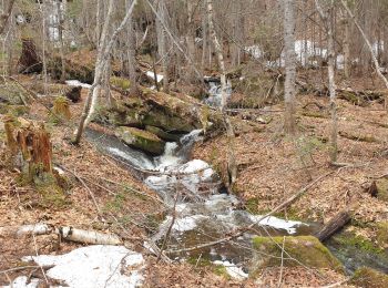
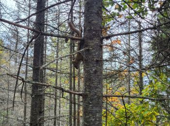
• Très beau sentier en pleine foret avec de magnifique point de vue sur le fleuve et les environs.
20 randonnées affichées sur 315
Application GPS de randonnée GRATUITE
Activités
Régions proches
- Abitibi-Ouest
- Agglomération de Montréal
- Antoine-Labelle
- Arthabaska
- Avignon
- Bellechasse
- Bonaventure
- Brome-Missisquoi
- Caniapiscau
- Charlevoix
- Charlevoix-Est
- Coaticook (MRC)
- D'Autray
- Deux-Montagnes
- Inconnu
- Jamésie
- Kamouraska (MRC)
- Kativik
- L'Ïle-d'Orléans
- La Côte-de-Beaupré
- La Côte-de-Gaspé
- La Haute-Côte-Nord
- La Haute-Gaspésie
- La Haute-Yamaska
- La Jacques-Cartier
- La Matanie
- La Matapédia
- La Mitis
- La Rivière-du-Nord
- La Tuque (agglomération)
- La Vallée-de-la-Gatineau
- La Vallée-du-Richelieu
- Lac-Saint-Jean-Est
- Le Domaine-du-Roy
- Le Fjord-du-Saguenay
- Le Granit
- Le Haut-Saint-François
- Le Rocher-Percé
- Le Val-Saint-François
- Les Appalaches
- Les Chenaux
- Les Collines-de-l'Outaouais
- Les Laurentides
- Les Moulins
- Les Pays-d'en-Haut
- Longueuil (agglomeration)
- Manicouagan
- Maskinongé (MRC)
- Matawinie
- Memphrémagog
- Minganie
- Montcalm
- Papineau
- Portneuf
- Québec (Agglomération)
- Rimouski-Neigette
- Rivière-du-Loup (MRC)
- Robert-Cliche
- Sept-Rivières
- Témiscouata
- Thérèse-De Blainville
- Vaudreuil-Soulanges
- communauté maritime des Îles-de-la-Madeleine