![](/images/other/stat-length.png)
- Randonnées
- Outdoor
- Autriche
- Tyrol
- Bezirk Kufstein
- Gemeinde Ebbs
Gemeinde Ebbs, Bezirk Kufstein : Les meilleures randonnées, itinéraires, parcours, balades et promenades
Gemeinde Ebbs : découvrez les meilleures randonnées : 15 pédestres. Tous ces circuits, parcours, itinéraires et activités en plein air sont disponibles dans nos applications SityTrail pour smartphones et tablettes.
Les meilleurs parcours (15)
![Randonnée A pied Gemeinde Ebbs - Inn Rundweg - Photo](https://media.geolcdn.com/t/350/260/daaecc59-bccf-4b5e-b34b-e9247f0a0214.jpeg&format=jpg&maxdim=2)
![A pied A pied](https://static1.geolcdn.com/sitytour/trail-icons/100.png)
Km
A pied
![](/images/other/stat-length.png)
![](https://static1.geolcdn.com/siteimages/upload/files/1508320355ic_sort_den_pos_24dp.png)
![](https://static1.geolcdn.com/siteimages/upload/files/1508320355ic_sort_den_neg_24dp.png)
![](https://static1.geolcdn.com/siteimages/upload/files/16400158638029165_repeat_loop_refresh_sync_direction_icon.png)
• Symbole: Türkise Rechtecke mit Wellensymbol und der Aufschrift "Inn Rundweg"
![Randonnée A pied Gemeinde Ebbs - St. Nikolaus Rundweg - Photo](https://media.geolcdn.com/t/350/260/3503f523-6992-40ce-bbac-ceb7704c0996.jpeg&format=jpg&maxdim=2)
![A pied A pied](https://static1.geolcdn.com/sitytour/trail-icons/100.png)
Km
A pied
![](/images/other/stat-length.png)
![](https://static1.geolcdn.com/siteimages/upload/files/1508320355ic_sort_den_pos_24dp.png)
![](https://static1.geolcdn.com/siteimages/upload/files/1508320355ic_sort_den_neg_24dp.png)
![](https://static1.geolcdn.com/siteimages/upload/files/16400158638029165_repeat_loop_refresh_sync_direction_icon.png)
• Symbole: Violette Rechtecke mit Kirchensymbol und der Aufschrift "St. Nikolaus Rundweg"
![Randonnée A pied Gemeinde Ebbs - Haflinger Rundweg - Photo](https://media.geolcdn.com/t/350/260/c486675e-7789-4fa8-85da-a10fdec7f7ad.jpeg&format=jpg&maxdim=2)
![A pied A pied](https://static1.geolcdn.com/sitytour/trail-icons/100.png)
Km
A pied
![](/images/other/stat-length.png)
![](https://static1.geolcdn.com/siteimages/upload/files/1508320355ic_sort_den_pos_24dp.png)
![](https://static1.geolcdn.com/siteimages/upload/files/1508320355ic_sort_den_neg_24dp.png)
![](https://static1.geolcdn.com/siteimages/upload/files/16400158638029165_repeat_loop_refresh_sync_direction_icon.png)
• Randonnée créée par Gemeinde Ebbs. Symbole: Braune Rechtecke mit Pferdekopf und der Aufschrift "Haflinger Rundweg"
![Randonnée A pied Gemeinde Ebbs - Oberndorf Rundweg - Photo](https://media.geolcdn.com/t/350/260/2f7b1df5-b971-4e18-8b9b-3fe840dfd0dd.jpeg&format=jpg&maxdim=2)
![A pied A pied](https://static1.geolcdn.com/sitytour/trail-icons/100.png)
Km
A pied
![](/images/other/stat-length.png)
![](https://static1.geolcdn.com/siteimages/upload/files/1508320355ic_sort_den_pos_24dp.png)
![](https://static1.geolcdn.com/siteimages/upload/files/1508320355ic_sort_den_neg_24dp.png)
![](https://static1.geolcdn.com/siteimages/upload/files/16400158638029165_repeat_loop_refresh_sync_direction_icon.png)
• Randonnée créée par Gemeinde Ebbs. Symbole: Rote Rechtecke mit Berg/Haussymbol und der Aufschrift "Oberndorf Rundweg"
![Randonnée A pied Gemeinde Ebbs - KOASA-Halbmarathon - Photo](https://media.geolcdn.com/t/350/260/649bb04a-41da-4465-a1b9-73917ea16bfa.jpeg&format=jpg&maxdim=2)
![A pied A pied](https://static1.geolcdn.com/sitytour/trail-icons/100.png)
Km
A pied
![](/images/other/stat-length.png)
![](https://static1.geolcdn.com/siteimages/upload/files/1508320355ic_sort_den_pos_24dp.png)
![](https://static1.geolcdn.com/siteimages/upload/files/1508320355ic_sort_den_neg_24dp.png)
![](https://static1.geolcdn.com/siteimages/upload/files/16400158638029165_repeat_loop_refresh_sync_direction_icon.png)
• Symbole: Rechteckige Schilder mit Richtungspfeil und farbigem Balken mit Namen und Nummer
![Randonnée A pied Gemeinde Ebbs - KOASA-Classic-Run - Photo](https://media.geolcdn.com/t/350/260/649bb04a-41da-4465-a1b9-73917ea16bfa.jpeg&format=jpg&maxdim=2)
![A pied A pied](https://static1.geolcdn.com/sitytour/trail-icons/100.png)
Km
A pied
![](/images/other/stat-length.png)
![](https://static1.geolcdn.com/siteimages/upload/files/1508320355ic_sort_den_pos_24dp.png)
![](https://static1.geolcdn.com/siteimages/upload/files/1508320355ic_sort_den_neg_24dp.png)
![](https://static1.geolcdn.com/siteimages/upload/files/16400158638029165_repeat_loop_refresh_sync_direction_icon.png)
• Symbole: Rechteckige Schilder mit Richtungspfeil und farbigem Balken mit Namen und Nummer
![Randonnée A pied Gemeinde Ebbs - KOASA-Marathon - Photo](https://media.geolcdn.com/t/350/260/be1f2f78-3256-4500-bf2a-b62a2fe3b621.jpeg&format=jpg&maxdim=2)
![A pied A pied](https://static1.geolcdn.com/sitytour/trail-icons/100.png)
Km
A pied
![](/images/other/stat-length.png)
![](https://static1.geolcdn.com/siteimages/upload/files/1508320355ic_sort_den_pos_24dp.png)
![](https://static1.geolcdn.com/siteimages/upload/files/1508320355ic_sort_den_neg_24dp.png)
![](https://static1.geolcdn.com/siteimages/upload/files/16400158638029165_repeat_loop_refresh_sync_direction_icon.png)
• Symbole: Rechteckige Schilder mit Richtungspfeil und farbigem Balken mit Namen und Nummer
![Randonnée A pied Gemeinde Ebbs - Dorf-Runde - Photo](https://media.geolcdn.com/t/350/260/fd8d9f28-2057-4c0d-9c1d-9faa61bc2275.jpeg&format=jpg&maxdim=2)
![A pied A pied](https://static1.geolcdn.com/sitytour/trail-icons/100.png)
Km
A pied
![](/images/other/stat-length.png)
![](https://static1.geolcdn.com/siteimages/upload/files/1508320355ic_sort_den_pos_24dp.png)
![](https://static1.geolcdn.com/siteimages/upload/files/1508320355ic_sort_den_neg_24dp.png)
![](https://static1.geolcdn.com/siteimages/upload/files/16400158638029165_repeat_loop_refresh_sync_direction_icon.png)
• Randonnée créée par Kufsteinerland. Symbole: Weiße Schilder mit Richtungspfeil und hellgrünem Streifen mit dem Namen...
![Randonnée A pied Gemeinde Ebbs - Fohlenhof-Runde - Photo](https://media.geolcdn.com/t/350/260/7bfaa8d7-3efe-4f72-977e-6085ad17dacd.jpeg&format=jpg&maxdim=2)
![A pied A pied](https://static1.geolcdn.com/sitytour/trail-icons/100.png)
Km
A pied
![](/images/other/stat-length.png)
![](https://static1.geolcdn.com/siteimages/upload/files/1508320355ic_sort_den_pos_24dp.png)
![](https://static1.geolcdn.com/siteimages/upload/files/1508320355ic_sort_den_neg_24dp.png)
![](https://static1.geolcdn.com/siteimages/upload/files/16400158638029165_repeat_loop_refresh_sync_direction_icon.png)
• Randonnée créée par Kufsteinerland. Symbole: Weiße Schilder mit Richtungspfeil und grünem Streifen mit dem Namen "Fo...
![Randonnée A pied Gemeinde Ebbs - Plafing-Runde - Photo](https://media.geolcdn.com/t/350/260/fd8d9f28-2057-4c0d-9c1d-9faa61bc2275.jpeg&format=jpg&maxdim=2)
![A pied A pied](https://static1.geolcdn.com/sitytour/trail-icons/100.png)
Km
A pied
![](/images/other/stat-length.png)
![](https://static1.geolcdn.com/siteimages/upload/files/1508320355ic_sort_den_pos_24dp.png)
![](https://static1.geolcdn.com/siteimages/upload/files/1508320355ic_sort_den_neg_24dp.png)
![](https://static1.geolcdn.com/siteimages/upload/files/16400158638029165_repeat_loop_refresh_sync_direction_icon.png)
• Randonnée créée par Kufsteinerland. Symbole: Weiße Schilder mit Richtungspfeil und schwarzem Streifen mit dem Namen ...
![Randonnée A pied Gemeinde Ebbs - Oberndorfer-Runde - Photo](https://media.geolcdn.com/t/350/260/a8ed3166-a29a-437b-812b-8dde191eb666.jpeg&format=jpg&maxdim=2)
![A pied A pied](https://static1.geolcdn.com/sitytour/trail-icons/100.png)
Km
A pied
![](/images/other/stat-length.png)
![](https://static1.geolcdn.com/siteimages/upload/files/1508320355ic_sort_den_pos_24dp.png)
![](https://static1.geolcdn.com/siteimages/upload/files/1508320355ic_sort_den_neg_24dp.png)
![](https://static1.geolcdn.com/siteimages/upload/files/16400158638029165_repeat_loop_refresh_sync_direction_icon.png)
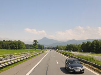
• Randonnée créée par Kufsteinerland. Symbole: Weiße Schilder mit Richtungspfeil und violettem Streifen mit dem Namen ...
![Randonnée A pied Gemeinde Ebbs - Schanzer-Runde - Photo](https://media.geolcdn.com/t/350/260/1bd04506-34e5-41f7-b716-66a3f2dd94bc.jpeg&format=jpg&maxdim=2)
![A pied A pied](https://static1.geolcdn.com/sitytour/trail-icons/100.png)
Km
A pied
![](/images/other/stat-length.png)
![](https://static1.geolcdn.com/siteimages/upload/files/1508320355ic_sort_den_pos_24dp.png)
![](https://static1.geolcdn.com/siteimages/upload/files/1508320355ic_sort_den_neg_24dp.png)
![](https://static1.geolcdn.com/siteimages/upload/files/16400158638029165_repeat_loop_refresh_sync_direction_icon.png)
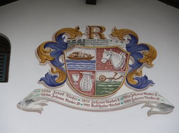
• Randonnée créée par Kufsteinerland. Symbole: Weiße Schilder mit Richtungspfeil und grünem Streifen mit dem Namen "Sc...
![Randonnée A pied Gemeinde Ebbs - Schanzer-Runde - Photo](https://media.geolcdn.com/t/350/260/fd8d9f28-2057-4c0d-9c1d-9faa61bc2275.jpeg&format=jpg&maxdim=2)
![A pied A pied](https://static1.geolcdn.com/sitytour/trail-icons/100.png)
Km
A pied
![](/images/other/stat-length.png)
![](https://static1.geolcdn.com/siteimages/upload/files/1508320355ic_sort_den_pos_24dp.png)
![](https://static1.geolcdn.com/siteimages/upload/files/1508320355ic_sort_den_neg_24dp.png)
![](https://static1.geolcdn.com/siteimages/upload/files/16400158638029165_repeat_loop_refresh_sync_direction_icon.png)
• Randonnée créée par Kufsteinerland. Symbole: Weiße Schilder mit Richtungspfeil und rotem Streifen mit dem Namen "Sch...
![Randonnée A pied Gemeinde Ebbs - Bärentalrunde - Photo](https://media.geolcdn.com/t/350/260/ext.jpg?maxdim=2&url=https%3A%2F%2Fstatic1.geolcdn.com%2Fsiteimages%2Fupload%2Ffiles%2F1545311037marcheuse_200dpi.jpg)
![A pied A pied](https://static1.geolcdn.com/sitytour/trail-icons/100.png)
Km
A pied
![](/images/other/stat-length.png)
![](https://static1.geolcdn.com/siteimages/upload/files/1508320355ic_sort_den_pos_24dp.png)
![](https://static1.geolcdn.com/siteimages/upload/files/1508320355ic_sort_den_neg_24dp.png)
![](https://static1.geolcdn.com/siteimages/upload/files/16400158638029165_repeat_loop_refresh_sync_direction_icon.png)
• Symbole: Holzschilder mit weißem Bärensymbol und Schrift "Bärentalrunde"
![Randonnée Marche Gemeinde Ebbs - r1j1 - Photo](https://media.geolcdn.com/t/350/260/ext.jpg?maxdim=2&url=https%3A%2F%2Fstatic1.geolcdn.com%2Fsiteimages%2Fupload%2Ffiles%2F1553511878bg_sport_marche.png)
![Marche Marche](https://static1.geolcdn.com/sitytour/trail-icons/101.png)
Km
Marche
![](/images/other/stat-length.png)
![](https://static1.geolcdn.com/siteimages/upload/files/1508320355ic_sort_den_pos_24dp.png)
![](https://static1.geolcdn.com/siteimages/upload/files/1508320355ic_sort_den_neg_24dp.png)
![](https://static1.geolcdn.com/siteimages/upload/files/16400158638029165_repeat_loop_refresh_sync_direction_icon.png)
• toti
15 randonnées affichées sur 15
Application GPS de randonnée GRATUITE