![](/images/other/stat-length.png)
- Randonnées
- Outdoor
- Autriche
- Haute-Autriche
- Bezirk Urfahr-Umgebung
- Bad Leonfelden
Bad Leonfelden, Bezirk Urfahr-Umgebung : Les meilleures randonnées, itinéraires, parcours, balades et promenades
Bad Leonfelden : découvrez les meilleures randonnées : 14 pédestres. Tous ces circuits, parcours, itinéraires et activités en plein air sont disponibles dans nos applications SityTrail pour smartphones et tablettes.
Les meilleurs parcours (14)
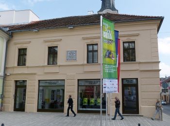
![Randonnée A pied Bad Leonfelden - Nordwaldkammweg Verbindungsweg V8 - Photo](https://media.geolcdn.com/t/350/260/88d15571-8747-49c7-b81f-659a84a71e0c.jpeg&format=jpg&maxdim=2)
![A pied A pied](https://static1.geolcdn.com/sitytour/trail-icons/100.png)
Km
A pied
![](/images/other/stat-length.png)
![](https://static1.geolcdn.com/siteimages/upload/files/1508320355ic_sort_den_pos_24dp.png)
![](https://static1.geolcdn.com/siteimages/upload/files/1508320355ic_sort_den_neg_24dp.png)
![](https://static1.geolcdn.com/siteimages/upload/files/16400158638029165_repeat_loop_refresh_sync_direction_icon.png)
• Randonnée créée par Alpenverein.
![Randonnée A pied Bad Leonfelden - Miesenwald-Runde - Photo](https://media.geolcdn.com/t/350/260/7893eb2d-2ad3-4677-80e4-3a8b22389954.jpeg&format=jpg&maxdim=2)
![A pied A pied](https://static1.geolcdn.com/sitytour/trail-icons/100.png)
Km
A pied
![](/images/other/stat-length.png)
![](https://static1.geolcdn.com/siteimages/upload/files/1508320355ic_sort_den_pos_24dp.png)
![](https://static1.geolcdn.com/siteimages/upload/files/1508320355ic_sort_den_neg_24dp.png)
![](https://static1.geolcdn.com/siteimages/upload/files/16400158638029165_repeat_loop_refresh_sync_direction_icon.png)
• Randonnée créée par Österreichischer Alpenverein. Symbole: Ausgefüllter grüner Kreis (meist auf gelbem Grund, manchm...
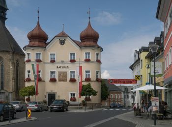
![Randonnée A pied Bad Leonfelden - Brunnwald Runde - Photo](https://media.geolcdn.com/t/350/260/b34cf27c-cf68-48f7-b6aa-e1c0f589c507.jpeg&format=jpg&maxdim=2)
![A pied A pied](https://static1.geolcdn.com/sitytour/trail-icons/100.png)
Km
A pied
![](/images/other/stat-length.png)
![](https://static1.geolcdn.com/siteimages/upload/files/1508320355ic_sort_den_pos_24dp.png)
![](https://static1.geolcdn.com/siteimages/upload/files/1508320355ic_sort_den_neg_24dp.png)
![](https://static1.geolcdn.com/siteimages/upload/files/16400158638029165_repeat_loop_refresh_sync_direction_icon.png)
• Randonnée créée par Kurverband Bad Leonfelden. Symbole: orange Aufkleber „Brunnwald-Runde”
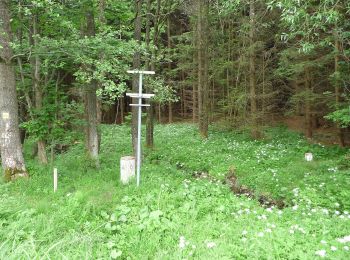
![Randonnée A pied Bad Leonfelden - Grasslmühl-Runde - Photo](https://media.geolcdn.com/t/350/260/7b46c5e4-b7ae-4c0b-a9b4-5d410b92945d.jpeg&format=jpg&maxdim=2)
![A pied A pied](https://static1.geolcdn.com/sitytour/trail-icons/100.png)
Km
A pied
![](/images/other/stat-length.png)
![](https://static1.geolcdn.com/siteimages/upload/files/1508320355ic_sort_den_pos_24dp.png)
![](https://static1.geolcdn.com/siteimages/upload/files/1508320355ic_sort_den_neg_24dp.png)
![](https://static1.geolcdn.com/siteimages/upload/files/16400158638029165_repeat_loop_refresh_sync_direction_icon.png)
• Randonnée créée par Tourismusverband Bad Leonfelden.
![Randonnée A pied Bad Leonfelden - Pannholz Runde - Photo](https://media.geolcdn.com/t/350/260/30db9486-5c87-40ea-ac10-fec50f59fdd2.jpeg&format=jpg&maxdim=2)
![A pied A pied](https://static1.geolcdn.com/sitytour/trail-icons/100.png)
Km
A pied
![](/images/other/stat-length.png)
![](https://static1.geolcdn.com/siteimages/upload/files/1508320355ic_sort_den_pos_24dp.png)
![](https://static1.geolcdn.com/siteimages/upload/files/1508320355ic_sort_den_neg_24dp.png)
![](https://static1.geolcdn.com/siteimages/upload/files/16400158638029165_repeat_loop_refresh_sync_direction_icon.png)
• Randonnée créée par Tourismusverband Bad Leonfelden.
![Randonnée A pied Bad Leonfelden - Waldschenke Runde - Photo](https://media.geolcdn.com/t/350/260/6e43a0e6-e8c5-46a4-88f9-d3220a18c19f.jpeg&format=jpg&maxdim=2)
![A pied A pied](https://static1.geolcdn.com/sitytour/trail-icons/100.png)
Km
A pied
![](/images/other/stat-length.png)
![](https://static1.geolcdn.com/siteimages/upload/files/1508320355ic_sort_den_pos_24dp.png)
![](https://static1.geolcdn.com/siteimages/upload/files/1508320355ic_sort_den_neg_24dp.png)
![](https://static1.geolcdn.com/siteimages/upload/files/16400158638029165_repeat_loop_refresh_sync_direction_icon.png)
• Randonnée créée par Kurverband Bad Leonfelden.
![Randonnée A pied Bad Leonfelden - Steinwaldrunde - Photo](https://media.geolcdn.com/t/350/260/3f7bbb37-a2e8-488c-abee-b2f45d700020.jpeg&format=jpg&maxdim=2)
![A pied A pied](https://static1.geolcdn.com/sitytour/trail-icons/100.png)
Km
A pied
![](/images/other/stat-length.png)
![](https://static1.geolcdn.com/siteimages/upload/files/1508320355ic_sort_den_pos_24dp.png)
![](https://static1.geolcdn.com/siteimages/upload/files/1508320355ic_sort_den_neg_24dp.png)
![](https://static1.geolcdn.com/siteimages/upload/files/16400158638029165_repeat_loop_refresh_sync_direction_icon.png)
• Randonnée créée par Kurverband Bad Leonfelden.
![Randonnée A pied Bad Leonfelden - Reichental - Bad Leonfelden - Photo](https://media.geolcdn.com/t/350/260/7893eb2d-2ad3-4677-80e4-3a8b22389954.jpeg&format=jpg&maxdim=2)
![A pied A pied](https://static1.geolcdn.com/sitytour/trail-icons/100.png)
Km
A pied
![](/images/other/stat-length.png)
![](https://static1.geolcdn.com/siteimages/upload/files/1508320355ic_sort_den_pos_24dp.png)
![](https://static1.geolcdn.com/siteimages/upload/files/1508320355ic_sort_den_neg_24dp.png)
![](https://static1.geolcdn.com/siteimages/upload/files/16400158638029165_repeat_loop_refresh_sync_direction_icon.png)
• Randonnée créée par Alpenverein. Symbole: rot weiß rot mit schwarzer Zahl 10
![Randonnée A pied Bad Leonfelden - Elmegg - Schönau - Photo](https://media.geolcdn.com/t/350/260/3b7e5391-2c12-4f75-8063-e08e610e115f.jpeg&format=jpg&maxdim=2)
![A pied A pied](https://static1.geolcdn.com/sitytour/trail-icons/100.png)
Km
A pied
![](/images/other/stat-length.png)
![](https://static1.geolcdn.com/siteimages/upload/files/1508320355ic_sort_den_pos_24dp.png)
![](https://static1.geolcdn.com/siteimages/upload/files/1508320355ic_sort_den_neg_24dp.png)
![](https://static1.geolcdn.com/siteimages/upload/files/16400158638029165_repeat_loop_refresh_sync_direction_icon.png)
• Randonnée créée par Alpenverein, Sektion Rodlland. Symbole: red-white-red
![Randonnée A pied Bad Leonfelden - Erlebnisweg Moorwald - Photo](https://media.geolcdn.com/t/350/260/3f7bbb37-a2e8-488c-abee-b2f45d700020.jpeg&format=jpg&maxdim=2)
![A pied A pied](https://static1.geolcdn.com/sitytour/trail-icons/100.png)
Km
A pied
![](/images/other/stat-length.png)
![](https://static1.geolcdn.com/siteimages/upload/files/1508320355ic_sort_den_pos_24dp.png)
![](https://static1.geolcdn.com/siteimages/upload/files/1508320355ic_sort_den_neg_24dp.png)
![](https://static1.geolcdn.com/siteimages/upload/files/16400158638029165_repeat_loop_refresh_sync_direction_icon.png)
• Randonnée créée par Kurverband Bad Leonfelden. Symbole: hölzernes Eichkätzchen Site web: http://www.badleonfelden....
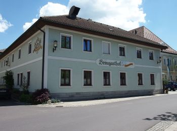
![Randonnée A pied Bad Leonfelden - Bad Leonfelden Vorderweißenbach - Photo](https://media.geolcdn.com/t/350/260/8692c1c8-69cd-4b3c-9073-3b37ce77e381.jpeg&format=jpg&maxdim=2)
![A pied A pied](https://static1.geolcdn.com/sitytour/trail-icons/100.png)
Km
A pied
![](/images/other/stat-length.png)
![](https://static1.geolcdn.com/siteimages/upload/files/1508320355ic_sort_den_pos_24dp.png)
![](https://static1.geolcdn.com/siteimages/upload/files/1508320355ic_sort_den_neg_24dp.png)
![](https://static1.geolcdn.com/siteimages/upload/files/16400158638029165_repeat_loop_refresh_sync_direction_icon.png)
• Randonnée créée par Alpenverein. Symbole: rot-weiss-rot 20
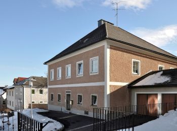
![Randonnée A pied Bad Leonfelden - Bad Leonfelden Traberg - Photo](https://media.geolcdn.com/t/350/260/1dd1a9d4-eeaa-4ae3-8473-4e283aca9da3.jpeg&format=jpg&maxdim=2)
![A pied A pied](https://static1.geolcdn.com/sitytour/trail-icons/100.png)
Km
A pied
![](/images/other/stat-length.png)
![](https://static1.geolcdn.com/siteimages/upload/files/1508320355ic_sort_den_pos_24dp.png)
![](https://static1.geolcdn.com/siteimages/upload/files/1508320355ic_sort_den_neg_24dp.png)
![](https://static1.geolcdn.com/siteimages/upload/files/16400158638029165_repeat_loop_refresh_sync_direction_icon.png)
• Randonnée créée par Alpenverein. Symbole: rot-weiss-rot 22
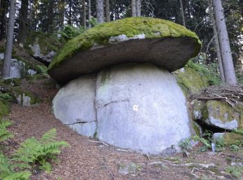
![Randonnée A pied Bad Leonfelden - Rading-Weigetschlag-Ablege-Sternstein 11 - Photo](https://media.geolcdn.com/t/350/260/07afe276-6584-4077-bea1-2e37df7a0d5f.jpeg&format=jpg&maxdim=2)
![A pied A pied](https://static1.geolcdn.com/sitytour/trail-icons/100.png)
Km
A pied
![](/images/other/stat-length.png)
![](https://static1.geolcdn.com/siteimages/upload/files/1508320355ic_sort_den_pos_24dp.png)
![](https://static1.geolcdn.com/siteimages/upload/files/1508320355ic_sort_den_neg_24dp.png)
![](https://static1.geolcdn.com/siteimages/upload/files/16400158638029165_repeat_loop_refresh_sync_direction_icon.png)
• Randonnée créée par Alpenverein. Symbole: rot weiß rot mit schwarzer Zahl 11
![Randonnée A pied Bad Leonfelden - Schönau - Oberwaldschlag - Photo](https://media.geolcdn.com/t/350/260/ext.jpg?maxdim=2&url=https%3A%2F%2Fstatic1.geolcdn.com%2Fsiteimages%2Fupload%2Ffiles%2F1545311037marcheuse_200dpi.jpg)
![A pied A pied](https://static1.geolcdn.com/sitytour/trail-icons/100.png)
Km
A pied
![](/images/other/stat-length.png)
![](https://static1.geolcdn.com/siteimages/upload/files/1508320355ic_sort_den_pos_24dp.png)
![](https://static1.geolcdn.com/siteimages/upload/files/1508320355ic_sort_den_neg_24dp.png)
![](https://static1.geolcdn.com/siteimages/upload/files/16400158638029165_repeat_loop_refresh_sync_direction_icon.png)
• Randonnée créée par Alpenverein, Sektion Rodlland. Symbole: red-white-red
14 randonnées affichées sur 14
Application GPS de randonnée GRATUITE