![](/images/other/stat-length.png)
- Randonnées
- Outdoor
- Autriche
- Basse-Autriche
- Bezirk Zwettl
- Gemeinde Zwettl-Niederösterreich
Gemeinde Zwettl-Niederösterreich, Bezirk Zwettl : Les meilleures randonnées, itinéraires, parcours, balades et promenades
Gemeinde Zwettl-Niederösterreich : découvrez les meilleures randonnées : 26 pédestres. Tous ces circuits, parcours, itinéraires et activités en plein air sont disponibles dans nos applications SityTrail pour smartphones et tablettes.
Les meilleurs parcours (26)
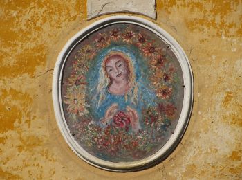
![Randonnée A pied Gemeinde Zwettl-Niederösterreich - Zwettl - Stift Zwettl 8 - Photo](https://media.geolcdn.com/t/350/260/370145a8-de5f-46a5-b7c8-9cbf61386797.jpeg&format=jpg&maxdim=2)
![A pied A pied](https://static1.geolcdn.com/sitytour/trail-icons/100.png)
Km
A pied
![](/images/other/stat-length.png)
![](https://static1.geolcdn.com/siteimages/upload/files/1508320355ic_sort_den_pos_24dp.png)
![](https://static1.geolcdn.com/siteimages/upload/files/1508320355ic_sort_den_neg_24dp.png)
![](https://static1.geolcdn.com/siteimages/upload/files/16400158638029165_repeat_loop_refresh_sync_direction_icon.png)
• Symbole: rot-weiß-rot 8
![Randonnée A pied Gemeinde Zwettl-Niederösterreich - Zwei Flüsse Rundwanderweg 58 - Photo](https://media.geolcdn.com/t/350/260/7eca8a98-457d-42eb-953e-f91796b9ba38.jpeg&format=jpg&maxdim=2)
![A pied A pied](https://static1.geolcdn.com/sitytour/trail-icons/100.png)
Km
A pied
![](/images/other/stat-length.png)
![](https://static1.geolcdn.com/siteimages/upload/files/1508320355ic_sort_den_pos_24dp.png)
![](https://static1.geolcdn.com/siteimages/upload/files/1508320355ic_sort_den_neg_24dp.png)
![](https://static1.geolcdn.com/siteimages/upload/files/16400158638029165_repeat_loop_refresh_sync_direction_icon.png)
• Symbole: 58 auf gelbem Grund
![Randonnée A pied Gemeinde Zwettl-Niederösterreich - Wasserwunderweg 55a - Photo](https://media.geolcdn.com/t/350/260/428fdd7b-60d6-4a4e-ae25-c9166a2bf88f.jpeg&format=jpg&maxdim=2)
![A pied A pied](https://static1.geolcdn.com/sitytour/trail-icons/100.png)
Km
A pied
![](/images/other/stat-length.png)
![](https://static1.geolcdn.com/siteimages/upload/files/1508320355ic_sort_den_pos_24dp.png)
![](https://static1.geolcdn.com/siteimages/upload/files/1508320355ic_sort_den_neg_24dp.png)
![](https://static1.geolcdn.com/siteimages/upload/files/16400158638029165_repeat_loop_refresh_sync_direction_icon.png)
• Ausgezeichnet mit dem Österreichischem Wandergütesigel! Symbole: 55a auf gelbem Grund
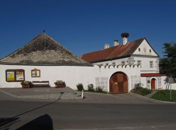
![Randonnée A pied Gemeinde Zwettl-Niederösterreich - 5-Dörfer-Weg 57 - Photo](https://media.geolcdn.com/t/350/260/2ddd0e60-3434-4720-ae69-d167aa631604.jpeg&format=jpg&maxdim=2)
![A pied A pied](https://static1.geolcdn.com/sitytour/trail-icons/100.png)
Km
A pied
![](/images/other/stat-length.png)
![](https://static1.geolcdn.com/siteimages/upload/files/1508320355ic_sort_den_pos_24dp.png)
![](https://static1.geolcdn.com/siteimages/upload/files/1508320355ic_sort_den_neg_24dp.png)
![](https://static1.geolcdn.com/siteimages/upload/files/16400158638029165_repeat_loop_refresh_sync_direction_icon.png)
• Symbole: 57 auf gelbem Grund
![Randonnée A pied Gemeinde Zwettl-Niederösterreich - Storchenblickweg 57C - Photo](https://media.geolcdn.com/t/350/260/e0f38942-b0af-4a68-ab01-fad5aa6203ad.jpeg&format=jpg&maxdim=2)
![A pied A pied](https://static1.geolcdn.com/sitytour/trail-icons/100.png)
Km
A pied
![](/images/other/stat-length.png)
![](https://static1.geolcdn.com/siteimages/upload/files/1508320355ic_sort_den_pos_24dp.png)
![](https://static1.geolcdn.com/siteimages/upload/files/1508320355ic_sort_den_neg_24dp.png)
![](https://static1.geolcdn.com/siteimages/upload/files/16400158638029165_repeat_loop_refresh_sync_direction_icon.png)
• Symbole: 57C auf gelbem Grund
![Randonnée A pied Gemeinde Zwettl-Niederösterreich - Sonnenweg 57B - Photo](https://media.geolcdn.com/t/350/260/5c784700-d9f5-40b9-834a-948c7aed398a.jpeg&format=jpg&maxdim=2)
![A pied A pied](https://static1.geolcdn.com/sitytour/trail-icons/100.png)
Km
A pied
![](/images/other/stat-length.png)
![](https://static1.geolcdn.com/siteimages/upload/files/1508320355ic_sort_den_pos_24dp.png)
![](https://static1.geolcdn.com/siteimages/upload/files/1508320355ic_sort_den_neg_24dp.png)
![](https://static1.geolcdn.com/siteimages/upload/files/16400158638029165_repeat_loop_refresh_sync_direction_icon.png)
• Symbole: 57B auf gelbem Grund
![Randonnée A pied Gemeinde Zwettl-Niederösterreich - Waldbachweg 57A - Photo](https://media.geolcdn.com/t/350/260/1b43b4c3-7cb4-4205-923d-ca0d9af6e29f.jpeg&format=jpg&maxdim=2)
![A pied A pied](https://static1.geolcdn.com/sitytour/trail-icons/100.png)
Km
A pied
![](/images/other/stat-length.png)
![](https://static1.geolcdn.com/siteimages/upload/files/1508320355ic_sort_den_pos_24dp.png)
![](https://static1.geolcdn.com/siteimages/upload/files/1508320355ic_sort_den_neg_24dp.png)
![](https://static1.geolcdn.com/siteimages/upload/files/16400158638029165_repeat_loop_refresh_sync_direction_icon.png)
• Symbole: 57A auf gelbem Grund
![Randonnée A pied Gemeinde Zwettl-Niederösterreich - Vabindaweg 57d - Photo](https://media.geolcdn.com/t/350/260/b1746b47-2e7c-4d19-8485-046fd2c2033d.jpeg&format=jpg&maxdim=2)
![A pied A pied](https://static1.geolcdn.com/sitytour/trail-icons/100.png)
Km
A pied
![](/images/other/stat-length.png)
![](https://static1.geolcdn.com/siteimages/upload/files/1508320355ic_sort_den_pos_24dp.png)
![](https://static1.geolcdn.com/siteimages/upload/files/1508320355ic_sort_den_neg_24dp.png)
![](https://static1.geolcdn.com/siteimages/upload/files/16400158638029165_repeat_loop_refresh_sync_direction_icon.png)
• Symbole: rot-weiss-rot 57d
![Randonnée A pied Gemeinde Zwettl-Niederösterreich - Seeteichweg 11 - Photo](https://media.geolcdn.com/t/350/260/11fabdf0-5871-4f71-b5a5-3836f6688cfc.jpeg&format=jpg&maxdim=2)
![A pied A pied](https://static1.geolcdn.com/sitytour/trail-icons/100.png)
Km
A pied
![](/images/other/stat-length.png)
![](https://static1.geolcdn.com/siteimages/upload/files/1508320355ic_sort_den_pos_24dp.png)
![](https://static1.geolcdn.com/siteimages/upload/files/1508320355ic_sort_den_neg_24dp.png)
![](https://static1.geolcdn.com/siteimages/upload/files/16400158638029165_repeat_loop_refresh_sync_direction_icon.png)
• Symbole: blau-weiß 11
![Randonnée A pied Gemeinde Zwettl-Niederösterreich - Waldteichweg 5 - Photo](https://media.geolcdn.com/t/350/260/6d8fa29d-0084-4002-9c73-1882daa0ef03.jpeg&format=jpg&maxdim=2)
![A pied A pied](https://static1.geolcdn.com/sitytour/trail-icons/100.png)
Km
A pied
![](/images/other/stat-length.png)
![](https://static1.geolcdn.com/siteimages/upload/files/1508320355ic_sort_den_pos_24dp.png)
![](https://static1.geolcdn.com/siteimages/upload/files/1508320355ic_sort_den_neg_24dp.png)
![](https://static1.geolcdn.com/siteimages/upload/files/16400158638029165_repeat_loop_refresh_sync_direction_icon.png)
• Symbole: blau-weiß 5
![Randonnée A pied Gemeinde Zwettl-Niederösterreich - Buche-Eiche 4 - Photo](https://media.geolcdn.com/t/350/260/be79e868-9b35-4fd5-8e18-b6cf86f4bcdd.jpeg&format=jpg&maxdim=2)
![A pied A pied](https://static1.geolcdn.com/sitytour/trail-icons/100.png)
Km
A pied
![](/images/other/stat-length.png)
![](https://static1.geolcdn.com/siteimages/upload/files/1508320355ic_sort_den_pos_24dp.png)
![](https://static1.geolcdn.com/siteimages/upload/files/1508320355ic_sort_den_neg_24dp.png)
![](https://static1.geolcdn.com/siteimages/upload/files/16400158638029165_repeat_loop_refresh_sync_direction_icon.png)
• Symbole: blau-weiß 4
![Randonnée A pied Gemeinde Zwettl-Niederösterreich - Der Prinzensteig 1 - Photo](https://media.geolcdn.com/t/350/260/0ba7703a-a82f-4c31-ade5-ce14812426be.jpeg&format=jpg&maxdim=2)
![A pied A pied](https://static1.geolcdn.com/sitytour/trail-icons/100.png)
Km
A pied
![](/images/other/stat-length.png)
![](https://static1.geolcdn.com/siteimages/upload/files/1508320355ic_sort_den_pos_24dp.png)
![](https://static1.geolcdn.com/siteimages/upload/files/1508320355ic_sort_den_neg_24dp.png)
![](https://static1.geolcdn.com/siteimages/upload/files/16400158638029165_repeat_loop_refresh_sync_direction_icon.png)
• Symbole: blau-weiß 1
![Randonnée A pied Gemeinde Zwettl-Niederösterreich - Pyramidenweg 53 - Photo](https://media.geolcdn.com/t/350/260/caf50ce7-4f4b-41fa-bb24-ae77f9746768.jpeg&format=jpg&maxdim=2)
![A pied A pied](https://static1.geolcdn.com/sitytour/trail-icons/100.png)
Km
A pied
![](/images/other/stat-length.png)
![](https://static1.geolcdn.com/siteimages/upload/files/1508320355ic_sort_den_pos_24dp.png)
![](https://static1.geolcdn.com/siteimages/upload/files/1508320355ic_sort_den_neg_24dp.png)
![](https://static1.geolcdn.com/siteimages/upload/files/16400158638029165_repeat_loop_refresh_sync_direction_icon.png)
• Symbole: 53 auf gelben Grund
![Randonnée A pied Gemeinde Zwettl-Niederösterreich - Evangelistenweg 12 - Photo](https://media.geolcdn.com/t/350/260/d04a85ab-633c-4dcc-bad4-d6789fcced6d.jpeg&format=jpg&maxdim=2)
![A pied A pied](https://static1.geolcdn.com/sitytour/trail-icons/100.png)
Km
A pied
![](/images/other/stat-length.png)
![](https://static1.geolcdn.com/siteimages/upload/files/1508320355ic_sort_den_pos_24dp.png)
![](https://static1.geolcdn.com/siteimages/upload/files/1508320355ic_sort_den_neg_24dp.png)
![](https://static1.geolcdn.com/siteimages/upload/files/16400158638029165_repeat_loop_refresh_sync_direction_icon.png)
• Symbole: blau-weiß 12
![Randonnée A pied Gemeinde Zwettl-Niederösterreich - Naturfreundeweg 11 - Photo](https://media.geolcdn.com/t/350/260/ac390f16-ca4d-4c0b-8d6c-6b613db9a0b2.jpeg&format=jpg&maxdim=2)
![A pied A pied](https://static1.geolcdn.com/sitytour/trail-icons/100.png)
Km
A pied
![](/images/other/stat-length.png)
![](https://static1.geolcdn.com/siteimages/upload/files/1508320355ic_sort_den_pos_24dp.png)
![](https://static1.geolcdn.com/siteimages/upload/files/1508320355ic_sort_den_neg_24dp.png)
![](https://static1.geolcdn.com/siteimages/upload/files/16400158638029165_repeat_loop_refresh_sync_direction_icon.png)
• Symbole: rot - weiß - rot 11
![Randonnée A pied Gemeinde Zwettl-Niederösterreich - Naturfreundeweg 7 Zwettl-Waldhausen - Photo](https://media.geolcdn.com/t/350/260/6607ee9e-c82b-47a2-a42b-20626ad04756.jpeg&format=jpg&maxdim=2)
![A pied A pied](https://static1.geolcdn.com/sitytour/trail-icons/100.png)
Km
A pied
![](/images/other/stat-length.png)
![](https://static1.geolcdn.com/siteimages/upload/files/1508320355ic_sort_den_pos_24dp.png)
![](https://static1.geolcdn.com/siteimages/upload/files/1508320355ic_sort_den_neg_24dp.png)
![](https://static1.geolcdn.com/siteimages/upload/files/16400158638029165_repeat_loop_refresh_sync_direction_icon.png)
• Symbole: rot - weiß - rot 7
![Randonnée A pied Gemeinde Zwettl-Niederösterreich - Zwettler Bierweg 52 - Photo](https://media.geolcdn.com/t/350/260/3aa5eb1c-9a63-4e60-bb76-b53b75aed4bf.jpeg&format=jpg&maxdim=2)
![A pied A pied](https://static1.geolcdn.com/sitytour/trail-icons/100.png)
Km
A pied
![](/images/other/stat-length.png)
![](https://static1.geolcdn.com/siteimages/upload/files/1508320355ic_sort_den_pos_24dp.png)
![](https://static1.geolcdn.com/siteimages/upload/files/1508320355ic_sort_den_neg_24dp.png)
![](https://static1.geolcdn.com/siteimages/upload/files/16400158638029165_repeat_loop_refresh_sync_direction_icon.png)
• Symbole: "52 - Zwettler Bierweg" auf gelben Grund
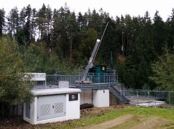
![Randonnée A pied Gemeinde Zwettl-Niederösterreich - Naturfreundeweg 12 - Photo](https://media.geolcdn.com/t/350/260/656f4199-ebd6-4a3b-ba06-13d129564daa.jpeg&format=jpg&maxdim=2)
![A pied A pied](https://static1.geolcdn.com/sitytour/trail-icons/100.png)
Km
A pied
![](/images/other/stat-length.png)
![](https://static1.geolcdn.com/siteimages/upload/files/1508320355ic_sort_den_pos_24dp.png)
![](https://static1.geolcdn.com/siteimages/upload/files/1508320355ic_sort_den_neg_24dp.png)
![](https://static1.geolcdn.com/siteimages/upload/files/16400158638029165_repeat_loop_refresh_sync_direction_icon.png)
• Symbole: rot - weiß - rot 12
![Randonnée A pied Gemeinde Zwettl-Niederösterreich - Naturfreundeweg 2 über Kaltenbrunnerfelsen - Photo](https://media.geolcdn.com/t/350/260/7783217f-4aea-4b56-aa04-2f81698f9a7c.jpeg&format=jpg&maxdim=2)
![A pied A pied](https://static1.geolcdn.com/sitytour/trail-icons/100.png)
Km
A pied
![](/images/other/stat-length.png)
![](https://static1.geolcdn.com/siteimages/upload/files/1508320355ic_sort_den_pos_24dp.png)
![](https://static1.geolcdn.com/siteimages/upload/files/1508320355ic_sort_den_neg_24dp.png)
![](https://static1.geolcdn.com/siteimages/upload/files/16400158638029165_repeat_loop_refresh_sync_direction_icon.png)
• Symbole: rot - weiß - rot 2
![Randonnée A pied Gemeinde Zwettl-Niederösterreich - Naturfreundeweg 3 Zwettl-Uttissenbach - Photo](https://media.geolcdn.com/t/350/260/b651d456-05e5-4bef-bfb9-bb9409e32691.jpeg&format=jpg&maxdim=2)
![A pied A pied](https://static1.geolcdn.com/sitytour/trail-icons/100.png)
Km
A pied
![](/images/other/stat-length.png)
![](https://static1.geolcdn.com/siteimages/upload/files/1508320355ic_sort_den_pos_24dp.png)
![](https://static1.geolcdn.com/siteimages/upload/files/1508320355ic_sort_den_neg_24dp.png)
![](https://static1.geolcdn.com/siteimages/upload/files/16400158638029165_repeat_loop_refresh_sync_direction_icon.png)
• Symbole: rot - weiß - rot 3
20 randonnées affichées sur 26
Application GPS de randonnée GRATUITE