![](/images/other/stat-length.png)
- Randonnées
- Outdoor
- Autriche
- Basse-Autriche
- Bezirk Baden
- Gemeinde Alland
Gemeinde Alland, Bezirk Baden : Les meilleures randonnées, itinéraires, parcours, balades et promenades
Gemeinde Alland : découvrez les meilleures randonnées : 27 pédestres. Tous ces circuits, parcours, itinéraires et activités en plein air sont disponibles dans nos applications SityTrail pour smartphones et tablettes.
Les meilleurs parcours (27)
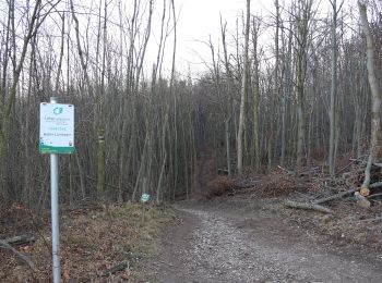
![Randonnée A pied Gemeinde Alland - Maria Raisenmarkt - Hoher Lindkogel - Photo](https://media.geolcdn.com/t/350/260/f28711c1-c58f-44b3-bc80-6633d2190f0e.jpeg&format=jpg&maxdim=2)
![A pied A pied](https://static1.geolcdn.com/sitytour/trail-icons/100.png)
Km
A pied
![](/images/other/stat-length.png)
![](https://static1.geolcdn.com/siteimages/upload/files/1508320355ic_sort_den_pos_24dp.png)
![](https://static1.geolcdn.com/siteimages/upload/files/1508320355ic_sort_den_neg_24dp.png)
![](https://static1.geolcdn.com/siteimages/upload/files/16400158638029165_repeat_loop_refresh_sync_direction_icon.png)
• Randonnée créée par ÖTK - Österreichischer Touristenklub Sektion Baden.
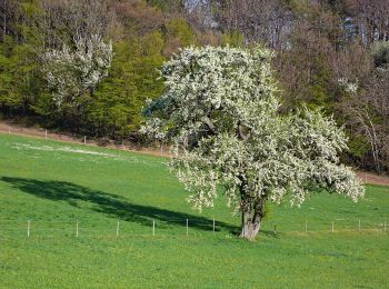
![Randonnée A pied Gemeinde Alland - Augustinerhütte - Zobelhof - Photo](https://media.geolcdn.com/t/350/260/d4acc02f-48be-4d40-b654-ee5e1a7a248e.jpeg&format=jpg&maxdim=2)
![A pied A pied](https://static1.geolcdn.com/sitytour/trail-icons/100.png)
Km
A pied
![](/images/other/stat-length.png)
![](https://static1.geolcdn.com/siteimages/upload/files/1508320355ic_sort_den_pos_24dp.png)
![](https://static1.geolcdn.com/siteimages/upload/files/1508320355ic_sort_den_neg_24dp.png)
![](https://static1.geolcdn.com/siteimages/upload/files/16400158638029165_repeat_loop_refresh_sync_direction_icon.png)
• Randonnée créée par ÖTK Österreichischer Touristenklub Sektion Baden.
![Randonnée A pied Gemeinde Alland - Raisenmarkt - Holzschlag - Peilstein - Photo](https://media.geolcdn.com/t/350/260/b38bf251-1d51-412b-a796-1cf470ade762.jpeg&format=jpg&maxdim=2)
![A pied A pied](https://static1.geolcdn.com/sitytour/trail-icons/100.png)
Km
A pied
![](/images/other/stat-length.png)
![](https://static1.geolcdn.com/siteimages/upload/files/1508320355ic_sort_den_pos_24dp.png)
![](https://static1.geolcdn.com/siteimages/upload/files/1508320355ic_sort_den_neg_24dp.png)
![](https://static1.geolcdn.com/siteimages/upload/files/16400158638029165_repeat_loop_refresh_sync_direction_icon.png)
• Randonnée créée par ÖAV Sektion ÖGV. Symbole: rot-weiss-rot 35
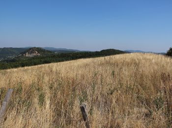
![Randonnée A pied Gemeinde Alland - Route 1 (Sonderkrankenhaus Alland) - Photo](https://media.geolcdn.com/t/350/260/0e4a6137-bdfc-4e87-96cd-01619b55a0ac.jpeg&format=jpg&maxdim=2)
![A pied A pied](https://static1.geolcdn.com/sitytour/trail-icons/100.png)
Km
A pied
![](/images/other/stat-length.png)
![](https://static1.geolcdn.com/siteimages/upload/files/1508320355ic_sort_den_pos_24dp.png)
![](https://static1.geolcdn.com/siteimages/upload/files/1508320355ic_sort_den_neg_24dp.png)
![](https://static1.geolcdn.com/siteimages/upload/files/16400158638029165_repeat_loop_refresh_sync_direction_icon.png)
• Symbole: violett, 1
![Randonnée A pied Gemeinde Alland - Route 6 (Sonderkrankenhaus Alland) - Photo](https://media.geolcdn.com/t/350/260/43bd24f0-9c84-4c90-a611-9fdbb4fdf643.jpeg&format=jpg&maxdim=2)
![A pied A pied](https://static1.geolcdn.com/sitytour/trail-icons/100.png)
Km
A pied
![](/images/other/stat-length.png)
![](https://static1.geolcdn.com/siteimages/upload/files/1508320355ic_sort_den_pos_24dp.png)
![](https://static1.geolcdn.com/siteimages/upload/files/1508320355ic_sort_den_neg_24dp.png)
![](https://static1.geolcdn.com/siteimages/upload/files/16400158638029165_repeat_loop_refresh_sync_direction_icon.png)
• Symbole: gelb, 6
![Randonnée A pied Gemeinde Alland - Route 7 (Sonderkrankenhaus Alland) - Photo](https://media.geolcdn.com/t/350/260/982c0cec-5d07-4c86-b856-13095b2f2b94.jpeg&format=jpg&maxdim=2)
![A pied A pied](https://static1.geolcdn.com/sitytour/trail-icons/100.png)
Km
A pied
![](/images/other/stat-length.png)
![](https://static1.geolcdn.com/siteimages/upload/files/1508320355ic_sort_den_pos_24dp.png)
![](https://static1.geolcdn.com/siteimages/upload/files/1508320355ic_sort_den_neg_24dp.png)
![](https://static1.geolcdn.com/siteimages/upload/files/16400158638029165_repeat_loop_refresh_sync_direction_icon.png)
• Symbole: türkis, 7
![Randonnée A pied Gemeinde Alland - Route 8 (Sonderkrankenhaus Alland) - Photo](https://media.geolcdn.com/t/350/260/43bd24f0-9c84-4c90-a611-9fdbb4fdf643.jpeg&format=jpg&maxdim=2)
![A pied A pied](https://static1.geolcdn.com/sitytour/trail-icons/100.png)
Km
A pied
![](/images/other/stat-length.png)
![](https://static1.geolcdn.com/siteimages/upload/files/1508320355ic_sort_den_pos_24dp.png)
![](https://static1.geolcdn.com/siteimages/upload/files/1508320355ic_sort_den_neg_24dp.png)
![](https://static1.geolcdn.com/siteimages/upload/files/16400158638029165_repeat_loop_refresh_sync_direction_icon.png)
• Symbole: rosa, 8
![Randonnée A pied Gemeinde Alland - Bad Vöslau B3 Hoher Lindkogel - Photo](https://media.geolcdn.com/t/350/260/4930081b-9050-4a35-9068-a99bca18cbea.jpeg&format=jpg&maxdim=2)
![A pied A pied](https://static1.geolcdn.com/sitytour/trail-icons/100.png)
Km
A pied
![](/images/other/stat-length.png)
![](https://static1.geolcdn.com/siteimages/upload/files/1508320355ic_sort_den_pos_24dp.png)
![](https://static1.geolcdn.com/siteimages/upload/files/1508320355ic_sort_den_neg_24dp.png)
![](https://static1.geolcdn.com/siteimages/upload/files/16400158638029165_repeat_loop_refresh_sync_direction_icon.png)
• Randonnée créée par Stadtgemeinde Bad Vöslau.
![Randonnée A pied Gemeinde Alland - Allander Wanderweg 10 - Photo](https://media.geolcdn.com/t/350/260/c3265708-7768-4297-a3cb-e6c840eda8bd.jpeg&format=jpg&maxdim=2)
![A pied A pied](https://static1.geolcdn.com/sitytour/trail-icons/100.png)
Km
A pied
![](/images/other/stat-length.png)
![](https://static1.geolcdn.com/siteimages/upload/files/1508320355ic_sort_den_pos_24dp.png)
![](https://static1.geolcdn.com/siteimages/upload/files/1508320355ic_sort_den_neg_24dp.png)
![](https://static1.geolcdn.com/siteimages/upload/files/16400158638029165_repeat_loop_refresh_sync_direction_icon.png)
• Randonnée créée par Fremdenverkehrs- und Ortsverschönerungsverein der Großgemeinde Alland. Symbole: 10 in orangen Pu...
![Randonnée A pied Gemeinde Alland - Allander Wanderweg 9 - Photo](https://media.geolcdn.com/t/350/260/f28711c1-c58f-44b3-bc80-6633d2190f0e.jpeg&format=jpg&maxdim=2)
![A pied A pied](https://static1.geolcdn.com/sitytour/trail-icons/100.png)
Km
A pied
![](/images/other/stat-length.png)
![](https://static1.geolcdn.com/siteimages/upload/files/1508320355ic_sort_den_pos_24dp.png)
![](https://static1.geolcdn.com/siteimages/upload/files/1508320355ic_sort_den_neg_24dp.png)
![](https://static1.geolcdn.com/siteimages/upload/files/16400158638029165_repeat_loop_refresh_sync_direction_icon.png)
• Randonnée créée par Fremdenverkehrs- und Ortsverschönerungsverein der Großgemeinde Alland. Symbole: 9 in orangen Punkt
![Randonnée A pied Gemeinde Alland - Via Sacra Rundwanderwege Alland - Photo](https://media.geolcdn.com/t/350/260/0e4a6137-bdfc-4e87-96cd-01619b55a0ac.jpeg&format=jpg&maxdim=2)
![A pied A pied](https://static1.geolcdn.com/sitytour/trail-icons/100.png)
Km
A pied
![](/images/other/stat-length.png)
![](https://static1.geolcdn.com/siteimages/upload/files/1508320355ic_sort_den_pos_24dp.png)
![](https://static1.geolcdn.com/siteimages/upload/files/1508320355ic_sort_den_neg_24dp.png)
![](https://static1.geolcdn.com/siteimages/upload/files/16400158638029165_repeat_loop_refresh_sync_direction_icon.png)
• Symbole: gelbes Schild mit Aufschrift "Via Sacra Rundwanderweg"
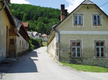
![Randonnée A pied Gemeinde Alland - Allander Wanderweg 11 - Photo](https://media.geolcdn.com/t/350/260/c330539d-2213-4355-a6fd-06f22ac45f5f.jpeg&format=jpg&maxdim=2)
![A pied A pied](https://static1.geolcdn.com/sitytour/trail-icons/100.png)
Km
A pied
![](/images/other/stat-length.png)
![](https://static1.geolcdn.com/siteimages/upload/files/1508320355ic_sort_den_pos_24dp.png)
![](https://static1.geolcdn.com/siteimages/upload/files/1508320355ic_sort_den_neg_24dp.png)
![](https://static1.geolcdn.com/siteimages/upload/files/16400158638029165_repeat_loop_refresh_sync_direction_icon.png)
• Randonnée créée par Fremdenverkehrs- und Ortsverschönerungsverein der Großgemeinde Alland. Symbole: 11 in orangen Pu...
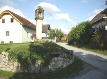
![Randonnée A pied Gemeinde Alland - Allander Wanderweg 8 - Photo](https://media.geolcdn.com/t/350/260/b9c27abf-dd59-4d02-85d8-d2328f6f8d9d.jpeg&format=jpg&maxdim=2)
![A pied A pied](https://static1.geolcdn.com/sitytour/trail-icons/100.png)
Km
A pied
![](/images/other/stat-length.png)
![](https://static1.geolcdn.com/siteimages/upload/files/1508320355ic_sort_den_pos_24dp.png)
![](https://static1.geolcdn.com/siteimages/upload/files/1508320355ic_sort_den_neg_24dp.png)
![](https://static1.geolcdn.com/siteimages/upload/files/16400158638029165_repeat_loop_refresh_sync_direction_icon.png)
• Randonnée créée par Fremdenverkehrs- und Ortsverschönerungsverein der Großgemeinde Alland. Symbole: 8 in orangen Punkt
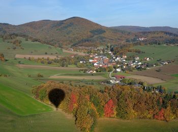
![Randonnée A pied Gemeinde Alland - Allander Wanderweg 7 - Photo](https://media.geolcdn.com/t/350/260/ea3550f6-1f16-4cb0-b96e-5968fcf54087.jpeg&format=jpg&maxdim=2)
![A pied A pied](https://static1.geolcdn.com/sitytour/trail-icons/100.png)
Km
A pied
![](/images/other/stat-length.png)
![](https://static1.geolcdn.com/siteimages/upload/files/1508320355ic_sort_den_pos_24dp.png)
![](https://static1.geolcdn.com/siteimages/upload/files/1508320355ic_sort_den_neg_24dp.png)
![](https://static1.geolcdn.com/siteimages/upload/files/16400158638029165_repeat_loop_refresh_sync_direction_icon.png)
• Randonnée créée par Fremdenverkehrs- und Ortsverschönerungsverein der Großgemeinde Alland. Symbole: 7 in orangen Punkt
![Randonnée A pied Gemeinde Alland - Allander Wanderweg 5 - Photo](https://media.geolcdn.com/t/350/260/ac5b28d2-d363-4ad3-8f4c-d414fa5664c1.jpeg&format=jpg&maxdim=2)
![A pied A pied](https://static1.geolcdn.com/sitytour/trail-icons/100.png)
Km
A pied
![](/images/other/stat-length.png)
![](https://static1.geolcdn.com/siteimages/upload/files/1508320355ic_sort_den_pos_24dp.png)
![](https://static1.geolcdn.com/siteimages/upload/files/1508320355ic_sort_den_neg_24dp.png)
![](https://static1.geolcdn.com/siteimages/upload/files/16400158638029165_repeat_loop_refresh_sync_direction_icon.png)
• Randonnée créée par Fremdenverkehrs- und Ortsverschönerungsverein der Großgemeinde Alland. Symbole: 5 in orangen Punkt
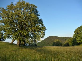
![Randonnée A pied Gemeinde Alland - Allander Wanderweg 12 - Photo](https://media.geolcdn.com/t/350/260/242ed863-b923-4415-a6b9-266fc7de53fc.jpeg&format=jpg&maxdim=2)
![A pied A pied](https://static1.geolcdn.com/sitytour/trail-icons/100.png)
Km
A pied
![](/images/other/stat-length.png)
![](https://static1.geolcdn.com/siteimages/upload/files/1508320355ic_sort_den_pos_24dp.png)
![](https://static1.geolcdn.com/siteimages/upload/files/1508320355ic_sort_den_neg_24dp.png)
![](https://static1.geolcdn.com/siteimages/upload/files/16400158638029165_repeat_loop_refresh_sync_direction_icon.png)
• Randonnée créée par Fremdenverkehrs- und Ortsverschönerungsverein der Großgemeinde Alland. Symbole: 12 in orangen Pu...
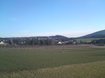
![Randonnée A pied Gemeinde Alland - Mayerling - Preinsfeld - Siegenfeld - Gaaden - Photo](https://media.geolcdn.com/t/350/260/5a614943-aefd-4044-ae93-346b84510ace.jpeg&format=jpg&maxdim=2)
![A pied A pied](https://static1.geolcdn.com/sitytour/trail-icons/100.png)
Km
A pied
![](/images/other/stat-length.png)
![](https://static1.geolcdn.com/siteimages/upload/files/1508320355ic_sort_den_pos_24dp.png)
![](https://static1.geolcdn.com/siteimages/upload/files/1508320355ic_sort_den_neg_24dp.png)
![](https://static1.geolcdn.com/siteimages/upload/files/16400158638029165_repeat_loop_refresh_sync_direction_icon.png)
• Randonnée créée par Österreichischer Touristenklub, Sektion Wienerwald. Symbole: grüner, waagrechter Balken
![Randonnée A pied Gemeinde Alland - Alland - Glashütten - Kleinmariazell - Photo](https://media.geolcdn.com/t/350/260/b9c27abf-dd59-4d02-85d8-d2328f6f8d9d.jpeg&format=jpg&maxdim=2)
![A pied A pied](https://static1.geolcdn.com/sitytour/trail-icons/100.png)
Km
A pied
![](/images/other/stat-length.png)
![](https://static1.geolcdn.com/siteimages/upload/files/1508320355ic_sort_den_pos_24dp.png)
![](https://static1.geolcdn.com/siteimages/upload/files/1508320355ic_sort_den_neg_24dp.png)
![](https://static1.geolcdn.com/siteimages/upload/files/16400158638029165_repeat_loop_refresh_sync_direction_icon.png)
• Randonnée créée par Österreichischer Touristenklub, Sektion Wienerwald. Symbole: roter, waagrechter Balken
![Randonnée A pied Gemeinde Alland - Allander Wanderweg 2 - Photo](https://media.geolcdn.com/t/350/260/b9c27abf-dd59-4d02-85d8-d2328f6f8d9d.jpeg&format=jpg&maxdim=2)
![A pied A pied](https://static1.geolcdn.com/sitytour/trail-icons/100.png)
Km
A pied
![](/images/other/stat-length.png)
![](https://static1.geolcdn.com/siteimages/upload/files/1508320355ic_sort_den_pos_24dp.png)
![](https://static1.geolcdn.com/siteimages/upload/files/1508320355ic_sort_den_neg_24dp.png)
![](https://static1.geolcdn.com/siteimages/upload/files/16400158638029165_repeat_loop_refresh_sync_direction_icon.png)
• Randonnée créée par Fremdenverkehrs- und Ortsverschönerungsverein der Großgemeinde Alland. Symbole: 2 in orangen Punkt
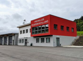
![Randonnée A pied Gemeinde Alland - Allander Wanderweg 1 - Photo](https://media.geolcdn.com/t/350/260/12b04d86-a193-4e1b-8e0f-61deaff243c0.jpeg&format=jpg&maxdim=2)
![A pied A pied](https://static1.geolcdn.com/sitytour/trail-icons/100.png)
Km
A pied
![](/images/other/stat-length.png)
![](https://static1.geolcdn.com/siteimages/upload/files/1508320355ic_sort_den_pos_24dp.png)
![](https://static1.geolcdn.com/siteimages/upload/files/1508320355ic_sort_den_neg_24dp.png)
![](https://static1.geolcdn.com/siteimages/upload/files/16400158638029165_repeat_loop_refresh_sync_direction_icon.png)
• Randonnée créée par Fremdenverkehrs- und Ortsverschönerungsverein der Großgemeinde Alland. Symbole: 1 in orangen Punkt
20 randonnées affichées sur 27
Application GPS de randonnée GRATUITE