


28 km | 32 km-effort
Île-de-France : découvrez les meilleures randonnées : 3 attelage, 2 randonnée à dos d'âne, 49 cheval et 92 randonnée équestre. Tous ces circuits, parcours, itinéraires et activités en plein air sont disponibles dans nos applications SityTrail pour smartphones et tablettes.

Cheval


• Très belle balade vallonné et variée, avec la vue imprenable a Hadancourt, un passage au chateau du Bouleaume, un arr...
Cheval
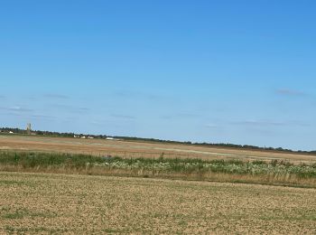
• Rando de 25km en passant par le haras st jacques, bessancourt, frépillon, mériel, l''isle adam.
Cheval

Randonnée équestre
• Tracé aller : du Parking de la Canche aux Merciers (Arbonne-la-Forêt) au cimetière Le Vaudoué (Rue des Palais)
Randonnée équestre
• Balade à travers champs pour rejoindre le jolie village de Recloses.
Randonnée équestre

Attelage
• petite boucle attelage 4 km 1h
Cheval
• Un circuit pour qui veut muscler son cheval en douceur, tout en se faisant plaisir sur une boucle relativement facile...
Cheval
•
Randonnée équestre
• Tracé Retour : du cimetière Le Vaudoué (77123), rue du Palais au Parking de la Canches aux Merciers, Noisy-sur-Ecole ...
Randonnée équestre
• 2h
Randonnée équestre
• pommeuse
Randonnée équestre
• pique nique wagon
Randonnée équestre
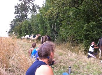
• Balade à cheval
Randonnée équestre
• Cheval
Randonnée équestre
• Balade piétonne et à cheval
Randonnée équestre
• Cheval/ course à pieds
Randonnée équestre
• Galop le long de l’aérodrome Et trotting que la route …
Randonnée équestre
• A courre
Cheval
• Boucle équestre
20 randonnées affichées sur 146
Application GPS de randonnée GRATUITE
 SityTrail
IGN / Instituts géographiques
SityTrail World
Le monde est à vous