![](/images/other/stat-length.png)
- Randonnées
- Divers
- France
- Normandie
- Orne
- Saint-Philbert-sur-Orne
Saint-Philbert-sur-Orne, Orne, Divers : Les meilleures randonnées, itinéraires, parcours, balades et promenades
Saint-Philbert-sur-Orne : découvrez les meilleures randonnées : 2 geocaching. Tous ces circuits, parcours, itinéraires et activités en plein air sont disponibles dans nos applications SityTrail pour smartphones et tablettes.
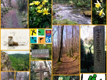
Les meilleurs parcours (3)
![Randonnée Geocaching Saint-Philbert-sur-Orne - Circuit des Roches - Photo](https://media.geolcdn.com/t/350/260/a57b9ed7-2fa2-4543-af32-042d25b2ce73.jpg&format=jpg&maxdim=2)
![Geocaching Geocaching](https://static1.geolcdn.com/sitytour/trail-icons/908.png)
Km
Geocaching
![](/images/other/stat-length.png)
![](https://static1.geolcdn.com/siteimages/upload/files/1508320355ic_sort_den_pos_24dp.png)
![](https://static1.geolcdn.com/siteimages/upload/files/1508320355ic_sort_den_neg_24dp.png)
![](https://static1.geolcdn.com/siteimages/upload/files/16400158638029165_repeat_loop_refresh_sync_direction_icon.png)
• Le Geocaching est une vraie chasse au trésor qui se déroule actuellement, tout autour de vous. Il y a 2,337,237 géoca...
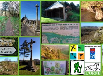
![Randonnée Geocaching Saint-Philbert-sur-Orne - Circuit des Méandres - Photo](https://media.geolcdn.com/t/350/260/873a9456-6554-4bf9-a808-aa28c0de68b4.jpg&format=jpg&maxdim=2)
![Geocaching Geocaching](https://static1.geolcdn.com/sitytour/trail-icons/908.png)
Km
Geocaching
![](/images/other/stat-length.png)
![](https://static1.geolcdn.com/siteimages/upload/files/1508320355ic_sort_den_pos_24dp.png)
![](https://static1.geolcdn.com/siteimages/upload/files/1508320355ic_sort_den_neg_24dp.png)
![](https://static1.geolcdn.com/siteimages/upload/files/16400158638029165_repeat_loop_refresh_sync_direction_icon.png)
• Venez découvrir les paysages époustouflants des gorges de la Rouvre et de ses méandres sur ce 2ème circuit à partir d...
![Randonnée Autre activité Saint-Philbert-sur-Orne - les roches doetre 16kms 2 boucles - Photo](https://media.geolcdn.com/t/350/260/ext.jpg?maxdim=2&url=https%3A%2F%2Fstatic1.geolcdn.com%2Fsiteimages%2Fupload%2Ffiles%2F1545311037marcheuse_200dpi.jpg)
![Autre activité Autre activité](https://static1.geolcdn.com/sitytour/trail-icons/900.png)
Km
Autre activité
![](/images/other/stat-length.png)
![](https://static1.geolcdn.com/siteimages/upload/files/1508320355ic_sort_den_pos_24dp.png)
![](https://static1.geolcdn.com/siteimages/upload/files/1508320355ic_sort_den_neg_24dp.png)
![](https://static1.geolcdn.com/siteimages/upload/files/16400158638029165_repeat_loop_refresh_sync_direction_icon.png)
3 randonnées affichées sur 3
Application GPS de randonnée GRATUITE