![](/images/other/stat-length.png)
- Randonnées
- A pied
- Portugal
- Nord
- Braga
- Antas
Antas, Braga, A pied : Les meilleures randonnées, itinéraires, parcours, balades et promenades
Antas : découvrez les meilleures randonnées : 4 a pied. Tous ces circuits, parcours, itinéraires et activités en plein air sont disponibles dans nos applications SityTrail pour smartphones et tablettes.
Les meilleurs parcours (4)
![Randonnée A pied Antas - Caminhos da Fé - Belinho - Photo](https://media.geolcdn.com/t/350/260/e975be8a-06a3-4a04-a541-6c786e95c32d.jpeg&format=jpg&maxdim=2)
![A pied A pied](https://static1.geolcdn.com/sitytour/trail-icons/100.png)
Km
A pied
![](/images/other/stat-length.png)
![](https://static1.geolcdn.com/siteimages/upload/files/1508320355ic_sort_den_pos_24dp.png)
![](https://static1.geolcdn.com/siteimages/upload/files/1508320355ic_sort_den_neg_24dp.png)
![](https://static1.geolcdn.com/siteimages/upload/files/16400158638029165_repeat_loop_refresh_sync_direction_icon.png)
• Promovido pela Associação Rio Neiva e pela Câmara Municipal de Esposende, este percurso circular inicia-se junto à ig...
![Randonnée A pied Antas - Casa Azenha Branca Trilho das Azenhas das Antas - Photo](https://media.geolcdn.com/t/350/260/dca20f23-8fe5-4cf1-a2cd-c4136ea4587c.jpeg&format=jpg&maxdim=2)
![A pied A pied](https://static1.geolcdn.com/sitytour/trail-icons/100.png)
Km
A pied
![](/images/other/stat-length.png)
![](https://static1.geolcdn.com/siteimages/upload/files/1508320355ic_sort_den_pos_24dp.png)
![](https://static1.geolcdn.com/siteimages/upload/files/1508320355ic_sort_den_neg_24dp.png)
![](https://static1.geolcdn.com/siteimages/upload/files/16400158638029165_repeat_loop_refresh_sync_direction_icon.png)
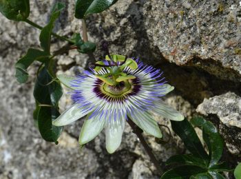
• Site web: https://www.visitesposende.com/pt/fazer/percursos/pr4-trilho-das-azenhas-das-antas
![Randonnée A pied Antas - Trilho das Cangostas - Photo](https://media.geolcdn.com/t/350/260/a14ed07d-95eb-4fdc-8b2b-a09d89b9c85b.jpeg&format=jpg&maxdim=2)
![A pied A pied](https://static1.geolcdn.com/sitytour/trail-icons/100.png)
Km
A pied
![](/images/other/stat-length.png)
![](https://static1.geolcdn.com/siteimages/upload/files/1508320355ic_sort_den_pos_24dp.png)
![](https://static1.geolcdn.com/siteimages/upload/files/1508320355ic_sort_den_neg_24dp.png)
![](https://static1.geolcdn.com/siteimages/upload/files/16400158638029165_repeat_loop_refresh_sync_direction_icon.png)
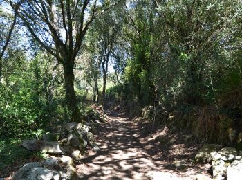
• Site web: https://www.visitesposende.com/pt/fazer/percursos/pr3-trilho-das-cangostas
![Randonnée A pied Antas - Entre o Neiva e o Atlântico - Photo](https://media.geolcdn.com/t/350/260/b69d3f32-6740-433b-9f17-d978825cbaa4.jpeg&format=jpg&maxdim=2)
![A pied A pied](https://static1.geolcdn.com/sitytour/trail-icons/100.png)
Km
A pied
![](/images/other/stat-length.png)
![](https://static1.geolcdn.com/siteimages/upload/files/1508320355ic_sort_den_pos_24dp.png)
![](https://static1.geolcdn.com/siteimages/upload/files/1508320355ic_sort_den_neg_24dp.png)
![](https://static1.geolcdn.com/siteimages/upload/files/16400158638029165_repeat_loop_refresh_sync_direction_icon.png)
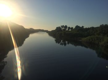
• Site web: https://www.visitesposende.com/pt/fazer/percursos/pr1-trilho-entre-o-neiva-e-o-atlantico
4 randonnées affichées sur 4
Application GPS de randonnée GRATUITE