![](/images/other/stat-length.png)
- Randonnées
- A pied
- Portugal
- Açores
- Inconnu
- Achadinha
Achadinha, Inconnu, A pied : Les meilleures randonnées, itinéraires, parcours, balades et promenades
Achadinha : découvrez les meilleures randonnées : 2 a pied. Tous ces circuits, parcours, itinéraires et activités en plein air sont disponibles dans nos applications SityTrail pour smartphones et tablettes.
Les meilleurs parcours (2)
![Randonnée A pied Achadinha - PRC38SMI Lomba D’El Rei - Photo](https://media.geolcdn.com/t/350/260/1023db09-886c-47eb-a5f7-74a0e1e018f1.jpeg&format=jpg&maxdim=2)
![A pied A pied](https://static1.geolcdn.com/sitytour/trail-icons/100.png)
Km
A pied
![](/images/other/stat-length.png)
![](https://static1.geolcdn.com/siteimages/upload/files/1508320355ic_sort_den_pos_24dp.png)
![](https://static1.geolcdn.com/siteimages/upload/files/1508320355ic_sort_den_neg_24dp.png)
![](https://static1.geolcdn.com/siteimages/upload/files/16400158638029165_repeat_loop_refresh_sync_direction_icon.png)
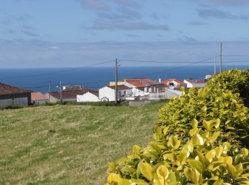
• Discover the hiking route PRC38SMI Lomba D'EL Rei. View the map and download the GPS track. Site web: http://trails....
![Randonnée A pied Achadinha - PR21SMI Padrão das Alminhas - Salto da Farinha - Photo](https://media.geolcdn.com/t/350/260/1023db09-886c-47eb-a5f7-74a0e1e018f1.jpeg&format=jpg&maxdim=2)
![A pied A pied](https://static1.geolcdn.com/sitytour/trail-icons/100.png)
Km
A pied
![](/images/other/stat-length.png)
![](https://static1.geolcdn.com/siteimages/upload/files/1508320355ic_sort_den_pos_24dp.png)
![](https://static1.geolcdn.com/siteimages/upload/files/1508320355ic_sort_den_neg_24dp.png)
![](https://static1.geolcdn.com/siteimages/upload/files/16400158638029165_repeat_loop_refresh_sync_direction_icon.png)
• Discover the hiking route PR21SMI Padrão das Alminhas - Salto da Farinha. View the map and download the GPS track. S...
2 randonnées affichées sur 2
Application GPS de randonnée GRATUITE