![](/images/other/stat-length.png)
- Randonnées
- A pied
- Portugal
- Açores
- Inconnu
- Santa Bárbara
Santa Bárbara, Inconnu, A pied : Les meilleures randonnées, itinéraires, parcours, balades et promenades
Santa Bárbara : découvrez les meilleures randonnées : 3 a pied et 1 marche. Tous ces circuits, parcours, itinéraires et activités en plein air sont disponibles dans nos applications SityTrail pour smartphones et tablettes.
Les meilleurs parcours (4)
![Randonnée A pied Santa Bárbara - PR6SMA Areia Branca - Photo](https://media.geolcdn.com/t/350/260/35da17b0-7cf5-4908-83a0-9c2ddfe62e3f.jpeg&format=jpg&maxdim=2)
![A pied A pied](https://static1.geolcdn.com/sitytour/trail-icons/100.png)
Km
A pied
![](/images/other/stat-length.png)
![](https://static1.geolcdn.com/siteimages/upload/files/1508320355ic_sort_den_pos_24dp.png)
![](https://static1.geolcdn.com/siteimages/upload/files/1508320355ic_sort_den_neg_24dp.png)
![](https://static1.geolcdn.com/siteimages/upload/files/16400158638029165_repeat_loop_refresh_sync_direction_icon.png)
• This linear route connects Praia Formosa (south coast) to Baía of São Lourenço (northeast coast), making the connecti...
![Randonnée A pied Santa Bárbara - PRC2SMA Pico Alto - Photo](https://media.geolcdn.com/t/350/260/c1c24386-8537-4540-947d-6346674f8ab7.jpeg&format=jpg&maxdim=2)
![A pied A pied](https://static1.geolcdn.com/sitytour/trail-icons/100.png)
Km
A pied
![](/images/other/stat-length.png)
![](https://static1.geolcdn.com/siteimages/upload/files/1508320355ic_sort_den_pos_24dp.png)
![](https://static1.geolcdn.com/siteimages/upload/files/1508320355ic_sort_den_neg_24dp.png)
![](https://static1.geolcdn.com/siteimages/upload/files/16400158638029165_repeat_loop_refresh_sync_direction_icon.png)
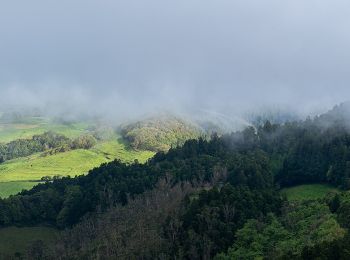
• Discover the hiking route PR2SMA Pico Alto - Anjos. View the map and download the GPS track. Site web: http://trails...
![Randonnée A pied Santa Bárbara - PRC3SMA Entre a Serra e o Mar - Photo](https://media.geolcdn.com/t/350/260/00e8e965-bbf9-404b-8416-0223f13db549.jpeg&format=jpg&maxdim=2)
![A pied A pied](https://static1.geolcdn.com/sitytour/trail-icons/100.png)
Km
A pied
![](/images/other/stat-length.png)
![](https://static1.geolcdn.com/siteimages/upload/files/1508320355ic_sort_den_pos_24dp.png)
![](https://static1.geolcdn.com/siteimages/upload/files/1508320355ic_sort_den_neg_24dp.png)
![](https://static1.geolcdn.com/siteimages/upload/files/16400158638029165_repeat_loop_refresh_sync_direction_icon.png)
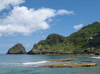
• Discover the hiking route PRC3SMA Entre a serra e o mar. View the map and download the GPS track. Site web: http://t...
![Randonnée Marche Santa Bárbara - Sta Maria jour 4 - Photo](https://media.geolcdn.com/t/350/260/ext.jpg?maxdim=2&url=https%3A%2F%2Fstatic1.geolcdn.com%2Fsiteimages%2Fupload%2Ffiles%2F1553511878bg_sport_marche.png)
![Marche Marche](https://static1.geolcdn.com/sitytour/trail-icons/101.png)
Km
Marche
![](/images/other/stat-length.png)
![](https://static1.geolcdn.com/siteimages/upload/files/1508320355ic_sort_den_pos_24dp.png)
![](https://static1.geolcdn.com/siteimages/upload/files/1508320355ic_sort_den_neg_24dp.png)
![](https://static1.geolcdn.com/siteimages/upload/files/16400158638029165_repeat_loop_refresh_sync_direction_icon.png)
4 randonnées affichées sur 4
Application GPS de randonnée GRATUITE