Twenterand, Inconnu, A pied : Les meilleures randonnées, itinéraires, parcours, balades et promenades

Twenterand : découvrez les meilleures randonnées : 14 a pied et 1 marche. Tous ces circuits, parcours, itinéraires et activités en plein air sont disponibles dans nos applications SityTrail pour smartphones et tablettes.


Les meilleurs parcours (15)

Randonnée A pied Twenterand - WNW Twente - Den Ham - groene route - Photo
A pied 6.477
Km
GUIDE+

A pied

Facile
Twenterand, Overijssel, Inconnu, Pays-Bas
6,5 km | 6,8 km-effort
1h 33min
28 m
27 m
Oui
SityTrail - itinéraires balisés pédestres

• Randonnée créée par Routenetwerken Twente.
Randonnée A pied Twenterand - WNW Twente - Meer - gele route - Photo
A pied 3.908
Km
GUIDE+

A pied

Facile
Twenterand, Overijssel, Inconnu, Pays-Bas
3,9 km | 4,2 km-effort
56min
19 m
18 m
Oui
SityTrail - itinéraires balisés pédestres

• Randonnée créée par Routenetwerken Twente.
Randonnée A pied Twenterand - WNW Twente - Linderflier/Daarlerveen - gele route - Photo
A pied 5.112
Km
GUIDE+

A pied

Facile
Twenterand, Overijssel, Inconnu, Pays-Bas
5,1 km | 5,4 km-effort
1h 13min
22 m
22 m
Oui
SityTrail - itinéraires balisés pédestres

• Randonnée créée par Routenetwerken Twente.
Randonnée A pied Twenterand - WNW Twente - Meer - oranje route - Photo
A pied 8.004
Km
GUIDE+

A pied

Facile
Twenterand, Overijssel, Inconnu, Pays-Bas
8 km | 8,5 km-effort
1h 56min
39 m
39 m
Oui
SityTrail - itinéraires balisés pédestres

• Randonnée créée par Routenetwerken Twente.
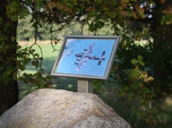
Randonnée A pied Twenterand - WNW Twente - Den Ham - blauwe route - Photo
A pied 6.668
Km
GUIDE+

A pied

Facile
Twenterand, Overijssel, Inconnu, Pays-Bas
6,7 km | 7,1 km-effort
1h 36min
29 m
29 m
Oui
SityTrail - itinéraires balisés pédestres

• Randonnée créée par Routenetwerken Twente.
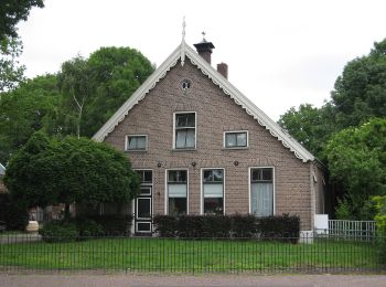
Randonnée A pied Twenterand - Wandelnetwerk Twente - groene route - Photo
A pied 5.252
Km
GUIDE+

A pied

Facile
Twenterand, Overijssel, Inconnu, Pays-Bas
5,3 km | 5,5 km-effort
1h 14min
18 m
17 m
Non
SityTrail - itinéraires balisés pédestres

Randonnée A pied Twenterand - WNW Twente - Linderflier - oranje route - Photo
A pied 5.081
Km
GUIDE+

A pied

Facile
Twenterand, Overijssel, Inconnu, Pays-Bas
5,1 km | 5,3 km-effort
1h 12min
18 m
17 m
Oui
SityTrail - itinéraires balisés pédestres

• Randonnée créée par Routenetwerken Twente.

Randonnée A pied Twenterand - WNW Twente - Meer - paarse route - Photo
A pied 5.132
Km
GUIDE+

A pied

Facile
Twenterand, Overijssel, Inconnu, Pays-Bas
5,1 km | 5,4 km-effort
1h 13min
18 m
17 m
Oui
SityTrail - itinéraires balisés pédestres

• Randonnée créée par Routenetwerken Twente.

Randonnée A pied Twenterand - WNW Twente - Zandstuve - blauwe route - Photo
A pied 4.021
Km
GUIDE+

A pied

Facile
Twenterand, Overijssel, Inconnu, Pays-Bas
4 km | 4,2 km-effort
57min
16 m
16 m
Oui
SityTrail - itinéraires balisés pédestres

• Randonnée créée par Routenetwerken Twente.

Randonnée A pied Twenterand - WNW Twente - Linderkuil - gele route - Photo
A pied 4.233
Km
GUIDE+

A pied

Facile
Twenterand, Overijssel, Inconnu, Pays-Bas
4,2 km | 4,6 km-effort
1h 2min
25 m
24 m
Oui
SityTrail - itinéraires balisés pédestres

• Randonnée créée par Routenetwerken Twente.

Randonnée A pied Twenterand - WNW Twente - Vroomshoop - paarse route - Photo
A pied 3.635
Km
GUIDE+

A pied

Facile
Twenterand, Overijssel, Inconnu, Pays-Bas
3,6 km | 3,8 km-effort
52min
14 m
15 m
Oui
SityTrail - itinéraires balisés pédestres

• Randonnée créée par Routenetwerken Twente.

Randonnée A pied Twenterand - WNW Twente - Vroomshoop - blauwe route - Photo
A pied 4.017
Km
GUIDE+

A pied

Facile
Twenterand, Overijssel, Inconnu, Pays-Bas
4 km | 4,2 km-effort
57min
16 m
17 m
Oui
SityTrail - itinéraires balisés pédestres

• Randonnée créée par Routenetwerken Twente.

Randonnée A pied Twenterand - WNW Twente - Linderkuil/Vroomshoop - oranje route - Photo
A pied 5.644
Km
GUIDE+

A pied

Facile
Twenterand, Overijssel, Inconnu, Pays-Bas
5,6 km | 6 km-effort
1h 22min
28 m
29 m
Oui
SityTrail - itinéraires balisés pédestres

• Randonnée créée par Routenetwerken Twente.

Randonnée A pied Twenterand - WNW Twente - Linderflier - paarse route - Photo
A pied 6.866
Km
GUIDE+

A pied

Facile
Twenterand, Overijssel, Inconnu, Pays-Bas
6,9 km | 7,3 km-effort
1h 39min
33 m
33 m
Oui
SityTrail - itinéraires balisés pédestres

• Randonnée créée par Routenetwerken Twente.

Randonnée Marche Twenterand - w-overijssel-engbersdijksveen - Photo
Marche 5.306
Km

Marche

Très facile
Twenterand, Overijssel, Inconnu, Pays-Bas
5,3 km | 5,6 km-effort
Inconnu
21 m
18 m
Oui
gpstracks

• More information on GPStracks.nl : http://www.gpstracks.nl

15 randonnées affichées sur 15

Application GPS de randonnée GRATUITE

Logo SityTrail SityTrail

IGN / Instituts géographiques

Télécharger SityTrail sur l'App Store Télécharger SityTrail sur Google Play

Logo SityTrail SityTrail World

Le monde est à vous

Télécharger SityTrail sur l'App Store Télécharger SityTrail sur Google Play Télécharger SityTrail sur Huawei AppGallery

Activités

Fermer
Mes abonnements