![](/images/other/stat-length.png)
- Randonnées
- A pied
- Italie
- Lombardie
- Côme
Côme, Lombardie, A pied : Les meilleures randonnées, itinéraires, parcours, balades et promenades
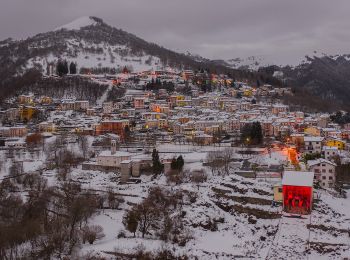
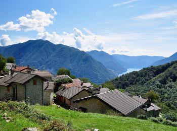
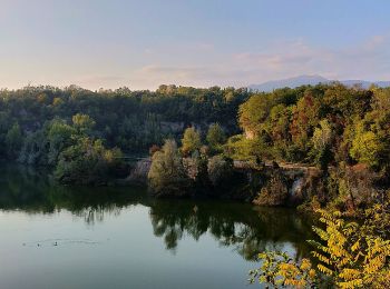
Côme : découvrez les meilleures randonnées : 44 a pied et 34 marche. Tous ces circuits, parcours, itinéraires et activités en plein air sont disponibles dans nos applications SityTrail pour smartphones et tablettes.
Les meilleurs parcours (78)
![Randonnée Marche Brunate - Boucle Brunate - Monte Piatto - Brunate - Photo](https://media.geolcdn.com/t/350/260/93a0945a-7986-4560-ba4c-8b9a27a09a51.jpg&format=jpg&maxdim=2)
![Marche Marche](https://static1.geolcdn.com/sitytour/trail-icons/101.png)
Km
Marche
![](/images/other/stat-length.png)
![](https://static1.geolcdn.com/siteimages/upload/files/1508320355ic_sort_den_pos_24dp.png)
![](https://static1.geolcdn.com/siteimages/upload/files/1508320355ic_sort_den_neg_24dp.png)
![](https://static1.geolcdn.com/siteimages/upload/files/16400158638029165_repeat_loop_refresh_sync_direction_icon.png)
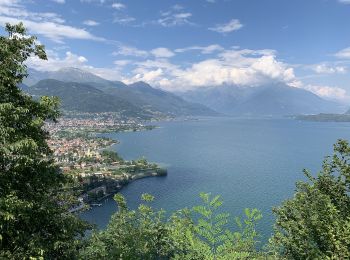
• Splendide parcours plutôt sportif. Le plus : Effectuée dans ce sens, l'ombre est présente toute la journée et la desc...
![Randonnée Marche Bellagio - Circuit Bellagio San Giovanni - Photo](https://media.geolcdn.com/t/350/260/b26ac013-c3d5-4e1a-8dea-0f587e4c1ff6.jpg&format=jpg&maxdim=2)
![Marche Marche](https://static1.geolcdn.com/sitytour/trail-icons/101.png)
Km
Marche
![](/images/other/stat-length.png)
![](https://static1.geolcdn.com/siteimages/upload/files/1508320355ic_sort_den_pos_24dp.png)
![](https://static1.geolcdn.com/siteimages/upload/files/1508320355ic_sort_den_neg_24dp.png)
![](https://static1.geolcdn.com/siteimages/upload/files/16400158638029165_repeat_loop_refresh_sync_direction_icon.png)
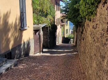
• Traversée rapide de la ville avec ses échoppes à touristes puis départ dans l'arrière pays bien plus sympa et scéniqu...
![Randonnée Marche Colonno - Greenway del lago - Colono---> Griante - Photo](https://media.geolcdn.com/t/350/260/2f26dfd5-aad1-431b-97a3-8a0c562b43b6.jpg&format=jpg&maxdim=2)
![Marche Marche](https://static1.geolcdn.com/sitytour/trail-icons/101.png)
Km
Marche
![](/images/other/stat-length.png)
![](https://static1.geolcdn.com/siteimages/upload/files/1508320355ic_sort_den_pos_24dp.png)
![](https://static1.geolcdn.com/siteimages/upload/files/1508320355ic_sort_den_neg_24dp.png)
![](https://static1.geolcdn.com/siteimages/upload/files/16400158638029165_repeat_loop_refresh_sync_direction_icon.png)
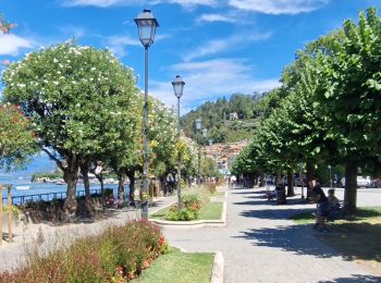
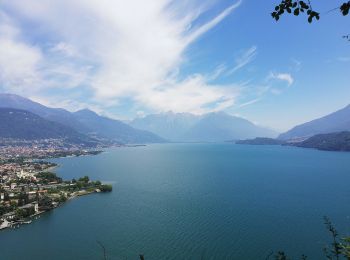
• Colonno - Sala Comacina- Ossucio - Lenno - Mezzegra- Tremezzo - Griante Aucune difficulté , balisage très visible et...
![Randonnée A pied Garzeno - Via dei Monti Lariani 4: Valle Albano - Sorico - Photo](https://media.geolcdn.com/t/350/260/d2ae6f2d-ddae-4dc4-a109-068774933e17.jpeg&format=jpg&maxdim=2)
![A pied A pied](https://static1.geolcdn.com/sitytour/trail-icons/100.png)
Km
A pied
![](/images/other/stat-length.png)
![](https://static1.geolcdn.com/siteimages/upload/files/1508320355ic_sort_den_pos_24dp.png)
![](https://static1.geolcdn.com/siteimages/upload/files/1508320355ic_sort_den_neg_24dp.png)
![](https://static1.geolcdn.com/siteimages/upload/files/16400158638029165_repeat_loop_refresh_sync_direction_icon.png)
• Symbole: red-white-red vertical stripes with a black text "4"
![Randonnée A pied Dongo - Dongo-Santa Eufemia-Sasso di Musso-San Bernardo - Photo](https://media.geolcdn.com/t/350/260/00d70f26-24cd-45b1-b436-56fc3fd4b75e.jpeg&format=jpg&maxdim=2)
![A pied A pied](https://static1.geolcdn.com/sitytour/trail-icons/100.png)
Km
A pied
![](/images/other/stat-length.png)
![](https://static1.geolcdn.com/siteimages/upload/files/1508320355ic_sort_den_pos_24dp.png)
![](https://static1.geolcdn.com/siteimages/upload/files/1508320355ic_sort_den_neg_24dp.png)
![](https://static1.geolcdn.com/siteimages/upload/files/16400158638029165_repeat_loop_refresh_sync_direction_icon.png)
• Club Alpino Italiano Sezione di SEREGNO Site web: http://www.caiseregno.it
![Randonnée A pied Dongo - Dongo-La Corna-Sasso di Musso-San Bernardo - Photo](https://media.geolcdn.com/t/350/260/35c87f6c-a4a1-4cf9-a3b2-aa63b3f3b2e8.jpeg&format=jpg&maxdim=2)
![A pied A pied](https://static1.geolcdn.com/sitytour/trail-icons/100.png)
Km
A pied
![](/images/other/stat-length.png)
![](https://static1.geolcdn.com/siteimages/upload/files/1508320355ic_sort_den_pos_24dp.png)
![](https://static1.geolcdn.com/siteimages/upload/files/1508320355ic_sort_den_neg_24dp.png)
![](https://static1.geolcdn.com/siteimages/upload/files/16400158638029165_repeat_loop_refresh_sync_direction_icon.png)
• Club Alpino Italiano Sezione di SEREGNO Site web: http://www.caiseregno.it
![Randonnée A pied Côme - Raccordo Strategico-Como Sentieri di Rovenna-Ferrovia - Photo](https://media.geolcdn.com/t/350/260/ead8144c-8395-4099-a9b8-b61c4122fa8d.jpeg&format=jpg&maxdim=2)
![A pied A pied](https://static1.geolcdn.com/sitytour/trail-icons/100.png)
Km
A pied
![](/images/other/stat-length.png)
![](https://static1.geolcdn.com/siteimages/upload/files/1508320355ic_sort_den_pos_24dp.png)
![](https://static1.geolcdn.com/siteimages/upload/files/1508320355ic_sort_den_neg_24dp.png)
![](https://static1.geolcdn.com/siteimages/upload/files/16400158638029165_repeat_loop_refresh_sync_direction_icon.png)
• Club Alpino Italiano Sezione di SEREGNO
![Randonnée A pied Eupilio - Attraversata - Monte Pesora - Monte Cornizzolo - Rifugio S.E.C. Marisa Consigliere - Photo](https://media.geolcdn.com/t/350/260/07a9f7da-ae46-4402-ab16-985ed82f932c.jpeg&format=jpg&maxdim=2)
![A pied A pied](https://static1.geolcdn.com/sitytour/trail-icons/100.png)
Km
A pied
![](/images/other/stat-length.png)
![](https://static1.geolcdn.com/siteimages/upload/files/1508320355ic_sort_den_pos_24dp.png)
![](https://static1.geolcdn.com/siteimages/upload/files/1508320355ic_sort_den_neg_24dp.png)
![](https://static1.geolcdn.com/siteimages/upload/files/16400158638029165_repeat_loop_refresh_sync_direction_icon.png)
• Club Alpino Italiano Sezione di SEREGNO
![Randonnée A pied Pigra - Circolare Piz Pasquela - Photo](https://media.geolcdn.com/t/350/260/c244535b-8ba8-4eb7-9be7-093b33742875.jpeg&format=jpg&maxdim=2)
![A pied A pied](https://static1.geolcdn.com/sitytour/trail-icons/100.png)
Km
A pied
![](/images/other/stat-length.png)
![](https://static1.geolcdn.com/siteimages/upload/files/1508320355ic_sort_den_pos_24dp.png)
![](https://static1.geolcdn.com/siteimages/upload/files/1508320355ic_sort_den_neg_24dp.png)
![](https://static1.geolcdn.com/siteimages/upload/files/16400158638029165_repeat_loop_refresh_sync_direction_icon.png)
• Randonnée créée par Associazione Amici di Pigra. Site web: http://www.aapigra.it/aap/escursioni/sentieri/777-perco...
![Randonnée A pied Pigra - Corniga - Alpe di Colonno - Photo](https://media.geolcdn.com/t/350/260/7a5f1f4f-7cc4-44f9-9d71-2aec39b30793.jpeg&format=jpg&maxdim=2)
![A pied A pied](https://static1.geolcdn.com/sitytour/trail-icons/100.png)
Km
A pied
![](/images/other/stat-length.png)
![](https://static1.geolcdn.com/siteimages/upload/files/1508320355ic_sort_den_pos_24dp.png)
![](https://static1.geolcdn.com/siteimages/upload/files/1508320355ic_sort_den_neg_24dp.png)
![](https://static1.geolcdn.com/siteimages/upload/files/16400158638029165_repeat_loop_refresh_sync_direction_icon.png)
• Randonnée créée par Associazione Amici di Pigra. Site web: http://www.aapigra.it/aap/escursioni/sentieri/738-perco...
![Randonnée A pied Brenna - 15 (Valle Sorda-Valle di Brenna) - Photo](https://media.geolcdn.com/t/350/260/d5e3204f-421a-4e86-96c4-5c4d87890c78.jpeg&format=jpg&maxdim=2)
![A pied A pied](https://static1.geolcdn.com/sitytour/trail-icons/100.png)
Km
A pied
![](/images/other/stat-length.png)
![](https://static1.geolcdn.com/siteimages/upload/files/1508320355ic_sort_den_pos_24dp.png)
![](https://static1.geolcdn.com/siteimages/upload/files/1508320355ic_sort_den_neg_24dp.png)
![](https://static1.geolcdn.com/siteimages/upload/files/16400158638029165_repeat_loop_refresh_sync_direction_icon.png)
• Randonnée créée par Parco della Brughiera Briantea.
![Randonnée A pied Merone - Baggero Brenno 2 ex Cave 1 Parco - Photo](https://media.geolcdn.com/t/350/260/7324530a-749d-4f73-be63-0bf319c8c4b8.jpeg&format=jpg&maxdim=2)
![A pied A pied](https://static1.geolcdn.com/sitytour/trail-icons/100.png)
Km
A pied
![](/images/other/stat-length.png)
![](https://static1.geolcdn.com/siteimages/upload/files/1508320355ic_sort_den_pos_24dp.png)
![](https://static1.geolcdn.com/siteimages/upload/files/1508320355ic_sort_den_neg_24dp.png)
![](https://static1.geolcdn.com/siteimages/upload/files/16400158638029165_repeat_loop_refresh_sync_direction_icon.png)
• Club Alpino Italiano Sezione di SEREGNO
![Randonnée A pied Canzo - IT-3 - Photo](https://media.geolcdn.com/t/350/260/4aa45b08-9bf7-4603-a963-73fbcfa8bd59.jpeg&format=jpg&maxdim=2)
![A pied A pied](https://static1.geolcdn.com/sitytour/trail-icons/100.png)
Km
A pied
![](/images/other/stat-length.png)
![](https://static1.geolcdn.com/siteimages/upload/files/1508320355ic_sort_den_pos_24dp.png)
![](https://static1.geolcdn.com/siteimages/upload/files/1508320355ic_sort_den_neg_24dp.png)
![](https://static1.geolcdn.com/siteimages/upload/files/16400158638029165_repeat_loop_refresh_sync_direction_icon.png)
• Site web: http://www.comune.canzo.co.it/zf/index.php/servizi-aggiuntivi/index/index/idtesto/123
![Randonnée A pied Merone - Lambro Gallarana Erba Merone - Photo](https://media.geolcdn.com/t/350/260/426fc66d-35de-425a-aecb-ba5111e013b2.jpeg&format=jpg&maxdim=2)
![A pied A pied](https://static1.geolcdn.com/sitytour/trail-icons/100.png)
Km
A pied
![](/images/other/stat-length.png)
![](https://static1.geolcdn.com/siteimages/upload/files/1508320355ic_sort_den_pos_24dp.png)
![](https://static1.geolcdn.com/siteimages/upload/files/1508320355ic_sort_den_neg_24dp.png)
![](https://static1.geolcdn.com/siteimages/upload/files/16400158638029165_repeat_loop_refresh_sync_direction_icon.png)
• Club Alpino Italiano Sezione di SEREGNO
![Randonnée A pied Canzo - IT-1 - Photo](https://media.geolcdn.com/t/350/260/69e8dbf3-6b43-4ac0-a43c-db333a9fe874.jpeg&format=jpg&maxdim=2)
![A pied A pied](https://static1.geolcdn.com/sitytour/trail-icons/100.png)
Km
A pied
![](/images/other/stat-length.png)
![](https://static1.geolcdn.com/siteimages/upload/files/1508320355ic_sort_den_pos_24dp.png)
![](https://static1.geolcdn.com/siteimages/upload/files/1508320355ic_sort_den_neg_24dp.png)
![](https://static1.geolcdn.com/siteimages/upload/files/16400158638029165_repeat_loop_refresh_sync_direction_icon.png)
• Site web: http://www.comune.canzo.co.it/zf/index.php/servizi-aggiuntivi/index/index/idtesto/121
![Randonnée A pied Bellagio - Sentiero del Lambro - Photo](https://media.geolcdn.com/t/350/260/f5032588-7d35-4a7e-bbe8-243a68066f68.jpeg&format=jpg&maxdim=2)
![A pied A pied](https://static1.geolcdn.com/sitytour/trail-icons/100.png)
Km
A pied
![](/images/other/stat-length.png)
![](https://static1.geolcdn.com/siteimages/upload/files/1508320355ic_sort_den_pos_24dp.png)
![](https://static1.geolcdn.com/siteimages/upload/files/1508320355ic_sort_den_neg_24dp.png)
![](https://static1.geolcdn.com/siteimages/upload/files/16400158638029165_repeat_loop_refresh_sync_direction_icon.png)
• Club Alpino Italiano Sezione di SEREGNO
![Randonnée A pied Sormano - (SI D11S) Piano del Tivano Rifugio Del Dosso - Alpe Cainallo - Photo](https://media.geolcdn.com/t/350/260/877307c7-518c-4942-9f77-ccb1701d3f01.jpeg&format=jpg&maxdim=2)
![A pied A pied](https://static1.geolcdn.com/sitytour/trail-icons/100.png)
Km
A pied
![](/images/other/stat-length.png)
![](https://static1.geolcdn.com/siteimages/upload/files/1508320355ic_sort_den_pos_24dp.png)
![](https://static1.geolcdn.com/siteimages/upload/files/1508320355ic_sort_den_neg_24dp.png)
![](https://static1.geolcdn.com/siteimages/upload/files/16400158638029165_repeat_loop_refresh_sync_direction_icon.png)
• Sentiero Italia CAI 2019
![Randonnée A pied Côme - (SI D10S) Como Monte Olimpino) - Piano del Tivano Rifugio Del Dosso - Photo](https://media.geolcdn.com/t/350/260/375b7a97-7915-45fb-b2a4-c0b06e6d2da7.jpeg&format=jpg&maxdim=2)
![A pied A pied](https://static1.geolcdn.com/sitytour/trail-icons/100.png)
Km
A pied
![](/images/other/stat-length.png)
![](https://static1.geolcdn.com/siteimages/upload/files/1508320355ic_sort_den_pos_24dp.png)
![](https://static1.geolcdn.com/siteimages/upload/files/1508320355ic_sort_den_neg_24dp.png)
![](https://static1.geolcdn.com/siteimages/upload/files/16400158638029165_repeat_loop_refresh_sync_direction_icon.png)
• Sentiero Italia CAI 2019
![Randonnée A pied Côme - (SI D10N) Como (Monte Olimpino) - Rifugio Prabello - Photo](https://media.geolcdn.com/t/350/260/9fd7e13f-242d-48c1-a371-3d7e031e62ab.jpeg&format=jpg&maxdim=2)
![A pied A pied](https://static1.geolcdn.com/sitytour/trail-icons/100.png)
Km
A pied
![](/images/other/stat-length.png)
![](https://static1.geolcdn.com/siteimages/upload/files/1508320355ic_sort_den_pos_24dp.png)
![](https://static1.geolcdn.com/siteimages/upload/files/1508320355ic_sort_den_neg_24dp.png)
![](https://static1.geolcdn.com/siteimages/upload/files/16400158638029165_repeat_loop_refresh_sync_direction_icon.png)
• Cammina Italia CAI 1995-1999
![Randonnée A pied Bizzarone - (SI D09) Bizzarrone - Como (Monte Olimpino) - Photo](https://media.geolcdn.com/t/350/260/30b6f553-da6a-4e7d-a2e7-8a42c8268077.jpeg&format=jpg&maxdim=2)
![A pied A pied](https://static1.geolcdn.com/sitytour/trail-icons/100.png)
Km
A pied
![](/images/other/stat-length.png)
![](https://static1.geolcdn.com/siteimages/upload/files/1508320355ic_sort_den_pos_24dp.png)
![](https://static1.geolcdn.com/siteimages/upload/files/1508320355ic_sort_den_neg_24dp.png)
![](https://static1.geolcdn.com/siteimages/upload/files/16400158638029165_repeat_loop_refresh_sync_direction_icon.png)
• Sentiero Italia CAI 2019
20 randonnées affichées sur 78
Application GPS de randonnée GRATUITE
Activités
Régions proches
- Albavilla
- Albese con Cassano
- Alta Valle Intelvi
- Asso
- Bellagio
- Bene Lario
- Binago
- Bizzarone
- Brenna
- Brienno
- Brunate
- Caglio
- Canzo
- Carate Urio
- Carlazzo
- Cavargna
- Centro Valle Intelvi
- Cerano d'Intelvi
- Cernobbio
- Colonno
- Côme
- Cremia
- Domaso
- Dongo
- Dosso del Liro
- Eupilio
- Faggeto Lario
- Garzeno
- Gera Lario
- Grandola ed Uniti
- Gravedona ed Uniti
- Griante
- Laglio
- Lezzeno
- Magreglio
- Menaggio
- Merone
- Moltrasio
- Musso
- Peglio
- Pigra
- Plesio
- Porlezza
- Rezzago
- San Siro
- Schignano
- Sorico
- Sormano
- Tremezzina
- Trezzone
- Valsolda
- Veleso
- Zelbio