![](/images/other/stat-length.png)
- Randonnées
- A pied
- Italie
- Lombardie
- Lecco
Lecco, Lombardie, A pied : Les meilleures randonnées, itinéraires, parcours, balades et promenades
Lecco : découvrez les meilleures randonnées : 90 a pied et 10 marche. Tous ces circuits, parcours, itinéraires et activités en plein air sont disponibles dans nos applications SityTrail pour smartphones et tablettes.
Les meilleurs parcours (100)
![Randonnée Marche Varenna - Sentiero del Viandante Varenna à Bellona - Photo](https://media.geolcdn.com/t/350/260/bf5728f9-3035-4f98-98c1-eb4da7218fef.jpg&format=jpg&maxdim=2)
![Marche Marche](https://static1.geolcdn.com/sitytour/trail-icons/101.png)
Km
Marche
![](/images/other/stat-length.png)
![](https://static1.geolcdn.com/siteimages/upload/files/1508320355ic_sort_den_pos_24dp.png)
![](https://static1.geolcdn.com/siteimages/upload/files/1508320355ic_sort_den_neg_24dp.png)
![](https://static1.geolcdn.com/siteimages/upload/files/16400158638029165_repeat_loop_refresh_sync_direction_icon.png)
• Attention quelques erreurs sur le parcours (aller -retour ) dues a des balisages un peu douteux Rando accessible a t...
![Randonnée A pied Calolziocorte - Sentiero 801: Sentiero della valle San Martino - Photo](https://media.geolcdn.com/t/350/260/3e10b426-148b-4fde-88cc-6904e8efdfd2.jpeg&format=jpg&maxdim=2)
![A pied A pied](https://static1.geolcdn.com/sitytour/trail-icons/100.png)
Km
A pied
![](/images/other/stat-length.png)
![](https://static1.geolcdn.com/siteimages/upload/files/1508320355ic_sort_den_pos_24dp.png)
![](https://static1.geolcdn.com/siteimages/upload/files/1508320355ic_sort_den_neg_24dp.png)
![](https://static1.geolcdn.com/siteimages/upload/files/16400158638029165_repeat_loop_refresh_sync_direction_icon.png)
• Randonnée créée par Comunità Montana Valle San Martino.
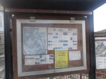
![Randonnée A pied Calolziocorte - Sentiero 801A: Ponte Serta (Calolziocorte) - Ponte Contrada (Torre de' Busi) - Photo](https://media.geolcdn.com/t/350/260/b6e4df54-c73f-41dc-867b-e80432539ddd.jpeg&format=jpg&maxdim=2)
![A pied A pied](https://static1.geolcdn.com/sitytour/trail-icons/100.png)
Km
A pied
![](/images/other/stat-length.png)
![](https://static1.geolcdn.com/siteimages/upload/files/1508320355ic_sort_den_pos_24dp.png)
![](https://static1.geolcdn.com/siteimages/upload/files/1508320355ic_sort_den_neg_24dp.png)
![](https://static1.geolcdn.com/siteimages/upload/files/16400158638029165_repeat_loop_refresh_sync_direction_icon.png)
• Randonnée créée par Comunità Montana Valle San Martino.
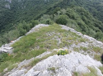
![Randonnée A pied Erve - Sentiero 831: Cappella del Corno (Erve) - M. Spedone - Nesolio - Erve - Photo](https://media.geolcdn.com/t/350/260/c22af308-c393-4424-b1e9-a24d00feb4e3.jpeg&format=jpg&maxdim=2)
![A pied A pied](https://static1.geolcdn.com/sitytour/trail-icons/100.png)
Km
A pied
![](/images/other/stat-length.png)
![](https://static1.geolcdn.com/siteimages/upload/files/1508320355ic_sort_den_pos_24dp.png)
![](https://static1.geolcdn.com/siteimages/upload/files/1508320355ic_sort_den_neg_24dp.png)
![](https://static1.geolcdn.com/siteimages/upload/files/16400158638029165_repeat_loop_refresh_sync_direction_icon.png)
• Randonnée créée par Comunità Montana Valle San Martino.
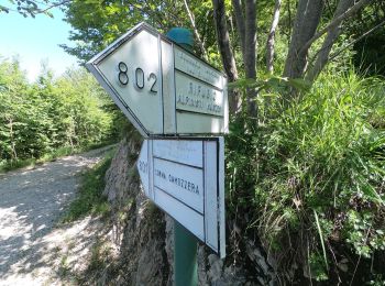
![Randonnée A pied Calolziocorte - Sentiero 812: Lorentino (Calolziocorte) - Passo della Pertulena - Photo](https://media.geolcdn.com/t/350/260/eb5832e0-a2cb-4ebf-bd27-87676c1ea21c.jpeg&format=jpg&maxdim=2)
![A pied A pied](https://static1.geolcdn.com/sitytour/trail-icons/100.png)
Km
A pied
![](/images/other/stat-length.png)
![](https://static1.geolcdn.com/siteimages/upload/files/1508320355ic_sort_den_pos_24dp.png)
![](https://static1.geolcdn.com/siteimages/upload/files/1508320355ic_sort_den_neg_24dp.png)
![](https://static1.geolcdn.com/siteimages/upload/files/16400158638029165_repeat_loop_refresh_sync_direction_icon.png)
• Randonnée créée par Comunità Montana Valle San Martino.
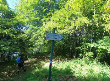
![Randonnée A pied Carenno - Sentiero 811: Carenno - Colle di Sogno - Pertüs - Photo](https://media.geolcdn.com/t/350/260/bc854a3c-84b8-45d7-a03f-9dd7f589afe9.jpeg&format=jpg&maxdim=2)
![A pied A pied](https://static1.geolcdn.com/sitytour/trail-icons/100.png)
Km
A pied
![](/images/other/stat-length.png)
![](https://static1.geolcdn.com/siteimages/upload/files/1508320355ic_sort_den_pos_24dp.png)
![](https://static1.geolcdn.com/siteimages/upload/files/1508320355ic_sort_den_neg_24dp.png)
![](https://static1.geolcdn.com/siteimages/upload/files/16400158638029165_repeat_loop_refresh_sync_direction_icon.png)
• Randonnée créée par Comunità Montana Valle San Martino.
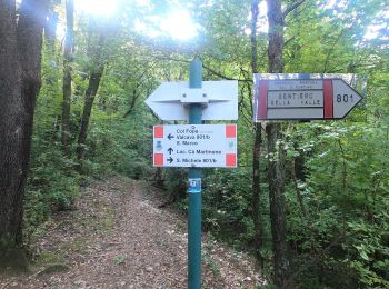
![Randonnée A pied Carenno - Sentiero 819: Carenno - Torre de' Busi - Photo](https://media.geolcdn.com/t/350/260/75f4d701-adad-4597-b2c8-0e35f23cd501.jpeg&format=jpg&maxdim=2)
![A pied A pied](https://static1.geolcdn.com/sitytour/trail-icons/100.png)
Km
A pied
![](/images/other/stat-length.png)
![](https://static1.geolcdn.com/siteimages/upload/files/1508320355ic_sort_den_pos_24dp.png)
![](https://static1.geolcdn.com/siteimages/upload/files/1508320355ic_sort_den_neg_24dp.png)
![](https://static1.geolcdn.com/siteimages/upload/files/16400158638029165_repeat_loop_refresh_sync_direction_icon.png)
• Randonnée créée par Comunità Montana Valle San Martino.
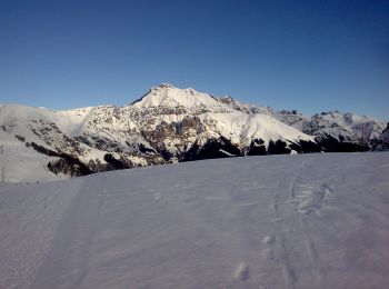
![Randonnée A pied Moggio - Traversata Artavaggio - Bobbio - Photo](https://media.geolcdn.com/t/350/260/09d510e2-f6ad-4996-b599-3605221ca888.jpeg&format=jpg&maxdim=2)
![A pied A pied](https://static1.geolcdn.com/sitytour/trail-icons/100.png)
Km
A pied
![](/images/other/stat-length.png)
![](https://static1.geolcdn.com/siteimages/upload/files/1508320355ic_sort_den_pos_24dp.png)
![](https://static1.geolcdn.com/siteimages/upload/files/1508320355ic_sort_den_neg_24dp.png)
![](https://static1.geolcdn.com/siteimages/upload/files/16400158638029165_repeat_loop_refresh_sync_direction_icon.png)
• Randonnée créée par Comunità montana della Valsassina, Valvarrone, Val d'Esino e Riviera. Symbole: red-white bars wi...
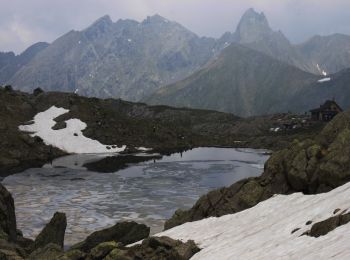
![Randonnée A pied Barzio - Sentiero delle Orobie Occidentali - Tappa 2 - Photo](https://media.geolcdn.com/t/350/260/62425f4a-83c8-4010-b4fe-ebd01c1857b6.jpeg&format=jpg&maxdim=2)
![A pied A pied](https://static1.geolcdn.com/sitytour/trail-icons/100.png)
Km
A pied
![](/images/other/stat-length.png)
![](https://static1.geolcdn.com/siteimages/upload/files/1508320355ic_sort_den_pos_24dp.png)
![](https://static1.geolcdn.com/siteimages/upload/files/1508320355ic_sort_den_neg_24dp.png)
![](https://static1.geolcdn.com/siteimages/upload/files/16400158638029165_repeat_loop_refresh_sync_direction_icon.png)
• Randonnée créée par Club Alpino Italiano (sezioni di Bergamo). Symbole: red-white bars, sometimes with black text "1...
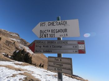
![Randonnée A pied Barzio - Sentiero degli stradini - Photo](https://media.geolcdn.com/t/350/260/5a6a4880-c1df-4055-a06f-5e2791a54330.jpeg&format=jpg&maxdim=2)
![A pied A pied](https://static1.geolcdn.com/sitytour/trail-icons/100.png)
Km
A pied
![](/images/other/stat-length.png)
![](https://static1.geolcdn.com/siteimages/upload/files/1508320355ic_sort_den_pos_24dp.png)
![](https://static1.geolcdn.com/siteimages/upload/files/1508320355ic_sort_den_neg_24dp.png)
![](https://static1.geolcdn.com/siteimages/upload/files/16400158638029165_repeat_loop_refresh_sync_direction_icon.png)
• Randonnée créée par Club Alpino Italiano.
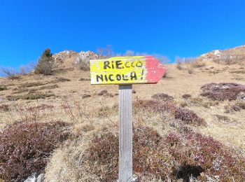
![Randonnée A pied Moggio - Sentiero del Vallone - Photo](https://media.geolcdn.com/t/350/260/43f11074-959b-404b-9e9e-33b262a80ce8.jpeg&format=jpg&maxdim=2)
![A pied A pied](https://static1.geolcdn.com/sitytour/trail-icons/100.png)
Km
A pied
![](/images/other/stat-length.png)
![](https://static1.geolcdn.com/siteimages/upload/files/1508320355ic_sort_den_pos_24dp.png)
![](https://static1.geolcdn.com/siteimages/upload/files/1508320355ic_sort_den_neg_24dp.png)
![](https://static1.geolcdn.com/siteimages/upload/files/16400158638029165_repeat_loop_refresh_sync_direction_icon.png)
• Randonnée créée par Comune di Moggio.
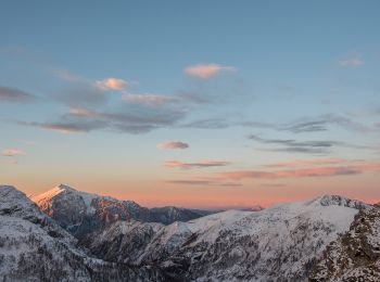
![Randonnée A pied Introbio - Introbio-Bocchetta di Agoredo-Rifugio Santa Rita - Photo](https://media.geolcdn.com/t/350/260/3aca67b8-5df0-4a67-933d-9e5b474a1d24.jpeg&format=jpg&maxdim=2)
![A pied A pied](https://static1.geolcdn.com/sitytour/trail-icons/100.png)
Km
A pied
![](/images/other/stat-length.png)
![](https://static1.geolcdn.com/siteimages/upload/files/1508320355ic_sort_den_pos_24dp.png)
![](https://static1.geolcdn.com/siteimages/upload/files/1508320355ic_sort_den_neg_24dp.png)
![](https://static1.geolcdn.com/siteimages/upload/files/16400158638029165_repeat_loop_refresh_sync_direction_icon.png)
• Club Alpino Italiano Sezione di SEREGNO
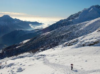
![Randonnée A pied Mandello del Lario - Traversata Alta delle Grigne - Photo](https://media.geolcdn.com/t/350/260/11177eda-b851-40ec-866f-92602503f3c4.jpeg&format=jpg&maxdim=2)
![A pied A pied](https://static1.geolcdn.com/sitytour/trail-icons/100.png)
Km
A pied
![](/images/other/stat-length.png)
![](https://static1.geolcdn.com/siteimages/upload/files/1508320355ic_sort_den_pos_24dp.png)
![](https://static1.geolcdn.com/siteimages/upload/files/1508320355ic_sort_den_neg_24dp.png)
![](https://static1.geolcdn.com/siteimages/upload/files/16400158638029165_repeat_loop_refresh_sync_direction_icon.png)
• Randonnée créée par Comunità montana Lario orientale.
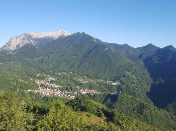
![Randonnée A pied Taceno - Tartavalle Terme-Parlasco-Passo Agueglio-Sasso di San Defendente - Photo](https://media.geolcdn.com/t/350/260/55645b49-90e7-4e56-bacb-b7500adf95c4.jpeg&format=jpg&maxdim=2)
![A pied A pied](https://static1.geolcdn.com/sitytour/trail-icons/100.png)
Km
A pied
![](/images/other/stat-length.png)
![](https://static1.geolcdn.com/siteimages/upload/files/1508320355ic_sort_den_pos_24dp.png)
![](https://static1.geolcdn.com/siteimages/upload/files/1508320355ic_sort_den_neg_24dp.png)
![](https://static1.geolcdn.com/siteimages/upload/files/16400158638029165_repeat_loop_refresh_sync_direction_icon.png)
• Club Alpino Italiano Sezione di SEREGNO
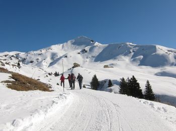
![Randonnée A pied Moggio - Sentiero Antichi Cippi Confinari - Photo](https://media.geolcdn.com/t/350/260/26d4af1d-bf34-4b3e-ba88-069511a4c80e.jpeg&format=jpg&maxdim=2)
![A pied A pied](https://static1.geolcdn.com/sitytour/trail-icons/100.png)
Km
A pied
![](/images/other/stat-length.png)
![](https://static1.geolcdn.com/siteimages/upload/files/1508320355ic_sort_den_pos_24dp.png)
![](https://static1.geolcdn.com/siteimages/upload/files/1508320355ic_sort_den_neg_24dp.png)
![](https://static1.geolcdn.com/siteimages/upload/files/16400158638029165_repeat_loop_refresh_sync_direction_icon.png)
• Club Alpino Italiano Sezione di SEREGNO
![Randonnée A pied Carenno - Sentiero 801D: Convento del Pertus - Erve - Photo](https://media.geolcdn.com/t/350/260/3e10b426-148b-4fde-88cc-6904e8efdfd2.jpeg&format=jpg&maxdim=2)
![A pied A pied](https://static1.geolcdn.com/sitytour/trail-icons/100.png)
Km
A pied
![](/images/other/stat-length.png)
![](https://static1.geolcdn.com/siteimages/upload/files/1508320355ic_sort_den_pos_24dp.png)
![](https://static1.geolcdn.com/siteimages/upload/files/1508320355ic_sort_den_neg_24dp.png)
![](https://static1.geolcdn.com/siteimages/upload/files/16400158638029165_repeat_loop_refresh_sync_direction_icon.png)
• Dal Convento del Pertüs si scende per un paio di tornanti sulla strada bianca per poi imboccare, a destra in prossimi...
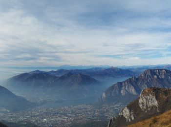
![Randonnée A pied Erve - Variante per Prá di Rat - Photo](https://media.geolcdn.com/t/350/260/b3ff494c-2581-4b0a-a6cd-25ad3d352528.jpeg&format=jpg&maxdim=2)
![A pied A pied](https://static1.geolcdn.com/sitytour/trail-icons/100.png)
Km
A pied
![](/images/other/stat-length.png)
![](https://static1.geolcdn.com/siteimages/upload/files/1508320355ic_sort_den_pos_24dp.png)
![](https://static1.geolcdn.com/siteimages/upload/files/1508320355ic_sort_den_neg_24dp.png)
![](https://static1.geolcdn.com/siteimages/upload/files/16400158638029165_repeat_loop_refresh_sync_direction_icon.png)
• Randonnée créée par CAI Monza. Symbole: red-white-yellow vertical bars with the black text "11"
![Randonnée A pied Esino Lario - (SI D12S) Alpe Cainallo - Rifugio Luigi Brioschi - Photo](https://media.geolcdn.com/t/350/260/11177eda-b851-40ec-866f-92602503f3c4.jpeg&format=jpg&maxdim=2)
![A pied A pied](https://static1.geolcdn.com/sitytour/trail-icons/100.png)
Km
A pied
![](/images/other/stat-length.png)
![](https://static1.geolcdn.com/siteimages/upload/files/1508320355ic_sort_den_pos_24dp.png)
![](https://static1.geolcdn.com/siteimages/upload/files/1508320355ic_sort_den_neg_24dp.png)
![](https://static1.geolcdn.com/siteimages/upload/files/16400158638029165_repeat_loop_refresh_sync_direction_icon.png)
• Sentiero Italia CAI 2019
![Randonnée A pied Pasturo - (SI D13S) Rifugio Luigi Brioschi - Pasturo - Photo](https://media.geolcdn.com/t/350/260/7321d799-4132-4e6e-b73d-c6a90ea1fe9a.jpeg&format=jpg&maxdim=2)
![A pied A pied](https://static1.geolcdn.com/sitytour/trail-icons/100.png)
Km
A pied
![](/images/other/stat-length.png)
![](https://static1.geolcdn.com/siteimages/upload/files/1508320355ic_sort_den_pos_24dp.png)
![](https://static1.geolcdn.com/siteimages/upload/files/1508320355ic_sort_den_neg_24dp.png)
![](https://static1.geolcdn.com/siteimages/upload/files/16400158638029165_repeat_loop_refresh_sync_direction_icon.png)
• Sentiero Italia CAI 2019
![Randonnée A pied Moggio - Sentiero del Canale di Bürei - Photo](https://media.geolcdn.com/t/350/260/d173a5fe-87eb-403f-9d91-cc95861c0a64.jpeg&format=jpg&maxdim=2)
![A pied A pied](https://static1.geolcdn.com/sitytour/trail-icons/100.png)
Km
A pied
![](/images/other/stat-length.png)
![](https://static1.geolcdn.com/siteimages/upload/files/1508320355ic_sort_den_pos_24dp.png)
![](https://static1.geolcdn.com/siteimages/upload/files/1508320355ic_sort_den_neg_24dp.png)
![](https://static1.geolcdn.com/siteimages/upload/files/16400158638029165_repeat_loop_refresh_sync_direction_icon.png)
• Randonnée créée par Comune di Moggio.
20 randonnées affichées sur 100
Application GPS de randonnée GRATUITE
Activités
Régions proches
- Abbadia Lariana
- Ballabio
- Barzio
- Bellano
- Calolziocorte
- Carenno
- Casargo
- Cassina Valsassina
- Civate
- Colico
- Cremeno
- Dervio
- Erve
- Esino Lario
- Galbiate
- Imbersago
- Introbio
- La Valletta Brianza
- Lecco
- Lierna
- Mandello del Lario
- Merate
- Missaglia
- Moggio
- Montevecchia
- Morterone
- Pasturo
- Perledo
- Premana
- Primaluna
- Sirtori
- Sueglio
- Taceno
- Valgreghentino
- Valmadrera
- Valvarrone
- Varenna
- Vercurago