![](/images/other/stat-length.png)
- Randonnées
- A pied
- Italie
- Piémont
- Verbano-Cusio-Ossola
- Valle Cannobina
Valle Cannobina, Verbano-Cusio-Ossola, A pied : Les meilleures randonnées, itinéraires, parcours, balades et promenades
Valle Cannobina : découvrez les meilleures randonnées : 13 a pied. Tous ces circuits, parcours, itinéraires et activités en plein air sont disponibles dans nos applications SityTrail pour smartphones et tablettes.
Les meilleurs parcours (13)
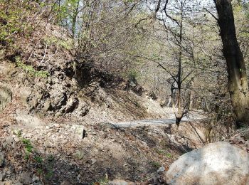
![Randonnée A pied Valle Cannobina - S14 Orasso - Alpe Pluni - Photo](https://media.geolcdn.com/t/350/260/24813fe8-9111-4743-a174-26a6650cfdde.jpeg&format=jpg&maxdim=2)
![A pied A pied](https://static1.geolcdn.com/sitytour/trail-icons/100.png)
Km
A pied
![](/images/other/stat-length.png)
![](https://static1.geolcdn.com/siteimages/upload/files/1508320355ic_sort_den_pos_24dp.png)
![](https://static1.geolcdn.com/siteimages/upload/files/1508320355ic_sort_den_neg_24dp.png)
![](https://static1.geolcdn.com/siteimages/upload/files/16400158638029165_repeat_loop_refresh_sync_direction_icon.png)
• Club Alpino Italiano Sezioni Est Monte Rosa - Associazione delle Sezioni del Club Alpino Italiano delle Province del ...
![Randonnée A pied Valle Cannobina - S10 Cavaglio - Le Biuse - Monte Limidario - Photo](https://media.geolcdn.com/t/350/260/4a40a993-db7d-4f7c-baa9-17bb88e3b159.jpeg&format=jpg&maxdim=2)
![A pied A pied](https://static1.geolcdn.com/sitytour/trail-icons/100.png)
Km
A pied
![](/images/other/stat-length.png)
![](https://static1.geolcdn.com/siteimages/upload/files/1508320355ic_sort_den_pos_24dp.png)
![](https://static1.geolcdn.com/siteimages/upload/files/1508320355ic_sort_den_neg_24dp.png)
![](https://static1.geolcdn.com/siteimages/upload/files/16400158638029165_repeat_loop_refresh_sync_direction_icon.png)
• Club Alpino Italiano Sezioni Est Monte Rosa - Associazione delle Sezioni del Club Alpino Italiano delle Province del ...
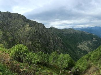
![Randonnée A pied Valle Cannobina - (SI E69) Falmenta - Cannobio - Photo](https://media.geolcdn.com/t/350/260/5bb46d64-a51d-4a3c-9920-e35948dac1f4.jpeg&format=jpg&maxdim=2)
![A pied A pied](https://static1.geolcdn.com/sitytour/trail-icons/100.png)
Km
A pied
![](/images/other/stat-length.png)
![](https://static1.geolcdn.com/siteimages/upload/files/1508320355ic_sort_den_pos_24dp.png)
![](https://static1.geolcdn.com/siteimages/upload/files/1508320355ic_sort_den_neg_24dp.png)
![](https://static1.geolcdn.com/siteimages/upload/files/16400158638029165_repeat_loop_refresh_sync_direction_icon.png)
• Sentiero Italia CAI 2019
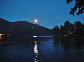
![Randonnée A pied Valle Cannobina - X11 - Bta di Terza - Bta di Campo - Photo](https://media.geolcdn.com/t/350/260/278c2e5f-9441-487f-a17c-ff6bec808e5c.jpeg&format=jpg&maxdim=2)
![A pied A pied](https://static1.geolcdn.com/sitytour/trail-icons/100.png)
Km
A pied
![](/images/other/stat-length.png)
![](https://static1.geolcdn.com/siteimages/upload/files/1508320355ic_sort_den_pos_24dp.png)
![](https://static1.geolcdn.com/siteimages/upload/files/1508320355ic_sort_den_neg_24dp.png)
![](https://static1.geolcdn.com/siteimages/upload/files/16400158638029165_repeat_loop_refresh_sync_direction_icon.png)
• attention: steep and exposed paths, sometimes sharp ridges. Relation with photos (click on → Web site) mantained by D...
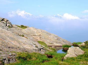
![Randonnée A pied Valle Cannobina - X11 - Sentiero BOVE tratto da Bta di Terza a Bta di Campo - Photo](https://media.geolcdn.com/t/350/260/278c2e5f-9441-487f-a17c-ff6bec808e5c.jpeg&format=jpg&maxdim=2)
![A pied A pied](https://static1.geolcdn.com/sitytour/trail-icons/100.png)
Km
A pied
![](/images/other/stat-length.png)
![](https://static1.geolcdn.com/siteimages/upload/files/1508320355ic_sort_den_pos_24dp.png)
![](https://static1.geolcdn.com/siteimages/upload/files/1508320355ic_sort_den_neg_24dp.png)
![](https://static1.geolcdn.com/siteimages/upload/files/16400158638029165_repeat_loop_refresh_sync_direction_icon.png)
• attention: steep and exposed paths, sometimes sharp ridges. Relation with photos (click on → Web site) mantained by D...
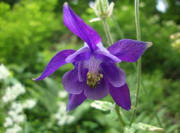
![Randonnée A pied Valle Cannobina - S19 Falmenta - Alpe Fornà - Piè di Zeda - Photo](https://media.geolcdn.com/t/350/260/0cec7fea-08b8-4afb-9c4e-fb068e35c42a.jpeg&format=jpg&maxdim=2)
![A pied A pied](https://static1.geolcdn.com/sitytour/trail-icons/100.png)
Km
A pied
![](/images/other/stat-length.png)
![](https://static1.geolcdn.com/siteimages/upload/files/1508320355ic_sort_den_pos_24dp.png)
![](https://static1.geolcdn.com/siteimages/upload/files/1508320355ic_sort_den_neg_24dp.png)
![](https://static1.geolcdn.com/siteimages/upload/files/16400158638029165_repeat_loop_refresh_sync_direction_icon.png)
• Report maintained by path detectors CAI SOSEC Piemonte - MT RC Symbole: white red flag
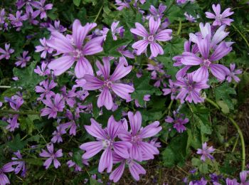
![Randonnée A pied Valle Cannobina - S16 Cursolo - Alpe Pluni - Photo](https://media.geolcdn.com/t/350/260/5f1d659e-c617-4bba-b8b7-e146c03b27d3.jpeg&format=jpg&maxdim=2)
![A pied A pied](https://static1.geolcdn.com/sitytour/trail-icons/100.png)
Km
A pied
![](/images/other/stat-length.png)
![](https://static1.geolcdn.com/siteimages/upload/files/1508320355ic_sort_den_pos_24dp.png)
![](https://static1.geolcdn.com/siteimages/upload/files/1508320355ic_sort_den_neg_24dp.png)
![](https://static1.geolcdn.com/siteimages/upload/files/16400158638029165_repeat_loop_refresh_sync_direction_icon.png)
• Symbole: white red flag
![Randonnée A pied Valle Cannobina - S08 Cavaglio - Monte Giove - Photo](https://media.geolcdn.com/t/350/260/3c264ff5-359f-4e02-a234-f1a30cccdf14.jpeg&format=jpg&maxdim=2)
![A pied A pied](https://static1.geolcdn.com/sitytour/trail-icons/100.png)
Km
A pied
![](/images/other/stat-length.png)
![](https://static1.geolcdn.com/siteimages/upload/files/1508320355ic_sort_den_pos_24dp.png)
![](https://static1.geolcdn.com/siteimages/upload/files/1508320355ic_sort_den_neg_24dp.png)
![](https://static1.geolcdn.com/siteimages/upload/files/16400158638029165_repeat_loop_refresh_sync_direction_icon.png)
• Symbole: white red flag
![Randonnée A pied Valle Cannobina - S12 Orasso - Bugnago - Spoccia - Photo](https://media.geolcdn.com/t/350/260/24813fe8-9111-4743-a174-26a6650cfdde.jpeg&format=jpg&maxdim=2)
![A pied A pied](https://static1.geolcdn.com/sitytour/trail-icons/100.png)
Km
A pied
![](/images/other/stat-length.png)
![](https://static1.geolcdn.com/siteimages/upload/files/1508320355ic_sort_den_pos_24dp.png)
![](https://static1.geolcdn.com/siteimages/upload/files/1508320355ic_sort_den_neg_24dp.png)
![](https://static1.geolcdn.com/siteimages/upload/files/16400158638029165_repeat_loop_refresh_sync_direction_icon.png)
• Club Alpino Italiano Sezioni Est Monte Rosa - Associazione delle Sezioni del Club Alpino Italiano delle Province del ...
![Randonnée A pied Valle Cannobina - S17 Falmenta - Cresta est Monte Vadà bivio R19 - Photo](https://media.geolcdn.com/t/350/260/ext.jpg?maxdim=2&url=https%3A%2F%2Fstatic1.geolcdn.com%2Fsiteimages%2Fupload%2Ffiles%2F1545311037marcheuse_200dpi.jpg)
![A pied A pied](https://static1.geolcdn.com/sitytour/trail-icons/100.png)
Km
A pied
![](/images/other/stat-length.png)
![](https://static1.geolcdn.com/siteimages/upload/files/1508320355ic_sort_den_pos_24dp.png)
![](https://static1.geolcdn.com/siteimages/upload/files/1508320355ic_sort_den_neg_24dp.png)
![](https://static1.geolcdn.com/siteimages/upload/files/16400158638029165_repeat_loop_refresh_sync_direction_icon.png)
• Report maintained by path detectors CAI SOSEC Piemonte - MT RC Symbole: white red flag
![Randonnée A pied Valle Cannobina - S10b Spoccia bivio S12 - Catta Margugna - Photo](https://media.geolcdn.com/t/350/260/ext.jpg?maxdim=2&url=https%3A%2F%2Fstatic1.geolcdn.com%2Fsiteimages%2Fupload%2Ffiles%2F1545311037marcheuse_200dpi.jpg)
![A pied A pied](https://static1.geolcdn.com/sitytour/trail-icons/100.png)
Km
A pied
![](/images/other/stat-length.png)
![](https://static1.geolcdn.com/siteimages/upload/files/1508320355ic_sort_den_pos_24dp.png)
![](https://static1.geolcdn.com/siteimages/upload/files/1508320355ic_sort_den_neg_24dp.png)
![](https://static1.geolcdn.com/siteimages/upload/files/16400158638029165_repeat_loop_refresh_sync_direction_icon.png)
• Club Alpino Italiano Sezioni Est Monte Rosa - Associazione delle Sezioni del Club Alpino Italiano delle Province del ...
![Randonnée A pied Valle Cannobina - S15 Crealla - Passo Folungo - Photo](https://media.geolcdn.com/t/350/260/ext.jpg?maxdim=2&url=https%3A%2F%2Fstatic1.geolcdn.com%2Fsiteimages%2Fupload%2Ffiles%2F1545311037marcheuse_200dpi.jpg)
![A pied A pied](https://static1.geolcdn.com/sitytour/trail-icons/100.png)
Km
A pied
![](/images/other/stat-length.png)
![](https://static1.geolcdn.com/siteimages/upload/files/1508320355ic_sort_den_pos_24dp.png)
![](https://static1.geolcdn.com/siteimages/upload/files/1508320355ic_sort_den_neg_24dp.png)
![](https://static1.geolcdn.com/siteimages/upload/files/16400158638029165_repeat_loop_refresh_sync_direction_icon.png)
• Club Alpino Italiano Sezioni Est Monte Rosa - Associazione delle Sezioni del Club Alpino Italiano delle Province del ...
![Randonnée A pied Valle Cannobina - P12 - Pogallo - Bocchetta di Terza - Photo](https://media.geolcdn.com/t/350/260/ext.jpg?maxdim=2&url=https%3A%2F%2Fstatic1.geolcdn.com%2Fsiteimages%2Fupload%2Ffiles%2F1545311037marcheuse_200dpi.jpg)
![A pied A pied](https://static1.geolcdn.com/sitytour/trail-icons/100.png)
Km
A pied
![](/images/other/stat-length.png)
![](https://static1.geolcdn.com/siteimages/upload/files/1508320355ic_sort_den_pos_24dp.png)
![](https://static1.geolcdn.com/siteimages/upload/files/1508320355ic_sort_den_neg_24dp.png)
![](https://static1.geolcdn.com/siteimages/upload/files/16400158638029165_repeat_loop_refresh_sync_direction_icon.png)
• Relation with photos (click on → Web site) mantained by Danilo (CAI Pallanza) Symbole: some red and white marks
13 randonnées affichées sur 13
Application GPS de randonnée GRATUITE