![](/images/other/stat-length.png)
- Randonnées
- A pied
- Italie
- Piémont
- Alexandrie
Alexandrie, Piémont, A pied : Les meilleures randonnées, itinéraires, parcours, balades et promenades
Alexandrie : découvrez les meilleures randonnées : 70 a pied et 1 marche. Tous ces circuits, parcours, itinéraires et activités en plein air sont disponibles dans nos applications SityTrail pour smartphones et tablettes.
Les meilleurs parcours (71)
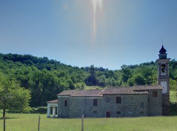
![Randonnée A pied Garbagna - Anello S.Vito - Photo](https://media.geolcdn.com/t/350/260/d09585c9-ae34-4d79-80fe-022d22cfe01a.jpeg&format=jpg&maxdim=2)
![A pied A pied](https://static1.geolcdn.com/sitytour/trail-icons/100.png)
Km
A pied
![](/images/other/stat-length.png)
![](https://static1.geolcdn.com/siteimages/upload/files/1508320355ic_sort_den_pos_24dp.png)
![](https://static1.geolcdn.com/siteimages/upload/files/1508320355ic_sort_den_neg_24dp.png)
![](https://static1.geolcdn.com/siteimages/upload/files/16400158638029165_repeat_loop_refresh_sync_direction_icon.png)
• Symbole: 139 on white ref flag
![Randonnée A pied Bistagno - Anello di Bistagno - Photo](https://media.geolcdn.com/t/350/260/fac81ddb-3d1c-4690-a227-f520fd9ca6bb.jpeg&format=jpg&maxdim=2)
![A pied A pied](https://static1.geolcdn.com/sitytour/trail-icons/100.png)
Km
A pied
![](/images/other/stat-length.png)
![](https://static1.geolcdn.com/siteimages/upload/files/1508320355ic_sort_den_pos_24dp.png)
![](https://static1.geolcdn.com/siteimages/upload/files/1508320355ic_sort_den_neg_24dp.png)
![](https://static1.geolcdn.com/siteimages/upload/files/16400158638029165_repeat_loop_refresh_sync_direction_icon.png)
• relation mantained by mogliasi Symbole: 500 on white red flag
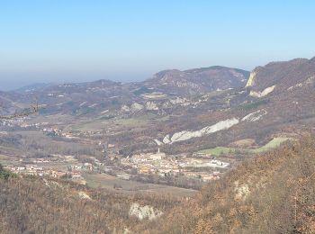
![Randonnée A pied Gremiasco - IT-3 - Photo](https://media.geolcdn.com/t/350/260/7f84eb22-2ff6-4e75-8384-d61b8410d0d9.jpeg&format=jpg&maxdim=2)
![A pied A pied](https://static1.geolcdn.com/sitytour/trail-icons/100.png)
Km
A pied
![](/images/other/stat-length.png)
![](https://static1.geolcdn.com/siteimages/upload/files/1508320355ic_sort_den_pos_24dp.png)
![](https://static1.geolcdn.com/siteimages/upload/files/1508320355ic_sort_den_neg_24dp.png)
![](https://static1.geolcdn.com/siteimages/upload/files/16400158638029165_repeat_loop_refresh_sync_direction_icon.png)
• Site web: https://www.cmop.movimentolento.it/
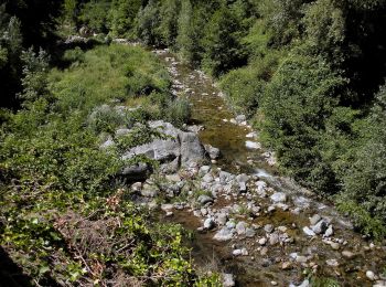
![Randonnée A pied Voltaggio - Isoverde - Monte delle Figne - Casa Carrosina - Photo](https://media.geolcdn.com/t/350/260/5c82e8f9-0370-435c-98b6-c72ef6c211eb.jpeg&format=jpg&maxdim=2)
![A pied A pied](https://static1.geolcdn.com/sitytour/trail-icons/100.png)
Km
A pied
![](/images/other/stat-length.png)
![](https://static1.geolcdn.com/siteimages/upload/files/1508320355ic_sort_den_pos_24dp.png)
![](https://static1.geolcdn.com/siteimages/upload/files/1508320355ic_sort_den_neg_24dp.png)
![](https://static1.geolcdn.com/siteimages/upload/files/16400158638029165_repeat_loop_refresh_sync_direction_icon.png)
• Symbole: 2 red cross
![Randonnée A pied Cabella Ligure - Dovanelli – San Fermo - Photo](https://media.geolcdn.com/t/350/260/8052c8c9-118e-46a2-94a8-0f9e967aba15.jpeg&format=jpg&maxdim=2)
![A pied A pied](https://static1.geolcdn.com/sitytour/trail-icons/100.png)
Km
A pied
![](/images/other/stat-length.png)
![](https://static1.geolcdn.com/siteimages/upload/files/1508320355ic_sort_den_pos_24dp.png)
![](https://static1.geolcdn.com/siteimages/upload/files/1508320355ic_sort_den_neg_24dp.png)
![](https://static1.geolcdn.com/siteimages/upload/files/16400158638029165_repeat_loop_refresh_sync_direction_icon.png)
• Symbole: 258 on white ref flag
![Randonnée A pied Cabella Ligure - Pian Degli Orsi – Bivio Sentiero 258 - Photo](https://media.geolcdn.com/t/350/260/8052c8c9-118e-46a2-94a8-0f9e967aba15.jpeg&format=jpg&maxdim=2)
![A pied A pied](https://static1.geolcdn.com/sitytour/trail-icons/100.png)
Km
A pied
![](/images/other/stat-length.png)
![](https://static1.geolcdn.com/siteimages/upload/files/1508320355ic_sort_den_pos_24dp.png)
![](https://static1.geolcdn.com/siteimages/upload/files/1508320355ic_sort_den_neg_24dp.png)
![](https://static1.geolcdn.com/siteimages/upload/files/16400158638029165_repeat_loop_refresh_sync_direction_icon.png)
• Symbole: 257 on white ref flag
![Randonnée A pied Grondona - Grondona – Lemmi – Costa dei Gatti - Photo](https://media.geolcdn.com/t/350/260/d7908a5e-d97c-4342-912a-a6c582d47643.jpeg&format=jpg&maxdim=2)
![A pied A pied](https://static1.geolcdn.com/sitytour/trail-icons/100.png)
Km
A pied
![](/images/other/stat-length.png)
![](https://static1.geolcdn.com/siteimages/upload/files/1508320355ic_sort_den_pos_24dp.png)
![](https://static1.geolcdn.com/siteimages/upload/files/1508320355ic_sort_den_neg_24dp.png)
![](https://static1.geolcdn.com/siteimages/upload/files/16400158638029165_repeat_loop_refresh_sync_direction_icon.png)
• Symbole: 271 on white ref flag
![Randonnée A pied Carrega Ligure - Cosola - Daglio - Photo](https://media.geolcdn.com/t/350/260/34bdc50c-9227-4cb1-8eb0-d9cb2a3c743a.jpeg&format=jpg&maxdim=2)
![A pied A pied](https://static1.geolcdn.com/sitytour/trail-icons/100.png)
Km
A pied
![](/images/other/stat-length.png)
![](https://static1.geolcdn.com/siteimages/upload/files/1508320355ic_sort_den_pos_24dp.png)
![](https://static1.geolcdn.com/siteimages/upload/files/1508320355ic_sort_den_neg_24dp.png)
![](https://static1.geolcdn.com/siteimages/upload/files/16400158638029165_repeat_loop_refresh_sync_direction_icon.png)
• Symbole: 229 on white ref flag
![Randonnée A pied Cantalupo Ligure - Cantalupo Ligure – Monte Giarolo - Photo](https://media.geolcdn.com/t/350/260/c71f4eae-05b3-4fe0-abf7-db47654785e4.jpeg&format=jpg&maxdim=2)
![A pied A pied](https://static1.geolcdn.com/sitytour/trail-icons/100.png)
Km
A pied
![](/images/other/stat-length.png)
![](https://static1.geolcdn.com/siteimages/upload/files/1508320355ic_sort_den_pos_24dp.png)
![](https://static1.geolcdn.com/siteimages/upload/files/1508320355ic_sort_den_neg_24dp.png)
![](https://static1.geolcdn.com/siteimages/upload/files/16400158638029165_repeat_loop_refresh_sync_direction_icon.png)
• Symbole: 210 on white ref flag
![Randonnée A pied Borghetto di Borbera - Strette Di Pertuso - M.Te Barillaro - Photo](https://media.geolcdn.com/t/350/260/734dee07-da51-40cd-9d02-faea82f275b6.jpeg&format=jpg&maxdim=2)
![A pied A pied](https://static1.geolcdn.com/sitytour/trail-icons/100.png)
Km
A pied
![](/images/other/stat-length.png)
![](https://static1.geolcdn.com/siteimages/upload/files/1508320355ic_sort_den_pos_24dp.png)
![](https://static1.geolcdn.com/siteimages/upload/files/1508320355ic_sort_den_neg_24dp.png)
![](https://static1.geolcdn.com/siteimages/upload/files/16400158638029165_repeat_loop_refresh_sync_direction_icon.png)
• Symbole: 208 on white ref flag
![Randonnée A pied Mongiardino Ligure - Anello Borbera Spinti - 10° Tappa Costa Salata Mongiardino - Borassi - Photo](https://media.geolcdn.com/t/350/260/211f9935-a69c-44ed-a888-6c3507f8c2e5.jpeg&format=jpg&maxdim=2)
![A pied A pied](https://static1.geolcdn.com/sitytour/trail-icons/100.png)
Km
A pied
![](/images/other/stat-length.png)
![](https://static1.geolcdn.com/siteimages/upload/files/1508320355ic_sort_den_pos_24dp.png)
![](https://static1.geolcdn.com/siteimages/upload/files/1508320355ic_sort_den_neg_24dp.png)
![](https://static1.geolcdn.com/siteimages/upload/files/16400158638029165_repeat_loop_refresh_sync_direction_icon.png)
• Symbole: 200 on white ref flag
![Randonnée A pied Mongiardino Ligure - Anello Borbera - Spinti 9° Tappa Costa Salata Mongiardino - San Fermo - Photo](https://media.geolcdn.com/t/350/260/42e7f1dd-e838-47c3-a544-f3ff67b5942f.jpeg&format=jpg&maxdim=2)
![A pied A pied](https://static1.geolcdn.com/sitytour/trail-icons/100.png)
Km
A pied
![](/images/other/stat-length.png)
![](https://static1.geolcdn.com/siteimages/upload/files/1508320355ic_sort_den_pos_24dp.png)
![](https://static1.geolcdn.com/siteimages/upload/files/1508320355ic_sort_den_neg_24dp.png)
![](https://static1.geolcdn.com/siteimages/upload/files/16400158638029165_repeat_loop_refresh_sync_direction_icon.png)
• Symbole: 200 on white ref flag
![Randonnée A pied Mongiardino Ligure - Anello Borbera - Spinti 8° Tappa S. Fermo – Monte Antola - Photo](https://media.geolcdn.com/t/350/260/8052c8c9-118e-46a2-94a8-0f9e967aba15.jpeg&format=jpg&maxdim=2)
![A pied A pied](https://static1.geolcdn.com/sitytour/trail-icons/100.png)
Km
A pied
![](/images/other/stat-length.png)
![](https://static1.geolcdn.com/siteimages/upload/files/1508320355ic_sort_den_pos_24dp.png)
![](https://static1.geolcdn.com/siteimages/upload/files/1508320355ic_sort_den_neg_24dp.png)
![](https://static1.geolcdn.com/siteimages/upload/files/16400158638029165_repeat_loop_refresh_sync_direction_icon.png)
• Symbole: 200 on white ref flag
![Randonnée A pied Carrega Ligure - Anello Borbera - Spinti 7° Tappa Capanne di Carrega – Monte Antola - Photo](https://media.geolcdn.com/t/350/260/7b74851a-8b56-42a8-8b5f-395c6a9b439f.jpeg&format=jpg&maxdim=2)
![A pied A pied](https://static1.geolcdn.com/sitytour/trail-icons/100.png)
Km
A pied
![](/images/other/stat-length.png)
![](https://static1.geolcdn.com/siteimages/upload/files/1508320355ic_sort_den_pos_24dp.png)
![](https://static1.geolcdn.com/siteimages/upload/files/1508320355ic_sort_den_neg_24dp.png)
![](https://static1.geolcdn.com/siteimages/upload/files/16400158638029165_repeat_loop_refresh_sync_direction_icon.png)
• Symbole: 200 on white ref flag
![Randonnée A pied Cabella Ligure - Anello Borbera - Spinti 6° Tappa Capanne di Cosola - Capanne di Carrega - Photo](https://media.geolcdn.com/t/350/260/0e042d61-446b-491e-9a8a-6c5a3f4769b3.jpeg&format=jpg&maxdim=2)
![A pied A pied](https://static1.geolcdn.com/sitytour/trail-icons/100.png)
Km
A pied
![](/images/other/stat-length.png)
![](https://static1.geolcdn.com/siteimages/upload/files/1508320355ic_sort_den_pos_24dp.png)
![](https://static1.geolcdn.com/siteimages/upload/files/1508320355ic_sort_den_neg_24dp.png)
![](https://static1.geolcdn.com/siteimages/upload/files/16400158638029165_repeat_loop_refresh_sync_direction_icon.png)
• Symbole: 200 on white ref flag
![Randonnée A pied Cabella Ligure - Anello Borbera - Spinti 5° Tappa Capanne Di Cosola - Monte Giarolo - Photo](https://media.geolcdn.com/t/350/260/1d7b19a6-43f9-4b49-abc1-b97adf072b54.jpeg&format=jpg&maxdim=2)
![A pied A pied](https://static1.geolcdn.com/sitytour/trail-icons/100.png)
Km
A pied
![](/images/other/stat-length.png)
![](https://static1.geolcdn.com/siteimages/upload/files/1508320355ic_sort_den_pos_24dp.png)
![](https://static1.geolcdn.com/siteimages/upload/files/1508320355ic_sort_den_neg_24dp.png)
![](https://static1.geolcdn.com/siteimages/upload/files/16400158638029165_repeat_loop_refresh_sync_direction_icon.png)
• Symbole: 200 on white ref flag
![Randonnée A pied Cantalupo Ligure - Anello Borbera - Spinti 4° Tappa Forcella Sud M. Barillaro – M. Giarolo - Photo](https://media.geolcdn.com/t/350/260/c71f4eae-05b3-4fe0-abf7-db47654785e4.jpeg&format=jpg&maxdim=2)
![A pied A pied](https://static1.geolcdn.com/sitytour/trail-icons/100.png)
Km
A pied
![](/images/other/stat-length.png)
![](https://static1.geolcdn.com/siteimages/upload/files/1508320355ic_sort_den_pos_24dp.png)
![](https://static1.geolcdn.com/siteimages/upload/files/1508320355ic_sort_den_neg_24dp.png)
![](https://static1.geolcdn.com/siteimages/upload/files/16400158638029165_repeat_loop_refresh_sync_direction_icon.png)
• Symbole: 200 on white ref flag
![Randonnée A pied Stazzano - Anello Borbera - Spinti 2° Tappa Ca del Bello – Molo Borbera - Photo](https://media.geolcdn.com/t/350/260/2eb6db9f-7065-4f9c-a06b-9d85611e7c83.jpeg&format=jpg&maxdim=2)
![A pied A pied](https://static1.geolcdn.com/sitytour/trail-icons/100.png)
Km
A pied
![](/images/other/stat-length.png)
![](https://static1.geolcdn.com/siteimages/upload/files/1508320355ic_sort_den_pos_24dp.png)
![](https://static1.geolcdn.com/siteimages/upload/files/1508320355ic_sort_den_neg_24dp.png)
![](https://static1.geolcdn.com/siteimages/upload/files/16400158638029165_repeat_loop_refresh_sync_direction_icon.png)
• Symbole: 200 on white ref flag
![Randonnée A pied Stazzano - Anello Borbera - Spinti 1° Tappa Stazzano – Ca’ del Bello - Photo](https://media.geolcdn.com/t/350/260/b05ed7cd-463a-451c-bc8e-4a9ddb9e4271.jpeg&format=jpg&maxdim=2)
![A pied A pied](https://static1.geolcdn.com/sitytour/trail-icons/100.png)
Km
A pied
![](/images/other/stat-length.png)
![](https://static1.geolcdn.com/siteimages/upload/files/1508320355ic_sort_den_pos_24dp.png)
![](https://static1.geolcdn.com/siteimages/upload/files/1508320355ic_sort_den_neg_24dp.png)
![](https://static1.geolcdn.com/siteimages/upload/files/16400158638029165_repeat_loop_refresh_sync_direction_icon.png)
• Symbole: 200 on white ref flag
![Randonnée A pied Pozzol Groppo - Anello del Monte Brienzone - Photo](https://media.geolcdn.com/t/350/260/6d089d3d-a334-47bc-9521-4b7957d86a24.jpeg&format=jpg&maxdim=2)
![A pied A pied](https://static1.geolcdn.com/sitytour/trail-icons/100.png)
Km
A pied
![](/images/other/stat-length.png)
![](https://static1.geolcdn.com/siteimages/upload/files/1508320355ic_sort_den_pos_24dp.png)
![](https://static1.geolcdn.com/siteimages/upload/files/1508320355ic_sort_den_neg_24dp.png)
![](https://static1.geolcdn.com/siteimages/upload/files/16400158638029165_repeat_loop_refresh_sync_direction_icon.png)
• Symbole: 153 on white ref flag
20 randonnées affichées sur 71
Application GPS de randonnée GRATUITE
Activités
Régions proches
- Acqui Terme
- Albera Ligure
- Alexandrie
- Arquata Scrivia
- Belforte Monferrato
- Bistagno
- Borghetto di Borbera
- Bosio
- Cabella Ligure
- Cantalupo Ligure
- Capriata d'Orba
- Carrega Ligure
- Casaleggio Boiro
- Cassine
- Denice
- Fabbrica Curone
- Garbagna
- Gavi
- Gremiasco
- Grognardo
- Grondona
- Lerma
- Merana
- Molare
- Mongiardino Ligure
- Monleale
- Montechiaro d'Acqui
- Montemarzino
- Pecetto di Valenza
- Ponzone
- Pozzol Groppo
- Roccaforte Ligure
- Rocchetta Ligure
- Serralunga di Crea
- Stazzano
- Tagliolo Monferrato
- Villamiroglio
- Visone
- Volpedo
- Voltaggio