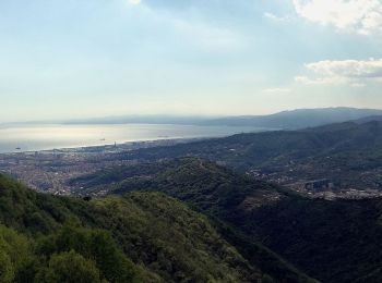
![](/images/other/stat-length.png)
- Randonnées
- A pied
- Italie
- Ligurie
- Gênes
Gênes, Ligurie, A pied : Les meilleures randonnées, itinéraires, parcours, balades et promenades
Gênes : découvrez les meilleures randonnées : 257 a pied, 25 marche et 1 trail. Tous ces circuits, parcours, itinéraires et activités en plein air sont disponibles dans nos applications SityTrail pour smartphones et tablettes.
Les meilleurs parcours (283)
![Randonnée A pied Camogli - sejour-cinque-terre-journee-3-la-presqu-ile-de-portofino - Photo](https://media.geolcdn.com/t/350/260/26390ebb-cd69-4489-8645-234a325fedd0.jpg&format=jpg&maxdim=2)
![A pied A pied](https://static1.geolcdn.com/sitytour/trail-icons/100.png)
Km
A pied
![](/images/other/stat-length.png)
![](https://static1.geolcdn.com/siteimages/upload/files/1508320355ic_sort_den_pos_24dp.png)
![](https://static1.geolcdn.com/siteimages/upload/files/1508320355ic_sort_den_neg_24dp.png)
![](https://static1.geolcdn.com/siteimages/upload/files/16400158638029165_repeat_loop_refresh_sync_direction_icon.png)
• Troisième journée du séjour Les cinque terre et le golf des poètes par Chemins du sud Randonnée hors des cinq terres...
![Randonnée A pied Santo Stefano d'Aveto - Rocca d'Aveto - Passo della Lepre - Strada Statale 654 - Passo del Chiodo - Photo](https://media.geolcdn.com/t/350/260/3d43f90b-cf8d-42ad-8c11-6a21735ff6bb.jpeg&format=jpg&maxdim=2)
![A pied A pied](https://static1.geolcdn.com/sitytour/trail-icons/100.png)
Km
A pied
![](/images/other/stat-length.png)
![](https://static1.geolcdn.com/siteimages/upload/files/1508320355ic_sort_den_pos_24dp.png)
![](https://static1.geolcdn.com/siteimages/upload/files/1508320355ic_sort_den_neg_24dp.png)
![](https://static1.geolcdn.com/siteimages/upload/files/16400158638029165_repeat_loop_refresh_sync_direction_icon.png)
• Symbole: 192 on white red flags
![Randonnée A pied Santo Stefano d'Aveto - Santo Stefano d'Aveto - Lago Riane - Monte Bue - Photo](https://media.geolcdn.com/t/350/260/2ff6b25d-557b-451e-a081-705464f6c595.jpeg&format=jpg&maxdim=2)
![A pied A pied](https://static1.geolcdn.com/sitytour/trail-icons/100.png)
Km
A pied
![](/images/other/stat-length.png)
![](https://static1.geolcdn.com/siteimages/upload/files/1508320355ic_sort_den_pos_24dp.png)
![](https://static1.geolcdn.com/siteimages/upload/files/1508320355ic_sort_den_neg_24dp.png)
![](https://static1.geolcdn.com/siteimages/upload/files/16400158638029165_repeat_loop_refresh_sync_direction_icon.png)
• Symbole: 190 on white red flags
![Randonnée A pied Santo Stefano d'Aveto - Flagello - Fontana Gelata - Monte Bue - Photo](https://media.geolcdn.com/t/350/260/ed3ed5c7-ec09-4f8d-8176-1958407cd72b.jpeg&format=jpg&maxdim=2)
![A pied A pied](https://static1.geolcdn.com/sitytour/trail-icons/100.png)
Km
A pied
![](/images/other/stat-length.png)
![](https://static1.geolcdn.com/siteimages/upload/files/1508320355ic_sort_den_pos_24dp.png)
![](https://static1.geolcdn.com/siteimages/upload/files/1508320355ic_sort_den_neg_24dp.png)
![](https://static1.geolcdn.com/siteimages/upload/files/16400158638029165_repeat_loop_refresh_sync_direction_icon.png)
• Symbole: 007 on white red flags
![Randonnée A pied Santo Stefano d'Aveto - Santo Stefano d'Aveto - Monte Maggiorasca - Photo](https://media.geolcdn.com/t/350/260/2ff6b25d-557b-451e-a081-705464f6c595.jpeg&format=jpg&maxdim=2)
![A pied A pied](https://static1.geolcdn.com/sitytour/trail-icons/100.png)
Km
A pied
![](/images/other/stat-length.png)
![](https://static1.geolcdn.com/siteimages/upload/files/1508320355ic_sort_den_pos_24dp.png)
![](https://static1.geolcdn.com/siteimages/upload/files/1508320355ic_sort_den_neg_24dp.png)
![](https://static1.geolcdn.com/siteimages/upload/files/16400158638029165_repeat_loop_refresh_sync_direction_icon.png)
• Randonnée créée par Club Alpino Italiano.
![Randonnée A pied Arenzano - Arenzano-Monte Argentea - Photo](https://media.geolcdn.com/t/350/260/67b6a1ff-7ebf-47f7-b189-535d22aaf554.jpeg&format=jpg&maxdim=2)
![A pied A pied](https://static1.geolcdn.com/sitytour/trail-icons/100.png)
Km
A pied
![](/images/other/stat-length.png)
![](https://static1.geolcdn.com/siteimages/upload/files/1508320355ic_sort_den_pos_24dp.png)
![](https://static1.geolcdn.com/siteimages/upload/files/1508320355ic_sort_den_neg_24dp.png)
![](https://static1.geolcdn.com/siteimages/upload/files/16400158638029165_repeat_loop_refresh_sync_direction_icon.png)
• Symbole: red full triangle
![Randonnée A pied Gênes - Borgoratti - Forte Ratti - Photo](https://media.geolcdn.com/t/350/260/f6d10e63-6774-496a-8a16-7d3e345eccf9.jpeg&format=jpg&maxdim=2)
![A pied A pied](https://static1.geolcdn.com/sitytour/trail-icons/100.png)
Km
A pied
![](/images/other/stat-length.png)
![](https://static1.geolcdn.com/siteimages/upload/files/1508320355ic_sort_den_pos_24dp.png)
![](https://static1.geolcdn.com/siteimages/upload/files/1508320355ic_sort_den_neg_24dp.png)
![](https://static1.geolcdn.com/siteimages/upload/files/16400158638029165_repeat_loop_refresh_sync_direction_icon.png)
• Symbole: unmarked
![Randonnée A pied Gênes - Sant'Eusebio - Forte Ratti - Photo](https://media.geolcdn.com/t/350/260/f6d10e63-6774-496a-8a16-7d3e345eccf9.jpeg&format=jpg&maxdim=2)
![A pied A pied](https://static1.geolcdn.com/sitytour/trail-icons/100.png)
Km
A pied
![](/images/other/stat-length.png)
![](https://static1.geolcdn.com/siteimages/upload/files/1508320355ic_sort_den_pos_24dp.png)
![](https://static1.geolcdn.com/siteimages/upload/files/1508320355ic_sort_den_neg_24dp.png)
![](https://static1.geolcdn.com/siteimages/upload/files/16400158638029165_repeat_loop_refresh_sync_direction_icon.png)
• Symbole: unmarked
![Randonnée A pied Chiavari - Chiavari Camping al Mare - Case del Monte - Photo](https://media.geolcdn.com/t/350/260/2f9f16db-64f5-49ff-b801-9ac1a2e75525.jpeg&format=jpg&maxdim=2)
![A pied A pied](https://static1.geolcdn.com/sitytour/trail-icons/100.png)
Km
A pied
![](/images/other/stat-length.png)
![](https://static1.geolcdn.com/siteimages/upload/files/1508320355ic_sort_den_pos_24dp.png)
![](https://static1.geolcdn.com/siteimages/upload/files/1508320355ic_sort_den_neg_24dp.png)
![](https://static1.geolcdn.com/siteimages/upload/files/16400158638029165_repeat_loop_refresh_sync_direction_icon.png)
• Symbole: unmarked
![Randonnée A pied Coreglia Ligure - Anello di Coreglia - Photo](https://media.geolcdn.com/t/350/260/a6bcf613-ccb0-4b2e-a18a-a9a08b6022b4.jpeg&format=jpg&maxdim=2)
![A pied A pied](https://static1.geolcdn.com/sitytour/trail-icons/100.png)
Km
A pied
![](/images/other/stat-length.png)
![](https://static1.geolcdn.com/siteimages/upload/files/1508320355ic_sort_den_pos_24dp.png)
![](https://static1.geolcdn.com/siteimages/upload/files/1508320355ic_sort_den_neg_24dp.png)
![](https://static1.geolcdn.com/siteimages/upload/files/16400158638029165_repeat_loop_refresh_sync_direction_icon.png)
• Symbole: unmarked
![Randonnée A pied Castiglione Chiavarese - Castiglione Chiavarese - AV5T (Santuario di Velva) - Photo](https://media.geolcdn.com/t/350/260/857d0f4f-0046-4c12-9e23-3927f8a98f9b.jpeg&format=jpg&maxdim=2)
![A pied A pied](https://static1.geolcdn.com/sitytour/trail-icons/100.png)
Km
A pied
![](/images/other/stat-length.png)
![](https://static1.geolcdn.com/siteimages/upload/files/1508320355ic_sort_den_pos_24dp.png)
![](https://static1.geolcdn.com/siteimages/upload/files/1508320355ic_sort_den_neg_24dp.png)
![](https://static1.geolcdn.com/siteimages/upload/files/16400158638029165_repeat_loop_refresh_sync_direction_icon.png)
• Symbole: two red circles
![Randonnée A pied Moneglia - Sella Crocetta (Bivio SVA) – Salto del Cavallo – Baracchino – Monte San Nicolao - Photo](https://media.geolcdn.com/t/350/260/5ff27ab8-192d-41d8-9ca3-8d68829dd71b.jpeg&format=jpg&maxdim=2)
![A pied A pied](https://static1.geolcdn.com/sitytour/trail-icons/100.png)
Km
A pied
![](/images/other/stat-length.png)
![](https://static1.geolcdn.com/siteimages/upload/files/1508320355ic_sort_den_pos_24dp.png)
![](https://static1.geolcdn.com/siteimages/upload/files/1508320355ic_sort_den_neg_24dp.png)
![](https://static1.geolcdn.com/siteimages/upload/files/16400158638029165_repeat_loop_refresh_sync_direction_icon.png)
• relation mantained by AlfredoSP (CAI-SP) Symbole: likely unmarked Site web: https://www.cailaspezia.it/
![Randonnée A pied Castiglione Chiavarese - Missano - Monte San Nicolao - Photo](https://media.geolcdn.com/t/350/260/5ff27ab8-192d-41d8-9ca3-8d68829dd71b.jpeg&format=jpg&maxdim=2)
![A pied A pied](https://static1.geolcdn.com/sitytour/trail-icons/100.png)
Km
A pied
![](/images/other/stat-length.png)
![](https://static1.geolcdn.com/siteimages/upload/files/1508320355ic_sort_den_pos_24dp.png)
![](https://static1.geolcdn.com/siteimages/upload/files/1508320355ic_sort_den_neg_24dp.png)
![](https://static1.geolcdn.com/siteimages/upload/files/16400158638029165_repeat_loop_refresh_sync_direction_icon.png)
• Symbole: red cross
![Randonnée A pied Castiglione Chiavarese - Santuario di Velva - Monte Alpe - Photo](https://media.geolcdn.com/t/350/260/36a895fd-9e9e-4879-8952-b89df2f75fba.jpeg&format=jpg&maxdim=2)
![A pied A pied](https://static1.geolcdn.com/sitytour/trail-icons/100.png)
Km
A pied
![](/images/other/stat-length.png)
![](https://static1.geolcdn.com/siteimages/upload/files/1508320355ic_sort_den_pos_24dp.png)
![](https://static1.geolcdn.com/siteimages/upload/files/1508320355ic_sort_den_neg_24dp.png)
![](https://static1.geolcdn.com/siteimages/upload/files/16400158638029165_repeat_loop_refresh_sync_direction_icon.png)
• Symbole: red diamond
![Randonnée A pied Gênes - Anello Acquedotto Storico di Genova (AQ2) - Photo](https://media.geolcdn.com/t/350/260/a887bd75-244a-467e-9462-1cfecd6d3fef.jpeg&format=jpg&maxdim=2)
![A pied A pied](https://static1.geolcdn.com/sitytour/trail-icons/100.png)
Km
A pied
![](/images/other/stat-length.png)
![](https://static1.geolcdn.com/siteimages/upload/files/1508320355ic_sort_den_pos_24dp.png)
![](https://static1.geolcdn.com/siteimages/upload/files/1508320355ic_sort_den_neg_24dp.png)
![](https://static1.geolcdn.com/siteimages/upload/files/16400158638029165_repeat_loop_refresh_sync_direction_icon.png)
• Symbole: AQ2 on white red flag
![Randonnée A pied Tiglieto - Badia di Tiglieto - Bric del Dente - Photo](https://media.geolcdn.com/t/350/260/da0ff890-df13-46b8-a9f0-69c9973d18e0.jpeg&format=jpg&maxdim=2)
![A pied A pied](https://static1.geolcdn.com/sitytour/trail-icons/100.png)
Km
A pied
![](/images/other/stat-length.png)
![](https://static1.geolcdn.com/siteimages/upload/files/1508320355ic_sort_den_pos_24dp.png)
![](https://static1.geolcdn.com/siteimages/upload/files/1508320355ic_sort_den_neg_24dp.png)
![](https://static1.geolcdn.com/siteimages/upload/files/16400158638029165_repeat_loop_refresh_sync_direction_icon.png)
• Symbole: yellow triangle
![Randonnée A pied Gênes - Sentiero EC1 - Photo](https://media.geolcdn.com/t/350/260/60bddd6e-482d-4120-a35b-ecf77ab5c115.jpeg&format=jpg&maxdim=2)
![A pied A pied](https://static1.geolcdn.com/sitytour/trail-icons/100.png)
Km
A pied
![](/images/other/stat-length.png)
![](https://static1.geolcdn.com/siteimages/upload/files/1508320355ic_sort_den_pos_24dp.png)
![](https://static1.geolcdn.com/siteimages/upload/files/1508320355ic_sort_den_neg_24dp.png)
![](https://static1.geolcdn.com/siteimages/upload/files/16400158638029165_repeat_loop_refresh_sync_direction_icon.png)
• Symbole: EC1
![Randonnée A pied Gênes - San Carlo di Cese - Punta Martin - Photo](https://media.geolcdn.com/t/350/260/df0d8653-b7ab-470b-8072-684f751f27e9.jpeg&format=jpg&maxdim=2)
![A pied A pied](https://static1.geolcdn.com/sitytour/trail-icons/100.png)
Km
A pied
![](/images/other/stat-length.png)
![](https://static1.geolcdn.com/siteimages/upload/files/1508320355ic_sort_den_pos_24dp.png)
![](https://static1.geolcdn.com/siteimages/upload/files/1508320355ic_sort_den_neg_24dp.png)
![](https://static1.geolcdn.com/siteimages/upload/files/16400158638029165_repeat_loop_refresh_sync_direction_icon.png)
• Symbole: 2 red stripe
![Randonnée A pied Mele - Acquasanta - Passo del Veleno - Monte Penello - Photo](https://media.geolcdn.com/t/350/260/1af02044-e39c-4c43-8ad4-b039df496540.jpeg&format=jpg&maxdim=2)
![A pied A pied](https://static1.geolcdn.com/sitytour/trail-icons/100.png)
Km
A pied
![](/images/other/stat-length.png)
![](https://static1.geolcdn.com/siteimages/upload/files/1508320355ic_sort_den_pos_24dp.png)
![](https://static1.geolcdn.com/siteimages/upload/files/1508320355ic_sort_den_neg_24dp.png)
![](https://static1.geolcdn.com/siteimages/upload/files/16400158638029165_repeat_loop_refresh_sync_direction_icon.png)
• Symbole: red triangle line
![Randonnée A pied Mele - Sentiero C4 - Photo](https://media.geolcdn.com/t/350/260/c795cecc-fa91-4d25-9025-ca836751e9f9.jpeg&format=jpg&maxdim=2)
![A pied A pied](https://static1.geolcdn.com/sitytour/trail-icons/100.png)
Km
A pied
![](/images/other/stat-length.png)
![](https://static1.geolcdn.com/siteimages/upload/files/1508320355ic_sort_den_pos_24dp.png)
![](https://static1.geolcdn.com/siteimages/upload/files/1508320355ic_sort_den_neg_24dp.png)
![](https://static1.geolcdn.com/siteimages/upload/files/16400158638029165_repeat_loop_refresh_sync_direction_icon.png)
• Symbole: red white stripe, C4 black
20 randonnées affichées sur 283
Application GPS de randonnée GRATUITE
Activités
Régions proches
- Arenzano
- Avegno
- Bargagli
- Bogliasco
- Borzonasca
- Busalla
- Camogli
- Campo Ligure
- Campomorone
- Carasco
- Casarza Ligure
- Casella
- Castiglione Chiavarese
- Ceranesi
- Chiavari
- Cicagna
- Cogoleto
- Cogorno
- Coreglia Ligure
- Crocefieschi
- Davagna
- Fascia
- Favale di Malvaro
- Fontanigorda
- Gênes
- Gorreto
- Isola del Cantone
- Lavagna
- Leivi
- Lorsica
- Lumarzo
- Masone
- Mele
- Mezzanego
- Mignanego
- Moconesi
- Moneglia
- Montoggio
- Ne
- Neirone
- Orero
- Pieve Ligure
- Portofino
- Propata
- Rapallo
- Recco
- Rezzoaglio
- Ronco Scrivia
- Rondanina
- Rossiglione
- Rovegno
- San Colombano Certenoli
- Santa Margherita Ligure
- Santo Stefano d'Aveto
- Savignone
- Serra Riccò
- Sestri Levante
- Sori
- Tiglieto
- Torriglia
- Valbrevenna
- Vobbia
- Zoagli