![](/images/other/stat-length.png)
- Randonnées
- A pied
- Italie
- Émilie-Romagne
- Parma
Parma, Émilie-Romagne, A pied : Les meilleures randonnées, itinéraires, parcours, balades et promenades
Parma : découvrez les meilleures randonnées : 113 a pied et 7 marche. Tous ces circuits, parcours, itinéraires et activités en plein air sont disponibles dans nos applications SityTrail pour smartphones et tablettes.
Les meilleurs parcours (120)
![Randonnée A pied Langhirano - Bivio 700 di Strognano - Casatico - Torrechiara - Photo](https://media.geolcdn.com/t/350/260/9ea49c7b-95c0-4343-b454-688e774901bf.jpeg&format=jpg&maxdim=2)
![A pied A pied](https://static1.geolcdn.com/sitytour/trail-icons/100.png)
Km
A pied
![](/images/other/stat-length.png)
![](https://static1.geolcdn.com/siteimages/upload/files/1508320355ic_sort_den_pos_24dp.png)
![](https://static1.geolcdn.com/siteimages/upload/files/1508320355ic_sort_den_neg_24dp.png)
![](https://static1.geolcdn.com/siteimages/upload/files/16400158638029165_repeat_loop_refresh_sync_direction_icon.png)
• relation maintained by Capataz (CAI Parma) Symbole: 700E on white red flags
![Randonnée A pied Lesignano de' Bagni - Bivio 700 di Rivalta - Guado T. Masdone - Bivio 700d - Lesignano - Photo](https://media.geolcdn.com/t/350/260/4a456eba-9522-48a1-8d4a-085acc7a8d01.jpeg&format=jpg&maxdim=2)
![A pied A pied](https://static1.geolcdn.com/sitytour/trail-icons/100.png)
Km
A pied
![](/images/other/stat-length.png)
![](https://static1.geolcdn.com/siteimages/upload/files/1508320355ic_sort_den_pos_24dp.png)
![](https://static1.geolcdn.com/siteimages/upload/files/1508320355ic_sort_den_neg_24dp.png)
![](https://static1.geolcdn.com/siteimages/upload/files/16400158638029165_repeat_loop_refresh_sync_direction_icon.png)
• relation maintained by Capataz (CAI Parma) Symbole: 700C on white red flags
![Randonnée A pied Felino - Felino - Langhirano - Traversetolo - Guardasone - La Guardiola - Costa di Bazzano - Pieve di Bazzano - Photo](https://media.geolcdn.com/t/350/260/562b6a20-edb2-4a29-93cc-83f230e83bdf.jpeg&format=jpg&maxdim=2)
![A pied A pied](https://static1.geolcdn.com/sitytour/trail-icons/100.png)
Km
A pied
![](/images/other/stat-length.png)
![](https://static1.geolcdn.com/siteimages/upload/files/1508320355ic_sort_den_pos_24dp.png)
![](https://static1.geolcdn.com/siteimages/upload/files/1508320355ic_sort_den_neg_24dp.png)
![](https://static1.geolcdn.com/siteimages/upload/files/16400158638029165_repeat_loop_refresh_sync_direction_icon.png)
• relation maintained by Capataz (CAI Parma) Symbole: 700 on white red flags
![Randonnée A pied Calestano - Percorso 772 - Monte Castellaro - Jano - Percorso 772 - Photo](https://media.geolcdn.com/t/350/260/7791c3b0-8d7b-485f-a120-89d88256d652.jpeg&format=jpg&maxdim=2)
![A pied A pied](https://static1.geolcdn.com/sitytour/trail-icons/100.png)
Km
A pied
![](/images/other/stat-length.png)
![](https://static1.geolcdn.com/siteimages/upload/files/1508320355ic_sort_den_pos_24dp.png)
![](https://static1.geolcdn.com/siteimages/upload/files/1508320355ic_sort_den_neg_24dp.png)
![](https://static1.geolcdn.com/siteimages/upload/files/16400158638029165_repeat_loop_refresh_sync_direction_icon.png)
• Randonnée créée par Club Alpino Italiano - sezione di Parma. relation maintained by Capataz (CAI Parma) Symbole: 77...
![Randonnée A pied Calestano - Calestano - Fragno - Fragnolo - Percorso 773 - Photo](https://media.geolcdn.com/t/350/260/a0c18c3f-be00-403e-bddd-3eb72117d667.jpeg&format=jpg&maxdim=2)
![A pied A pied](https://static1.geolcdn.com/sitytour/trail-icons/100.png)
Km
A pied
![](/images/other/stat-length.png)
![](https://static1.geolcdn.com/siteimages/upload/files/1508320355ic_sort_den_pos_24dp.png)
![](https://static1.geolcdn.com/siteimages/upload/files/1508320355ic_sort_den_neg_24dp.png)
![](https://static1.geolcdn.com/siteimages/upload/files/16400158638029165_repeat_loop_refresh_sync_direction_icon.png)
• Randonnée créée par Club Alpino Italiano - sezione di Parma. relation maintained by Capataz (CAI Parma) Symbole: 77...
![Randonnée A pied Monchio delle Corti - Percorso Blu delle Frazioni - Photo](https://media.geolcdn.com/t/350/260/464d5f1c-4a3b-4344-847a-968b2932da98.jpeg&format=jpg&maxdim=2)
![A pied A pied](https://static1.geolcdn.com/sitytour/trail-icons/100.png)
Km
A pied
![](/images/other/stat-length.png)
![](https://static1.geolcdn.com/siteimages/upload/files/1508320355ic_sort_den_pos_24dp.png)
![](https://static1.geolcdn.com/siteimages/upload/files/1508320355ic_sort_den_neg_24dp.png)
![](https://static1.geolcdn.com/siteimages/upload/files/16400158638029165_repeat_loop_refresh_sync_direction_icon.png)
• Randonnée créée par Parchi del Ducato. relation maintained by Capataz (CAI Parma) Symbole: blue symbols
![Randonnée A pied Calestano - Chiastre - Torrente Baganza - Cassio - Chiastra di San Benedetto - Photo](https://media.geolcdn.com/t/350/260/7e93b827-f397-412b-907e-dc1a77be06c3.jpeg&format=jpg&maxdim=2)
![A pied A pied](https://static1.geolcdn.com/sitytour/trail-icons/100.png)
Km
A pied
![](/images/other/stat-length.png)
![](https://static1.geolcdn.com/siteimages/upload/files/1508320355ic_sort_den_pos_24dp.png)
![](https://static1.geolcdn.com/siteimages/upload/files/1508320355ic_sort_den_neg_24dp.png)
![](https://static1.geolcdn.com/siteimages/upload/files/16400158638029165_repeat_loop_refresh_sync_direction_icon.png)
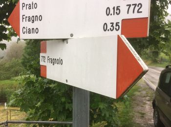
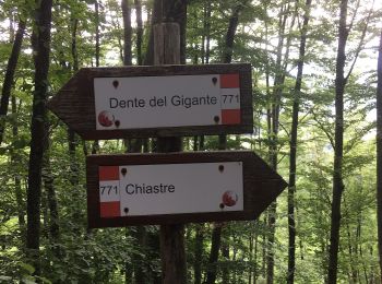
• relation maintained by Capataz (CAI Parma) Symbole: 771 on white red flags
![Randonnée A pied Terenzo - Cassio - Torrente Baganza - Il Casino - Chiastre - Dente del Gigante - Photo](https://media.geolcdn.com/t/350/260/7e93b827-f397-412b-907e-dc1a77be06c3.jpeg&format=jpg&maxdim=2)
![A pied A pied](https://static1.geolcdn.com/sitytour/trail-icons/100.png)
Km
A pied
![](/images/other/stat-length.png)
![](https://static1.geolcdn.com/siteimages/upload/files/1508320355ic_sort_den_pos_24dp.png)
![](https://static1.geolcdn.com/siteimages/upload/files/1508320355ic_sort_den_neg_24dp.png)
![](https://static1.geolcdn.com/siteimages/upload/files/16400158638029165_repeat_loop_refresh_sync_direction_icon.png)
• relation maintained by Capataz (CAI Parma) Symbole: 771A on white red flags
![Randonnée A pied Calestano - Castello di Ravarano - San Biagio - Monte Scaletta - Castello di Ravarano - Photo](https://media.geolcdn.com/t/350/260/91d217bd-c39d-497d-a5b2-6fca2efa46ba.jpeg&format=jpg&maxdim=2)
![A pied A pied](https://static1.geolcdn.com/sitytour/trail-icons/100.png)
Km
A pied
![](/images/other/stat-length.png)
![](https://static1.geolcdn.com/siteimages/upload/files/1508320355ic_sort_den_pos_24dp.png)
![](https://static1.geolcdn.com/siteimages/upload/files/1508320355ic_sort_den_neg_24dp.png)
![](https://static1.geolcdn.com/siteimages/upload/files/16400158638029165_repeat_loop_refresh_sync_direction_icon.png)
• relation maintained by Capataz (CAI Parma) Symbole: 770 on white red flags
![Randonnée A pied Corniglio - Passo Sillara - Roccaferrara - Graiana Castello - Maesta' di Graiana - Fugazzolo di Sopra - Photo](https://media.geolcdn.com/t/350/260/940156f7-d9ab-449b-9669-0a972d467b61.jpeg&format=jpg&maxdim=2)
![A pied A pied](https://static1.geolcdn.com/sitytour/trail-icons/100.png)
Km
A pied
![](/images/other/stat-length.png)
![](https://static1.geolcdn.com/siteimages/upload/files/1508320355ic_sort_den_pos_24dp.png)
![](https://static1.geolcdn.com/siteimages/upload/files/1508320355ic_sort_den_neg_24dp.png)
![](https://static1.geolcdn.com/siteimages/upload/files/16400158638029165_repeat_loop_refresh_sync_direction_icon.png)
• relation maintained by Capataz (CAI Parma) Symbole: 743 on white red flags
![Randonnée A pied Medesano - Varano Marchesi - Monte San Biagio - Faieto - Case Buca Violi - Varano Marchesi - Photo](https://media.geolcdn.com/t/350/260/cca2824a-687a-4ca0-b683-5eafd4757cc9.jpeg&format=jpg&maxdim=2)
![A pied A pied](https://static1.geolcdn.com/sitytour/trail-icons/100.png)
Km
A pied
![](/images/other/stat-length.png)
![](https://static1.geolcdn.com/siteimages/upload/files/1508320355ic_sort_den_pos_24dp.png)
![](https://static1.geolcdn.com/siteimages/upload/files/1508320355ic_sort_den_neg_24dp.png)
![](https://static1.geolcdn.com/siteimages/upload/files/16400158638029165_repeat_loop_refresh_sync_direction_icon.png)
• relation maintained by Capataz (CAI Parma) Symbole: 800C on white red flags
![Randonnée A pied Varsi - Strada di Campo del Gallo - Lago di Citta' - Cresta N - Monte Barigazzo - Photo](https://media.geolcdn.com/t/350/260/04597bf5-2a93-4b23-b117-aa9f457f73e5.jpeg&format=jpg&maxdim=2)
![A pied A pied](https://static1.geolcdn.com/sitytour/trail-icons/100.png)
Km
A pied
![](/images/other/stat-length.png)
![](https://static1.geolcdn.com/siteimages/upload/files/1508320355ic_sort_den_pos_24dp.png)
![](https://static1.geolcdn.com/siteimages/upload/files/1508320355ic_sort_den_neg_24dp.png)
![](https://static1.geolcdn.com/siteimages/upload/files/16400158638029165_repeat_loop_refresh_sync_direction_icon.png)
• Randonnée créée par Club Alpino Italiano - sezione di Parma sottosezione di Fidenza. relation maintained by Capataz ...
![Randonnée A pied Valmozzola - Piano Dell'Arato - Bora del Baccarino - Monte Barigazzo - Percorso 803 - Piano Dell'Arato - Photo](https://media.geolcdn.com/t/350/260/54d40eac-9ae8-49c9-81d0-674675831c05.jpeg&format=jpg&maxdim=2)
![A pied A pied](https://static1.geolcdn.com/sitytour/trail-icons/100.png)
Km
A pied
![](/images/other/stat-length.png)
![](https://static1.geolcdn.com/siteimages/upload/files/1508320355ic_sort_den_pos_24dp.png)
![](https://static1.geolcdn.com/siteimages/upload/files/1508320355ic_sort_den_neg_24dp.png)
![](https://static1.geolcdn.com/siteimages/upload/files/16400158638029165_repeat_loop_refresh_sync_direction_icon.png)
• Randonnée créée par Club Alpino Italiano - Sezione di Parma sottosezione di Fidenza. relation maintained by Capataz ...
![Randonnée A pied Bardi - Bardi - Torbiera di Gazzo - Photo](https://media.geolcdn.com/t/350/260/c0276ce9-8d4f-4639-a9a2-245ee98824f5.jpeg&format=jpg&maxdim=2)
![A pied A pied](https://static1.geolcdn.com/sitytour/trail-icons/100.png)
Km
A pied
![](/images/other/stat-length.png)
![](https://static1.geolcdn.com/siteimages/upload/files/1508320355ic_sort_den_pos_24dp.png)
![](https://static1.geolcdn.com/siteimages/upload/files/1508320355ic_sort_den_neg_24dp.png)
![](https://static1.geolcdn.com/siteimages/upload/files/16400158638029165_repeat_loop_refresh_sync_direction_icon.png)
• Randonnée créée par Club Alpino Italiano - Sezione di Parma sottosezione di Fidenza. relation maintained by Capataz ...
![Randonnée A pied Bardi - Madonna del Monte - Croce dei Segni - Passo dei Guselli - Passo di Santa Franca - Passo Linguadà - Photo](https://media.geolcdn.com/t/350/260/57bd2676-7794-4c2c-9a29-346b6b09c9b5.jpeg&format=jpg&maxdim=2)
![A pied A pied](https://static1.geolcdn.com/sitytour/trail-icons/100.png)
Km
A pied
![](/images/other/stat-length.png)
![](https://static1.geolcdn.com/siteimages/upload/files/1508320355ic_sort_den_pos_24dp.png)
![](https://static1.geolcdn.com/siteimages/upload/files/1508320355ic_sort_den_neg_24dp.png)
![](https://static1.geolcdn.com/siteimages/upload/files/16400158638029165_repeat_loop_refresh_sync_direction_icon.png)
• Symbole: 901 on white red flags
![Randonnée A pied Bedonia - Selvola - Strada Statale 654 - Pratogrande di Monte Nero - Photo](https://media.geolcdn.com/t/350/260/ed3ed5c7-ec09-4f8d-8176-1958407cd72b.jpeg&format=jpg&maxdim=2)
![A pied A pied](https://static1.geolcdn.com/sitytour/trail-icons/100.png)
Km
A pied
![](/images/other/stat-length.png)
![](https://static1.geolcdn.com/siteimages/upload/files/1508320355ic_sort_den_pos_24dp.png)
![](https://static1.geolcdn.com/siteimages/upload/files/1508320355ic_sort_den_neg_24dp.png)
![](https://static1.geolcdn.com/siteimages/upload/files/16400158638029165_repeat_loop_refresh_sync_direction_icon.png)
• relation maintained by Capataz (CAI Parma) Symbole: 821 on white red flags
![Randonnée A pied Bardi - Percorso 803 - Lavacchielli - Cerreto - Bre' - Pieve di Gravago - Brugnola - Monte Disperata - Photo](https://media.geolcdn.com/t/350/260/937634bf-72b7-4f20-b77c-382226d182ad.jpeg&format=jpg&maxdim=2)
![A pied A pied](https://static1.geolcdn.com/sitytour/trail-icons/100.png)
Km
A pied
![](/images/other/stat-length.png)
![](https://static1.geolcdn.com/siteimages/upload/files/1508320355ic_sort_den_pos_24dp.png)
![](https://static1.geolcdn.com/siteimages/upload/files/1508320355ic_sort_den_neg_24dp.png)
![](https://static1.geolcdn.com/siteimages/upload/files/16400158638029165_repeat_loop_refresh_sync_direction_icon.png)
• Randonnée créée par Club Alpino Italiano - Sezione di Parma sottosezione di Fidenza. relation maintained by Capataz ...
![Randonnée A pied Borgo Val di Taro - Il Castellaccio - Bardi - Pizzo d'Oca - Pianelleto - Monte Grosso - Monte La Tagliata - La Maestà - Photo](https://media.geolcdn.com/t/350/260/01a455ae-9414-4b32-9a1c-73db902e8a48.jpeg&format=jpg&maxdim=2)
![A pied A pied](https://static1.geolcdn.com/sitytour/trail-icons/100.png)
Km
A pied
![](/images/other/stat-length.png)
![](https://static1.geolcdn.com/siteimages/upload/files/1508320355ic_sort_den_pos_24dp.png)
![](https://static1.geolcdn.com/siteimages/upload/files/1508320355ic_sort_den_neg_24dp.png)
![](https://static1.geolcdn.com/siteimages/upload/files/16400158638029165_repeat_loop_refresh_sync_direction_icon.png)
• Randonnée créée par Club Alpino Italiano - sezione Parma sottosezione di Fidenza. relation maintained by Capataz (CA...
![Randonnée A pied Borgo Val di Taro - Borgotaro - Porcigatone - Bocca di Santa Donna - Percorso 843 (la Ramata) - Photo](https://media.geolcdn.com/t/350/260/2dfb51db-b2a0-4eb5-9be1-335dcc656561.jpeg&format=jpg&maxdim=2)
![A pied A pied](https://static1.geolcdn.com/sitytour/trail-icons/100.png)
Km
A pied
![](/images/other/stat-length.png)
![](https://static1.geolcdn.com/siteimages/upload/files/1508320355ic_sort_den_pos_24dp.png)
![](https://static1.geolcdn.com/siteimages/upload/files/1508320355ic_sort_den_neg_24dp.png)
![](https://static1.geolcdn.com/siteimages/upload/files/16400158638029165_repeat_loop_refresh_sync_direction_icon.png)
• Randonnée créée par Club Alpino Italiano - Sezione di Parma- Gruppo territoriale Altavaltaro. relation maintained by...
![Randonnée A pied Corniglio - Rifugio Lagoni-Sella di Rocca Pumacciolo-Lago Verde - Photo](https://media.geolcdn.com/t/350/260/4dee78fe-2d13-4f0a-9608-5299a17ac6cb.jpeg&format=jpg&maxdim=2)
![A pied A pied](https://static1.geolcdn.com/sitytour/trail-icons/100.png)
Km
A pied
![](/images/other/stat-length.png)
![](https://static1.geolcdn.com/siteimages/upload/files/1508320355ic_sort_den_pos_24dp.png)
![](https://static1.geolcdn.com/siteimages/upload/files/1508320355ic_sort_den_neg_24dp.png)
![](https://static1.geolcdn.com/siteimages/upload/files/16400158638029165_repeat_loop_refresh_sync_direction_icon.png)
• Randonnée créée par Club Alpino Italiano - sezione di Parma. relation maintained by Capataz (CAI Parma) Symbole: 71...
20 randonnées affichées sur 120
Application GPS de randonnée GRATUITE
Activités
Régions proches
- Albareto
- Bardi
- Bedonia
- Berceto
- Bore
- Borgo Val di Taro
- Calestano
- Compiano
- Corniglio
- Felino
- Fidenza
- Fornovo di Taro
- Langhirano
- Lesignano de' Bagni
- Medesano
- Monchio delle Corti
- Montechiarugolo
- Neviano degli Arduini
- Noceto
- Palanzano
- Parme
- Pellegrino Parmense
- Salsomaggiore Terme
- Solignano
- Terenzo
- Tizzano Val Parma
- Tornolo
- Traversetolo
- Valmozzola
- Varano de' Melegari
- Varsi