![](/images/other/stat-length.png)
- Randonnées
- A pied
- Italie
- Abruzzes
- Pescara
- Roccamorice
Roccamorice, Pescara, A pied : Les meilleures randonnées, itinéraires, parcours, balades et promenades
Roccamorice : découvrez les meilleures randonnées : 3 a pied et 2 marche. Tous ces circuits, parcours, itinéraires et activités en plein air sont disponibles dans nos applications SityTrail pour smartphones et tablettes.
Les meilleurs parcours (5)
![Randonnée A pied Roccamorice - Tratto Roccamorice - Serramonacesca - Photo](https://media.geolcdn.com/t/350/260/1ef23a23-23c0-4b47-8cde-bff9c7508148.jpeg&format=jpg&maxdim=2)
![A pied A pied](https://static1.geolcdn.com/sitytour/trail-icons/100.png)
Km
A pied
![](/images/other/stat-length.png)
![](https://static1.geolcdn.com/siteimages/upload/files/1508320355ic_sort_den_pos_24dp.png)
![](https://static1.geolcdn.com/siteimages/upload/files/1508320355ic_sort_den_neg_24dp.png)
![](https://static1.geolcdn.com/siteimages/upload/files/16400158638029165_repeat_loop_refresh_sync_direction_icon.png)
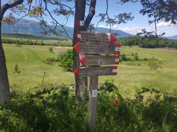
• Symbole: S on white red flags
![Randonnée A pied Roccamorice - Anello di Colle della Civita - Photo](https://media.geolcdn.com/t/350/260/40146891-37b1-4c0a-84f0-93f9b91e7e7f.jpeg&format=jpg&maxdim=2)
![A pied A pied](https://static1.geolcdn.com/sitytour/trail-icons/100.png)
Km
A pied
![](/images/other/stat-length.png)
![](https://static1.geolcdn.com/siteimages/upload/files/1508320355ic_sort_den_pos_24dp.png)
![](https://static1.geolcdn.com/siteimages/upload/files/1508320355ic_sort_den_neg_24dp.png)
![](https://static1.geolcdn.com/siteimages/upload/files/16400158638029165_repeat_loop_refresh_sync_direction_icon.png)
• Symbole: CP on white red flags
![Randonnée A pied Roccamorice - Macchia Metola - Hotel Panorama - Photo](https://media.geolcdn.com/t/350/260/bd1c84ef-bf37-4c47-81d0-3a2dc58fcfa6.jpeg&format=jpg&maxdim=2)
![A pied A pied](https://static1.geolcdn.com/sitytour/trail-icons/100.png)
Km
A pied
![](/images/other/stat-length.png)
![](https://static1.geolcdn.com/siteimages/upload/files/1508320355ic_sort_den_pos_24dp.png)
![](https://static1.geolcdn.com/siteimages/upload/files/1508320355ic_sort_den_neg_24dp.png)
![](https://static1.geolcdn.com/siteimages/upload/files/16400158638029165_repeat_loop_refresh_sync_direction_icon.png)
• Symbole: C2 on white red flags
![Randonnée Marche Roccamorice - 324 mai 2024 Roccamorice - Photo](https://media.geolcdn.com/t/350/260/99cd4e21-a377-4ad0-938e-4340f50add49.jpg&format=jpg&maxdim=2)
![Marche Marche](https://static1.geolcdn.com/sitytour/trail-icons/101.png)
Km
Marche
![](/images/other/stat-length.png)
![](https://static1.geolcdn.com/siteimages/upload/files/1508320355ic_sort_den_pos_24dp.png)
![](https://static1.geolcdn.com/siteimages/upload/files/1508320355ic_sort_den_neg_24dp.png)
![](https://static1.geolcdn.com/siteimages/upload/files/16400158638029165_repeat_loop_refresh_sync_direction_icon.png)
• randonnée du camping
![Randonnée Marche Roccamorice - 23 mai 2024 hermitage san bertomolomeo san spirito - Photo](https://media.geolcdn.com/t/350/260/04482d07-7f38-4cb2-8b4f-5beb43116d1a.jpg&format=jpg&maxdim=2)
![Marche Marche](https://static1.geolcdn.com/sitytour/trail-icons/101.png)
Km
Marche
![](/images/other/stat-length.png)
![](https://static1.geolcdn.com/siteimages/upload/files/1508320355ic_sort_den_pos_24dp.png)
![](https://static1.geolcdn.com/siteimages/upload/files/1508320355ic_sort_den_neg_24dp.png)
![](https://static1.geolcdn.com/siteimages/upload/files/16400158638029165_repeat_loop_refresh_sync_direction_icon.png)
• randonnée au départ du camping dimore montane par les 2 hermitages
5 randonnées affichées sur 5
Application GPS de randonnée GRATUITE