![](/images/other/stat-length.png)
- Randonnées
- A pied
- Irlande
- Inconnu
Inconnu, Irlande, A pied : Les meilleures randonnées, itinéraires, parcours, balades et promenades
Inconnu : découvrez les meilleures randonnées : 132 a pied, 213 marche, 4 course à pied et 4 trail. Tous ces circuits, parcours, itinéraires et activités en plein air sont disponibles dans nos applications SityTrail pour smartphones et tablettes.
Les meilleurs parcours (353)
![Randonnée A pied Westport-Belmullet Municipal District - Slí Tóin a' tSeanbhaile / Valley Loop Walk - Photo](https://media.geolcdn.com/t/350/260/677f1f71-59af-4264-8e32-5db8b94c8a4d.jpeg&format=jpg&maxdim=2)
![A pied A pied](https://static1.geolcdn.com/sitytour/trail-icons/100.png)
Km
A pied
![](/images/other/stat-length.png)
![](https://static1.geolcdn.com/siteimages/upload/files/1508320355ic_sort_den_pos_24dp.png)
![](https://static1.geolcdn.com/siteimages/upload/files/1508320355ic_sort_den_neg_24dp.png)
![](https://static1.geolcdn.com/siteimages/upload/files/16400158638029165_repeat_loop_refresh_sync_direction_icon.png)
• Site web: https://achilltourism.com/valley-loop-walk-sli-toin-a-tseanbhaile/
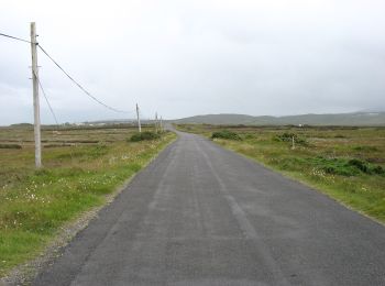
![Randonnée A pied Inconnu - Howth Cliff Path Loop - Photo](https://media.geolcdn.com/t/350/260/a16f08f7-577d-40f2-94ec-05093acb77a2.jpeg&format=jpg&maxdim=2)
![A pied A pied](https://static1.geolcdn.com/sitytour/trail-icons/100.png)
Km
A pied
![](/images/other/stat-length.png)
![](https://static1.geolcdn.com/siteimages/upload/files/1508320355ic_sort_den_pos_24dp.png)
![](https://static1.geolcdn.com/siteimages/upload/files/1508320355ic_sort_den_neg_24dp.png)
![](https://static1.geolcdn.com/siteimages/upload/files/16400158638029165_repeat_loop_refresh_sync_direction_icon.png)
• Symbole: Green arrow on white background Site web: https://www.irishtrails.ie/Trail/Howth---Cliff-Path-loop/107/
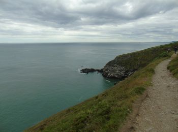
![Randonnée A pied Inconnu - Howth Tramline Loop - Photo](https://media.geolcdn.com/t/350/260/b7a65142-3b17-4bd1-9a56-9e37c46936a9.jpeg&format=jpg&maxdim=2)
![A pied A pied](https://static1.geolcdn.com/sitytour/trail-icons/100.png)
Km
A pied
![](/images/other/stat-length.png)
![](https://static1.geolcdn.com/siteimages/upload/files/1508320355ic_sort_den_pos_24dp.png)
![](https://static1.geolcdn.com/siteimages/upload/files/1508320355ic_sort_den_neg_24dp.png)
![](https://static1.geolcdn.com/siteimages/upload/files/16400158638029165_repeat_loop_refresh_sync_direction_icon.png)
• Symbole: Blue arrow on white background Site web: https://www.irishtrails.ie/Trail/Howth---Tramline-loop/108/
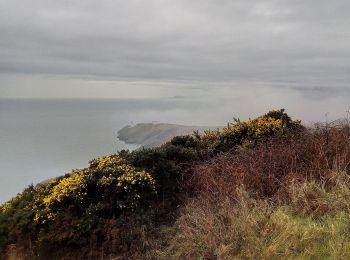
![Randonnée A pied Inconnu - Howth Black Linn Loop - Photo](https://media.geolcdn.com/t/350/260/2e702afb-8187-4430-b3c1-8ab636972ea4.jpeg&format=jpg&maxdim=2)
![A pied A pied](https://static1.geolcdn.com/sitytour/trail-icons/100.png)
Km
A pied
![](/images/other/stat-length.png)
![](https://static1.geolcdn.com/siteimages/upload/files/1508320355ic_sort_den_pos_24dp.png)
![](https://static1.geolcdn.com/siteimages/upload/files/1508320355ic_sort_den_neg_24dp.png)
![](https://static1.geolcdn.com/siteimages/upload/files/16400158638029165_repeat_loop_refresh_sync_direction_icon.png)
• Symbole: Red arrow on white background Site web: https://www.irishtrails.ie/Trail/Howth---Black-Linn-loop/109/
![Randonnée A pied West Cork - Drimoleague Heritage Loop Walk - Photo](https://media.geolcdn.com/t/350/260/5af78ae5-8f40-4589-8c64-a19dbd7ce429.jpeg&format=jpg&maxdim=2)
![A pied A pied](https://static1.geolcdn.com/sitytour/trail-icons/100.png)
Km
A pied
![](/images/other/stat-length.png)
![](https://static1.geolcdn.com/siteimages/upload/files/1508320355ic_sort_den_pos_24dp.png)
![](https://static1.geolcdn.com/siteimages/upload/files/1508320355ic_sort_den_neg_24dp.png)
![](https://static1.geolcdn.com/siteimages/upload/files/16400158638029165_repeat_loop_refresh_sync_direction_icon.png)
• Site web: http://explorewestcork.ie/walking/the-drimoleague-heritage-walkways/
![Randonnée A pied West Cork - Glanatnaw Walk - Photo](https://media.geolcdn.com/t/350/260/d8bf993e-3382-4d88-bfbe-9b909c6568a4.jpeg&format=jpg&maxdim=2)
![A pied A pied](https://static1.geolcdn.com/sitytour/trail-icons/100.png)
Km
A pied
![](/images/other/stat-length.png)
![](https://static1.geolcdn.com/siteimages/upload/files/1508320355ic_sort_den_pos_24dp.png)
![](https://static1.geolcdn.com/siteimages/upload/files/1508320355ic_sort_den_neg_24dp.png)
![](https://static1.geolcdn.com/siteimages/upload/files/16400158638029165_repeat_loop_refresh_sync_direction_icon.png)
• Site web: http://explorewestcork.ie/walking/the-drimoleague-heritage-walkways/
![Randonnée A pied West Cork - Trawlebane Walk - Photo](https://media.geolcdn.com/t/350/260/0c94100a-cecf-4130-85bb-3fe5f8308c29.jpeg&format=jpg&maxdim=2)
![A pied A pied](https://static1.geolcdn.com/sitytour/trail-icons/100.png)
Km
A pied
![](/images/other/stat-length.png)
![](https://static1.geolcdn.com/siteimages/upload/files/1508320355ic_sort_den_pos_24dp.png)
![](https://static1.geolcdn.com/siteimages/upload/files/1508320355ic_sort_den_neg_24dp.png)
![](https://static1.geolcdn.com/siteimages/upload/files/16400158638029165_repeat_loop_refresh_sync_direction_icon.png)
• Site web: http://explorewestcork.ie/walking/the-drimoleague-heritage-walkways/
![Randonnée A pied West Cork - Barnageehy Loop Walk - Photo](https://media.geolcdn.com/t/350/260/c0edeeeb-ee72-4e7f-bc5a-e50c2d887170.jpeg&format=jpg&maxdim=2)
![A pied A pied](https://static1.geolcdn.com/sitytour/trail-icons/100.png)
Km
A pied
![](/images/other/stat-length.png)
![](https://static1.geolcdn.com/siteimages/upload/files/1508320355ic_sort_den_pos_24dp.png)
![](https://static1.geolcdn.com/siteimages/upload/files/1508320355ic_sort_den_neg_24dp.png)
![](https://static1.geolcdn.com/siteimages/upload/files/16400158638029165_repeat_loop_refresh_sync_direction_icon.png)
• “Water and ground in their extremity…” – Seamus Heaney The Sheep’s Head Way is a long distance walking trail in West ...
![Randonnée A pied West Cork - Foilakilly Loop - Photo](https://media.geolcdn.com/t/350/260/b3aff1b4-469f-4f4e-be15-0bdb8a90424e.jpeg&format=jpg&maxdim=2)
![A pied A pied](https://static1.geolcdn.com/sitytour/trail-icons/100.png)
Km
A pied
![](/images/other/stat-length.png)
![](https://static1.geolcdn.com/siteimages/upload/files/1508320355ic_sort_den_pos_24dp.png)
![](https://static1.geolcdn.com/siteimages/upload/files/1508320355ic_sort_den_neg_24dp.png)
![](https://static1.geolcdn.com/siteimages/upload/files/16400158638029165_repeat_loop_refresh_sync_direction_icon.png)
• “Water and ground in their extremity…” – Seamus Heaney The Sheep’s Head Way is a long distance walking trail in West ...
![Randonnée A pied West Cork - Gortnakilly Loop - Photo](https://media.geolcdn.com/t/350/260/642e0f67-e469-457d-8c22-f45f9cb7baf3.jpeg&format=jpg&maxdim=2)
![A pied A pied](https://static1.geolcdn.com/sitytour/trail-icons/100.png)
Km
A pied
![](/images/other/stat-length.png)
![](https://static1.geolcdn.com/siteimages/upload/files/1508320355ic_sort_den_pos_24dp.png)
![](https://static1.geolcdn.com/siteimages/upload/files/1508320355ic_sort_den_neg_24dp.png)
![](https://static1.geolcdn.com/siteimages/upload/files/16400158638029165_repeat_loop_refresh_sync_direction_icon.png)
• “Water and ground in their extremity…” – Seamus Heaney The Sheep’s Head Way is a long distance walking trail in West ...
![Randonnée A pied West Cork - Glanlough Loop - Photo](https://media.geolcdn.com/t/350/260/daf5f9ee-36ca-4c74-b725-c302cdc1d3e4.jpeg&format=jpg&maxdim=2)
![A pied A pied](https://static1.geolcdn.com/sitytour/trail-icons/100.png)
Km
A pied
![](/images/other/stat-length.png)
![](https://static1.geolcdn.com/siteimages/upload/files/1508320355ic_sort_den_pos_24dp.png)
![](https://static1.geolcdn.com/siteimages/upload/files/1508320355ic_sort_den_neg_24dp.png)
![](https://static1.geolcdn.com/siteimages/upload/files/16400158638029165_repeat_loop_refresh_sync_direction_icon.png)
• “Water and ground in their extremity…” – Seamus Heaney The Sheep’s Head Way is a long distance walking trail in West ...
![Randonnée A pied West Cork - Peakeen Ridge Loop Walk - Photo](https://media.geolcdn.com/t/350/260/60ced130-bccc-42da-b44d-930e68129354.jpeg&format=jpg&maxdim=2)
![A pied A pied](https://static1.geolcdn.com/sitytour/trail-icons/100.png)
Km
A pied
![](/images/other/stat-length.png)
![](https://static1.geolcdn.com/siteimages/upload/files/1508320355ic_sort_den_pos_24dp.png)
![](https://static1.geolcdn.com/siteimages/upload/files/1508320355ic_sort_den_neg_24dp.png)
![](https://static1.geolcdn.com/siteimages/upload/files/16400158638029165_repeat_loop_refresh_sync_direction_icon.png)
• “Water and ground in their extremity…” – Seamus Heaney The Sheep’s Head Way is a long distance walking trail in West ...
![Randonnée A pied West Cork - Caher Loop Walk - Photo](https://media.geolcdn.com/t/350/260/239ad555-544a-4a9b-9726-abf0de7ba208.jpeg&format=jpg&maxdim=2)
![A pied A pied](https://static1.geolcdn.com/sitytour/trail-icons/100.png)
Km
A pied
![](/images/other/stat-length.png)
![](https://static1.geolcdn.com/siteimages/upload/files/1508320355ic_sort_den_pos_24dp.png)
![](https://static1.geolcdn.com/siteimages/upload/files/1508320355ic_sort_den_neg_24dp.png)
![](https://static1.geolcdn.com/siteimages/upload/files/16400158638029165_repeat_loop_refresh_sync_direction_icon.png)
• “Water and ground in their extremity…” – Seamus Heaney The Sheep’s Head Way is a long distance walking trail in West ...
![Randonnée A pied West Cork - Cahergal Loop Walk - Photo](https://media.geolcdn.com/t/350/260/ce478dcc-cb35-4555-be41-74d6cfec757f.jpeg&format=jpg&maxdim=2)
![A pied A pied](https://static1.geolcdn.com/sitytour/trail-icons/100.png)
Km
A pied
![](/images/other/stat-length.png)
![](https://static1.geolcdn.com/siteimages/upload/files/1508320355ic_sort_den_pos_24dp.png)
![](https://static1.geolcdn.com/siteimages/upload/files/1508320355ic_sort_den_neg_24dp.png)
![](https://static1.geolcdn.com/siteimages/upload/files/16400158638029165_repeat_loop_refresh_sync_direction_icon.png)
• “Water and ground in their extremity…” – Seamus Heaney The Sheep’s Head Way is a long distance walking trail in West ...
![Randonnée A pied West Cork - Mass Path Linear Walk - Photo](https://media.geolcdn.com/t/350/260/5f02adc8-2f3b-4d27-8c1a-931d8f80f7ab.jpeg&format=jpg&maxdim=2)
![A pied A pied](https://static1.geolcdn.com/sitytour/trail-icons/100.png)
Km
A pied
![](/images/other/stat-length.png)
![](https://static1.geolcdn.com/siteimages/upload/files/1508320355ic_sort_den_pos_24dp.png)
![](https://static1.geolcdn.com/siteimages/upload/files/1508320355ic_sort_den_neg_24dp.png)
![](https://static1.geolcdn.com/siteimages/upload/files/16400158638029165_repeat_loop_refresh_sync_direction_icon.png)
• “Water and ground in their extremity…” – Seamus Heaney The Sheep’s Head Way is a long distance walking trail in West ...
![Randonnée A pied West Cork - Seefin Loop - Photo](https://media.geolcdn.com/t/350/260/5f02adc8-2f3b-4d27-8c1a-931d8f80f7ab.jpeg&format=jpg&maxdim=2)
![A pied A pied](https://static1.geolcdn.com/sitytour/trail-icons/100.png)
Km
A pied
![](/images/other/stat-length.png)
![](https://static1.geolcdn.com/siteimages/upload/files/1508320355ic_sort_den_pos_24dp.png)
![](https://static1.geolcdn.com/siteimages/upload/files/1508320355ic_sort_den_neg_24dp.png)
![](https://static1.geolcdn.com/siteimages/upload/files/16400158638029165_repeat_loop_refresh_sync_direction_icon.png)
• “Water and ground in their extremity…” – Seamus Heaney The Sheep’s Head Way is a long distance walking trail in West ...
![Randonnée A pied West Cork - Barán Loop - Photo](https://media.geolcdn.com/t/350/260/5f02adc8-2f3b-4d27-8c1a-931d8f80f7ab.jpeg&format=jpg&maxdim=2)
![A pied A pied](https://static1.geolcdn.com/sitytour/trail-icons/100.png)
Km
A pied
![](/images/other/stat-length.png)
![](https://static1.geolcdn.com/siteimages/upload/files/1508320355ic_sort_den_pos_24dp.png)
![](https://static1.geolcdn.com/siteimages/upload/files/1508320355ic_sort_den_neg_24dp.png)
![](https://static1.geolcdn.com/siteimages/upload/files/16400158638029165_repeat_loop_refresh_sync_direction_icon.png)
• “Water and ground in their extremity…” – Seamus Heaney The Sheep’s Head Way is a long distance walking trail in West ...
![Randonnée A pied Inconnu - The Sugar Loaf Way - Photo](https://media.geolcdn.com/t/350/260/16c72303-970b-49d8-80b1-81de04133254.jpeg&format=jpg&maxdim=2)
![A pied A pied](https://static1.geolcdn.com/sitytour/trail-icons/100.png)
Km
A pied
![](/images/other/stat-length.png)
![](https://static1.geolcdn.com/siteimages/upload/files/1508320355ic_sort_den_pos_24dp.png)
![](https://static1.geolcdn.com/siteimages/upload/files/1508320355ic_sort_den_neg_24dp.png)
![](https://static1.geolcdn.com/siteimages/upload/files/16400158638029165_repeat_loop_refresh_sync_direction_icon.png)
• Randonnée créée par Wicklow Uplands Council. Symbole: Yellow Hiker Site web: http://www.wicklowuplands.ie/the-suga...
![Randonnée A pied West Cork - Coomkeen Loop Walk - Photo](https://media.geolcdn.com/t/350/260/00760be0-f32d-4b68-a82a-c2318f969364.jpeg&format=jpg&maxdim=2)
![A pied A pied](https://static1.geolcdn.com/sitytour/trail-icons/100.png)
Km
A pied
![](/images/other/stat-length.png)
![](https://static1.geolcdn.com/siteimages/upload/files/1508320355ic_sort_den_pos_24dp.png)
![](https://static1.geolcdn.com/siteimages/upload/files/1508320355ic_sort_den_neg_24dp.png)
![](https://static1.geolcdn.com/siteimages/upload/files/16400158638029165_repeat_loop_refresh_sync_direction_icon.png)
• Symbole: orange arrow
![Randonnée A pied The Municipal District of Arklow - Avonmore Way - Photo](https://media.geolcdn.com/t/350/260/adc18544-8eb0-4f4e-899d-5564960c0b0a.jpeg&format=jpg&maxdim=2)
![A pied A pied](https://static1.geolcdn.com/sitytour/trail-icons/100.png)
Km
A pied
![](/images/other/stat-length.png)
![](https://static1.geolcdn.com/siteimages/upload/files/1508320355ic_sort_den_pos_24dp.png)
![](https://static1.geolcdn.com/siteimages/upload/files/1508320355ic_sort_den_neg_24dp.png)
![](https://static1.geolcdn.com/siteimages/upload/files/16400158638029165_repeat_loop_refresh_sync_direction_icon.png)
• Randonnée créée par Wicklow Uplands Council. Symbole: yellow hiker on black Site web: http://www.irishtrails.ie/Tr...
20 randonnées affichées sur 353
Application GPS de randonnée GRATUITE
Activités
Régions proches
- County Carlow
- County Cavan
- County Clare
- County Cork
- County Donegal
- County Dublin
- County Galway
- County Kerry
- County Kildare
- County Kilkenny
- County Laois
- County Leitrim
- County Limerick
- County Longford
- County Louth
- County Mayo
- County Meath
- County Offaly
- County Roscommon
- County Sligo
- County Tipperary
- County Waterford
- County Westmeath
- County Wexford
- County Wicklow
- Inconnu