![](/images/other/stat-length.png)
- Randonnées
- A pied
- Hongrie
- Grande plaine et nord
- Heves megye
Heves megye, Grande plaine et nord, A pied : Les meilleures randonnées, itinéraires, parcours, balades et promenades
Heves megye : découvrez les meilleures randonnées : 48 a pied. Tous ces circuits, parcours, itinéraires et activités en plein air sont disponibles dans nos applications SityTrail pour smartphones et tablettes.
Les meilleurs parcours (48)
![Randonnée A pied Felsőtárkány - P+ (Varró-ház -Oldal-völgy) - Photo](https://media.geolcdn.com/t/350/260/2180e776-7797-4bbb-bd79-41399666d696.jpeg&format=jpg&maxdim=2)
![A pied A pied](https://static1.geolcdn.com/sitytour/trail-icons/100.png)
Km
A pied
![](/images/other/stat-length.png)
![](https://static1.geolcdn.com/siteimages/upload/files/1508320355ic_sort_den_pos_24dp.png)
![](https://static1.geolcdn.com/siteimages/upload/files/1508320355ic_sort_den_neg_24dp.png)
![](https://static1.geolcdn.com/siteimages/upload/files/16400158638029165_repeat_loop_refresh_sync_direction_icon.png)
• Randonnée créée par Kaptárkő. Symbole: red cross
![Randonnée A pied Nagyréde - Mária Út M56-02 - Photo](https://media.geolcdn.com/t/350/260/45d757cc-93a4-49fe-871f-80afae3ee0c4.jpeg&format=jpg&maxdim=2)
![A pied A pied](https://static1.geolcdn.com/sitytour/trail-icons/100.png)
Km
A pied
![](/images/other/stat-length.png)
![](https://static1.geolcdn.com/siteimages/upload/files/1508320355ic_sort_den_pos_24dp.png)
![](https://static1.geolcdn.com/siteimages/upload/files/1508320355ic_sort_den_neg_24dp.png)
![](https://static1.geolcdn.com/siteimages/upload/files/16400158638029165_repeat_loop_refresh_sync_direction_icon.png)
• Randonnée créée par MUTKE.
![Randonnée A pied Parád - S+ - Photo](https://media.geolcdn.com/t/350/260/9ca43b40-9011-4135-a1cf-0773701c74ef.jpeg&format=jpg&maxdim=2)
![A pied A pied](https://static1.geolcdn.com/sitytour/trail-icons/100.png)
Km
A pied
![](/images/other/stat-length.png)
![](https://static1.geolcdn.com/siteimages/upload/files/1508320355ic_sort_den_pos_24dp.png)
![](https://static1.geolcdn.com/siteimages/upload/files/1508320355ic_sort_den_neg_24dp.png)
![](https://static1.geolcdn.com/siteimages/upload/files/16400158638029165_repeat_loop_refresh_sync_direction_icon.png)
• Randonnée créée par kekesturista.
![Randonnée A pied Felsőtárkány - Vár-hegyi tanösvény - Photo](https://media.geolcdn.com/t/350/260/ac05ad25-7867-410d-99b3-4e94de80ba2d.jpeg&format=jpg&maxdim=2)
![A pied A pied](https://static1.geolcdn.com/sitytour/trail-icons/100.png)
Km
A pied
![](/images/other/stat-length.png)
![](https://static1.geolcdn.com/siteimages/upload/files/1508320355ic_sort_den_pos_24dp.png)
![](https://static1.geolcdn.com/siteimages/upload/files/1508320355ic_sort_den_neg_24dp.png)
![](https://static1.geolcdn.com/siteimages/upload/files/16400158638029165_repeat_loop_refresh_sync_direction_icon.png)
• Randonnée créée par Bükki Nemzeti Park Igazgatóság.
![Randonnée A pied Szarvaskő - Szarvaskői Geológiai Tanösvény - Photo](https://media.geolcdn.com/t/350/260/ccebe838-ef3c-4302-9a5f-d5aee3390712.jpeg&format=jpg&maxdim=2)
![A pied A pied](https://static1.geolcdn.com/sitytour/trail-icons/100.png)
Km
A pied
![](/images/other/stat-length.png)
![](https://static1.geolcdn.com/siteimages/upload/files/1508320355ic_sort_den_pos_24dp.png)
![](https://static1.geolcdn.com/siteimages/upload/files/1508320355ic_sort_den_neg_24dp.png)
![](https://static1.geolcdn.com/siteimages/upload/files/16400158638029165_repeat_loop_refresh_sync_direction_icon.png)
• Symbole: blue slash
![Randonnée A pied Eger - Nagy-Egedi tanösvény - Photo](https://media.geolcdn.com/t/350/260/9b11c847-da4d-49e0-b151-015a4d74bf60.jpeg&format=jpg&maxdim=2)
![A pied A pied](https://static1.geolcdn.com/sitytour/trail-icons/100.png)
Km
A pied
![](/images/other/stat-length.png)
![](https://static1.geolcdn.com/siteimages/upload/files/1508320355ic_sort_den_pos_24dp.png)
![](https://static1.geolcdn.com/siteimages/upload/files/1508320355ic_sort_den_neg_24dp.png)
![](https://static1.geolcdn.com/siteimages/upload/files/16400158638029165_repeat_loop_refresh_sync_direction_icon.png)
• Randonnée créée par Tűzliliom Egyesület - Eszterházy Károly Főiskola (Eger). Symbole: blue slash
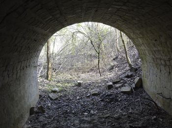
![Randonnée A pied Eger - K+ (Eger-Egerlátó) - Photo](https://media.geolcdn.com/t/350/260/3a309797-1f56-4515-912b-0f59b5e4ff0a.jpeg&format=jpg&maxdim=2)
![A pied A pied](https://static1.geolcdn.com/sitytour/trail-icons/100.png)
Km
A pied
![](/images/other/stat-length.png)
![](https://static1.geolcdn.com/siteimages/upload/files/1508320355ic_sort_den_pos_24dp.png)
![](https://static1.geolcdn.com/siteimages/upload/files/1508320355ic_sort_den_neg_24dp.png)
![](https://static1.geolcdn.com/siteimages/upload/files/16400158638029165_repeat_loop_refresh_sync_direction_icon.png)
• Randonnée créée par Füzesabonyi TE. Symbole: blue cross
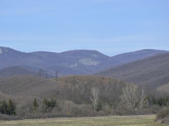
![Randonnée A pied Eger - P+ (Felnémet-Varró-ház) - Photo](https://media.geolcdn.com/t/350/260/ecbb0272-b626-4493-ac73-379ef7807049.jpeg&format=jpg&maxdim=2)
![A pied A pied](https://static1.geolcdn.com/sitytour/trail-icons/100.png)
Km
A pied
![](/images/other/stat-length.png)
![](https://static1.geolcdn.com/siteimages/upload/files/1508320355ic_sort_den_pos_24dp.png)
![](https://static1.geolcdn.com/siteimages/upload/files/1508320355ic_sort_den_neg_24dp.png)
![](https://static1.geolcdn.com/siteimages/upload/files/16400158638029165_repeat_loop_refresh_sync_direction_icon.png)
• Randonnée créée par Kárpát Egyesület Eger. Symbole: red cross
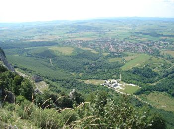
![Randonnée A pied Bélapátfalva - Bélapátfalva - Bél-kői Tanösvény - Photo](https://media.geolcdn.com/t/350/260/2d5bd130-a598-4cc5-85e7-53bf9d505ef4.jpeg&format=jpg&maxdim=2)
![A pied A pied](https://static1.geolcdn.com/sitytour/trail-icons/100.png)
Km
A pied
![](/images/other/stat-length.png)
![](https://static1.geolcdn.com/siteimages/upload/files/1508320355ic_sort_den_pos_24dp.png)
![](https://static1.geolcdn.com/siteimages/upload/files/1508320355ic_sort_den_neg_24dp.png)
![](https://static1.geolcdn.com/siteimages/upload/files/16400158638029165_repeat_loop_refresh_sync_direction_icon.png)
• Randonnée créée par Bükki Nemzeti Park Igazgatóság. Symbole: blue slash
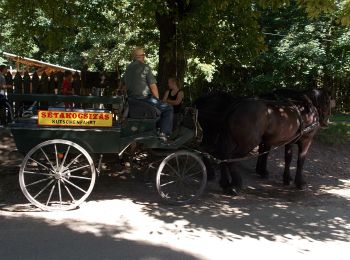
![Randonnée A pied Szilvásvárad - Szilvásvárad - Szalajka-völgyi Tanösvény - Photo](https://media.geolcdn.com/t/350/260/075e9e46-4fa5-4d8b-9abb-02e939485c86.jpeg&format=jpg&maxdim=2)
![A pied A pied](https://static1.geolcdn.com/sitytour/trail-icons/100.png)
Km
A pied
![](/images/other/stat-length.png)
![](https://static1.geolcdn.com/siteimages/upload/files/1508320355ic_sort_den_pos_24dp.png)
![](https://static1.geolcdn.com/siteimages/upload/files/1508320355ic_sort_den_neg_24dp.png)
![](https://static1.geolcdn.com/siteimages/upload/files/16400158638029165_repeat_loop_refresh_sync_direction_icon.png)
• Randonnée créée par Szilvásváradi Erdészeti Igazgatóság. Symbole: blue slash
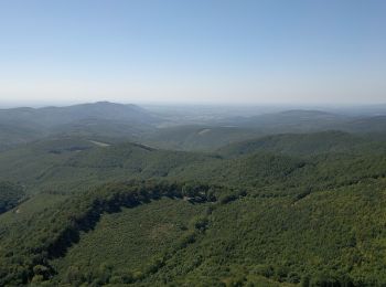
![Randonnée A pied Szilvásvárad - Bükk-fennsík - Olasz-kapui Tanösvény - Photo](https://media.geolcdn.com/t/350/260/2127bc37-080c-4950-8897-e2ccf727c64e.jpeg&format=jpg&maxdim=2)
![A pied A pied](https://static1.geolcdn.com/sitytour/trail-icons/100.png)
Km
A pied
![](/images/other/stat-length.png)
![](https://static1.geolcdn.com/siteimages/upload/files/1508320355ic_sort_den_pos_24dp.png)
![](https://static1.geolcdn.com/siteimages/upload/files/1508320355ic_sort_den_neg_24dp.png)
![](https://static1.geolcdn.com/siteimages/upload/files/16400158638029165_repeat_loop_refresh_sync_direction_icon.png)
• Randonnée créée par Bükki Nemzeti Park Igazgatóság. Symbole: blue slash
![Randonnée A pied Markaz - ZL (Hegyes-tető-Markazi várrom) - Photo](https://media.geolcdn.com/t/350/260/1129ceab-95b3-4fea-af78-2eb562019c5b.jpeg&format=jpg&maxdim=2)
![A pied A pied](https://static1.geolcdn.com/sitytour/trail-icons/100.png)
Km
A pied
![](/images/other/stat-length.png)
![](https://static1.geolcdn.com/siteimages/upload/files/1508320355ic_sort_den_pos_24dp.png)
![](https://static1.geolcdn.com/siteimages/upload/files/1508320355ic_sort_den_neg_24dp.png)
![](https://static1.geolcdn.com/siteimages/upload/files/16400158638029165_repeat_loop_refresh_sync_direction_icon.png)
• Symbole: green L
![Randonnée A pied Gyöngyöspata - S+ (Tóthegyes-János-vára) - Photo](https://media.geolcdn.com/t/350/260/9e64f252-51a3-49e9-b9f1-330402f89d90.jpeg&format=jpg&maxdim=2)
![A pied A pied](https://static1.geolcdn.com/sitytour/trail-icons/100.png)
Km
A pied
![](/images/other/stat-length.png)
![](https://static1.geolcdn.com/siteimages/upload/files/1508320355ic_sort_den_pos_24dp.png)
![](https://static1.geolcdn.com/siteimages/upload/files/1508320355ic_sort_den_neg_24dp.png)
![](https://static1.geolcdn.com/siteimages/upload/files/16400158638029165_repeat_loop_refresh_sync_direction_icon.png)
• Symbole: yellow cross
![Randonnée A pied Felsőtárkány - K+ ( Stimecz-ház - Tamás-kút ) - Photo](https://media.geolcdn.com/t/350/260/90e7210d-dcb5-4459-9201-c174667d457f.jpeg&format=jpg&maxdim=2)
![A pied A pied](https://static1.geolcdn.com/sitytour/trail-icons/100.png)
Km
A pied
![](/images/other/stat-length.png)
![](https://static1.geolcdn.com/siteimages/upload/files/1508320355ic_sort_den_pos_24dp.png)
![](https://static1.geolcdn.com/siteimages/upload/files/1508320355ic_sort_den_neg_24dp.png)
![](https://static1.geolcdn.com/siteimages/upload/files/16400158638029165_repeat_loop_refresh_sync_direction_icon.png)
• Symbole: blue cross
![Randonnée A pied Szilvásvárad - Z▲ (Szalajka-völgy - Istállós-kő) - Photo](https://media.geolcdn.com/t/350/260/96e0d3ab-5f98-4a8f-8a92-60c891263f00.jpeg&format=jpg&maxdim=2)
![A pied A pied](https://static1.geolcdn.com/sitytour/trail-icons/100.png)
Km
A pied
![](/images/other/stat-length.png)
![](https://static1.geolcdn.com/siteimages/upload/files/1508320355ic_sort_den_pos_24dp.png)
![](https://static1.geolcdn.com/siteimages/upload/files/1508320355ic_sort_den_neg_24dp.png)
![](https://static1.geolcdn.com/siteimages/upload/files/16400158638029165_repeat_loop_refresh_sync_direction_icon.png)
• Symbole: green triangle
![Randonnée A pied Gyöngyössolymos - S3 (Lajosháza - Őrlőmű - Dezsővár - Csigéd-farok) - Photo](https://media.geolcdn.com/t/350/260/4d7c1c93-3826-481b-8351-49a62c6524aa.jpeg&format=jpg&maxdim=2)
![A pied A pied](https://static1.geolcdn.com/sitytour/trail-icons/100.png)
Km
A pied
![](/images/other/stat-length.png)
![](https://static1.geolcdn.com/siteimages/upload/files/1508320355ic_sort_den_pos_24dp.png)
![](https://static1.geolcdn.com/siteimages/upload/files/1508320355ic_sort_den_neg_24dp.png)
![](https://static1.geolcdn.com/siteimages/upload/files/16400158638029165_repeat_loop_refresh_sync_direction_icon.png)
• Symbole: yellow triangle
![Randonnée A pied Mátraszentimre - Mária út M10/10 Mátraverebély-Szentkút - Fallóskút - Photo](https://media.geolcdn.com/t/350/260/d3309216-208b-4b94-9293-4bd45d671121.jpeg&format=jpg&maxdim=2)
![A pied A pied](https://static1.geolcdn.com/sitytour/trail-icons/100.png)
Km
A pied
![](/images/other/stat-length.png)
![](https://static1.geolcdn.com/siteimages/upload/files/1508320355ic_sort_den_pos_24dp.png)
![](https://static1.geolcdn.com/siteimages/upload/files/1508320355ic_sort_den_neg_24dp.png)
![](https://static1.geolcdn.com/siteimages/upload/files/16400158638029165_repeat_loop_refresh_sync_direction_icon.png)
• Randonnée créée par MUTKE. Symbole: purple m Site web: http://mariaut.hu
![Randonnée A pied Gyöngyössolymos - Z+ (Vörösmarty th. - Lajosháza) - Photo](https://media.geolcdn.com/t/350/260/6350831f-7b11-4c7b-b0a0-946277a7982f.jpeg&format=jpg&maxdim=2)
![A pied A pied](https://static1.geolcdn.com/sitytour/trail-icons/100.png)
Km
A pied
![](/images/other/stat-length.png)
![](https://static1.geolcdn.com/siteimages/upload/files/1508320355ic_sort_den_pos_24dp.png)
![](https://static1.geolcdn.com/siteimages/upload/files/1508320355ic_sort_den_neg_24dp.png)
![](https://static1.geolcdn.com/siteimages/upload/files/16400158638029165_repeat_loop_refresh_sync_direction_icon.png)
• Symbole: green cross
![Randonnée A pied Gyöngyössolymos - K+ (Csór-hegy - Mogyorós-orom) - Photo](https://media.geolcdn.com/t/350/260/c03c6565-9a61-4bb3-8946-40a036515182.jpeg&format=jpg&maxdim=2)
![A pied A pied](https://static1.geolcdn.com/sitytour/trail-icons/100.png)
Km
A pied
![](/images/other/stat-length.png)
![](https://static1.geolcdn.com/siteimages/upload/files/1508320355ic_sort_den_pos_24dp.png)
![](https://static1.geolcdn.com/siteimages/upload/files/1508320355ic_sort_den_neg_24dp.png)
![](https://static1.geolcdn.com/siteimages/upload/files/16400158638029165_repeat_loop_refresh_sync_direction_icon.png)
• Symbole: blue cross
![Randonnée A pied Noszvaj - HU-P+ - Photo](https://media.geolcdn.com/t/350/260/5509c7ee-5967-4c6b-9ed2-c4a1ce351f53.jpeg&format=jpg&maxdim=2)
![A pied A pied](https://static1.geolcdn.com/sitytour/trail-icons/100.png)
Km
A pied
![](/images/other/stat-length.png)
![](https://static1.geolcdn.com/siteimages/upload/files/1508320355ic_sort_den_pos_24dp.png)
![](https://static1.geolcdn.com/siteimages/upload/files/1508320355ic_sort_den_neg_24dp.png)
![](https://static1.geolcdn.com/siteimages/upload/files/16400158638029165_repeat_loop_refresh_sync_direction_icon.png)
• Symbole: red cross
20 randonnées affichées sur 48
Application GPS de randonnée GRATUITE