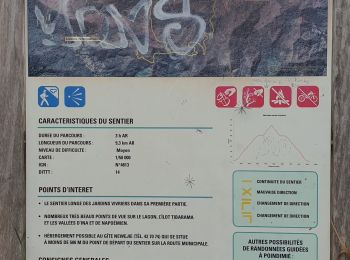
![](/images/other/stat-length.png)
- Randonnées
- A pied
- France
- Inconnu
- Province Nord
- Poindimié
Poindimié, Province Nord, A pied : Les meilleures randonnées, itinéraires, parcours, balades et promenades
Poindimié : découvrez les meilleures randonnées : 3 marche. Tous ces circuits, parcours, itinéraires et activités en plein air sont disponibles dans nos applications SityTrail pour smartphones et tablettes.
Les meilleurs parcours (3)
![Randonnée Marche Poindimié - GR Nord - St Thomas au portail Totem (Nouvelle Calédonie) - Photo](https://media.geolcdn.com/t/350/260/69c7aab0-b986-4d00-aed7-00c530a7b43b.jpg&format=jpg&maxdim=2)
![Marche Marche](https://static1.geolcdn.com/sitytour/trail-icons/101.png)
Km
Marche
![](/images/other/stat-length.png)
![](https://static1.geolcdn.com/siteimages/upload/files/1508320355ic_sort_den_pos_24dp.png)
![](https://static1.geolcdn.com/siteimages/upload/files/1508320355ic_sort_den_neg_24dp.png)
![](https://static1.geolcdn.com/siteimages/upload/files/16400158638029165_repeat_loop_refresh_sync_direction_icon.png)
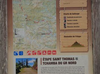
• Poindimié Sens St Thomas - Tchamba
![Randonnée Marche Poindimié - GR Nord - Épave avion Dakota (Nouvelle Calédonie) - Photo](https://media.geolcdn.com/t/350/260/1d3a7b40-b631-4e4a-9e06-3bc097d1bc1f.jpg&format=jpg&maxdim=2)
![Marche Marche](https://static1.geolcdn.com/sitytour/trail-icons/101.png)
Km
Marche
![](/images/other/stat-length.png)
![](https://static1.geolcdn.com/siteimages/upload/files/1508320355ic_sort_den_pos_24dp.png)
![](https://static1.geolcdn.com/siteimages/upload/files/1508320355ic_sort_den_neg_24dp.png)
![](https://static1.geolcdn.com/siteimages/upload/files/16400158638029165_repeat_loop_refresh_sync_direction_icon.png)
• A la découverte d'un avion Dakota (transport de courrier) crashé le 31 mars 1946 sur le secteur de la tribu de Pombeï...
![Randonnée Marche Poindimié - Sentier de Koyaboa - Poindimié (Nouvelle Calédonie) - Photo](https://media.geolcdn.com/t/350/260/8e696856-98d4-471c-9860-e2c6d311c96a.jpg&format=jpg&maxdim=2)
![Marche Marche](https://static1.geolcdn.com/sitytour/trail-icons/101.png)
Km
Marche
![](/images/other/stat-length.png)
![](https://static1.geolcdn.com/siteimages/upload/files/1508320355ic_sort_den_pos_24dp.png)
![](https://static1.geolcdn.com/siteimages/upload/files/1508320355ic_sort_den_neg_24dp.png)
![](https://static1.geolcdn.com/siteimages/upload/files/16400158638029165_repeat_loop_refresh_sync_direction_icon.png)
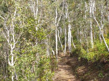
• Points de vue sur les vallée d'Ina et de Napoémien et l'ilôt Tibarama. Nombreuses fougères arborescentes. Végétation ...
3 randonnées affichées sur 3
Application GPS de randonnée GRATUITE