


8,7 km | 11,5 km-effort
Égletons : découvrez les meilleures randonnées : 10 marche. Tous ces circuits, parcours, itinéraires et activités en plein air sont disponibles dans nos applications SityTrail pour smartphones et tablettes.

Marche


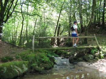
• Entre Vedrenne et la Brette - Égletons - Pays d'Égletons. L’histoire et le paysage se côtoient pour le plaisir du ran...
Marche
• Entre Vedrenne et la Brette - Égletons - Pays d'Égletons. L’histoire et le paysage se côtoient pour le plaisir du ran...

Marche
• Entre Vedrenne et la Brette - Pays de Ventadour. Parcourez les pays boisés caractéristiques de la région, découvrez l...

Marche
• aerodrome vers ville. toute petite sans plus. lac très joli à faire
Marche
Marche
Marche
Marche
Marche
Marche
10 randonnées affichées sur 10
Application GPS de randonnée GRATUITE
 SityTrail
IGN / Instituts géographiques
SityTrail World
Le monde est à vous