![](/images/other/stat-length.png)
- Randonnées
- A pied
- France
- Normandie
- Orne
- Bretoncelles
Bretoncelles, Orne, A pied : Les meilleures randonnées, itinéraires, parcours, balades et promenades
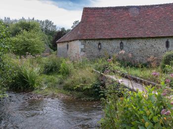
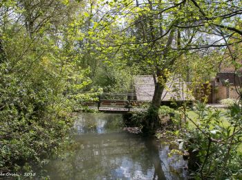
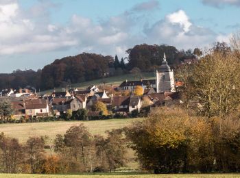
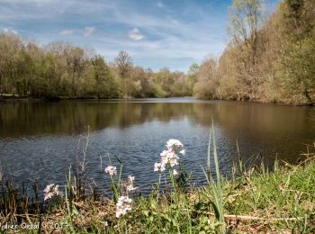
Bretoncelles : découvrez les meilleures randonnées : 4 a pied, 65 marche et 1 marche nordique. Tous ces circuits, parcours, itinéraires et activités en plein air sont disponibles dans nos applications SityTrail pour smartphones et tablettes.
Les meilleurs parcours (70)
![Randonnée Marche Bretoncelles - BRETONCELLES ET SES HAMEAUX - Photo](https://media.geolcdn.com/t/350/260/1ac05758-9066-478d-9efc-58a133a29698.jpg&format=jpg&maxdim=2)
![Marche Marche](https://static1.geolcdn.com/sitytour/trail-icons/101.png)
Km
Marche
![](/images/other/stat-length.png)
![](https://static1.geolcdn.com/siteimages/upload/files/1508320355ic_sort_den_pos_24dp.png)
![](https://static1.geolcdn.com/siteimages/upload/files/1508320355ic_sort_den_neg_24dp.png)
![](https://static1.geolcdn.com/siteimages/upload/files/16400158638029165_repeat_loop_refresh_sync_direction_icon.png)
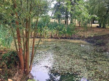
• superbe itinéraire pour découvrir la campagne vallonnée du PERCHE sur des sentiers parfaitement balisés et très bien...
![Randonnée Marche Bretoncelles - Les Douves du Grand Cumont 15 Km - Photo](https://media.geolcdn.com/t/350/260/d3f7aac7-ac8c-46dc-96d3-852253cb1421.jpg&format=jpg&maxdim=2)
![Marche Marche](https://static1.geolcdn.com/sitytour/trail-icons/101.png)
Km
Marche
![](/images/other/stat-length.png)
![](https://static1.geolcdn.com/siteimages/upload/files/1508320355ic_sort_den_pos_24dp.png)
![](https://static1.geolcdn.com/siteimages/upload/files/1508320355ic_sort_den_neg_24dp.png)
![](https://static1.geolcdn.com/siteimages/upload/files/16400158638029165_repeat_loop_refresh_sync_direction_icon.png)
• Pas à pas en cours de rédaction, le sens de cette boucle ayant été inversées récemment
![Randonnée Marche Bretoncelles - Le Petit Houx du Parc 5,1 Km - Photo](https://media.geolcdn.com/t/350/260/7bdb7e04-5754-4fe7-8144-30a332f42ad5.jpg&format=jpg&maxdim=2)
![Marche Marche](https://static1.geolcdn.com/sitytour/trail-icons/101.png)
Km
Marche
![](/images/other/stat-length.png)
![](https://static1.geolcdn.com/siteimages/upload/files/1508320355ic_sort_den_pos_24dp.png)
![](https://static1.geolcdn.com/siteimages/upload/files/1508320355ic_sort_den_neg_24dp.png)
![](https://static1.geolcdn.com/siteimages/upload/files/16400158638029165_repeat_loop_refresh_sync_direction_icon.png)
• Départ : Bretoncelles, parking de l'aire de loisirs de la Croix des Chênes Sens : celui des aiguilles d'une montre Ba...
![Randonnée Marche Bretoncelles - La boucle des Trois Moulins 27,0 Km - Photo](https://media.geolcdn.com/t/350/260/5529bff9-ebf0-4b36-a1dd-763157d3177d.jpg&format=jpg&maxdim=2)
![Marche Marche](https://static1.geolcdn.com/sitytour/trail-icons/101.png)
Km
Marche
![](/images/other/stat-length.png)
![](https://static1.geolcdn.com/siteimages/upload/files/1508320355ic_sort_den_pos_24dp.png)
![](https://static1.geolcdn.com/siteimages/upload/files/1508320355ic_sort_den_neg_24dp.png)
![](https://static1.geolcdn.com/siteimages/upload/files/16400158638029165_repeat_loop_refresh_sync_direction_icon.png)
• Circuit balisé en jaune + signalétique (suivre les flèches "La boucle des Trois Moulins") Pas à pas : Départ : Breto...
![Randonnée Marche Bretoncelles - La butte du château 15,0 Km - Photo](https://media.geolcdn.com/t/350/260/8a4df6ff-d1ea-4423-a025-4761f0dd639a.jpg&format=jpg&maxdim=2)
![Marche Marche](https://static1.geolcdn.com/sitytour/trail-icons/101.png)
Km
Marche
![](/images/other/stat-length.png)
![](https://static1.geolcdn.com/siteimages/upload/files/1508320355ic_sort_den_pos_24dp.png)
![](https://static1.geolcdn.com/siteimages/upload/files/1508320355ic_sort_den_neg_24dp.png)
![](https://static1.geolcdn.com/siteimages/upload/files/16400158638029165_repeat_loop_refresh_sync_direction_icon.png)
• Circuit balisé en jaune + signalétique "suivre les flèches "La butte du château") Départ : Bretoncelles, parking de ...
![Randonnée Marche Bretoncelles - Sur les ponts de la Corbionne 7,5 Km - Photo](https://media.geolcdn.com/t/350/260/410ed619-cc75-498e-a27f-9446ae3b62c0.jpg&format=jpg&maxdim=2)
![Marche Marche](https://static1.geolcdn.com/sitytour/trail-icons/101.png)
Km
Marche
![](/images/other/stat-length.png)
![](https://static1.geolcdn.com/siteimages/upload/files/1508320355ic_sort_den_pos_24dp.png)
![](https://static1.geolcdn.com/siteimages/upload/files/1508320355ic_sort_den_neg_24dp.png)
![](https://static1.geolcdn.com/siteimages/upload/files/16400158638029165_repeat_loop_refresh_sync_direction_icon.png)
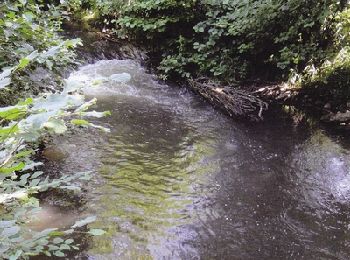
• Circuit balisé en jaune + signalétique (suivre les flèches "Sur les ponts de la Corbionne") Départ : Bretoncelles, p...
![Randonnée Marche Bretoncelles - Les chaudrons de la Dourdannerie 7,6 Km - Photo](https://media.geolcdn.com/t/350/260/33832808-3ade-47a2-83e4-74d2c6faf2b7.jpg&format=jpg&maxdim=2)
![Marche Marche](https://static1.geolcdn.com/sitytour/trail-icons/101.png)
Km
Marche
![](/images/other/stat-length.png)
![](https://static1.geolcdn.com/siteimages/upload/files/1508320355ic_sort_den_pos_24dp.png)
![](https://static1.geolcdn.com/siteimages/upload/files/1508320355ic_sort_den_neg_24dp.png)
![](https://static1.geolcdn.com/siteimages/upload/files/16400158638029165_repeat_loop_refresh_sync_direction_icon.png)
• Départ : Bretoncelles, parking de l'aire de loisirs de la Croix des Chênes Sens : celui des aiguilles d'une montre Ba...
![Randonnée Marche Bretoncelles - Bretoncelles - Saint-Victor-de-Buthon 11 km - Photo](https://media.geolcdn.com/t/350/260/771ce522-727b-4ec3-91fb-bf26ab33d9ef.jpg&format=jpg&maxdim=2)
![Marche Marche](https://static1.geolcdn.com/sitytour/trail-icons/101.png)
Km
Marche
![](/images/other/stat-length.png)
![](https://static1.geolcdn.com/siteimages/upload/files/1508320355ic_sort_den_pos_24dp.png)
![](https://static1.geolcdn.com/siteimages/upload/files/1508320355ic_sort_den_neg_24dp.png)
![](https://static1.geolcdn.com/siteimages/upload/files/16400158638029165_repeat_loop_refresh_sync_direction_icon.png)
• LES TRAVERSÉES PERCHERONNES.. Vous offrent la description de près de 1700 kilomètres de chemins de randonnée perche...
![Randonnée Marche Bretoncelles - La marche de l'écrevisse Variante 9,0 Km - Photo](https://media.geolcdn.com/t/350/260/ff60845a-ff03-4bd7-9e4e-1b6ed183df2a.jpg&format=jpg&maxdim=2)
![Marche Marche](https://static1.geolcdn.com/sitytour/trail-icons/101.png)
Km
Marche
![](/images/other/stat-length.png)
![](https://static1.geolcdn.com/siteimages/upload/files/1508320355ic_sort_den_pos_24dp.png)
![](https://static1.geolcdn.com/siteimages/upload/files/1508320355ic_sort_den_neg_24dp.png)
![](https://static1.geolcdn.com/siteimages/upload/files/16400158638029165_repeat_loop_refresh_sync_direction_icon.png)
• Quitter le parking et gagner le pont sur la Donnette ; la franchir. Continuer tout droit et longer la résidence des G...
![Randonnée Marche nordique Bretoncelles - Bretoncelles - La Loupe 14 km - Photo](https://media.geolcdn.com/t/350/260/3604c3bd-c0c4-4f7a-8184-f0207e71c613.jpg&format=jpg&maxdim=2)
![Marche nordique Marche nordique](https://static1.geolcdn.com/sitytour/trail-icons/102.png)
Km
Marche nordique
![](/images/other/stat-length.png)
![](https://static1.geolcdn.com/siteimages/upload/files/1508320355ic_sort_den_pos_24dp.png)
![](https://static1.geolcdn.com/siteimages/upload/files/1508320355ic_sort_den_neg_24dp.png)
![](https://static1.geolcdn.com/siteimages/upload/files/16400158638029165_repeat_loop_refresh_sync_direction_icon.png)
• LES TRAVERSÉES PERCHERONNES.. Vous offrent la description de près de 1700 kilomètres de chemins de randonnée perche...
![Randonnée Marche Bretoncelles - Bretoncelles - Condé-sur-Huisne 13 km - Photo](https://media.geolcdn.com/t/350/260/0e28f50a-351d-4b54-b4a7-e8a04a850a6a.jpg&format=jpg&maxdim=2)
![Marche Marche](https://static1.geolcdn.com/sitytour/trail-icons/101.png)
Km
Marche
![](/images/other/stat-length.png)
![](https://static1.geolcdn.com/siteimages/upload/files/1508320355ic_sort_den_pos_24dp.png)
![](https://static1.geolcdn.com/siteimages/upload/files/1508320355ic_sort_den_neg_24dp.png)
![](https://static1.geolcdn.com/siteimages/upload/files/16400158638029165_repeat_loop_refresh_sync_direction_icon.png)
• LES TRAVERSÉES PERCHERONNES.. Vous offrent la description de près de 1700 kilomètres de chemins de randonnée perche...
![Randonnée Marche Bretoncelles - Bretoncelles - Rémalard via Dorceau 11 km - Photo](https://media.geolcdn.com/t/350/260/1a4115db-44ed-4007-9a58-67c77326484f.jpg&format=jpg&maxdim=2)
![Marche Marche](https://static1.geolcdn.com/sitytour/trail-icons/101.png)
Km
Marche
![](/images/other/stat-length.png)
![](https://static1.geolcdn.com/siteimages/upload/files/1508320355ic_sort_den_pos_24dp.png)
![](https://static1.geolcdn.com/siteimages/upload/files/1508320355ic_sort_den_neg_24dp.png)
![](https://static1.geolcdn.com/siteimages/upload/files/16400158638029165_repeat_loop_refresh_sync_direction_icon.png)
• LES TRAVERSÉES PERCHERONNES.. Vous offrent la description de près de 1700 kilomètres de chemins de randonnée perche...
![Randonnée Marche Bretoncelles - La marche de l'écrevisse 10 Km + Variante 9 km - Photo](https://media.geolcdn.com/t/350/260/f3078d56-ce4a-48c0-b460-9f8033ffdb4f.jpg&format=jpg&maxdim=2)
![Marche Marche](https://static1.geolcdn.com/sitytour/trail-icons/101.png)
Km
Marche
![](/images/other/stat-length.png)
![](https://static1.geolcdn.com/siteimages/upload/files/1508320355ic_sort_den_pos_24dp.png)
![](https://static1.geolcdn.com/siteimages/upload/files/1508320355ic_sort_den_neg_24dp.png)
![](https://static1.geolcdn.com/siteimages/upload/files/16400158638029165_repeat_loop_refresh_sync_direction_icon.png)
• Quitter le parking et gagner le pont sur la Donnette ; la franchir. Continuer tout droit et longer la résidence des G...
![Randonnée Marche Bretoncelles - Les Bruyères du Noyer 13,0 Km - Photo](https://media.geolcdn.com/t/350/260/22d68789-aa7a-4238-a2db-433839f59723.jpg&format=jpg&maxdim=2)
![Marche Marche](https://static1.geolcdn.com/sitytour/trail-icons/101.png)
Km
Marche
![](/images/other/stat-length.png)
![](https://static1.geolcdn.com/siteimages/upload/files/1508320355ic_sort_den_pos_24dp.png)
![](https://static1.geolcdn.com/siteimages/upload/files/1508320355ic_sort_den_neg_24dp.png)
![](https://static1.geolcdn.com/siteimages/upload/files/16400158638029165_repeat_loop_refresh_sync_direction_icon.png)
• Quitter le parking en longeant La Donnette jusqu’à la D 918, tourner à droite et rejoindre le bourg, la place de l’ég...
![Randonnée Marche Bretoncelles - Bretoncelles - Senonches 24 km - Photo](https://media.geolcdn.com/t/350/260/6c89d0e0-52a5-4dd6-8707-3ad6606817fd.jpg&format=jpg&maxdim=2)
![Marche Marche](https://static1.geolcdn.com/sitytour/trail-icons/101.png)
Km
Marche
![](/images/other/stat-length.png)
![](https://static1.geolcdn.com/siteimages/upload/files/1508320355ic_sort_den_pos_24dp.png)
![](https://static1.geolcdn.com/siteimages/upload/files/1508320355ic_sort_den_neg_24dp.png)
![](https://static1.geolcdn.com/siteimages/upload/files/16400158638029165_repeat_loop_refresh_sync_direction_icon.png)
• LES TRAVERSÉES PERCHERONNES.. Vous offrent la description de près de 1700 kilomètres de chemins de randonnée perche...
![Randonnée Marche Bretoncelles - Bretoncelles - Moutiers-au-Perche via Forêt de Saussay 16 km - Photo](https://media.geolcdn.com/t/350/260/57a26b5a-b9bd-4e28-9311-92cb483af233.jpg&format=jpg&maxdim=2)
![Marche Marche](https://static1.geolcdn.com/sitytour/trail-icons/101.png)
Km
Marche
![](/images/other/stat-length.png)
![](https://static1.geolcdn.com/siteimages/upload/files/1508320355ic_sort_den_pos_24dp.png)
![](https://static1.geolcdn.com/siteimages/upload/files/1508320355ic_sort_den_neg_24dp.png)
![](https://static1.geolcdn.com/siteimages/upload/files/16400158638029165_repeat_loop_refresh_sync_direction_icon.png)
• LES TRAVERSÉES PERCHERONNES.. Vous offrent la description de près de 1700 kilomètres de chemins de randonnée perche...
![Randonnée Marche Bretoncelles - Bretoncelles - Rémalard via Les Aubées 12 km - Photo](https://media.geolcdn.com/t/350/260/1b88911d-5f59-4a68-a998-7fd06db58a8d.jpg&format=jpg&maxdim=2)
![Marche Marche](https://static1.geolcdn.com/sitytour/trail-icons/101.png)
Km
Marche
![](/images/other/stat-length.png)
![](https://static1.geolcdn.com/siteimages/upload/files/1508320355ic_sort_den_pos_24dp.png)
![](https://static1.geolcdn.com/siteimages/upload/files/1508320355ic_sort_den_neg_24dp.png)
![](https://static1.geolcdn.com/siteimages/upload/files/16400158638029165_repeat_loop_refresh_sync_direction_icon.png)
• LES TRAVERSÉES PERCHERONNES.. Vous offrent la description de près de 1700 kilomètres de chemins de randonnée perche...
![Randonnée Marche Bretoncelles - Bretoncelles - Moutiers-au-Perche via La-Madeleine-Bouvet 14 km - Photo](https://media.geolcdn.com/t/350/260/851d2005-4f10-453d-9c32-ee82ba2983a3.jpg&format=jpg&maxdim=2)
![Marche Marche](https://static1.geolcdn.com/sitytour/trail-icons/101.png)
Km
Marche
![](/images/other/stat-length.png)
![](https://static1.geolcdn.com/siteimages/upload/files/1508320355ic_sort_den_pos_24dp.png)
![](https://static1.geolcdn.com/siteimages/upload/files/1508320355ic_sort_den_neg_24dp.png)
![](https://static1.geolcdn.com/siteimages/upload/files/16400158638029165_repeat_loop_refresh_sync_direction_icon.png)
• LES TRAVERSÉES PERCHERONNES.. Vous offrent la description de près de 1700 kilomètres de chemins de randonnée perche...
![Randonnée Marche Bretoncelles - NewTrack - Photo](https://media.geolcdn.com/t/350/260/421aba2f-9a57-41fa-8dfe-d1b9fd6e138a.jpg&format=jpg&maxdim=2)
![Marche Marche](https://static1.geolcdn.com/sitytour/trail-icons/101.png)
Km
Marche
![](/images/other/stat-length.png)
![](https://static1.geolcdn.com/siteimages/upload/files/1508320355ic_sort_den_pos_24dp.png)
![](https://static1.geolcdn.com/siteimages/upload/files/1508320355ic_sort_den_neg_24dp.png)
![](https://static1.geolcdn.com/siteimages/upload/files/16400158638029165_repeat_loop_refresh_sync_direction_icon.png)
![Randonnée Marche Bretoncelles - NewTrack - Photo](https://media.geolcdn.com/t/350/260/9ae17f79-6bdb-4622-82f8-6c0572b270b3.jpg&format=jpg&maxdim=2)
![Marche Marche](https://static1.geolcdn.com/sitytour/trail-icons/101.png)
Km
Marche
![](/images/other/stat-length.png)
![](https://static1.geolcdn.com/siteimages/upload/files/1508320355ic_sort_den_pos_24dp.png)
![](https://static1.geolcdn.com/siteimages/upload/files/1508320355ic_sort_den_neg_24dp.png)
![](https://static1.geolcdn.com/siteimages/upload/files/16400158638029165_repeat_loop_refresh_sync_direction_icon.png)
20 randonnées affichées sur 70
Application GPS de randonnée GRATUITE