![](/images/other/stat-length.png)
Saint-Maurice-lès-Charencey, Charencey, A pied : Les meilleures randonnées, itinéraires, parcours, balades et promenades
Saint-Maurice-lès-Charencey : découvrez les meilleures randonnées : 3 marche. Tous ces circuits, parcours, itinéraires et activités en plein air sont disponibles dans nos applications SityTrail pour smartphones et tablettes.
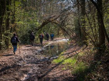
Les meilleurs parcours (3)
![Randonnée Marche Charencey - Saint-Maurice-lès-Charencey - Soligny-la-Trappe 25 km - Photo](https://media.geolcdn.com/t/350/260/635a3b0e-8213-4bfe-ad72-3765a1ef9dc9.jpg&format=jpg&maxdim=2)
![Marche Marche](https://static1.geolcdn.com/sitytour/trail-icons/101.png)
Km
Marche
![](/images/other/stat-length.png)
![](https://static1.geolcdn.com/siteimages/upload/files/1508320355ic_sort_den_pos_24dp.png)
![](https://static1.geolcdn.com/siteimages/upload/files/1508320355ic_sort_den_neg_24dp.png)
![](https://static1.geolcdn.com/siteimages/upload/files/16400158638029165_repeat_loop_refresh_sync_direction_icon.png)
• LES TRAVERSÉES PERCHERONNES.. Vous offrent la description de près de 1700 kilomètres de chemins de randonnée perche...
![Randonnée Marche Charencey - Saint-Maurice-les-Charencey - Tourouvre 28 km - Photo](https://media.geolcdn.com/t/350/260/9519f3da-1784-48ad-8139-7518bffded63.jpg&format=jpg&maxdim=2)
![Marche Marche](https://static1.geolcdn.com/sitytour/trail-icons/101.png)
Km
Marche
![](/images/other/stat-length.png)
![](https://static1.geolcdn.com/siteimages/upload/files/1508320355ic_sort_den_pos_24dp.png)
![](https://static1.geolcdn.com/siteimages/upload/files/1508320355ic_sort_den_neg_24dp.png)
![](https://static1.geolcdn.com/siteimages/upload/files/16400158638029165_repeat_loop_refresh_sync_direction_icon.png)
• LES TRAVERSÉES PERCHERONNES.. Vous offrent la description de près de 1700 kilomètres de chemins de randonnée perche...
![Randonnée Marche Charencey - TPE 2018 Etape 3 Saint-Maurice-lès-Charencey - Tourouvre 26,1Km - Photo](https://media.geolcdn.com/t/350/260/ext.jpg?maxdim=2&url=https%3A%2F%2Fstatic1.geolcdn.com%2Fsiteimages%2Fupload%2Ffiles%2F1553511878bg_sport_marche.png)
![Marche Marche](https://static1.geolcdn.com/sitytour/trail-icons/101.png)
Km
Marche
![](/images/other/stat-length.png)
![](https://static1.geolcdn.com/siteimages/upload/files/1508320355ic_sort_den_pos_24dp.png)
![](https://static1.geolcdn.com/siteimages/upload/files/1508320355ic_sort_den_neg_24dp.png)
![](https://static1.geolcdn.com/siteimages/upload/files/16400158638029165_repeat_loop_refresh_sync_direction_icon.png)
• Un Tour du Perche "A travers Forêts et Collines du Perche" Autre nom : TPE pour Tour du Perche Eurélien En 1984 que...
3 randonnées affichées sur 3
Application GPS de randonnée GRATUITE