![](/images/other/stat-length.png)
- Randonnées
- A pied
- France
- Normandie
- Orne
- Gouffern en Auge
- Chambois
Chambois, Gouffern en Auge, A pied : Les meilleures randonnées, itinéraires, parcours, balades et promenades
Chambois : découvrez les meilleures randonnées : 2 marche. Tous ces circuits, parcours, itinéraires et activités en plein air sont disponibles dans nos applications SityTrail pour smartphones et tablettes.
Les meilleurs parcours (2)
![Randonnée Marche Gouffern en Auge - Août 1944 - Chambois - Photo](https://media.geolcdn.com/t/350/260/ext.jpg?maxdim=2&url=https%3A%2F%2Fservices.sitytrail.com%2FGeolivesWS%2FDownloadMedia.ashx%3FTrailID%3D111643%26Media%3D7887_2.jpg)
![Marche Marche](https://static1.geolcdn.com/sitytour/trail-icons/101.png)
Km
#1 - Août 1944 - Chambois
Marche
Difficile
Gouffern en Auge,
Normandie,
Orne,
France
![](/images/other/stat-length.png)
16,1 km | 19 km-effort
5h 0min
![](https://static1.geolcdn.com/siteimages/upload/files/1508320355ic_sort_den_pos_24dp.png)
214 m
![](https://static1.geolcdn.com/siteimages/upload/files/1508320355ic_sort_den_neg_24dp.png)
215 m
![](https://static1.geolcdn.com/siteimages/upload/files/16400158638029165_repeat_loop_refresh_sync_direction_icon.png)
Oui
tracegps
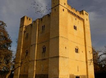
• Août 1944 – Chambois. Circuit VTT, praticable à pied et à cheval. Départ du donjon de Chambois. Retrouvez les Coup de...
![Randonnée Marche Gouffern en Auge - Chambois - Avenelles (boucle) - Photo](https://media.geolcdn.com/t/350/260/ext.jpg?maxdim=2&url=https%3A%2F%2Fstatic1.geolcdn.com%2Fsiteimages%2Fupload%2Ffiles%2F1553511878bg_sport_marche.png)
![Marche Marche](https://static1.geolcdn.com/sitytour/trail-icons/101.png)
Km
#2 - Chambois - Avenelles (boucle)
Marche
Moyen
Gouffern en Auge,
Normandie,
Orne,
France
![](/images/other/stat-length.png)
21 km | 25 km-effort
5h 20min
![](https://static1.geolcdn.com/siteimages/upload/files/1508320355ic_sort_den_pos_24dp.png)
255 m
![](https://static1.geolcdn.com/siteimages/upload/files/1508320355ic_sort_den_neg_24dp.png)
253 m
![](https://static1.geolcdn.com/siteimages/upload/files/16400158638029165_repeat_loop_refresh_sync_direction_icon.png)
Oui
neitag61
• Joli parcours valloné
2 randonnées affichées sur 2
Application GPS de randonnée GRATUITE