![](/images/other/stat-length.png)
- Randonnées
- A pied
- France
- Normandie
- Manche
- Huisnes-sur-Mer
Huisnes-sur-Mer, Manche, A pied : Les meilleures randonnées, itinéraires, parcours, balades et promenades
Huisnes-sur-Mer : découvrez les meilleures randonnées : 3 marche. Tous ces circuits, parcours, itinéraires et activités en plein air sont disponibles dans nos applications SityTrail pour smartphones et tablettes.
Les meilleurs parcours (3)
![Randonnée Marche Huisnes-sur-Mer - Huisnes-sur-Mer - vue Mont-St-Michel - Pointe de Roche Torin - 14km 75m 4h30 (45mn) - 2017 06 26 - Photo](https://media.geolcdn.com/t/350/260/9d39b175-437c-4c0f-9152-c4bc208b1660.jpg&format=jpg&maxdim=2)
![Marche Marche](https://static1.geolcdn.com/sitytour/trail-icons/101.png)
Km
#1 - Huisnes-sur-Mer - vue Mont-St-Michel - Pointe de Roche Torin - 14km 75m 4h30 ...
Marche
Facile
Huisnes-sur-Mer,
Normandie,
Manche,
France
![](/images/other/stat-length.png)
14 km | 15 km-effort
4h 30min
![](https://static1.geolcdn.com/siteimages/upload/files/1508320355ic_sort_den_pos_24dp.png)
75 m
![](https://static1.geolcdn.com/siteimages/upload/files/1508320355ic_sort_den_neg_24dp.png)
74 m
![](https://static1.geolcdn.com/siteimages/upload/files/16400158638029165_repeat_loop_refresh_sync_direction_icon.png)
Oui
Orcal37
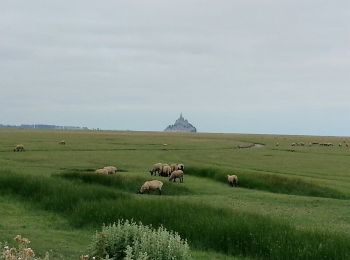
• Huisnes-sur-Mer - vue sur le Mont-St-Michel - Pointe de Roche Torin - 14km 75m 4h30 (45mn) - 2017 06 26
![Randonnée Marche Huisnes-sur-Mer - huisnes mont st michel - Photo](https://media.geolcdn.com/t/350/260/ext.jpg?maxdim=2&url=https%3A%2F%2Fstatic1.geolcdn.com%2Fsiteimages%2Fupload%2Ffiles%2F1553511878bg_sport_marche.png)
![Marche Marche](https://static1.geolcdn.com/sitytour/trail-icons/101.png)
Km
#2 - huisnes mont st michel
Marche
Moyen
Huisnes-sur-Mer,
Normandie,
Manche,
France
![](/images/other/stat-length.png)
14,8 km | 16,1 km-effort
4h 23min
![](https://static1.geolcdn.com/siteimages/upload/files/1508320355ic_sort_den_pos_24dp.png)
93 m
![](https://static1.geolcdn.com/siteimages/upload/files/1508320355ic_sort_den_neg_24dp.png)
92 m
![](https://static1.geolcdn.com/siteimages/upload/files/16400158638029165_repeat_loop_refresh_sync_direction_icon.png)
Oui
atmosphil
![Randonnée Marche Huisnes-sur-Mer - MONT SAINT MICHEL - Photo](https://media.geolcdn.com/t/350/260/ext.jpg?maxdim=2&url=https%3A%2F%2Fstatic1.geolcdn.com%2Fsiteimages%2Fupload%2Ffiles%2F1553511878bg_sport_marche.png)
![Marche Marche](https://static1.geolcdn.com/sitytour/trail-icons/101.png)
Km
#3 - MONT SAINT MICHEL
Marche
Facile
Huisnes-sur-Mer,
Normandie,
Manche,
France
![](/images/other/stat-length.png)
7,3 km | 8 km-effort
1h 47min
![](https://static1.geolcdn.com/siteimages/upload/files/1508320355ic_sort_den_pos_24dp.png)
66 m
![](https://static1.geolcdn.com/siteimages/upload/files/1508320355ic_sort_den_neg_24dp.png)
27 m
![](https://static1.geolcdn.com/siteimages/upload/files/16400158638029165_repeat_loop_refresh_sync_direction_icon.png)
Non
Bernardroland
3 randonnées affichées sur 3
Application GPS de randonnée GRATUITE