![](/images/other/stat-length.png)
- Randonnées
- A pied
- France
- Centre-Val de Loire
- Eure-et-Loir
Eure-et-Loir, Centre-Val de Loire, A pied : Les meilleures randonnées, itinéraires, parcours, balades et promenades
Eure-et-Loir : découvrez les meilleures randonnées : 51 a pied, 1635 marche, 31 marche nordique et 16 course à pied. Tous ces circuits, parcours, itinéraires et activités en plein air sont disponibles dans nos applications SityTrail pour smartphones et tablettes.
Les meilleurs parcours (1728)
![Randonnée Marche Mézières-en-Drouais - Rando_Ecluzelles_12km - Photo](https://media.geolcdn.com/t/350/260/ext.jpg?maxdim=2&url=https%3A%2F%2Fservices.sitytrail.com%2FGeolivesWS%2FDownloadMedia.ashx%3FTrailID%3D864408%26Media%3Dfix__20171119103520.jpg)
![Marche Marche](https://static1.geolcdn.com/sitytour/trail-icons/101.png)
Km
Marche
![](/images/other/stat-length.png)
![](https://static1.geolcdn.com/siteimages/upload/files/1508320355ic_sort_den_pos_24dp.png)
![](https://static1.geolcdn.com/siteimages/upload/files/1508320355ic_sort_den_neg_24dp.png)
![](https://static1.geolcdn.com/siteimages/upload/files/16400158638029165_repeat_loop_refresh_sync_direction_icon.png)
![Randonnée Marche Gallardon - De Gallardon à Maintenon - Photo](https://media.geolcdn.com/t/350/260/e04bc3ee-1da5-4e1b-a89c-179ee6140533.jpg&format=jpg&maxdim=2)
![Marche Marche](https://static1.geolcdn.com/sitytour/trail-icons/101.png)
Km
Marche
![](/images/other/stat-length.png)
![](https://static1.geolcdn.com/siteimages/upload/files/1508320355ic_sort_den_pos_24dp.png)
![](https://static1.geolcdn.com/siteimages/upload/files/1508320355ic_sort_den_neg_24dp.png)
![](https://static1.geolcdn.com/siteimages/upload/files/16400158638029165_repeat_loop_refresh_sync_direction_icon.png)
• Parcours rendu difficile par l'humidité présente sur tout le terrain. Beaucoup de branchages et de passages impossibl...
![Randonnée Marche Chartres - Parcours historique Chartres en Lumières - Photo](https://media.geolcdn.com/t/350/260/5af69804-d751-4429-87e4-2de41d93a942.jpg&format=jpg&maxdim=2)
![Marche Marche](https://static1.geolcdn.com/sitytour/trail-icons/101.png)
Km
Marche
![](/images/other/stat-length.png)
![](https://static1.geolcdn.com/siteimages/upload/files/1508320355ic_sort_den_pos_24dp.png)
![](https://static1.geolcdn.com/siteimages/upload/files/1508320355ic_sort_den_neg_24dp.png)
![](https://static1.geolcdn.com/siteimages/upload/files/16400158638029165_repeat_loop_refresh_sync_direction_icon.png)
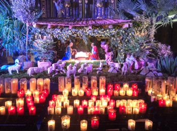
• Edition décembre 2024
![Randonnée Marche Illiers-Combray - Illiers-Combray promenade - Photo](https://media.geolcdn.com/t/350/260/ext.jpg?maxdim=2&url=https%3A%2F%2Fstatic1.geolcdn.com%2Fsiteimages%2Fupload%2Ffiles%2F1553511878bg_sport_marche.png)
![Marche Marche](https://static1.geolcdn.com/sitytour/trail-icons/101.png)
Km
Marche
![](/images/other/stat-length.png)
![](https://static1.geolcdn.com/siteimages/upload/files/1508320355ic_sort_den_pos_24dp.png)
![](https://static1.geolcdn.com/siteimages/upload/files/1508320355ic_sort_den_neg_24dp.png)
![](https://static1.geolcdn.com/siteimages/upload/files/16400158638029165_repeat_loop_refresh_sync_direction_icon.png)
• A partir de la gare
![Randonnée Marche Droue-sur-Drouette - Droue sur Drouette st hillarion - Photo](https://media.geolcdn.com/t/350/260/ext.jpg?maxdim=2&url=https%3A%2F%2Fstatic1.geolcdn.com%2Fsiteimages%2Fupload%2Ffiles%2F1553511878bg_sport_marche.png)
![Marche Marche](https://static1.geolcdn.com/sitytour/trail-icons/101.png)
Km
Marche
![](/images/other/stat-length.png)
![](https://static1.geolcdn.com/siteimages/upload/files/1508320355ic_sort_den_pos_24dp.png)
![](https://static1.geolcdn.com/siteimages/upload/files/1508320355ic_sort_den_neg_24dp.png)
![](https://static1.geolcdn.com/siteimages/upload/files/16400158638029165_repeat_loop_refresh_sync_direction_icon.png)
• 11km5
![Randonnée Marche Trizay-Coutretot-Saint-Serge - 100 Kms Perche Boucle B - Photo](https://media.geolcdn.com/t/350/260/ext.jpg?maxdim=2&url=https%3A%2F%2Fstatic1.geolcdn.com%2Fsiteimages%2Fupload%2Ffiles%2F1553511878bg_sport_marche.png)
![Marche Marche](https://static1.geolcdn.com/sitytour/trail-icons/101.png)
Km
Marche
![](/images/other/stat-length.png)
![](https://static1.geolcdn.com/siteimages/upload/files/1508320355ic_sort_den_pos_24dp.png)
![](https://static1.geolcdn.com/siteimages/upload/files/1508320355ic_sort_den_neg_24dp.png)
![](https://static1.geolcdn.com/siteimages/upload/files/16400158638029165_repeat_loop_refresh_sync_direction_icon.png)
• 100 Kms du Perche 2014
![Randonnée Marche Saint-Lubin-des-Joncherets - Saint Lubin des Joncherets / Tillières sur Avre (28) - Photo](https://media.geolcdn.com/t/350/260/ext.jpg?maxdim=2&url=https%3A%2F%2Fservices.sitytrail.com%2FGeolivesWS%2FDownloadMedia.ashx%3FTrailID%3D187386%26Media%3D1b9cba9c-d9b6-490c-ba3f-3700dfb78d43.JPG)
![Marche Marche](https://static1.geolcdn.com/sitytour/trail-icons/101.png)
Km
Marche
![](/images/other/stat-length.png)
![](https://static1.geolcdn.com/siteimages/upload/files/1508320355ic_sort_den_pos_24dp.png)
![](https://static1.geolcdn.com/siteimages/upload/files/1508320355ic_sort_den_neg_24dp.png)
![](https://static1.geolcdn.com/siteimages/upload/files/16400158638029165_repeat_loop_refresh_sync_direction_icon.png)
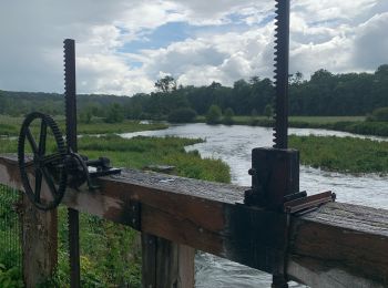
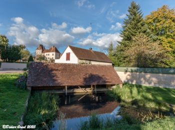
• Randonnée linéaire des étangs des Saint Lubin des Joncherets à l'église de Tillières sur Avre. Relief nul, mis a part...
![Randonnée Marche Chartres - Parcours de la ville historique de Chartres - Photo](https://media.geolcdn.com/t/350/260/5e4a7e3c-abb5-42c8-8b44-13932b698f48.jpg&format=jpg&maxdim=2)
![Marche Marche](https://static1.geolcdn.com/sitytour/trail-icons/101.png)
Km
Marche
![](/images/other/stat-length.png)
![](https://static1.geolcdn.com/siteimages/upload/files/1508320355ic_sort_den_pos_24dp.png)
![](https://static1.geolcdn.com/siteimages/upload/files/1508320355ic_sort_den_neg_24dp.png)
![](https://static1.geolcdn.com/siteimages/upload/files/16400158638029165_repeat_loop_refresh_sync_direction_icon.png)
![Randonnée Marche Bonneval - VOIE DE TOURS - Bonneval - Chateaudun - Cloyes sur le Loir - Photo](https://media.geolcdn.com/t/350/260/99c47626-2a79-4a8a-b1f7-30a77f3fa4b3.jpg&format=jpg&maxdim=2)
![Marche Marche](https://static1.geolcdn.com/sitytour/trail-icons/101.png)
Km
Marche
![](/images/other/stat-length.png)
![](https://static1.geolcdn.com/siteimages/upload/files/1508320355ic_sort_den_pos_24dp.png)
![](https://static1.geolcdn.com/siteimages/upload/files/1508320355ic_sort_den_neg_24dp.png)
![](https://static1.geolcdn.com/siteimages/upload/files/16400158638029165_repeat_loop_refresh_sync_direction_icon.png)
• 36 km environ Gros orage pendant 1h l’après midi …
![Randonnée Marche Blandainville - VOIE DE TOURS -Harville - Illiers - Bonneval - Photo](https://media.geolcdn.com/t/350/260/2386320c-626a-4374-89a8-3b0715d6e783.jpg&format=jpg&maxdim=2)
![Marche Marche](https://static1.geolcdn.com/sitytour/trail-icons/101.png)
Km
Marche
![](/images/other/stat-length.png)
![](https://static1.geolcdn.com/siteimages/upload/files/1508320355ic_sort_den_pos_24dp.png)
![](https://static1.geolcdn.com/siteimages/upload/files/1508320355ic_sort_den_neg_24dp.png)
![](https://static1.geolcdn.com/siteimages/upload/files/16400158638029165_repeat_loop_refresh_sync_direction_icon.png)
• 36km Belle journée ( 10 minutes de pluies orageuses avant l’arrivée à Bonneval.
![Randonnée Marche Chartres - balade autour cathédrale de Chartres - Photo](https://media.geolcdn.com/t/350/260/589e1a6c-9aee-41e4-b0c1-21e1dc04e42e.jpg&format=jpg&maxdim=2)
![Marche Marche](https://static1.geolcdn.com/sitytour/trail-icons/101.png)
Km
Marche
![](/images/other/stat-length.png)
![](https://static1.geolcdn.com/siteimages/upload/files/1508320355ic_sort_den_pos_24dp.png)
![](https://static1.geolcdn.com/siteimages/upload/files/1508320355ic_sort_den_neg_24dp.png)
![](https://static1.geolcdn.com/siteimages/upload/files/16400158638029165_repeat_loop_refresh_sync_direction_icon.png)
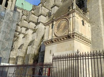
• autour de Notre Dame
![Randonnée Course à pied La Bazoche-Gouet - La Bazoches-Gouet - Photo](https://media.geolcdn.com/t/350/260/067548a4-0319-4113-93e7-471b34c88b23.jpg&format=jpg&maxdim=2)
![Course à pied Course à pied](https://static1.geolcdn.com/sitytour/trail-icons/103.png)
Km
Course à pied
![](/images/other/stat-length.png)
![](https://static1.geolcdn.com/siteimages/upload/files/1508320355ic_sort_den_pos_24dp.png)
![](https://static1.geolcdn.com/siteimages/upload/files/1508320355ic_sort_den_neg_24dp.png)
![](https://static1.geolcdn.com/siteimages/upload/files/16400158638029165_repeat_loop_refresh_sync_direction_icon.png)
• jolie balade en passant par l'Yerre
![Randonnée Marche Arcisses - Coudreceau, les panoramas du Perche Eurélien 9,4 km - Photo](https://media.geolcdn.com/t/350/260/93185f9c-ce34-4e92-883e-ab49829b2889.jpeg&format=jpg&maxdim=2)
![Marche Marche](https://static1.geolcdn.com/sitytour/trail-icons/101.png)
Km
Marche
![](/images/other/stat-length.png)
![](https://static1.geolcdn.com/siteimages/upload/files/1508320355ic_sort_den_pos_24dp.png)
![](https://static1.geolcdn.com/siteimages/upload/files/1508320355ic_sort_den_neg_24dp.png)
![](https://static1.geolcdn.com/siteimages/upload/files/16400158638029165_repeat_loop_refresh_sync_direction_icon.png)
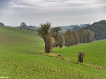
• Une balade très vallonnée, propice à la découverte des panoramas du Perche eurélien, en particulier celui que l'on pe...
![Randonnée Marche Vichères - Vichères - la colline de Rougemont 8 km - Photo](https://media.geolcdn.com/t/350/260/fab65f98-ee3c-448f-86cc-f0faa2c1c5aa.jpeg&format=jpg&maxdim=2)
![Marche Marche](https://static1.geolcdn.com/sitytour/trail-icons/101.png)
Km
Marche
![](/images/other/stat-length.png)
![](https://static1.geolcdn.com/siteimages/upload/files/1508320355ic_sort_den_pos_24dp.png)
![](https://static1.geolcdn.com/siteimages/upload/files/1508320355ic_sort_den_neg_24dp.png)
![](https://static1.geolcdn.com/siteimages/upload/files/16400158638029165_repeat_loop_refresh_sync_direction_icon.png)
• La colline de Rougemont culmine à 285 m. Elle porte bien son nom car le sable local présente une large palette d’ocre...
![Randonnée Marche Arcisses - Brunelles - Autour du Promontoire 10 km - Photo](https://media.geolcdn.com/t/350/260/d22874c5-839f-4011-a0f9-00e8c44e1208.jpeg&format=jpg&maxdim=2)
![Marche Marche](https://static1.geolcdn.com/sitytour/trail-icons/101.png)
Km
Marche
![](/images/other/stat-length.png)
![](https://static1.geolcdn.com/siteimages/upload/files/1508320355ic_sort_den_pos_24dp.png)
![](https://static1.geolcdn.com/siteimages/upload/files/1508320355ic_sort_den_neg_24dp.png)
![](https://static1.geolcdn.com/siteimages/upload/files/16400158638029165_repeat_loop_refresh_sync_direction_icon.png)
• Brunelles est un petit village juché sur une colline qui domine la plaine. Cette randonnée en fait le tour en passant...
![Randonnée Marche Nogent-le-Rotrou - NOGENT LE ROTROU - Photo](https://media.geolcdn.com/t/350/260/c00ba3d7-9b96-49a3-b019-bc489240b465.jpg&format=jpg&maxdim=2)
![Marche Marche](https://static1.geolcdn.com/sitytour/trail-icons/101.png)
Km
Marche
![](/images/other/stat-length.png)
![](https://static1.geolcdn.com/siteimages/upload/files/1508320355ic_sort_den_pos_24dp.png)
![](https://static1.geolcdn.com/siteimages/upload/files/1508320355ic_sort_den_neg_24dp.png)
![](https://static1.geolcdn.com/siteimages/upload/files/16400158638029165_repeat_loop_refresh_sync_direction_icon.png)
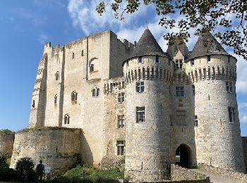
• Ce parcours permet de découvrir la petite ville de Nogent le Retrou, son château, son hôtel de ville, ses églises, se...
![Randonnée A pied Senonches - Senonches - En pays senonchois 5,3 km - Photo](https://media.geolcdn.com/t/350/260/61bc1a20-8230-4087-9a08-2621b726d935.jpeg&format=jpg&maxdim=2)
![A pied A pied](https://static1.geolcdn.com/sitytour/trail-icons/100.png)
Km
A pied
![](/images/other/stat-length.png)
![](https://static1.geolcdn.com/siteimages/upload/files/1508320355ic_sort_den_pos_24dp.png)
![](https://static1.geolcdn.com/siteimages/upload/files/1508320355ic_sort_den_neg_24dp.png)
![](https://static1.geolcdn.com/siteimages/upload/files/16400158638029165_repeat_loop_refresh_sync_direction_icon.png)
• Départ / Arrivée : Senonches Depuis le centre-ville prendre la direction du collège de La Loge des bois jusqu'au rond...
![Randonnée Marche Arcisses - Ozée 9,1 km - Photo](https://media.geolcdn.com/t/350/260/ext.jpg?maxdim=2&url=https%3A%2F%2Fstatic1.geolcdn.com%2Fsiteimages%2Fupload%2Ffiles%2F1553511878bg_sport_marche.png)
![Marche Marche](https://static1.geolcdn.com/sitytour/trail-icons/101.png)
Km
Marche
![](/images/other/stat-length.png)
![](https://static1.geolcdn.com/siteimages/upload/files/1508320355ic_sort_den_pos_24dp.png)
![](https://static1.geolcdn.com/siteimages/upload/files/1508320355ic_sort_den_neg_24dp.png)
![](https://static1.geolcdn.com/siteimages/upload/files/16400158638029165_repeat_loop_refresh_sync_direction_icon.png)
![Randonnée Marche Saint-Prest - St prèst>> Soulaires>>jouy >> St prest - Photo](https://media.geolcdn.com/t/350/260/ea64a9c0-2691-49ad-9b96-29e6fbe97de4.jpg&format=jpg&maxdim=2)
![Marche Marche](https://static1.geolcdn.com/sitytour/trail-icons/101.png)
Km
Marche
![](/images/other/stat-length.png)
![](https://static1.geolcdn.com/siteimages/upload/files/1508320355ic_sort_den_pos_24dp.png)
![](https://static1.geolcdn.com/siteimages/upload/files/1508320355ic_sort_den_neg_24dp.png)
![](https://static1.geolcdn.com/siteimages/upload/files/16400158638029165_repeat_loop_refresh_sync_direction_icon.png)
• Repas grange, Soulaires
![Randonnée Marche La Gaudaine - La Gaudaine - les panoramas 12 km - Photo](https://media.geolcdn.com/t/350/260/7d44d83e-0c4d-469b-b2b8-1846d9ca6509.jpeg&format=jpg&maxdim=2)
![Marche Marche](https://static1.geolcdn.com/sitytour/trail-icons/101.png)
Km
Marche
![](/images/other/stat-length.png)
![](https://static1.geolcdn.com/siteimages/upload/files/1508320355ic_sort_den_pos_24dp.png)
![](https://static1.geolcdn.com/siteimages/upload/files/1508320355ic_sort_den_neg_24dp.png)
![](https://static1.geolcdn.com/siteimages/upload/files/16400158638029165_repeat_loop_refresh_sync_direction_icon.png)
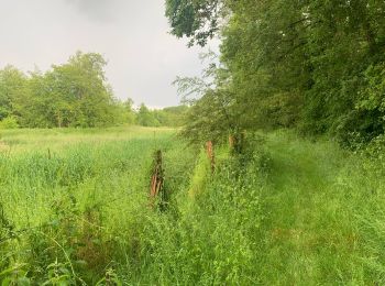
• En partie sur l’ancien « chemin des vaches », ce circuit dévoile les versants bocagers des vallées de l’Arcisses et d...
20 randonnées affichées sur 1728
Application GPS de randonnée GRATUITE
Activités
Régions proches
- Abondant
- Allainville
- Alluyes
- Amilly
- Anet
- Arcisses
- Ardelles
- Argenvilliers
- Aunay-sous-Auneau
- Aunay-sous-Crécy
- Auneau-Bleury-Saint-Symphorien
- Authon-du-Perche
- Bailleau-Armenonville
- Bailleau-l'Évêque
- Bailleau-le-Pin
- Barjouville
- Bazoches-en-Dunois
- Bazoches-les-Hautes
- Beauche
- Beaumont-les-Autels
- Beauvilliers
- Belhomert-Guéhouville
- Berchères-Saint-Germain
- Berchères-les-Pierres
- Berchères-sur-Vesgre
- Bérou-la-Mulotière
- Béthonvilliers
- Béville-le-Comte
- Billancelles
- Blandainville
- Boissy-en-Drouais
- Boissy-lès-Perche
- Boisville-la-Saint-Père
- Boncé
- Boncourt
- Bonneval
- Bouglainval
- Boutigny-Prouais
- Bréchamps
- Brezolles
- Briconville
- Brou
- Broué
- Bû
- Champhol
- Champrond-en-Gâtine
- Champrond-en-Perchet
- Champseru
- Chapelle-Royale
- Charbonnières
- Charonville
- Charpont
- Chartainvilliers
- Chartres
- Chassant
- Châtaincourt
- Châteaudun
- Châteauneuf-en-Thymerais
- Chaudon
- Cherisy
- Chuisnes
- Cloyes-les-Trois-Rivières
- Coltainville
- Combres
- Commune nouvelle d'Arrou
- Conie-Molitard
- Corancez
- Cormainville
- Coudray-au-Perche
- Coulombs
- Courbehaye
- Courville-sur-Eure
- Crécy-Couvé
- Croisilles
- Dambron
- Dammarie
- Dampierre-sous-Brou
- Dampierre-sur-Avre
- Dangeau
- Dangers
- Denonville
- Digny
- Donnemain-Saint-Mamès
- Dreux
- Droue-sur-Drouette
- Écluzelles
- Écrosnes
- Éole-en-Beauce
- Épeautrolles
- Épernon
- Escorpain
- Faverolles
- Favières
- Flacey
- Fontaine-Simon
- Fontaine-la-Guyon
- Fontaine-les-Ribouts
- Fontenay-sur-Conie
- Fontenay-sur-Eure
- Frazé
- Fresnay-l'Évêque
- Friaize
- Fruncé
- Gallardon
- Garancières-en-Beauce
- Garancières-en-Drouais
- Garnay
- Gas
- Gasville-Oisème
- Gellainville
- Germainville
- Gilles
- Gommerville
- Gouillons
- Goussainville
- Guainville
- Hanches
- Havelu
- Houville-la-Branche
- Houx
- Illiers-Combray
- Jallans
- Janville-en-Beauce
- Jaudrais
- Jouy
- La Bazoche-Gouet
- La Chapelle-Forainvilliers
- La Chapelle-du-Noyer
- La Chaussée-d'Ivry
- La Croix-du-Perche
- La Ferté-Vidame
- La Framboisière
- La Gaudaine
- La Loupe
- La Mancelière
- La Puisaye
- La Saucelle
- Lamblore
- Landelles
- Le Boullay-Mivoye
- Le Boullay-Thierry
- Le Boullay-les-Deux-Églises
- Le Coudray
- Le Favril
- Le Gault-Saint-Denis
- Le Gué-de-Longroi
- Le Mesnil-Simon
- Le Thieulin
- Les Autels-Villevillon
- Les Châtelliers-Notre-Dame
- Les Corvées-les-Yys
- Les Étilleux
- Les Pinthières
- Les Ressuintes
- Les Villages Vovéens
- Levainville
- Lèves
- Lormaye
- Louvilliers-en-Drouais
- Louvilliers-lès-Perche
- Lucé
- Luigny
- Luisant
- Lumeau
- Luray
- Magny
- Maillebois
- Maintenon
- Mainvilliers
- Maisons
- Manou
- Marboué
- Marchéville
- Marolles-les-Buis
- Marville-Moutiers-Brûlé
- Meaucé
- Mérouville
- Meslay-le-Grenet
- Meslay-le-Vidame
- Mévoisins
- Mézières-en-Drouais
- Miermaigne
- Mignières
- Mittainvilliers-Vérigny
- Moléans
- Montboissier
- Montigny-le-Chartif
- Montigny-sur-Avre
- Montireau
- Montlandon
- Montreuil
- Morancez
- Morvilliers
- Moutiers
- Néron
- Nogent-le-Phaye
- Nogent-le-Roi
- Nogent-le-Rotrou
- Nogent-sur-Eure
- Nonvilliers-Grandhoux
- Nottonville
- Oinville-sous-Auneau
- Orgères-en-Beauce
- Ormoy
- Ouarville
- Ouerre
- Oulins
- Oysonville
- Pierres
- Poinville
- Poisvilliers
- Pontgouin
- Poupry
- Prudemanche
- Puiseux
- Revercourt
- Roinville
- Rouvray-Saint-Denis
- Rouvres
- Rueil-la-Gadelière
- Saint-Ange-et-Torçay
- Saint-Arnoult-des-Bois
- Saint-Aubin-des-Bois
- Saint-Avit-les-Guespières
- Saint-Christophe
- Saint-Denis-Lanneray
- Saint-Éliph
- Saint-Éman
- Saint-Georges-sur-Eure
- Saint-Germain-le-Gaillard
- Saint-Jean-Pierre-Fixte
- Saint-Jean-de-Rebervilliers
- Saint-Laurent-la-Gâtine
- Saint-Léger-des-Aubées
- Saint-Lubin-de-Cravant
- Saint-Lubin-de-la-Haye
- Saint-Lubin-des-Joncherets
- Saint-Lucien
- Saint-Luperce
- Saint-Maixme-Hauterive
- Saint-Martin-de-Nigelles
- Saint-Maur-sur-le-Loir
- Saint-Maurice-Saint-Germain
- Saint-Ouen-Marchefroy
- Saint-Piat
- Saint-Prest
- Saint-Rémy-sur-Avre
- Saint-Sauveur-Marville
- Saint-Victor-de-Buthon
- Sainte-Gemme-Moronval
- Saintigny
- Sainville
- Sandarville
- Santilly
- Saulnières
- Saumeray
- Saussay
- Senantes
- Senonches
- Serazereux
- Sorel-Moussel
- Souancé-au-Perche
- Soulaires
- Sours
- Terminiers
- Thimert-Gâtelles
- Thiron-Gardais
- Thivars
- Tillay-le-Péneux
- Toury
- Tremblay-les-Villages
- Tréon
- Trizay-Coutretot-Saint-Serge
- Umpeau
- Unverre
- Varize
- Vaupillon
- Ver-lès-Chartres
- Vernouillet
- Vert-en-Drouais
- Vichères
- Vierville
- Vieuvicq
- Villampuy
- Villebon
- Villemaury
- Villemeux-sur-Eure
- Villiers-Saint-Orien
- Villiers-le-Morhier
- Voise
- Yermenonville
- Yèvres
- Ymeray
- Ymonville