


13,4 km | 18,9 km-effort
Nozeroy : découvrez les meilleures randonnées : 12 marche. Tous ces circuits, parcours, itinéraires et activités en plein air sont disponibles dans nos applications SityTrail pour smartphones et tablettes.
Marche


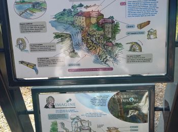
• Splendide randonnée entre plateau et vallée encaissée de l'Ain. Ce circuit propose de découvrir la haute vallée de l'...
Marche
Marche
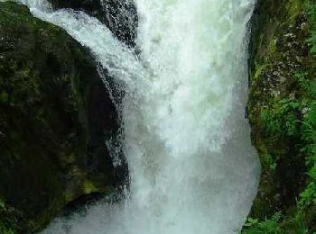
• superbe randonnée difficulté moyenne à refaire au printemps après une semaine de pluie pour avoir plein d'eau casse-c...
Marche

Marche
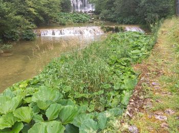
• Parking Waze : "Parking Cascade Moulin du Saut - Doye 39250" Trajet aller 10 km 10 min
Marche
• Parking Waze : "Parking Cascade Moulin du Saut - Doye 39250" Trajet aller 10 km 10 min
Marche
• Parking Waze : "Parking Cascade Moulin du Saut - Doye 39250" Trajet aller 10 km 10 min
Marche
• Splendide randonnée entre plateau et vallée encaissée de l'Ain. Ce circuit propose de découvrir la haute vallée de l'...
Marche
• source de l'ain rocher des commeres
Marche
Marche
Marche
12 randonnées affichées sur 12
Application GPS de randonnée GRATUITE
 SityTrail
IGN / Instituts géographiques
SityTrail World
Le monde est à vous